2007 BMW 6 Series Owner's Manual - Page 149
2007 BMW 6 Series Manual
Page 149 highlights
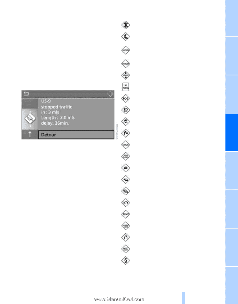
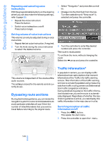
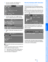
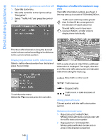
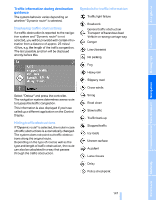
Traffic information during destination guidance The system behavior varies depending on whether "Dynamic route" is selected. Symbols for traffic information Traffic light failure Roadwork Displaying traffic obstructions If a traffic obstruction is reported to the navigation system and "Dynamic route" is not selected, you will be provided with certain information from a distance of approx. 25 miles/ 40 km, e.g. the length of the traffic congestion. The last possible junction will be displayed shortly before this. Danger Low clearance Fog Heavy rain Slippery road Cross winds Select "Detour" and press the controller. The navigation system determines a new route to bypass the traffic congestion. This information is also displayed if you have called up a different application on the Control Display. Smog Road close Slow traffic Traffic back up Stopped traffic Icy roads Uneven surface Accident Lane closure Delay Police checkpoint Hiding traffic obstructions If "Dynamic route" is selected, the route in case of traffic obstructions is automatically changed. The system does not point out traffic obstructions along the original route. Depending on the type of road as well as the type and length of traffic obstruction, the route can also be calculated in a way that passes through the traffic obstruction. 147 Online Edition for Part no. 01 41 0 013 312 - © 02/07 BMW AG Reference Mobility Communications Entertainment Navigation Driving tips No parking Controls General traffic obstruction Transport of hazardous load Vehicle on wrong carriage way At a glance
-
 1
1 -
2
-
3
-
4
-
5
-
6
-
7
-
8
-
9
-
10
-
11
-
12
-
13
-
14
-
15
-
16
-
17
-
18
-
19
-
20
-
21
-
22
-
23
-
24
-
25
-
26
-
27
-
28
-
29
-
30
-
31
-
32
-
33
-
34
-
35
-
36
-
37
-
38
-
39
-
40
-
41
-
42
-
43
-
44
-
45
-
46
-
47
-
48
-
49
-
50
-
51
-
52
-
53
-
54
-
55
-
56
-
57
-
58
-
59
-
60
-
61
-
62
-
63
-
64
-
65
-
66
-
67
-
68
-
69
-
70
-
71
-
72
-
73
-
74
-
75
-
76
-
77
-
78
-
79
-
80
-
81
-
82
-
83
-
84
-
85
-
86
-
87
-
88
-
89
-
90
-
91
-
92
-
93
-
94
-
95
-
96
-
97
-
98
-
99
-
100
-
101
-
102
-
103
-
104
-
105
-
106
-
107
-
108
-
109
-
110
-
111
-
112
-
113
-
114
-
115
-
116
-
117
-
118
-
119
-
120
-
121
-
122
-
123
-
124
-
125
-
126
-
127
-
128
-
129
-
130
-
131
-
132
-
133
-
134
-
135
-
136
-
137
-
138
-
139
-
140
-
141
-
142
-
143
-
 144
144 -
 145
145 -
 146
146 -
 147
147 -
 148
148 -
 149
149 -
 150
150 -
 151
151 -
 152
152 -
 153
153 -
 154
154 -
155
-
156
-
157
-
158
-
159
-
160
-
161
-
162
-
163
-
164
-
165
-
166
-
167
-
168
-
169
-
170
-
171
-
172
-
173
-
174
-
175
-
176
-
177
-
178
-
179
-
180
-
181
-
182
-
183
-
184
-
185
-
186
-
187
-
188
-
189
-
190
-
191
-
192
-
193
-
194
-
195
-
196
-
197
-
198
-
199
-
200
-
201
-
202
-
203
-
204
-
205
-
206
-
207
-
208
-
209
-
210
-
211
-
212
-
213
-
214
-
215
-
216
-
217
-
218
-
219
-
220
-
221
-
222
-
223
-
224
-
225
-
226
-
227
-
228
-
229
-
230
-
231
-
232
-
233
-
234
-
235
-
236
-
237
-
238
-
239
-
240
-
241
-
242
-
243
-
244
-
245
-
246
-
247
-
248
-
249
-
250
-
251
-
252
-
253
-
254
 |
 |