Garmin GPSMAP 296 Pilot's Guide - Page 122
Location Sub Tab, Units Sub Tab, Location Format Sub Tab, Map Datum Sub Tab - 78s
 |
View all Garmin GPSMAP 296 manuals
Add to My Manuals
Save this manual to your list of manuals |
Page 122 highlights
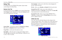
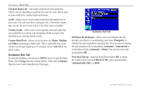
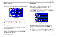
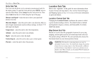
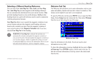
MAIN MENU > SETUP TAB Units Sub Tab The Units sub tab allows you to customize measurement units for the entire system. To open the Units sub tab, press MENU twice to open the Main Menu. Select Setup from the vertical tab list. Then select Units from the row of tabs along the top of the page. Distance and Speed-select the unit to show your speed and distance traveled. Direction Display-select the unit to show your direction. Mils is a unit of angle measurement used in military settings, in which 17.78 mils equal one degree. Temperature-select the unit to show the temperature. Altitude-select the unit to show your altitude. Depth-select the unit to show the depth. Vertical Speed-select the unit to show your vertical speed. Pressure-select the unit to show the pressure. Location Sub Tab Refer to the "Appendix" of this guide for more information about location formats and map datums. Also visit the National Imagery and Mapping Agency at http://www.nima.mil for more information on grids and datums. Location Format Sub Tab Changing the Location Format coordinates the system in which a given location reading is shown. The default format is latitude and longitude in degrees, minutes, and thousandths of a minute (hddd°mm.mmm). Map Datum Sub Tab Datums are used to describe geographic locations for surveying, mapping, and navigation and are not actual maps built in the unit. The default setting is WGS 84. The unit automatically chooses the best datum based on your chosen position format. WARNING: Selecting the wrong map datum can result in substantial location errors. You should only change the position format if you are using a map or chart that specifies a different position format or map datum or want to use a format you are familiar with. When in doubt, use the default WGS 84 datum for best overall performance. 114 GPSMAP 296 Pilot's Guide
-
 1
1 -
2
-
3
-
4
-
5
-
6
-
7
-
8
-
9
-
10
-
11
-
12
-
13
-
14
-
15
-
16
-
17
-
18
-
19
-
20
-
21
-
22
-
23
-
24
-
25
-
26
-
27
-
28
-
29
-
30
-
31
-
32
-
33
-
34
-
35
-
36
-
37
-
38
-
39
-
40
-
41
-
42
-
43
-
44
-
45
-
46
-
47
-
48
-
49
-
50
-
51
-
52
-
53
-
54
-
55
-
56
-
57
-
58
-
59
-
60
-
61
-
62
-
63
-
64
-
65
-
66
-
67
-
68
-
69
-
70
-
71
-
72
-
73
-
74
-
75
-
76
-
77
-
78
-
79
-
80
-
81
-
82
-
83
-
84
-
85
-
86
-
87
-
88
-
89
-
90
-
91
-
92
-
93
-
94
-
95
-
96
-
97
-
98
-
99
-
100
-
101
-
102
-
103
-
104
-
105
-
106
-
107
-
108
-
109
-
110
-
111
-
112
-
113
-
114
-
115
-
116
-
 117
117 -
 118
118 -
 119
119 -
 120
120 -
 121
121 -
 122
122 -
 123
123 -
 124
124 -
 125
125 -
 126
126 -
 127
127 -
128
-
129
-
130
-
131
-
132
-
133
-
134
-
135
-
136
-
137
-
138
-
139
-
140
-
141
-
142
-
143
-
144
-
145
-
146
-
147
-
148
-
149
-
150
-
151
-
152
-
153
-
154
-
155
-
156
-
157
-
158
-
159
-
160
-
161
-
162
-
163
-
164
-
165
-
166
-
167
-
168
 |
 |
