Garmin GPSMAP 296 Pilot's Guide - Page 24
ROCKER, ENTER, Viewing Frequency Restrictions
 |
View all Garmin GPSMAP 296 manuals
Add to My Manuals
Save this manual to your list of manuals |
Page 24 highlights
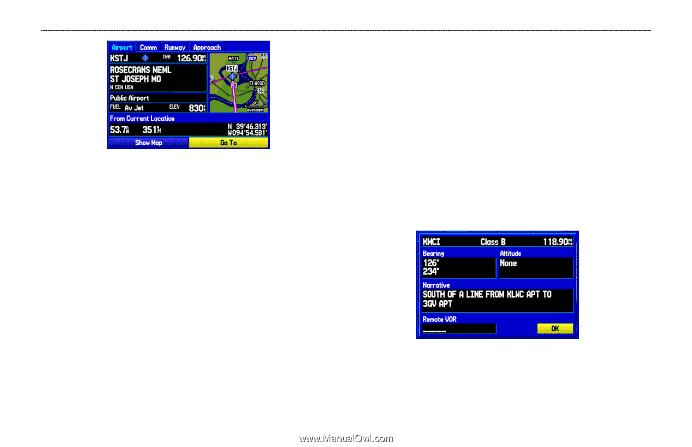
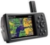
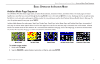
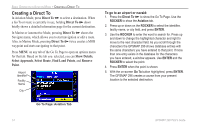
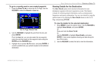
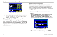
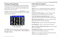
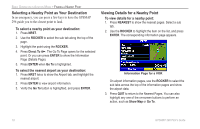
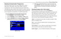
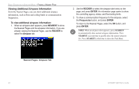
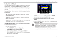
BASIC OPERATION IN AVIATION MODE > CREATING A DIRECT TO Airport Tab of Details Page 3. Highlight Show Map, and press ENTER to view the item on the map. Press QUIT when done. Highlight OK, and press ENTER to return to the Go To Page. When viewing information for the Runway or Approach tabs, use the ROCKER to highlight the runway designation or approach name, and press ENTER. Then press up or down on the ROCKER to scroll through available runways and approaches. Press ENTER to select the runway or approach for which you would like to view additional information. Viewing Frequency Restrictions The Comm tab on the Airport Details Page provides a list of communication frequencies for that airport. Some frequencies are noted with an asterisk (*), which indicates that the frequency has usage restrictions. You can show the usage restriction information on your GPSMAP 296. To view usage restrictions for a communication frequency: 1. With the Comm tab selected, use the ROCKER to highlight any frequency with usage restrictions (noted with an asterisk), and press ENTER. A Usage Restrictions Page appears describing the restrictions for the selected frequency. Usage Restrictions Page 2. To return to the Comm Information Page, press ENTER. 16 GPSMAP 296 Pilot's Guide
-
 1
1 -
2
-
3
-
4
-
5
-
6
-
7
-
8
-
9
-
10
-
11
-
12
-
13
-
14
-
15
-
16
-
17
-
18
-
 19
19 -
 20
20 -
 21
21 -
 22
22 -
 23
23 -
 24
24 -
 25
25 -
 26
26 -
 27
27 -
 28
28 -
 29
29 -
30
-
31
-
32
-
33
-
34
-
35
-
36
-
37
-
38
-
39
-
40
-
41
-
42
-
43
-
44
-
45
-
46
-
47
-
48
-
49
-
50
-
51
-
52
-
53
-
54
-
55
-
56
-
57
-
58
-
59
-
60
-
61
-
62
-
63
-
64
-
65
-
66
-
67
-
68
-
69
-
70
-
71
-
72
-
73
-
74
-
75
-
76
-
77
-
78
-
79
-
80
-
81
-
82
-
83
-
84
-
85
-
86
-
87
-
88
-
89
-
90
-
91
-
92
-
93
-
94
-
95
-
96
-
97
-
98
-
99
-
100
-
101
-
102
-
103
-
104
-
105
-
106
-
107
-
108
-
109
-
110
-
111
-
112
-
113
-
114
-
115
-
116
-
117
-
118
-
119
-
120
-
121
-
122
-
123
-
124
-
125
-
126
-
127
-
128
-
129
-
130
-
131
-
132
-
133
-
134
-
135
-
136
-
137
-
138
-
139
-
140
-
141
-
142
-
143
-
144
-
145
-
146
-
147
-
148
-
149
-
150
-
151
-
152
-
153
-
154
-
155
-
156
-
157
-
158
-
159
-
160
-
161
-
162
-
163
-
164
-
165
-
166
-
167
-
168
 |
 |