Garmin GPSMAP 296 Pilot's Guide - Page 39
Airspace Information, To retrieve airspace information from the Map
 |
View all Garmin GPSMAP 296 manuals
Add to My Manuals
Save this manual to your list of manuals |
Page 39 highlights
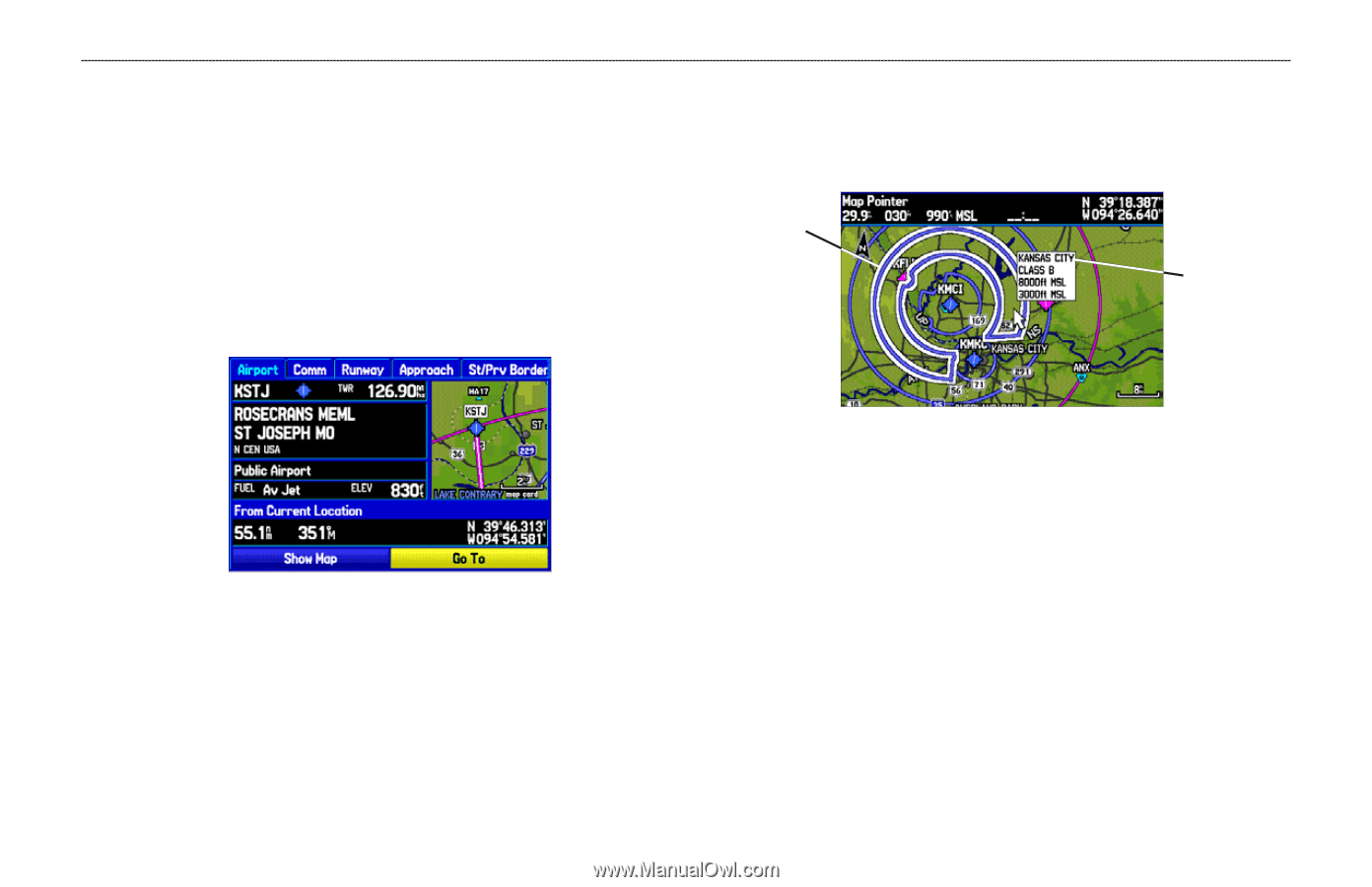
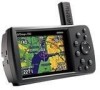
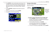
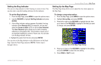
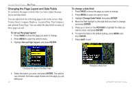
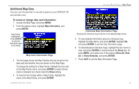
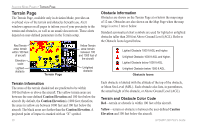
2. Press ENTER to view more information about the point. The information and on-screen buttons shown vary based on the type of item selected. In some cases, additional information tabs appear at the top of the Information Page or Waypoint Page. 3. Use the ROCKER to highlight the extra tabs and view the information. 4. Select an on-screen button, and press ENTER. 5. Press QUIT to exit the Information Page. AVIATION MODE PAGES > MAP PAGE Airspace Information Pan mode can also be used to retrieve information on airspaces depicted on the map. Highlighted airspace area Information box with airspace name, type, and floor/ceiling limits Airport Information Page Airspace Information To retrieve airspace information from the Map Page: 1. Use the ROCKER to select an area within the airspace boundary. The boundary line is highlighted and the airspace type and floor/ceiling limits are shown. 2. To show additional information, press ENTER. View communication frequencies by highlighting the onscreen Frequencies button, and pressing ENTER. 3. To return the to Map Page, highlight OK, and press ENTER. GPSMAP 296 Pilot's Guide 31
-
 1
1 -
2
-
3
-
4
-
5
-
6
-
7
-
8
-
9
-
10
-
11
-
12
-
13
-
14
-
15
-
16
-
17
-
18
-
19
-
20
-
21
-
22
-
23
-
24
-
25
-
26
-
27
-
28
-
29
-
30
-
31
-
32
-
33
-
 34
34 -
 35
35 -
 36
36 -
 37
37 -
 38
38 -
 39
39 -
 40
40 -
 41
41 -
 42
42 -
 43
43 -
 44
44 -
45
-
46
-
47
-
48
-
49
-
50
-
51
-
52
-
53
-
54
-
55
-
56
-
57
-
58
-
59
-
60
-
61
-
62
-
63
-
64
-
65
-
66
-
67
-
68
-
69
-
70
-
71
-
72
-
73
-
74
-
75
-
76
-
77
-
78
-
79
-
80
-
81
-
82
-
83
-
84
-
85
-
86
-
87
-
88
-
89
-
90
-
91
-
92
-
93
-
94
-
95
-
96
-
97
-
98
-
99
-
100
-
101
-
102
-
103
-
104
-
105
-
106
-
107
-
108
-
109
-
110
-
111
-
112
-
113
-
114
-
115
-
116
-
117
-
118
-
119
-
120
-
121
-
122
-
123
-
124
-
125
-
126
-
127
-
128
-
129
-
130
-
131
-
132
-
133
-
134
-
135
-
136
-
137
-
138
-
139
-
140
-
141
-
142
-
143
-
144
-
145
-
146
-
147
-
148
-
149
-
150
-
151
-
152
-
153
-
154
-
155
-
156
-
157
-
158
-
159
-
160
-
161
-
162
-
163
-
164
-
165
-
166
-
167
-
168
 |
 |