Garmin GPSMAP 296 Pilot's Guide - Page 9
Getting Started, Unit Overview - gps receiver
 |
View all Garmin GPSMAP 296 manuals
Add to My Manuals
Save this manual to your list of manuals |
Page 9 highlights
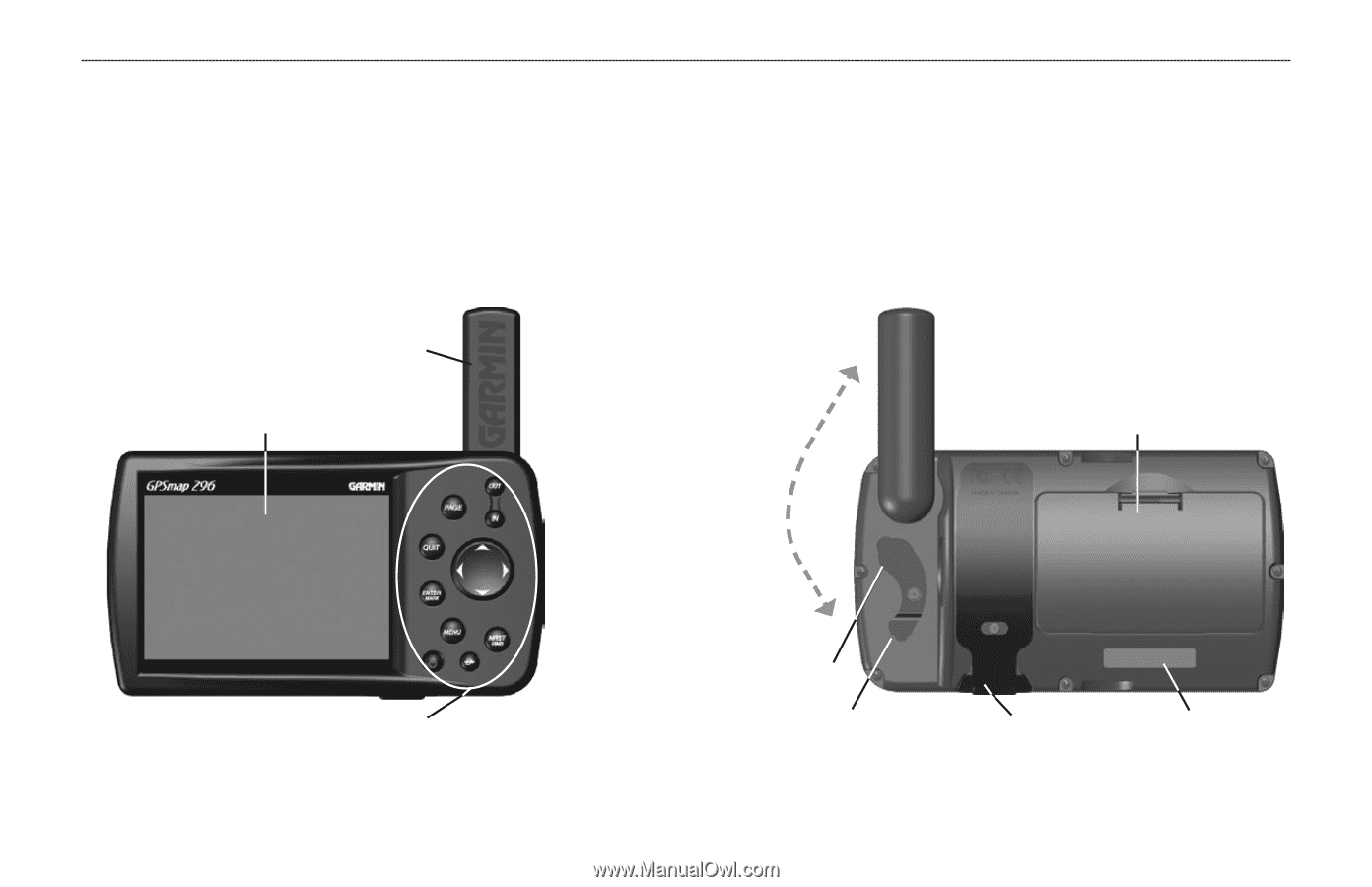
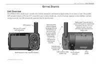
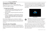
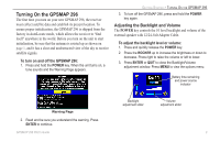
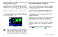
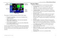
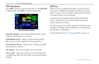
GETTING STARTED GETTING STARTED > UNIT OVERVIEW Unit Overview The GPSMAP 296 is an all-in-one, versatile color aviation, automotive, and marine navigator-perfect for air, land, or water. This portable GPS navigator features a 256-color TFT screen that is easy to read in bright sun, a built-in basemap, Jeppesen aviation database, and auto routing to provide you with automatically generated turn-by-turn directions. GPS antenna 256-Color TFT screen with backlighting Backlit keypad for easy nighttime operation Detachable GPS antenna collapses for storage. Be sure the antenna is up (as shown here) to receive satellite signals. Refer to the Appendix, page 137, for instructions on removing the antenna. Battery pack. Press tab down to remove battery pack for replacement, if necessary. See the "Warning" section on page iv for more information about the lithium-ion battery pack. External power connector under weather cap USB connector under weather cap Slot for optional data card Serial number GPSMAP 296 Pilot's Guide 1
-
 1
1 -
2
-
3
-
 4
4 -
 5
5 -
 6
6 -
 7
7 -
 8
8 -
 9
9 -
 10
10 -
 11
11 -
 12
12 -
 13
13 -
 14
14 -
15
-
16
-
17
-
18
-
19
-
20
-
21
-
22
-
23
-
24
-
25
-
26
-
27
-
28
-
29
-
30
-
31
-
32
-
33
-
34
-
35
-
36
-
37
-
38
-
39
-
40
-
41
-
42
-
43
-
44
-
45
-
46
-
47
-
48
-
49
-
50
-
51
-
52
-
53
-
54
-
55
-
56
-
57
-
58
-
59
-
60
-
61
-
62
-
63
-
64
-
65
-
66
-
67
-
68
-
69
-
70
-
71
-
72
-
73
-
74
-
75
-
76
-
77
-
78
-
79
-
80
-
81
-
82
-
83
-
84
-
85
-
86
-
87
-
88
-
89
-
90
-
91
-
92
-
93
-
94
-
95
-
96
-
97
-
98
-
99
-
100
-
101
-
102
-
103
-
104
-
105
-
106
-
107
-
108
-
109
-
110
-
111
-
112
-
113
-
114
-
115
-
116
-
117
-
118
-
119
-
120
-
121
-
122
-
123
-
124
-
125
-
126
-
127
-
128
-
129
-
130
-
131
-
132
-
133
-
134
-
135
-
136
-
137
-
138
-
139
-
140
-
141
-
142
-
143
-
144
-
145
-
146
-
147
-
148
-
149
-
150
-
151
-
152
-
153
-
154
-
155
-
156
-
157
-
158
-
159
-
160
-
161
-
162
-
163
-
164
-
165
-
166
-
167
-
168
 |
 |