Garmin GPSMAP 441s Owner's Manual - Page 48
Viewing Tide-station Information, Heading Source, Selecting the Range of the Close Hauled Wind, Gauge - - gps receiver
 |
View all Garmin GPSMAP 441s manuals
Add to My Manuals
Save this manual to your list of manuals |
Page 48 highlights
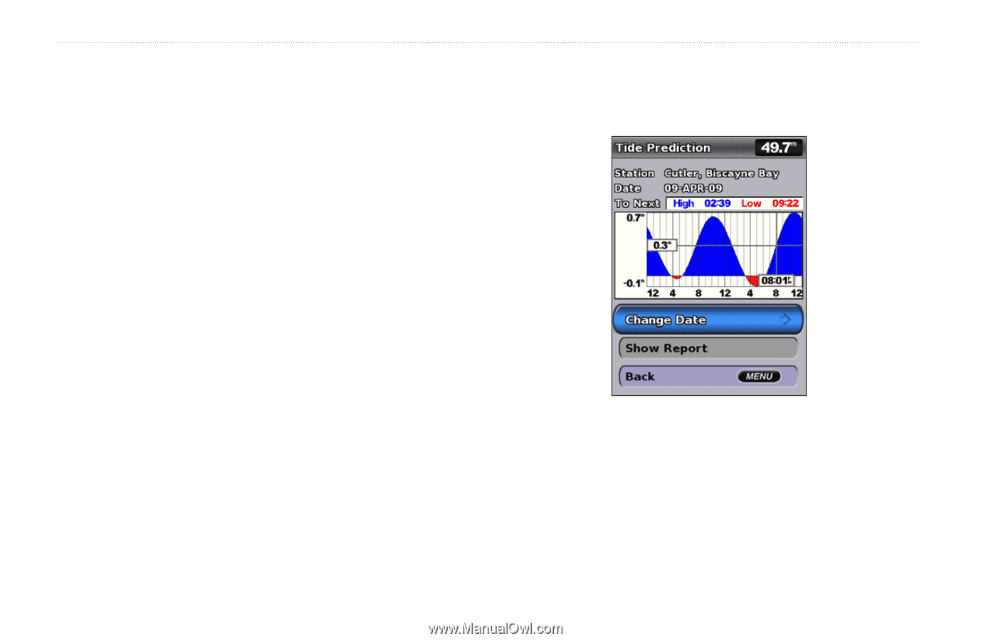
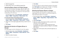
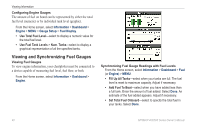
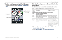
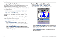
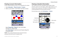
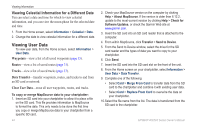
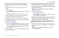
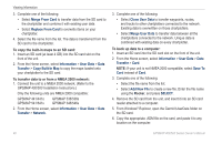
Viewing Information Configuring the Heading Source You can specify the source of the heading displayed on the wind gauge. Magnetic heading is the heading data received from a heading (or magnetic) sensor, and GPS heading data is calculated by your chartplotter GPS. From the Home screen, select Information > Dashboard > Wind > MENU > Heading Source. Selecting the Range of the Close Hauled Wind Gauge You can specify the range of the close hauled wind gauge for both the upwind scale and the downwind scale. From the Home screen, select Information > Dashboard > Wind > MENU. • Select Change Upwind Scale. Set the maximum and minimum angle values that appear when the upwind close hauled wind gauge appears. • Select Change Downwind Scale. Set the maximum and minimum angle values that appear when the downwind close hauled wind gauge appears. Viewing Tide-station Information 1. Select Information > Tides & Currents > Tides. 2. Select a tide station. Tide-station information is shown. • Select Change Date > Manual to view tide information for a different date. Select the left and right arrows on the Rocker to move the time line. • Select Show Report to view the Tide Prediction Report for the selected station. 42 GPSMAP 400/500 Series Owner's Manual
-
 1
1 -
2
-
3
-
4
-
5
-
6
-
7
-
8
-
9
-
10
-
11
-
12
-
13
-
14
-
15
-
16
-
17
-
18
-
19
-
20
-
21
-
22
-
23
-
24
-
25
-
26
-
27
-
28
-
29
-
30
-
31
-
32
-
33
-
34
-
35
-
36
-
37
-
38
-
39
-
40
-
41
-
42
-
 43
43 -
 44
44 -
 45
45 -
 46
46 -
 47
47 -
 48
48 -
 49
49 -
 50
50 -
 51
51 -
 52
52 -
 53
53 -
54
-
55
-
56
-
57
-
58
-
59
-
60
-
61
-
62
-
63
-
64
-
65
-
66
-
67
-
68
-
69
-
70
-
71
-
72
-
73
-
74
-
75
-
76
-
77
-
78
-
79
-
80
-
81
-
82
-
83
-
84
-
85
-
86
-
87
-
88
-
89
-
90
-
91
-
92
-
93
-
94
-
95
-
96
 |
 |