Garmin GPSMAP 441s Owner's Manual - Page 91
Index
 |
View all Garmin GPSMAP 441s manuals
Add to My Manuals
Save this manual to your list of manuals |
Page 91 highlights
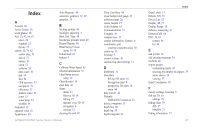
Index Index A A-scope 60 Active Tracks 16 aerial photos 20 AIS 23, 47, 56, 67 alarm 56 symbols 23 threats 27 alarms 52, 79-82 anchor drag 53 arrival 53 battery 53 clock 53 collision 26 deep water 53 fish 54 fuel 54 GPS accuracy 53 navigation 53 off course 53 shallow water 53 sonar 53 water temp 54 weather 54 Animated 12 apparent wind 41 Appearance 60 Auto Magnetic 49 automatic guidance 22, 49 autopilot 35 B backing up data 46 backlight, adjusting 4 Baro. Ref. Time 49 barometric pressure trend 49 Beeper/Display 48 BlueChart g2 Vision using 34-38 bottom lock 61 buttons 5 C Calibrate Water Speed 55 celestial information 43 Chart/Sonar screen using 22 Chart Borders 14 chart data 10 charts detail 13 fish eye 3D 18 fishing 19 mariner's eye 3D 16 navigation 8 settings 12 cleaning the unit 82 Clear User Data 44 close hauled wind gauge 42 collision alarm 26 colors, hazard 17 Color Scheme 61 Communications 51 Compass 36 compass rose 12 contact information, Garmin iv coordinates, grid creating waypoints using 30 course up 13 Cruising 9 current stations 43 customizing chart settings 12 D dashboard 36 Data Bars fish eye 3D chart 18 Navigation chart 9 perspective 3D chart 16 sonar 60 data transfer 44 Defaults NMEA 0183 sentences 51 delete a waypoint 31 depth line 60 depth log 59 depth waypoint 61 Detail, chart 13 Details, AIS 25 Device List 52 Display 48, 77 Display Range 25 distance, measuring 31 Distress Calls 64 DSC 56, 63 contact 64 list 64 E edit a route 32 edit existing waypoint 30 EGNOS 48 engine gauges customizing limits 38 selecting the number of engines 39 status alarms 39 viewing 37 Enter Coordinates 30 F factory settings, restoring 6 fish eye 3D 18 settings 18 fishing chart 19 AIS 27 MARPA 27 fishing information 73 GPSMAP 400/500 Series Owner's Manual 85
-
 1
1 -
2
-
3
-
4
-
5
-
6
-
7
-
8
-
9
-
10
-
11
-
12
-
13
-
14
-
15
-
16
-
17
-
18
-
19
-
20
-
21
-
22
-
23
-
24
-
25
-
26
-
27
-
28
-
29
-
30
-
31
-
32
-
33
-
34
-
35
-
36
-
37
-
38
-
39
-
40
-
41
-
42
-
43
-
44
-
45
-
46
-
47
-
48
-
49
-
50
-
51
-
52
-
53
-
54
-
55
-
56
-
57
-
58
-
59
-
60
-
61
-
62
-
63
-
64
-
65
-
66
-
67
-
68
-
69
-
70
-
71
-
72
-
73
-
74
-
75
-
76
-
77
-
78
-
79
-
80
-
81
-
82
-
83
-
84
-
85
-
 86
86 -
 87
87 -
 88
88 -
 89
89 -
 90
90 -
 91
91 -
 92
92 -
 93
93 -
 94
94 -
 95
95 -
 96
96
 |
 |