Garmin GPSMAP 5212 Quick Reference Guide
Garmin GPSMAP 5212 - Marine GPS Receiver Manual
 |
UPC - 753759066109
View all Garmin GPSMAP 5212 manuals
Add to My Manuals
Save this manual to your list of manuals |
Garmin GPSMAP 5212 manual content summary:
- Garmin GPSMAP 5212 | Quick Reference Guide - Page 1
comment. To create a new waypoint: 1. From the Home screen, touch Charts > Navigation Chart. 2. Touch the location you want to save as a waypoint. 3. Touch Create Waypoint. GPSMAP® 5000 Series quick reference guide List of Marine Service Items Go to Destination Navigating to a Destination on the - Garmin GPSMAP 5212 | Quick Reference Guide - Page 2
I Agree. To turn off the chartplotter: 1. Press and hold the Power key. 2. If one chartplotter is connected, the chartplotter shuts down. If multiple chartplotters are connected, a prompt asks if you want to turn off the entire system. Touch Yes to turn off the entire network, or touch No to put the
-
 1
1 -
 2
2
 |
 |
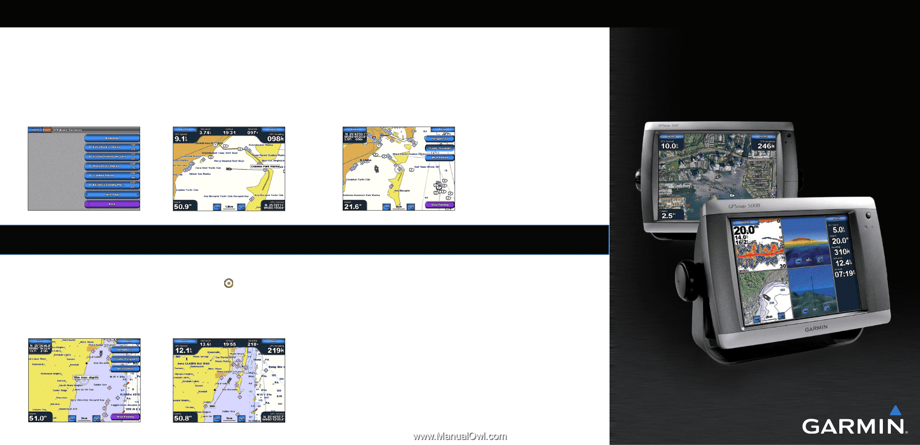
Finding a Marine Service and Navigating to It
To find
and navigate to a marine service from your current location:
1. From the Home screen, touch
Where To?
>
Offshore Services
.
2. Touch the marine service category to which you want to navigate. The chartplotter shows the
list of the 50 nearest locations and the distance and bearing to each.
3. Touch the marine service item to which you want to navigate. A screen containing information
about the selected marine service appears.
4. Touch
Navigate To
>
Go To
to navigate directly to the location. (Or touch
Route To
to create a
specific route to the location.)
5. Follow the colored line on the screen to the destination.
Navigating to a Destination on the Chart
To navigate to a destination on the chart:
1. From the Home screen, touch
Charts
>
Navigation Chart
.
2. Touch the point on the chart to where you want to navigate. A pointer (
) marks the point.
3. Touch
Navigate To
.
4. Touch
Go To
to navigate directly to the location.
5. Follow the line on the Navigation Chart to the destination.
Marking a Waypoint
To mark your current location as a waypoint:
1. From the Home screen, touch
Mark
.
2. Touch
Edit
to designate a specific name, symbol, water depth, water temperature, or add a
comment.
To create a new waypoint:
1. From the Home screen, touch
Charts
>
Navigation Chart
.
2. Touch the location you want to save as a waypoint.
3. Touch
Create Waypoint
.
Navigation Chart
Navigation Chart
Go to Destination
List of Marine Service Items
Go to Destination
GPSMAP
®
5000 Series
quick reference guide
To edit a waypoint:
1. From the Home screen, touch
Charts
>
Navigation Chart
.
2. Touch the waypoint on the Navigation chart.
3. Touch the button for the waypoint you want to edit.
4. Touch
Edit
.
5. Touch the waypoint attribute you want to change (
Name
,
Symbol
,
Depth
,
Water Temp
, or
Comment
).
To delete a waypoint:
1. From the Home screen, touch
Information
>
User Data
>
Waypoints
.
2. Touch the waypoint you want to delete.
3. Touch
Review
>
Delete
.
Editing or Deleting a Waypoint