Garmin GPSMAP 527 Weather Supplement
Garmin GPSMAP 527 Manual
 |
View all Garmin GPSMAP 527 manuals
Add to My Manuals
Save this manual to your list of manuals |
Garmin GPSMAP 527 manual content summary:
- Garmin GPSMAP 527 | Weather Supplement - Page 1
GPSMAP® 400/500 Series Weather and XM Satellite Radio supplement - Garmin GPSMAP 527 | Weather Supplement - Page 2
changes in the content of this manual without obligation to notify any person or organization of such changes or improvements. Go to www.garmin.com for current updates and supplemental information concerning the use of this product. Garmin®, the Gamin logo, GPSMAP®, BlueChart®, GDL®, and g2 Vision - Garmin GPSMAP 527 | Weather Supplement - Page 3
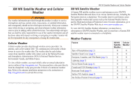
in-country support. Simulator Mode Simulator mode provides simulated weather data. Cellular Equipment Requirements To use cellular weather, you must have a cellular GSM antenna such as the Garmin GDL 40. To connect your chartplotter to a cellular antenna, refer to the installation instructions for - Garmin GPSMAP 527 | Weather Supplement - Page 4
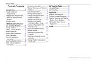
Garmin Product Support i Simulator Mode i XM WX Satellite Weather and Cellular Weather.......... 1 Cellular Weather 1 XM WX Satellite Weather........... 1 Weather Features 1 Weather Data Broadcasts.......... 2 Status Messages 2 Viewing Precipitation Information 2 Switching Weather Charts - Garmin GPSMAP 527 | Weather Supplement - Page 5
com. You may purchase a day pass directly from the chartplotter. A day pass provides 24 hours of continuous weather data. Refer to the antenna installation instructions or the instructions at http://my.garmin.com to activate this service. XM WX Satellite Weather and Cellular Weather XM WX Satellite - Garmin GPSMAP 527 | Weather Supplement - Page 6
different feature appears on the chart. Note: Any weather feature can change in appearance if the source that provides the information changes. When you purchase cellular weather data or when the chartplotter automatically requests a cellular weather update, the current boat position is transmitted - Garmin GPSMAP 527 | Weather Supplement - Page 7
. 1. From the Home screen, select Information > Weather. 2. Select a weather chart. 3. Select MENU > Change Weather. 4. Select a different weather chart. Red cones ➋ appear with a storm cell icon, and the widest part of each cone points in the direction of the projected path of the storm cell. The - Garmin GPSMAP 527 | Weather Supplement - Page 8
which the hurricane will pass, as received from the weather data provider. Weather Warnings and Weather Bulletins When a marine weather warning shaded area. The aqua lines ➋ on the chart indicate the boundaries of marine forecasts, coastal forecasts, and offshore forecasts. Weather bulletins may - Garmin GPSMAP 527 | Weather Supplement - Page 9
Forecast Information The Forecast chart shows city forecasts, marine forecasts, warnings, hurricane warnings, METARS, county warnings, weather fronts and pressure centers (XM data only), surface pressure, and WX buoys. Viewing Present Forecast Information From the Home screen, select Information > - Garmin GPSMAP 527 | Weather Supplement - Page 10
Weather includes data for the next 48 hours. Cellular weather includes data for the next chart shows information about surface conditions, including winds, wave height, wave period, and wave direction. From the Home screen, select Information > Weather > Sea Conditions. Symbol Weather Partly - Garmin GPSMAP 527 | Weather Supplement - Page 11
10 knots, and triangle represents 50 knots. Wind Barb Wind Speed Wind Direction Calm 5 knots 10 knots 15 knots 20 knots 50 knots 65 knots XM WX areas that have the same wave period. Wave directions appear on the chart using red arrows ➍. The direction of each arrow pointer indicates the direction - Garmin GPSMAP 527 | Weather Supplement - Page 12
you are receiving XM WX Satellite Weather data. It is not available if you are receiving only cellular weather data. 1. From the Home screen, select on the Rocker again. Viewing Fishing Information The weather Fishing chart shows present water temperature, present surface pressure conditions, and - Garmin GPSMAP 527 | Weather Supplement - Page 13
if you are receiving only cellular weather data. Visibility is the forecast maximum horizontal distance that can be seen at the surface, as shown in the legend ➊ on the left of the screen. Variations in the visibility shading ➋ show the forecast change in surface visibility. ➊ ➋ GPSMAP 400/500 - Garmin GPSMAP 527 | Weather Supplement - Page 14
Reports Report readings are taken from buoys and coastal observation stations. These readings are used to determine chart. • Pan to a new location, and select the location on the chart. 4. Select Local Weather. 5. Complete an action: • To view present weather conditions from a local weather service - Garmin GPSMAP 527 | Weather Supplement - Page 15
use on one chart are not applied to another chart. The weather overlay settings for each chart must be configured separately. Note: The Fishing chart is available if you use a BlueChart g2 Vision® data card, a BlueChart g2 data card, or if your built-in map supports Fishing charts. XM WX Satellite - Garmin GPSMAP 527 | Weather Supplement - Page 16
seen at the surface. From the Home screen, select Charts > Navigation Chart > MENU > Chart Setup > Weather > Visibility > On. Showing Sea Temperature Data on the Fishing Chart Before you can show sea temperature data on the Fishing chart, you must turn on the weather overlay (page 11). From the Home - Garmin GPSMAP 527 | Weather Supplement - Page 17
conditions for specific species of fish. 1. From the Home screen, select Charts > Fishing Chart > MENU > Chart Setup > Weather > Fish Species > On. 2. Select a species available only if you are receiving cellular weather data. They are not available if you are receiving only XM WX Satellite Weather - Garmin GPSMAP 527 | Weather Supplement - Page 18
> Communication > NMEA 2000 Setup > Device List > GDL 40 > Configure > GSM Antenna > External. Viewing Weather Subscription Information You can view information about the weather services you have subscribed to and how many minutes have passed since the data for each service was updated. The time - Garmin GPSMAP 527 | Weather Supplement - Page 19
Garmin XM satellite radio receiver connected to your chartplotter and to the audio input of your boat. You must also have a subscription to XM Satellite Radio. Go to www.garmin manually, select MENU, Channel Entry, enter a channel number, and select SELECT. Customizing the Channel Guide To turn the - Garmin GPSMAP 527 | Weather Supplement - Page 20
Radio XM Radio Bar Displaying the XM Radio Data Bar on a Chart The XM Radio data bar ➊ is available on all charts. On a chartplotter, a data bar configured to appear on one chart may not appear on another chart. The data bar for each chart must be configured separately. ➊ 1. From the Home screen - Garmin GPSMAP 527 | Weather Supplement - Page 21
, reliability, completeness or timeliness of the traffic and weather information disclosed on the Radio Service. In no event will XM and Garmin, their data suppliers, service providers, marketing/distribution, software or Internet partners or hardware manufacturers be liable to you or to any third - Garmin GPSMAP 527 | Weather Supplement - Page 22
laws of any other applicable country. Software License Agreement BY USING THE CHARTPLOTTER, YOU AGREE TO BE BOUND BY THE TERMS AND CONDITIONS OF THE FOLLOWING SOFTWARE LICENSE AGREEMENT. PLEASE READ THIS AGREEMENT CAREFULLY. Garmin Ltd. and its subsidiaries ("Garmin") grant you a limited license to - Garmin GPSMAP 527 | Weather Supplement - Page 23
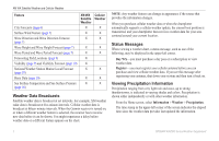
Weather Categories Group Light Blue Flash Flood Dark Blue Flood Yellow Marine/Wind Pink Miscellaneous Orange Severe Storm Areal Flood, Coastal Flood, Debris Flow, Flood, High Water Level, Hydrological, Lakeshore Flood, Storm Surge Brisk Wind, Extreme Wind, Freezing Spray, Gale, Hazardous - Garmin GPSMAP 527 | Weather Supplement - Page 24
Appendix XM Satellite Radio Service Agreement XM Satellite Radio Inc. Hardware and required monthly subscription sold separately. Subscription fee is consumer only. Other fees and taxes, including a one-time activation fee apply. All programming fees and weather data subject to change. XM WX weather - Garmin GPSMAP 527 | Weather Supplement - Page 25
, weather data 2 bulletins, weather 4 buoy reports 10 C channel guide 15 charts fishing 11 chart 5, 10 forecasts 5 city 6 fish 12 future 5 marine 5 offshore 5 past 5 present 5 weather 5 G Garmin Product Support i H hurricanes 4 L legends 7, 12 lightning 3 N National Weather Service 1 Navigation chart - Garmin GPSMAP 527 | Weather Supplement - Page 26
- Garmin GPSMAP 527 | Weather Supplement - Page 27
- Garmin GPSMAP 527 | Weather Supplement - Page 28
the latest free software updates (excluding map data) throughout the life of your Garmin products, visit the Garmin Web site at www.garmin.com. May 2011 © 2011 Garmin Ltd. or its subsidiaries Garmin International, Inc. 1200 East 151st Street, Olathe, Kansas 66062, USA Garmin (Europe) Ltd. Liberty
-
 1
1 -
 2
2 -
 3
3 -
 4
4 -
 5
5 -
 6
6 -
 7
7 -
8
-
9
-
10
-
11
-
12
-
13
-
14
-
15
-
16
-
17
-
18
-
19
-
20
-
21
-
22
-
23
-
24
-
25
-
26
-
27
-
28
 |
 |
GPSMAP
®
400/500 Series
Weather and XM Satellite Radio
supplement