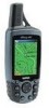
Garmin GPSMAP 60C Owner's Manual
Garmin GPSMAP 60C - Hiking GPS Receiver Manual
 |
UPC - 753759044039
View all Garmin GPSMAP 60C manuals
Add to My Manuals
Save this manual to your list of manuals |
Garmin GPSMAP 60C manual content summary:
- Garmin GPSMAP 60C | Owner's Manual - Page 1
GPSMAP® 60C color map navigator owner's manual - Garmin GPSMAP 60C | Owner's Manual - Page 2
any purpose without the express prior written consent of Garmin. Garmin hereby grants permission to download a single copy of this manual onto a hard drive or other electronic storage medium to be viewed and to print one copy of this manual or of any revision hereto, provided that such electronic - Garmin GPSMAP 60C | Owner's Manual - Page 3
Preface Thank you for choosing the Garmin GPSmap 60C handheld navigation system. This Owner's Manual and Reference Guide is comprised of the following sections: Introduction - contains the Garmin software license agreement, FCC and safety information, the Table of Contents and an overview of the - Garmin GPSMAP 60C | Owner's Manual - Page 4
GPSmap 60C Introduction Software License Agreement Software License Agreement BY USING THE GPSmap 60C, YOU AGREE TO BE BOUND BY THE TERMS AND CONDITIONS OF THE FOLLOWING SOFTWARE LICENSE AGREEMENT. PLEASE READ THIS AGREEMENT CAREFULLY. Garmin grants you a limited license to use the software - Garmin GPSMAP 60C | Owner's Manual - Page 5
with the instructions, may cause receiver is connected. • Consult the dealer or an experienced radio/TV technician for help. GPSmap 60C Introduction FCC Compliance Information The GPSmap 60C does not contain any userserviceable parts. Repairs should only be made by an authorized Garmin service - Garmin GPSMAP 60C | Owner's Manual - Page 6
Introduction Warnings and Precautions CAUTION: Use the GPSmap® 60C at your own risk. To reduce the risk of unsafe operation, carefully review and understand all aspects of this Owner's Manual - and thoroughly practice operation using the Demo Mode prior to actual use. When in actual use, carefully - Garmin GPSMAP 60C | Owner's Manual - Page 7
MAP DATA INFORMATION: One of the goals of Garmin is to provide customers with the most complete and accurate subject to changes which could affect the accuracy and performance of all GPS equipment. Although the Garmin GPSmap 60C is a precision electronic NAVigation AID (NAVAID), any NAVAID can be - Garmin GPSMAP 60C | Owner's Manual - Page 8
Introduction Warnings and Precautions Important Because the Garmin GPSmap 60C can be used for vehicular navigation, important safety considerations must be observed. Please read and observe the instructions on this page. Do Not Mount Where Driver's Field of Vision is Blocked Do Not Place Unsecured - Garmin GPSMAP 60C | Owner's Manual - Page 9
4 The Satellite Page 4 Navigating with the GPSmap 60C 5 The Main Page Sequence 6 The Main Page Features 7 Table of Contents Section 3: GPS Navigation 8-54 The Map Page 8 The Compass Page 14 The Trip Computer Page 16 Using Waypoints 17 Using Find 21 The Main Menu 33 Using Tracks 34 - Garmin GPSMAP 60C | Owner's Manual - Page 10
58 Stopwatch 59 Sun and Moon Tables 60 Hunt and Fish Tables 61 GPS Enhanced Games 62 Non-Enhanced Game 65 Section 5: Appendix 66-83 Accessories 66 Specifications 68 Data Field Definitions 70 Connecting the GPSmap 60C to a Computer 74 Downloading MapSource Map Data 75 UTC Offset Chart 76 - Garmin GPSMAP 60C | Owner's Manual - Page 11
lock in place. USE BY: 2009 USE BY: 2009 Battery Compartment GPSmap 60C Getting Started Battery Installation and Start Up Important Note When replacing batteries, use and damage to the battery compartment. Follow the manufacturer's instructions for proper care and disposal of used batteries. Do - Garmin GPSMAP 60C | Owner's Manual - Page 12
and hold for MOB. MARK Key • Press and release at any time to mark your current location as a waypoint. QUIT Key • Press and release to cancel data entry or exit a page. 2 GPSmap 60C IN FIND OUT PAGE MARK QUIT MENU ENTER POWER/BACKLIGHT Key • Press and Hold to turn unit On/Off. • Press and - Garmin GPSMAP 60C | Owner's Manual - Page 13
the USB Cable drivers included with the MapSource Trip and Waypoint Manager CD-ROM provided with this unit. Otherwise, your PC may attempt to auto-install USB drivers incompatible with the unit. Refer to page 74 for detailed instructions. GPSmap 60C Getting Started Unit Features GPS Helix Antenna - Garmin GPSMAP 60C | Owner's Manual - Page 14
the Map Page to determine your general location so the GPSmap 60C can search for just those satellites above your position. To initialize your GPSmap 60C: 1. Press and release the POWER key to turn on the unit. 2. Observe the "Power On" Page followed by the Satellite Page. 3. While the GPS receiver - Garmin GPSMAP 60C | Owner's Manual - Page 15
your GPSmap 60C, the solution could be as simple as moving slightly to avoid objects that are blocking or deflecting the satellite signals. 5. Press and release the PAGE key until the Map Page is displayed. You are now ready to begin GPS-aided navigation. Active Navigation is supported by - Garmin GPSMAP 60C | Owner's Manual - Page 16
The Main Page Sequence When you turn on the GPSmap 60C, you can see the Power On Page followed by page. "Power On" Page Satellite Page Trip Computer Page Map Page Satellite Page Options 6 Trip Computer Page Options Map Page Options Compass Page Main Menu Compass Page Options There are - Garmin GPSMAP 60C | Owner's Manual - Page 17
a two-dimensional fix is attained and when four or more satellites have been received (three dimensional fix). • Backlighting is Off when you power up the unit. the ENTER key acknowledges the message and closes the window. GPSmap 60C Getting Started The Main Page Features Status Bar Battery Power - Garmin GPSMAP 60C | Owner's Manual - Page 18
streets, parks, etc.) because Garmin MapSource® detailed mapping data has been downloaded from a CD-ROM program. You can use the Map Page to do the following: • Determine your current location and progress while moving. • Select and save a map point as a waypoint. • Locate and navigate to - Garmin GPSMAP 60C | Owner's Manual - Page 19
word, "overzoom" displays just below the map scale. When using MapSource detailed maps, "mapsource" appears below the scale. In many instances the map displays an "Accuracy Circle" surrounding the "Position Icon." The GPSmap 60C uses both map resolution and GPS accuracy in defining your location to - Garmin GPSMAP 60C | Owner's Manual - Page 20
GPSmap 60C GPS Navigation The Map Page The Map Page Options Menu A Quick Look at the Map Page Options Stop Navigation - Stops navigation and is disabled when there is no active navigation. Recalculate - Recalculates a route and is disabled when there is no - Garmin GPSMAP 60C | Owner's Manual - Page 21
Map Page as is (full page map), or add two, three or four navigation data fields. 3. Highlight your choice and press ENTER. GPSmap 60C GPS Navigation The Map Options are related to the display of data received from other devices interfaced to the GPSmap 60C. For an explanation of what each option - Garmin GPSMAP 60C | Owner's Manual - Page 22
GPSmap 60C GPS Navigation The Map Page Guidance Text Options Menu GPS Status Message when not navigating To display Guidance Text: 1. With Map Page displayed, press the MENU key to display the Map Page Options Menu. 2. Highlight the Guidance Text Option and press ENTER to display the Guidance Text - Garmin GPSMAP 60C | Owner's Manual - Page 23
"Declutter On" and press ENTER to activate. Do the same to cancel the "Declutter" option. Restoring Default Settings This option allows you to return the map settings to factory settings. GPSmap 60C GPS Navigation The Map Page Measured Distance The "Measure Distance" Option Enabled - Garmin GPSMAP 60C | Owner's Manual - Page 24
GPSmap 60C GPS Navigation The Compass Page The your destination. Using the Compass Page The Compass Page is your guide to accurate and efficient navigation. It uses traditional navigation displays to is especially helpful when using a paper map in conjunction with your unit for navigation. 14 - Garmin GPSMAP 60C | Owner's Manual - Page 25
" which allows you to determine what data is displayed in the fields. Refer to page 11 for details on changing data fields. GPSmap 60C GPS Navigation The Compass Page Compass Page Options Menu Course Deviation Scale Setting Course Deviation Indicator (CDI) Course Pointer Option Change Data Fields - Garmin GPSMAP 60C | Owner's Manual - Page 26
GPSmap 60C GPS Navigation done in the same manner as for the similar data fields on the Map Page. (See page 11 for details.) Because you want to record new data computer data, clearing the Track Log and deleting Saved Tracks, Waypoints and Routes. This page allows you select individual items , select - Garmin GPSMAP 60C | Owner's Manual - Page 27
GPSmap 60C GPS Navigation The Mark Waypoint Page The Mark Waypoint Page allows you to mark and record your current (or any other) location as a waypoint and displays name for that waypoint and a waypoint symbol. You can mark your current location at any time. Using Waypoints ENTER To mark your - Garmin GPSMAP 60C | Owner's Manual - Page 28
GPSmap 60C GPS Navigation Using Waypoints Map Item selected as a Waypoint Information Page for a Map Point with Data 18 Waypoint Page for a Map Point without Data To create a waypoint with the map panning arrow: 1. With the Map Page displayed, move the panning arrow (Map Pointer) to the map item - Garmin GPSMAP 60C | Owner's Manual - Page 29
. To delete a Waypoint: 1. Use the Find Feature to display the desired waypoint information page. 2. Highlight the "Delete" button at the bottom of the page and press ENTER. Answer "Yes" to the pop-up prompt and press ENTER to delete. GPSmap 60C GPS Navigation Using Waypoints Waypoint Symbols Chart - Garmin GPSMAP 60C | Owner's Manual - Page 30
GPSmap 60C GPS Navigation Using Waypoints New Location Original Location Moving a Waypoint Project Waypoint Page 20 Projected Waypoint on the Map To move a Waypoint on the Map Page: 1. Use the Find Feature to display the Information Page for the desired waypoint (refer to page 23). 2. - Garmin GPSMAP 60C | Owner's Manual - Page 31
to the Garmin website: http://www.garmin.com//cartography/mapSource/ bluechartCD.jsp GPSmap 60C GPS Navigation FIND Press the FIND key to display the Find Menu Using Find Auto Ordering Option places the last selected category at the top of the page. Options Menu for Waypoints Find Menu Options - Garmin GPSMAP 60C | Owner's Manual - Page 32
GPSmap 60C GPS Navigation Using Find "Finding" icon displays while searching Pressing the FIND key with Find Menu displayed will take you to this page. Options Menu 22 Recent Finds List Searching for a location using Find By Name If you know the name of the location you want to find, the Find By - Garmin GPSMAP 60C | Owner's Manual - Page 33
- start a Go To navigation. • If selecting an item to add to a list of points, these three buttons displays as: Save - save as a waypoint. Map - display on the Map Page. Use - insert into a list of points on a route.. GPSmap 60C GPS Navigation Using Find Select as a destination Information Page for - Garmin GPSMAP 60C | Owner's Manual - Page 34
GPSmap 60C GPS Navigation Using Find Waypoint Information Page Options include "Average Location" Find Map Database Item Information Page Options 24 The Find Information Page Options Menu offers eight options for using a Find Item as a tool for navigation. To use the Find Item Information Page - Garmin GPSMAP 60C | Owner's Manual - Page 35
Information Page. (Refer to the Section on Proximity Waypoints on page 56 for detailed information.) • Add To Route - Include this item on a New Route or add it to an existing route. (See Using Routes, page 43 on for details.) GPSmap 60C GPS Navigation Using Find • View Sun and Moon View the Sun - Garmin GPSMAP 60C | Owner's Manual - Page 36
GPSmap 60C GPS Navigation Using Find Find Waypoint Options Find Waypoints List Waypoint Information Page Waypoint Name and Symbol Enter a notation using the Waypoint Location on-screen keypad Coordinates, Elevation and Depth (if applicable) Distance and Direction from Current Location - Garmin GPSMAP 60C | Owner's Manual - Page 37
waypoints list. For more information on creating a geocache point refer to Geocache Setup instruction on page 53 and the Garmin website at www.garmin.com/products/gpsmap60c/. GPSmap 60C GPS Navigation Using Find mode and any additional information about downloaded cache location is displayed in the - Garmin GPSMAP 60C | Owner's Manual - Page 38
GPSmap 60C GPS Navigation Using Find Cities Options Menu Select Maps Options City Page Options Find Cities List City Information Page Searching for a City The Find Cities feature allows you to search for any city listed in the mapping database (either in the basemap or from downloaded detailed - Garmin GPSMAP 60C | Owner's Manual - Page 39
ENTER to display the Information Page for the selected service. The Exit Services Information Page displays the name of the service, its direction from the exit, and a list of the services available. GPSmap 60C GPS Navigation Using Find Find Exits List Options Menus Exit Information Page Exit - Garmin GPSMAP 60C | Owner's Manual - Page 40
GPSmap 60C GPS Navigation Using Find Find Addresses Search Page Find Address Matches 30 Address Information Page Searching for an Address The Find Addresses feature allows you to search for an address if you have downloaded detailed mapping data. Enter the street number, street name and city and - Garmin GPSMAP 60C | Owner's Manual - Page 41
downloaded detailed mapping data. Enter the two street names and city and the Find Feature matches that data with intersections in the map database. To find an Intersection: 1. Press and hold the MENU/FIND key to display the Find follow instructions in step GPSmap 60C GPS Navigation Using Find Options Menu - Garmin GPSMAP 60C | Owner's Manual - Page 42
GPSmap 60C GPS Navigation Using Find Find POI Topic List Search Method Select Category Searching for a Point of Interest You can use the Find Point of Interest feature to locate a nearby restaurant, lodging, landmark, public building, park, etc. However, you must have downloaded MapSource detailed - Garmin GPSMAP 60C | Owner's Manual - Page 43
GPSmap 60C GPS Navigation About the Main Menu The Main Menu The Main Menu is the directory for all unit features not in the Main Page sequence with the exception of Mark Waypoint and the Find Menu, which are accessed by pressing the MARK and FIND keys. The Time and Date can be found at the bottom - Garmin GPSMAP 60C | Owner's Manual - Page 44
GPSmap 60C GPS Navigation Using Tracks Tracks Page with Saved Track Log Options Menu Track Log Setup Page 34 Using a Track Log The Tracks feature creates an electronic trail on the map page as you travel about and is referred to as a Track Log. A track log contains information about points along - Garmin GPSMAP 60C | Owner's Manual - Page 45
display the Distance, Time and Auto options. Because a track is made of a series of points that define your path of travel, they can be placed a speci on the following page) GPSmap 60C GPS Navigation Using Tracks Save Track Page Saved Track on Map Select Track Ending Point Select Track Beginning - Garmin GPSMAP 60C | Owner's Manual - Page 46
GPSmap 60C GPS Navigation Using Tracks Saved Track Page Area Calculation Option Saved Track on the Map Page Start displayed, highlight the Map button and press ENTER to display the Map Page. 2. A map showing the entire track appears with Begin and End markers. Any User Waypoints added to the - Garmin GPSMAP 60C | Owner's Manual - Page 47
supported by the DEM map data loaded on your GPSmap 60C. A Track Profile page displays when you select "Profile." See page 75 for more information about MapSource U.S. Topo 24K maps on the map. 4. Press the MENU key to use "Zoom Ranges" and "Hide Symbols" options. GPSmap 60C GPS Navigation Using - Garmin GPSMAP 60C | Owner's Manual - Page 48
GPSmap 60C GPS Navigation Using Tracks TracBack Page Create User Waypoint Prompt 38 To use the TracBack feature: 1. With the Saved Tracks Page for the track or the Track Log displayed, highlight the TracBack button and press ENTER to display the TracBack Page. 2. A map showing the entire track - Garmin GPSMAP 60C | Owner's Manual - Page 49
. The GPSmap 60C stores 50 routes, with up to 250 waypoints each. A route can be created and modified from the Routes Page, and waypoints can be added to a route from the Find Menu. More complex routes can be created using a PC and MapSource mapping programs and then transferred to the unit memory - Garmin GPSMAP 60C | Owner's Manual - Page 50
GPSmap 60C GPS Navigation Using Routes Direct Line Navigation Go To (Distance) Navigation from Waypoint to Waypoint Auto Routing 40 Manual Routing use existing roadways (either those in the basemap or from downloaded detail mapping) to automatically calculate a route to your destination. Turns on - Garmin GPSMAP 60C | Owner's Manual - Page 51
GPSmap 60C GPS Navigation Navigating a Route After you have created a route, you can on a Route 2. Highlight the "Navigate" button and press ENTER to begin navigation and display the route on the Map Page. 3. To view the list of turns on the route, press the PAGE key to display the Active Route - Garmin GPSMAP 60C | Owner's Manual - Page 52
GPSmap 60C GPS Navigation Using Routes Saved Routes to delete all routes?" Select "Yes" and press ENTER. Route Leg Transition Options Route on the map will transition to the next leg point when you are within a 1 mile radius of that point list of options. Select "Auto," "Manual" or "Distance." 42 - Garmin GPSMAP 60C | Owner's Manual - Page 53
a waypoint on a Route Detail Page: Select the waypoint from the list of waypoints and press ENTER to access the Route Waypoint Options Menu. GPSmap 60C GPS Navigation Using Routes Route Detail Page Route Waypoint Options Menu Options Menu Route Vertical Profile using U.S. Topo 24K DEM mapping data - Garmin GPSMAP 60C | Owner's Manual - Page 54
GPSmap 60C GPS Navigation The Highway Page Highway Page with an Active Route Highway Page Options Menu Data Field Display Options 44 The Highway Page When you are navigating a route, the Highway Page can guide you to the destination using data fields and a graphic highway. Up to four user - Garmin GPSMAP 60C | Owner's Manual - Page 55
select the feature you wish to modify and press ENTER. 3. Instructions for modifying features are explained in the sections that follow. System Setup to select. To view the software version, press MENU, select "Software Version" and press ENTER. GPSmap 60C GPS Navigation The Setup Menu Setup Menu - Garmin GPSMAP 60C | Owner's Manual - Page 56
GPSmap 60C GPS Navigation Display Setup Color Scheme waypoint, route, track log and MapSource data with a PC. GARMIN DGPS - The proprietary format used with a Garmin differential beacon receiver. Provides for tuning of the beacon receiver directly from the GPSmap 60C. NMEA In/NMEA Out - Supports - Garmin GPSMAP 60C | Owner's Manual - Page 57
- Allows DGPS input using a standard RTCM SC-104 format and supports the output of simple ASCII text output of location and velocity information are displayed in the bottom of the page. GPSmap 60C GPS Navigation Interface Setup Data Format Page for GARMIN DGPS Data Format Page for RTCM In/NMEA Out - Garmin GPSMAP 60C | Owner's Manual - Page 58
GPSmap 60C GPS Navigation Tones Setup Tones Sound when highlighted Check the "Mute" box to turn tones off Page Sequence Setup Options Menu Restores to original setting Adds all pages to the list Page Sequence Setup Page 48 Tones Setup The Tones Setup Page allows you to customize the signal - Garmin GPSMAP 60C | Owner's Manual - Page 59
Page has a menu of general options. This menu can be accessed by pressing the MENU key with the page displayed. GPSmap 60C GPS Navigation Map Setup The "General Settings" Map Setup Page Many of the Setup fea- tures use the same type of option lists: Off/On, Most to Least, Small to Large, a scale - Garmin GPSMAP 60C | Owner's Manual - Page 60
GPSmap 60C GPS Navigation Map Setup The "General Settings" Map Setup Page The "Tracks Settings" Map Setup Page The "Points Settings" Map Setup Page 50 Map Setup - General Settings The first page of the Map Setup feature is the General Settings Page. Use this page: to select the map of the Map Setup. - Garmin GPSMAP 60C | Owner's Manual - Page 61
the Marine Settings Page. Use this page to control the display of marine chart items when using downloaded marine charts (i.e. MapSource BlueChart® marine mapping data). GPSmap 60C GPS Navigation Map Setup The "Text Settings" Map Setup Page The "Map Information" Map Setup Page The "Marine Settings - Garmin GPSMAP 60C | Owner's Manual - Page 62
GPSmap 60C GPS Navigation Routing Setup Routing Setup The Routing Setup Page allows you to customize the manner in which routing functions behave. There are setup and option - Garmin GPSMAP 60C | Owner's Manual - Page 63
to find and record items hidden at geographic locations. Refer to the Garmin website, www.garmin.com, for details and how to download geocache alarm. Highlight "OK" and press ENTER to close. GPSmap 60C GPS Navigation Geocache Setup Waypoint Symbols List Marine Setup Speed Filter Options "Deep" - Garmin GPSMAP 60C | Owner's Manual - Page 64
GPSmap 60C GPS Navigation Time Setup To set 60C. To use the Units Setup feature: 1. Access the Units Setup Page. 2. Use the ROCKER and ENTER keys to highlight the various units fields and select the desired units from the lists displayed. For more information about selecting Position Formats and Map - Garmin GPSMAP 60C | Owner's Manual - Page 65
your unit Off and then On again to view your Welcome Page message. You may edit the message as desired by following steps 1 through 3 again. GPSmap 60C GPS Navigation Heading Setup North Reference Options Display Options Welcome Page Setup Text and Number Keypad 55 - Garmin GPSMAP 60C | Owner's Manual - Page 66
GPSmap 60C GPS Navigation Proximity Waypoints Use the ENTER key to Review or Remove an entry. Proximity Waypoints List Number Keypad Press the Menu key to Clear the Entire List Selected Waypoint 56 Proximity Waypoints The Proximity Waypoints Page allows you to establish waypoints that have - Garmin GPSMAP 60C | Owner's Manual - Page 67
and location, press the MENU key and use the ROCKER key to make your choice. GPSmap 60C GPS Features Calendar New Location Options Calendar: Week Format Options Menu Remove Points Options Calendar: Day Format Calendar: Month Format Marked waypoints are automatically added to the Calendar. 57 - Garmin GPSMAP 60C | Owner's Manual - Page 68
GPSmap 60C GPS Features Alarm Clock Calculator Options Menus Alarm Clock The Alarm Clock Feature allows you to use your GPSmap 60C as silence the alarm. Calculator The Calculator Feature allows you to use your GPSmap 60C as a calculator. You can select either a Standard or Scientific calculator - Garmin GPSMAP 60C | Owner's Manual - Page 69
Stopwatch This feature allows you to use the GPSmap 60C as a stopwatch, which includes a lap timer. You may have the unit record lap the new value and press ENTER. When done, highlight "OK" and press ENTER. GPSmap 60C GPS Features Stopwatch Lap Options Menu Stopwatch Page Setting Lap By Distance 59 - Garmin GPSMAP 60C | Owner's Manual - Page 70
GPSmap 60C GPS Features Sun and Moon Tables Location Options Menu Sun and Moon The Sun and Moon Tables provide you with a graphic depiction of the for a different location, highlight the Location field and press ENTER to display the "New Location" options menu and choose from the options shown. 60 - Garmin GPSMAP 60C | Owner's Manual - Page 71
for hunting and fishing for a chosen date and location. GPSmap 60C GPS Features Hunt and Fish Tables To display hunting and fishing predictions states "Map Location." Choose "Use Find Menu" to select a point from the Find Feature database. Follow instructions for using the Find Feature beginning - Garmin GPSMAP 60C | Owner's Manual - Page 72
Unopened Opened Symbol Symbol 62 Games The GPSmap 60C provides games as an entertainment feature. Several of these games employ GPS. To select and play a game for each game. Memory Race This is a GPS virtual game where the playing piece moves where you move. To win the Memory Race, remember which - Garmin GPSMAP 60C | Owner's Manual - Page 73
and large fields being 60 yards by 90 yards (about the size of an American football field). The difficulty levels are: Easy, Normal and Hard. These levels determine how often Gekos appear. The pace quickens and values vary as difficulty levels increase. GPSmap 60C GPS Features GPS Enhanced Games 63 - Garmin GPSMAP 60C | Owner's Manual - Page 74
GPSmap 60C GPS Features GPS Enhanced Games 64 Nibbons In this GPS Orient Map "Northwards" rotates your ship in the center of the map. The map is stationary and north is always up. Orient Map reasonable and prudent caution in selecting an area free of hazards such a holes, obstructions or proximity - Garmin GPSMAP 60C | Owner's Manual - Page 75
Beast Hunt Although not a true GPS game, Beast Hunt requires some navigation skills, in which you must find and defeat the dragon with an arrow to shoot. Hit the dragon and you win. GPSmap 60C GPS Features Non-Enhanced Game Game Symbols Player Pit Warning Dragon Near Pit Dragon Aim Arrow 65 - Garmin GPSMAP 60C | Owner's Manual - Page 76
GPSmap 60C Appendix Accessories Belt Clip Assembly USB Interface Cable and MapSource Trip and Waypoint Manager CD-ROM with USB cable drivers. GA 27C Remote GPS Antenna with MCX Connector. CAUTION: Garmin Accessories have been designed and tested specifically for use with Garmin products. Accessories - Garmin GPSMAP 60C | Owner's Manual - Page 77
shown on this page) Belt Clip (attaches to belt or waistband) USB Connector (under weather cover) Back of GPSmap 60C Power/Data Cable Connector "Serial Port" (under weather cover) GPSmap 60C Appendix Accessories Suction Mount Kit Auto Dash Mount Kit Marine Mount Kit Bicycle Mount Kit 67 - Garmin GPSMAP 60C | Owner's Manual - Page 78
GPSmap 60C Appendix Specifications GPSmap 60C 68 PHYSICAL Case: Size: Weight: Display: Antenna: Keypad: Operating Range: Rugged, fully gasketed, water 5 to 158oF (-15 to 70oC)1 PERFORMANCE Receiver: Acquisition Time: Update Rate: GPS Accuracy Position: Velocity: WAAS enabled, 12 parallel - Garmin GPSMAP 60C | Owner's Manual - Page 79
and proprietary Garmin with RS-232 and USB for PC interface Data Storage Life: Indefinite: no memory battery required Map Storage: Receiver input.) 4. Alkaline batteries lose a significant amount of their capacity as the temperature decreases. Use Lithium batteries when operating the GPSmap 60C - Garmin GPSMAP 60C | Owner's Manual - Page 80
list provides a brief description of each data field option. Some of these options are supported only by devices interfaced to your GPSmap 60C. Accuracy GPS - The current accuracy of your GPS determined location. Bearing - The compass direction from your current position to a destination point - Garmin GPSMAP 60C | Owner's Manual - Page 81
in degrees or cardinal letters (N,S,E,W). Location (lat/lon) - Your current location as latitude/longitude coordinates. Location (selected) - Your current location described in the selected units of determined by both the moving and stopped time and speed. GPSmap 60C Appendix Data Field Options 71 - Garmin GPSMAP 60C | Owner's Manual - Page 82
GPSmap 60C Appendix Data Field Options 72 Sunrise - The time of sunrise for the current date and location. Sunset - The time of sunset for the current date - Garmin GPSMAP 60C | Owner's Manual - Page 83
speed over water. Water Temperature - The temperature of water at a measured depth using measurement devices interfaced to the GPSmap 60C. Waypoint - Destination - The last point on a route, your destination. Waypoint - Next - The next point on your route. GPSmap 60C Appendix Data Field Options 73 - Garmin GPSMAP 60C | Owner's Manual - Page 84
. Connection to your computer is necessary for downloading of detailed map from Garmin MapSource Map Data CDs. You can also save routes, waypoints, and tracks from the GPSmap 60C to MapSource. Refer to the MapSource User's Guide provided with your MapSource CDs. To connect to your computer using - Garmin GPSMAP 60C | Owner's Manual - Page 85
unless you are using mapping data they are designed to support, such as many of the Find Features and DEM Elevation Profiles. Visit the Garmin website for details on all of the maps you can use with the GPSmap 60C. GPSmap 60C Appendix Downloading MapSource Map Data Garmin MapSource CD-ROM's offer - Garmin GPSMAP 60C | Owner's Manual - Page 86
GPSmap 60C Appendix UTC Offset Chart Longitudinal Zone E007.5° to E022.5° E022.5° to E037.5° E052.5° to E067.5° , press and hold the ENTER/MARK key and observe the longitude value in the Mark Waypoint Location field. It should fall within one of the sets of values on the chart. Press the QUIT - Garmin GPSMAP 60C | Owner's Manual - Page 87
of latitude and longitude on a map or chart are referenced to a specific map datum. Every chart has a map datum reference and the GPSmap 60C can be set to match most of those commonly used. If you are navigating and comparing the GPS coordinates to a map, chart or other reference, the map datum - Garmin GPSMAP 60C | Owner's Manual - Page 88
that the GPSmap 60C is not relying on the LORAN signal for navigation and actually converts the TD coordinate to a useful LAT/LON coordinate before storing the waypoint to memory or using LORAN TD Position Format Handbook, available at the Garmin Web site, at www.garmin.com/support/userManual.html. - Garmin GPSMAP 60C | Owner's Manual - Page 89
status of the differential beacon sites. Using DGPS requires interfacing of your unit to additional equipment in the form of a beacon receiver compatible with the RTCM format sentences supported by your Garmin GPS. Refer to the section titled "Interface Setup." GPSmap 60C Appendix WAAS and DGPS 79 - Garmin GPSMAP 60C | Owner's Manual - Page 90
manual. The input/output lines on your GPSmap 60C are RS-232 compatible, allowing easy interface to a wide range of external devices, including PC's, differential beacon receivers, marine autopilots and /or a second GPS receiver. The NMEA 0183 version 3.01 interface format is supported by the GPSmap - Garmin GPSMAP 60C | Owner's Manual - Page 91
GPSmap 60C Appendix Index A D Find Waypoints 26 Accessories 66 Accuracy Circle 9 Activate a Route 40 Active Route page 6, 41 Alarm Clock 58 Arrow, Panning 9 Data Fields 11, 15, 43, 44 Map Display 8 Data Field Definitions 70 G Map Features 9 Date and Time Setup 54, 76 Games 62-65 Map Page - Garmin GPSMAP 60C | Owner's Manual - Page 92
GPSmap 60C Appendix Index P Page Sequence Setup 48 Panning (Map) 18 Position Format 55, 77 Product Registration i Projecting a Waypoint 20 Proximity Waypoints 56 R Reset Trip Page 16 Routes 39-43 Creating 39 Copying 43 Deleting 43 Editing 43 Navigating 43 Reversing 41 Routing Setup 52 S Satellite - Garmin GPSMAP 60C | Owner's Manual - Page 93
GPSmap 60C Appendix Limited Warranty This Garmin product is warranted to be free from defects in materials or workmanship for one year from the date of purchase. Within this period, Garmin will at its sole option, repair or replace any components that fail in normal use. Such repairs or replacement - Garmin GPSMAP 60C | Owner's Manual - Page 94
GPSmap 60C 84 - Garmin GPSMAP 60C | Owner's Manual - Page 95
- Garmin GPSMAP 60C | Owner's Manual - Page 96
For the latest free software updates (excluding map data) throughout the life of your Garmin products, visit the Garmin web site at www.garmin.com © Copyright 2004 Garmin Ltd. or its subsidiaries Garmin International, Inc. 1200 East 151st Street, Olathe, Kansas 66062, U.S.A. Garmin (Europe) Ltd.
-
 1
1 -
 2
2 -
 3
3 -
 4
4 -
 5
5 -
 6
6 -
 7
7 -
8
-
9
-
10
-
11
-
12
-
13
-
14
-
15
-
16
-
17
-
18
-
19
-
20
-
21
-
22
-
23
-
24
-
25
-
26
-
27
-
28
-
29
-
30
-
31
-
32
-
33
-
34
-
35
-
36
-
37
-
38
-
39
-
40
-
41
-
42
-
43
-
44
-
45
-
46
-
47
-
48
-
49
-
50
-
51
-
52
-
53
-
54
-
55
-
56
-
57
-
58
-
59
-
60
-
61
-
62
-
63
-
64
-
65
-
66
-
67
-
68
-
69
-
70
-
71
-
72
-
73
-
74
-
75
-
76
-
77
-
78
-
79
-
80
-
81
-
82
-
83
-
84
-
85
-
86
-
87
-
88
-
89
-
90
-
91
-
92
-
93
-
94
-
95
-
96
 |
 |

color map navigator
owner’s manual
GPSMAP
®
60C