Garmin GPSMAP 740/740s Owner's Manual - Page 46
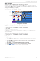
Change Upwind Scale, Show True Wind
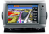 |
View all Garmin GPSMAP 740/740s manuals
Add to My Manuals
Save this manual to your list of manuals |
Page 46 highlights
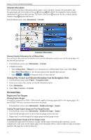
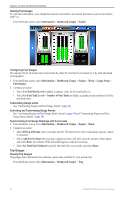
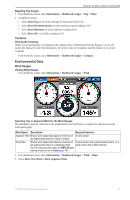
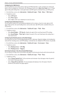
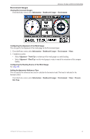
Almanac, On-boat, and Environmental Data Configuring the VMG Source You can specify the source of the velocity made good (VMG) data that is used to calculate true wind speed. Before you can configure the VMG source, the wind gauge must be set to Show True Wind (page 41). Water speed is the speed reading from a water-speed sensor, and GPS speed is calculated from your GPS position. 1. From the Home screen, select Information > Dashboard Gauges > Wind > Menu > VMG Source. 2. Complete an action: • Select GPS Speed. • Select Water Speed. • Select Auto to allow your chartplotter to select the source. Configuring the Wind Speed Source You can specify whether the vessel speed data displayed on the compass is based on water speed or GPS speed. Water speed is the speed reading from a water-speed sensor, and GPS speed is calculated from your GPS position. 1. From the Home screen, select Information > Dashboard Gauges > Wind > Menu. 2. Complete an action: • Select Speed Display > GPS Speed to display the speed of the vessel based upon GPS readings. • Select Speed Display > Water Spd to display the speed of the vessel based upon the reading from a water speed sensor. Configuring the Heading Source of the Wind Gauge You can specify the source of the heading displayed on the wind gauge. Magnetic heading is the heading data received from a heading sensor, and GPS heading is calculated by your chartplotter GPS (course over ground). 1. From the Home screen, select Information > Dashboard Gauges > Environment > Menu. 2. Complete an action: • Select Heading Source > GPS Hdg. • Select Heading Source > Magnetic. Selecting the Range of the Close Hauled Wind Gauge You can specify the range of the close hauled wind gauge for both the upwind scale and the downwind scale. 1. From the Home screen, select Information > Dashboard Gauges > Wind > Menu. 2. Complete an action: • Select Change Upwind Scale. Set the maximum and minimum values that appear when the upwind close hauled wind gauge appears. • Select Change Downwind Scale. Set the maximum and minimum values that appear when the downwind close hauled wind gauge appears. 42 GPSMAP 700 Series Owner's Manual
-
 1
1 -
2
-
3
-
4
-
5
-
6
-
7
-
8
-
9
-
10
-
11
-
12
-
13
-
14
-
15
-
16
-
17
-
18
-
19
-
20
-
21
-
22
-
23
-
24
-
25
-
26
-
27
-
28
-
29
-
30
-
31
-
32
-
33
-
34
-
35
-
36
-
37
-
38
-
39
-
40
-
 41
41 -
 42
42 -
 43
43 -
 44
44 -
 45
45 -
 46
46 -
 47
47 -
 48
48 -
 49
49 -
 50
50 -
 51
51 -
52
-
53
-
54
-
55
-
56
-
57
-
58
-
59
-
60
-
61
-
62
-
63
-
64
-
65
-
66
-
67
-
68
-
69
-
70
-
71
-
72
-
73
-
74
-
75
-
76
-
77
-
78
-
79
-
80
-
81
-
82
-
83
-
84
-
85
-
86
-
87
-
88
-
89
-
90
-
91
-
92
-
93
-
94
-
95
-
96
-
97
-
98
-
99
-
100
 |
 |