Garmin GPSMAP 740/740s Owner's Manual - Page 49
Display Configuration, Navigation Preferences, Setting the Sound, Setting the Language, Route Settings
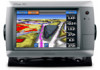 |
View all Garmin GPSMAP 740/740s manuals
Add to My Manuals
Save this manual to your list of manuals |
Page 49 highlights
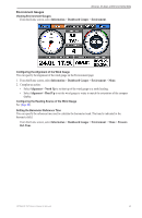
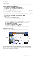
Device Configuration Display Configuration Setting the Sound You can set when the chartplotter makes audible sounds. 1. From the Home screen, select Configure > System > Beeper/Display > Beeper. 2. Complete an action: • Select Alarms Only to have the chartplotter beep only when alarms are triggered (default). • Select On (Touch and Alarms) to have the chartplotter beep when the screen is touched and when alarms are triggered. Setting the Language You can select the language that appears on the chartplotter. 1. From the Home screen, select Configure > System > Language. 2. Select a language. Navigation Preferences Route Settings Selecting a Route Label Type You can select the type of labels shown with route turns on the map. 1. From the Home screen, select Configure > Navigation > Route Labels. 2. Complete an action: • Select Show Name to identify route turns using waypoint names. • Select Show Number to identify route turns using numbers, such as Turn 1 and Turn 2. Configuring Route Turn Transitions You can set how much time, or how far, before a turn in a route that you transition to the next leg. Raising this value can help improve the accuracy of the autopilot when navigating a route or an Auto Guidance line with many frequent turns, or at higher speeds. For straighter routes or slower speeds, lowering this value can improve autopilot accuracy. 1. From the Home screen, select Configure > Navigation > Turn Transition Activation. 2. Complete an action: • Select Time > Turn Transition Time, and enter the time. • Select Distance > Turn Transition Distance, and enter the distance. 3. Select Done. Configuring Speed Data Sources You can specify the source of the speed data that is used to calculate true wind speed or fuel economy. Water speed is the speed reading from a water-speed sensor, and GPS speed is calculated from your GPS position. 1. From the Home screen, select Configure > System > Speed Sources. 2. Complete an action: • Select Wind, and indicate if the calculated wind speed data comes from a Water Speed sensor, if it is based on the GPS Speed, or whether the chartplotter selects a speed data source automatically. • Select Fuel Economy, and indicate whether the speed data that is used to calculate fuel economy comes from a Water Speed sensor or is based on the GPS Speed. Auto Guidance Line Configurations You can set the parameters the chartplotter uses when calculating an Auto Guidance line. Note: Auto Guidance is available with a preprogrammed BlueChart g2 Vision data card. GPSMAP 700 Series Owner's Manual 45
-
 1
1 -
2
-
3
-
4
-
5
-
6
-
7
-
8
-
9
-
10
-
11
-
12
-
13
-
14
-
15
-
16
-
17
-
18
-
19
-
20
-
21
-
22
-
23
-
24
-
25
-
26
-
27
-
28
-
29
-
30
-
31
-
32
-
33
-
34
-
35
-
36
-
37
-
38
-
39
-
40
-
41
-
42
-
43
-
 44
44 -
 45
45 -
 46
46 -
 47
47 -
 48
48 -
 49
49 -
 50
50 -
 51
51 -
 52
52 -
 53
53 -
 54
54 -
55
-
56
-
57
-
58
-
59
-
60
-
61
-
62
-
63
-
64
-
65
-
66
-
67
-
68
-
69
-
70
-
71
-
72
-
73
-
74
-
75
-
76
-
77
-
78
-
79
-
80
-
81
-
82
-
83
-
84
-
85
-
86
-
87
-
88
-
89
-
90
-
91
-
92
-
93
-
94
-
95
-
96
-
97
-
98
-
99
-
100
 |
 |