Garmin GPSMAP 78sc Owner's Manual
Garmin GPSMAP 78sc Manual
 |
View all Garmin GPSMAP 78sc manuals
Add to My Manuals
Save this manual to your list of manuals |
Garmin GPSMAP 78sc manual content summary:
- Garmin GPSMAP 78sc | Owner's Manual - Page 1
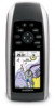
GPSMAP® 78 series owner's manual for use with the GPSMAP 78, GPSMAP 78S, and GPSMAP 78Sc - Garmin GPSMAP 78sc | Owner's Manual - Page 2
changes or improvements. Visit the Garmin Web site (www.garmin.com) for current updates and supplemental information concerning the use and operation of this and other Garmin products. Garmin®, BlueChart®, City Navigator®, and GPSMAP® are trademarks of Garmin Ltd. or its subsidiaries, registered - Garmin GPSMAP 78sc | Owner's Manual - Page 3
the Device On or Off..... 3 Acquiring Satellite Signals......... 4 Buttons 4 Navigating with Waypoints and Routes 6 Waypoints 6 Routes 7 Additional Maps 9 Tracks 10 About Tracks 10 Navigating a Saved Track.........11 Using the Main Pages....... 12 Customizing the Data Fields.... 12 Restoring - Garmin GPSMAP 78sc | Owner's Manual - Page 4
Garmin Product Support 35 Using the Backlight 36 Specifications 36 Maximizing Battery Life 37 About the Batteries 38 Buying Optional Accessories... 38 Using Optional Fitness Accessories 39 Data Management 40 Attaching the Wrist Strap......... 43 Caring for the Device 44 Troubleshooting - Garmin GPSMAP 78sc | Owner's Manual - Page 5
instructed to press something, use the buttons on the unit. Use the Rocker to select something in a list, and then press ENTER. See page 5. The small arrows (>) used in the text indicate that you should select a series of items in order, for example, "Select Delete > Yes." GPSMAP 78 Series Owner - Garmin GPSMAP 78sc | Owner's Manual - Page 6
Getting Started Device Overview Internal antenna Buttons Display 2 MCX connector for external GPS antenna (under weather cap) Serial port (under weather cap) mini-USB port (under weather cap) Battery compartment microSD™ card slot (under batteries) GPSMAP 78 Series Owner's Manual - Garmin GPSMAP 78sc | Owner's Manual - Page 7
the Device On or Off Press and hold . Setting Your Language 1. Turn on the unit. 2. Use the Rocker to select a language. 3. Replace the battery cover. For best results, after you install new batteries, update the battery type in the system settings (page 37). GPSMAP 78 Series Owner's Manual 3 - Garmin GPSMAP 78sc | Owner's Manual - Page 8
. 4. Quickly press to open the backlight status page. The GPS bars indicate satellite strength. When the bars are green, the waypoint and begin navigation to that point. Press and hold to turn the device on and off. Quickly press to open the backlight status page. GPSMAP 78 Series Owner's Manual - Garmin GPSMAP 78sc | Owner's Manual - Page 9
acknowledge messages. Press and hold MARK to save your current location as a waypoint. Rocker + - Getting Started Press up, down, right, and left to select menu options and to move the map cursor. Press + to zoom in on the map. Press - to zoom out on the map. GPSMAP 78 Series Owner's Manual 5 - Garmin GPSMAP 78sc | Owner's Manual - Page 10
Waypoint Manager. 2. Select a waypoint. 3. Select an attribute (such as the name or location). 4. Enter the new information. 5. Select Done. Deleting a Waypoint 1. From the main menu, select Waypoint Manager. 2. Select a waypoint. 3. Press Menu. 4. Select Delete. 6 GPSMAP 78 Series Owner's Manual - Garmin GPSMAP 78sc | Owner's Manual - Page 11
. 5. Select Done. Editing a Route 1. From the main menu, select Route Planner. 2. Select a route. 3. Select Edit Route. 4. Select a point. 5. Select an option: • Review-shows the point on the map. • Move Down (or Up)-changes the order of the point on the route. GPSMAP 78 Series Owner's Manual 7 - Garmin GPSMAP 78sc | Owner's Manual - Page 12
Stopping Navigation of a Route 1. From any page, press FIND. 2. Select Stop Navigation. Navigating a Reverse Route 1. From the main menu, select Route Planner. 2. Select a route. 3. Select Reverse Route. 4. Select the route again. 5. Select View Map. 6. Select Go. 8 GPSMAP 78 Series Owner's Manual - Garmin GPSMAP 78sc | Owner's Manual - Page 13
code searching. 5. Select the city. Navigating with Waypoints and Routes 6. Enter the house number. 7. Enter the street. 8. Select Go. Finding Marine Services 1. Press FIND. 2. Select Marine Services. 3. Select a category. 4. Select a destination. 5. Select Go. GPSMAP 78 Series Owner's Manual 9 - Garmin GPSMAP 78sc | Owner's Manual - Page 14
Garmin device records a track log while you are moving. You can save these tracks and navigate On Map. If you select Record, Show On Map, a line on the map Using the Most Often interval provides the most track detail and fills up the device memory quicker. 10 GPSMAP 78 Series Owner's Manual - Garmin GPSMAP 78sc | Owner's Manual - Page 15
an option: • View Map-shows the current track on the map. • Elevation Plot-shows Delete > Yes. Navigating a Saved Track You must record and save a track (page 11) before you can navigate using it. 1. Press FIND. 2. Select Tracks. 3. Select a saved track. 4. Select Go. GPSMAP 78 Series Owner's Manual - Garmin GPSMAP 78sc | Owner's Manual - Page 16
, press MENU. 2. Select Setup Map > Orientation. 3. Select an orientation: • Select North Up to show north at the top of the page. • Select Track Up to show your current direction of travel at the top of the page. • Select Automotive Mode to show a perspective view. GPSMAP 78 Series Owner's Manual - Garmin GPSMAP 78sc | Owner's Manual - Page 17
at the top of the page. 4. Press quit to stop measuring. Map Setup Options From the map, press menu, and select Setup Map. • Map Orientation-allows you to select how the map is displayed (page 12). GPSMAP 78 Series Owner's Manual Using the Main Pages • Guidance Text-allows you to select when to - Garmin GPSMAP 78sc | Owner's Manual - Page 18
the GPSMAP 78S and GPSMAP 78Sc. You should calibrate the compass after moving long distances, experiencing temperature changes, or changing the batteries. 1. From the compass, press MENU. 2. Select Calibrate Compass > Start. 3. Follow the on-screen instructions. 14 GPSMAP 78 Series Owner's Manual - Garmin GPSMAP 78sc | Owner's Manual - Page 19
. 3. Follow the bearing pointer to your destination. Using Sight 'N Go NOTE: Sight 'N Go is available only with the GPSMAP 78S and GPSMAP 78Sc. You can point the device at an object in the distance, such as a lighthouse, lock in the direction, and then navigate to the object. 1. From the main menu - Garmin GPSMAP 78sc | Owner's Manual - Page 20
GPSMAP 78S and GPSMAP 78Sc. Calibrating the Barometric Altimeter You can manually calibrate the barometric altimeter if you know the correct elevation or the correct pressure. 1. From the elevation plot, press menu. 2. Select Calibrate Altimeter. 3. Follow the on-screen instructions. 16 GPSMAP 78 - Garmin GPSMAP 78sc | Owner's Manual - Page 21
-restores the device to factory settings. Calibrate Altimeter-see page 16. Opening the Main Menu The main menu gives you access to setup screens including waypoints, tracks, and routes. See page 19 for main menu settings pages. From any page, press MENU twice. GPSMAP 78 Series Owner's Manual 17 - Garmin GPSMAP 78sc | Owner's Manual - Page 22
Using the Main Pages Trip Computer The trip computer displays your current speed, average speed, maximum speed, trip odometer, and other note: Your customized settings are remembered by the dashboard, and will not be lost when you change profiles (page 20). 18 GPSMAP 78 Series Owner's Manual - Garmin GPSMAP 78sc | Owner's Manual - Page 23
or receive data when connected to another compatible device. You must be within 10 feet (3 m) of the compatible Garmin device. Sending and Receiving Data 1. From the main menu, select Share Wirelessly. 2. Select Send or Receive. 3. Follow the on-screen instructions. GPSMAP 78 Series Owner's Manual - Garmin GPSMAP 78sc | Owner's Manual - Page 24
area you want to calculate. 3. Select Calculate when finished. After you calculate the area, you can save the track to your device and change the unit of measure. GPSMAP 78 Series Owner's Manual - Garmin GPSMAP 78sc | Owner's Manual - Page 25
. • AutoLocate® Position-calculates your GPS position using the Garmin AutoLocate feature. Additional Main Menu Tools • Calendar-displays a calendar. • Calculator-displays a calculator. • Sun and Moon-displays sunrise and sunset times along with the moon phase. GPSMAP 78 Series Owner's Manual 21 - Garmin GPSMAP 78sc | Owner's Manual - Page 26
are not currently using the device, you can set the device to turn on at a specific time. • use a timer, mark a lap, and time laps. • Waypoint Averaging-allows you to refine a waypoint location with multiple samples to achieve the most-accurate location possible. 22 GPSMAP 78 Series Owner's Manual - Garmin GPSMAP 78sc | Owner's Manual - Page 27
a data field. 4. Follow the on-screen instructions. Data Field Options ** Available only with the GPSMAP 78S and GPSMAP 78Sc. Data Field Accuracy of GPS Description The margin of error for your exact The direction from your starting location to a destination. GPSMAP 78 Series Owner's Manual 23 - Garmin GPSMAP 78sc | Owner's Manual - Page 28
of day you will reach the next waypoint on the route. Glide Ratio The ratio GPS Signal Strength The strength of the GPS signal. Heading The direction you are moving. **Heart Rate Your heart rate in beats (heart rate monitor per minute (bpm). required) 24 GPSMAP 78 Series Owner's Manual - Garmin GPSMAP 78sc | Owner's Manual - Page 29
the next waypoint or turn. The current rate of speed at which you are moving since last reset. GPSMAP 78 Series Owner's Manual Customizing Your Device The time of sunrise based on your GPS position. Sunset The time of sunset based on your GPS position. Temperature - Water The temperature of - Garmin GPSMAP 78sc | Owner's Manual - Page 30
Dest. The measurement of your rate of ascent or descent to a predetermined altitude. Vertical Speed Your rate of altitude gain or loss over time. Waypoint at Dest. The last point on a route to your destination. Waypoint at Next The next point on your route. 26 GPSMAP 78 Series Owner's Manual - Garmin GPSMAP 78sc | Owner's Manual - Page 31
/European Geostationary Navigation Overlay Service), or Demo Mode (GPS off). For information about WAAS, go to www.garmin.com/aboutGPS/waas .html. • Language-sets the text language on the device. note: Changing the text language does not change the language of user-entered data or map data, such - Garmin GPSMAP 78sc | Owner's Manual - Page 32
that the marine POIs are more readable. The nautical chart reflects the drawing scheme of paper charts. ◦◦ Fishing-(requires marine maps) displays a detailed view of bottom contours and depth soundings. Simplifies map presentation for optimal use while fishing. 28 GPSMAP 78 Series Owner's Manual - Garmin GPSMAP 78sc | Owner's Manual - Page 33
Sectors-displays the sector in which a navigational light is visible. You can select On to show NOAA or IALA symbols on the map. • Marine Alarm Setup-sets the anchor drag alarm, Marine Settings. 2. Select Off Course Alarm > On. 3. Enter a distance. 4. Select Done. GPSMAP 78 Series Owner's Manual 29 - Garmin GPSMAP 78sc | Owner's Manual - Page 34
1. From the main menu, select Setup > Marine > Marine Alarm Setup. 2. Select Shallow Water > On to alarm. 7. Select Done. Resetting Data You can reset trip data, delete all waypoints, clear the current track, or restore default values. 1. From . 5. Press Enter. 30 GPSMAP 78 Series Owner's Manual - Garmin GPSMAP 78sc | Owner's Manual - Page 35
main menu, select Setup > Units. 2. Select a setting. 3. Select a unit for the setting. GPSMAP 78 Series Owner's Manual Customizing Your Device 4. Repeat GPS position. Position Format Settings Note: Do not change the position format or the map datum coordinate system unless you are using a map or - Garmin GPSMAP 78sc | Owner's Manual - Page 36
location reading appears. • Map Datum-sets the coordinate system on which the map is structured. • Map Spheroid-shows the coordinate system the device is using. The default coordinate system Barometric Pressure-records barometric pressure over a period of time. 32 GPSMAP 78 Series Owner's Manual - Garmin GPSMAP 78sc | Owner's Manual - Page 37
road, compensating for variances in map position accuracy (requires routable maps). • Off Road Transitions ◦◦ Auto-automatically routes you to the next point. ◦◦ Manual-allows you to select the next point on the route by using the point on the active route page. GPSMAP 78 Series Owner's Manual 33 - Garmin GPSMAP 78sc | Owner's Manual - Page 38
> OK. Editing a Profile Name 1. From the main menu, select Setup > Profiles. 2. Select a profile. 3. Select Edit Name. 4. Enter the new name. 5. Select Done. Deleting a Profile 1. From the main menu, select Setup > Profiles. 2. Select a profile. 3. Select Delete. 34 GPSMAP 78 Series Owner's Manual - Garmin GPSMAP 78sc | Owner's Manual - Page 39
can contact Garmin Product Support if you have any questions about this product. • In the USA, go to www.garmin .com/support, or contact Garmin USA by phone at (913) 397.8200 or (800) 800.1020. • In the UK, contact Garmin (Europe) Ltd. by phone at 0808 2380000. GPSMAP 78 Series Owner's Manual 35 - Garmin GPSMAP 78sc | Owner's Manual - Page 40
No memory battery is required. The GPSMAP 78S and 78Sc have a microSD card slot for additional data storage. USB and serial Two AA batteries (alkaline, NiMH, or lithium) See page 38. Up to 20 hours, typical usage From 5°F to 158°F (from -15 to 70°C) See page 38. 36 GPSMAP 78 Series Owner's Manual - Garmin GPSMAP 78sc | Owner's Manual - Page 41
> On. Decreasing the Backlight Extensive use of screen backlighting can significantly reduce battery life. You can adjust the backlight brightness and decrease the backlight timeout to maximize battery power. 1. Quickly press to open the backlight status page. GPSMAP 78 Series Owner's Manual 37 - Garmin GPSMAP 78sc | Owner's Manual - Page 42
batteries. Stored data is not lost when batteries are removed. Buying Optional Accessories Go to http://buy.garmin.com, or contact your Garmin dealer for information about optional accessories, preloaded map data cards, fitness accessories, and replacement parts. 38 GPSMAP 78 Series Owner's Manual - Garmin GPSMAP 78sc | Owner's Manual - Page 43
option is available only with the GPSMAP 78S and GPSMAP 78Sc. Before you can use the fitness accessory with your device, you must install the accessory according to the instructions that are included with the accessory. You can use optional fitness accessories including a heart rate monitor or - Garmin GPSMAP 78sc | Owner's Manual - Page 44
Card You can purchase microSD memory cards from an electronics supplier, or purchase preloaded detailed map data cards from your Garmin dealer. In addition to map and data storage, the memory cards can be used to store files such as images, cartridges, geocaches, routes, waypoints, and custom POIs - Garmin GPSMAP 78sc | Owner's Manual - Page 45
USB Cable notice To prevent corrosion, thoroughly dry the mini-USB port, the weather cap, and the surrounding area before charging or connecting to a computer. 1. Connect the USB cable to a USB port on your computer. 2. Pull up the weather cap from the mini-USB port. GPSMAP 78 Series Owner's Manual - Garmin GPSMAP 78sc | Owner's Manual - Page 46
weather cap microSD card slot (inside battery compartment) 3. Plug the small end of the USB cable into the mini-USB port. Your device and micro SD card (optional 3. Select Edit > Copy. 4. Open the "Garmin" or memory card drive/volume. 5. Select Edit > Paste. 42 GPSMAP 78 Series Owner's Manual - Garmin GPSMAP 78sc | Owner's Manual - Page 47
40). 1. Open the "Garmin" drive or volume. 2. If necessary, open a folder or volume. 3. Select the files. 4. Press the Delete key on your keyboard. Appendix Disconnecting the USB Cable 1. Complete an action: 2. Route the strap through the loop and pull it tight. GPSMAP 78 Series Owner's Manual 43 - Garmin GPSMAP 78sc | Owner's Manual - Page 48
with a mild detergent solution. 2. Wipe it dry. Cleaning the Screen 1. Use a soft, clean, lint-free cloth. 2. If necessary, use water, isopropyl alcohol, or eyeglass lens cleaner. 3. Apply the liquid to the cloth, and gently wipe the screen with the cloth. 44 GPSMAP 78 Series Owner's Manual - Garmin GPSMAP 78sc | Owner's Manual - Page 49
Appendix Troubleshooting Problem Solution The screen or buttons do 1. Remove How do I know my device is in USB mass storage mode? On the device, a screen appears showing the Garmin logo and the USB symbol. On your computer, you should see mass storage mode. GPSMAP 78 Series Owner's Manual 45 - Garmin GPSMAP 78sc | Owner's Manual - Page 50
your operating system to learn how to assign drive letters. I need replacement parts Go to http://buy.garmin.com, or contact your Garmin dealer. or accessories. I want to buy an external Go to http://buy.garmin.com, or contact your Garmin dealer. GPS antenna. 46 GPSMAP 78 Series Owner's Manual - Garmin GPSMAP 78sc | Owner's Manual - Page 51
for the device 44 long-term storage 38 compass calibrating 14 navigating 14 setup options 15 connecting USB cable 41 wireless accessories 39 GPSMAP 78 Series Owner's Manual Index wirelessly 19 creating routes 7 waypoints 6 customizing data fields 12 device settings 27-34 profiles 34 - Garmin GPSMAP 78sc | Owner's Manual - Page 52
system 31 marine settings 28-29 MARK button 5 MCX connector 2 measuring area 20 distance 13 MENU button 5, 12, 17, 23 microSD card 36, 39-41 MOB button 4 moonphase 21 N navigating compass 14 routes 8 to geocaches 19 to waypoints 6 tracks 11 48 GPSMAP 78 Series Owner's Manual - Garmin GPSMAP 78sc | Owner's Manual - Page 53
guidance method 33 navigating 8 settings 33 S satellite signals 4, 21, 23, 24, 37, 45 AutoLocate 21 system settings 27 turning off GPS 21 saving tracks 11 search menu 4, 6 Sight 'N Go 15 GPSMAP 78 Series Owner's Manual Index software updating 35 version 35 specifications 36 stopwatch - Garmin GPSMAP 78sc | Owner's Manual - Page 54
wirelessly 19 trip computer 18 troubleshooting 45 U unit ID 35 updating software 35 USB cable 45 connecting 41 disconnecting 43 W waypoints averaging 22 creating 6 deleting 6 editting 6 navigating to 6 wrist strap 43 50 Z zooming 5, 13 zoom ranges 17 GPSMAP 78 Series Owner's Manual - Garmin GPSMAP 78sc | Owner's Manual - Page 55
- Garmin GPSMAP 78sc | Owner's Manual - Page 56
For the latest free software updates (excluding map data) throughout the life of your Garmin products, visit the Garmin Web site at www.garmin.com. © 2010 Garmin Ltd. or its subsidiaries Garmin International, Inc. 1200 East 151st Street, Olathe, Kansas 66062, USA Garmin (Europe) Ltd. Liberty
-
 1
1 -
 2
2 -
 3
3 -
 4
4 -
 5
5 -
 6
6 -
 7
7 -
8
-
9
-
10
-
11
-
12
-
13
-
14
-
15
-
16
-
17
-
18
-
19
-
20
-
21
-
22
-
23
-
24
-
25
-
26
-
27
-
28
-
29
-
30
-
31
-
32
-
33
-
34
-
35
-
36
-
37
-
38
-
39
-
40
-
41
-
42
-
43
-
44
-
45
-
46
-
47
-
48
-
49
-
50
-
51
-
52
-
53
-
54
-
55
-
56
 |
 |

GPSMAP
®
78 series
owner’s manual
for use with the GPSMAP 78, GPSMAP
78S, and GPSMAP 78Sc