Garmin GPSMAP 8530 Black Box Owner's Manual
Garmin GPSMAP 8530 Black Box Manual
 |
View all Garmin GPSMAP 8530 Black Box manuals
Add to My Manuals
Save this manual to your list of manuals |
Garmin GPSMAP 8530 Black Box manual content summary:
- Garmin GPSMAP 8530 Black Box | Owner's Manual - Page 1
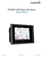
GPSMAP® 8000 Glass Helm Series Owner's Manual March 2013 190-01557-00_0A Printed in Taiwan - Garmin GPSMAP 8530 Black Box | Owner's Manual - Page 2
the content of this manual without obligation to notify any person or organization of such changes or improvements. Go to www.garmin.com for current updates and supplemental information concerning the use of this product. Garmin®, the Garmin logo, BlueChart®, g2 Vision®, GPSMAP®, and MapSource® are - Garmin GPSMAP 8530 Black Box | Owner's Manual - Page 3
GPSMAP 8000 Series Front View 1 Inserting a Memory Card 1 Using the Touchscreen 1 Locking the Touchscreen 1 Tips and Shortcuts 1 GPS Satellite Signals 1 Stations and Station Layouts 1 Customizing the Home Chart 7 Searching for a Marine Services Destination 7 Courses 7 Setting and Following - Garmin GPSMAP 8530 Black Box | Owner's Manual - Page 4
and Clutter 14 Automatically Adjusting Gain on the Radar Screen ....... 14 Manually Adjusting Gain on the Radar Screen 14 Minimizing Nearby Large-Object Weather Subscription Information 22 SiriusXM Radio 22 Customizing the Channel Guide 22 Saving a SiriusXM Channel to the Presets List 22 - Garmin GPSMAP 8530 Black Box | Owner's Manual - Page 5
NMEA 0183 Settings 23 Configuring NMEA 0183 Output Sentences 24 Setting the Communication Format for Each NMEA 0183 Port 24 NMEA 2000 Settings 24 Garmin Marine Network 24 Setting Alarms 24 Navigation Alarms 24 System Alarms 24 Setting the Fuel Alarm 24 Setting Weather Alarms 24 My Vessel - Garmin GPSMAP 8530 Black Box | Owner's Manual - Page 6
- Garmin GPSMAP 8530 Black Box | Owner's Manual - Page 7
and Station Layouts When multiple displays are installed on the Garmin® Marine Network, you can group them together into a station. A station enables the displays to work together, rather than as several separate displays. When you select Home on one display, each display in the station returns to - Garmin GPSMAP 8530 Black Box | Owner's Manual - Page 8
, select Overlays > Data, select an option, and follow the onscreen instructions to change the data shown. Resetting the Station Layouts You can restore the detailed charts. Icon Description Buoy Information Marine services Tide station Current station Overhead photo available Perspective - Garmin GPSMAP 8530 Black Box | Owner's Manual - Page 9
directly to the location, select Go To. • To create a route to the location, including turns, select Route To. • To use Auto Guidance, select Guide To. 5 Review the course indicated by the magenta line. NOTE: When using Auto Guidance, a gray segment within any part of the magenta line indicates - Garmin GPSMAP 8530 Black Box | Owner's Manual - Page 10
. The information reported for each vessel includes the Maritime Mobile Service Identity (MMSI), location, GPS speed, GPS heading, time over ground and heading information are provided by an activated AIS target, but rate of turn information is not provided, the projected course of the target is - Garmin GPSMAP 8530 Black Box | Owner's Manual - Page 11
vessels. Mini Automatic Radar Plotting Aid (MARPA) functionality works with radar. You can configure how other vessels appear on a chart or on a 3D chart view. The display range and MARPA settings configured for one chart or one 3D chart view are applied only to that chart or to that 3D chart - Garmin GPSMAP 8530 Black Box | Owner's Manual - Page 12
(page 4). Tides & Currents: Shows current station indicators and tide station indicators on the chart (page 4). Service Points: Shows locations where marine maintenance and repair services may be obtained. Roses: Shows a compass rose around your boat, indicating compass direction oriented to the - Garmin GPSMAP 8530 Black Box | Owner's Manual - Page 13
a path for me? If you have premium maps that support Auto Guidance and are in an area covered by Auto routes, saved tracks, and marine services destinations by name. 1 Select Info > Services > Search by Name. 2 Guide To), if you are connected through a NMEA 2000® network to a compatible Garmin - Garmin GPSMAP 8530 Black Box | Owner's Manual - Page 14
directly to the location, select Go To. • To create a route to the location, including turns, select Route To. • To use Auto Guidance, select Guide To. 5 Review the course indicated by the magenta line. NOTE: When using Auto Guidance, a gray segment within any part of the magenta line indicates - Garmin GPSMAP 8530 Black Box | Owner's Manual - Page 15
Viewing a List of Routes Select Info > User Data > Routes. Editing a Saved Route You can change the name of a route or change the turns the route contains. 1 Select Info > User Data > Routes. 2 Select a route. 3 Select Review > Edit Route. 4 Select an option: • To change the name, select Name, - Garmin GPSMAP 8530 Black Box | Owner's Manual - Page 16
User Data > All > OK. Sonar When properly connected to an optional Garmin sounder module and a transducer, your compatible chartplotter can be used as a , select Bottom Lock. • To set the depth range of the magnified area manually, select Set Zoom, select View Up or View Down to set the depth - Garmin GPSMAP 8530 Black Box | Owner's Manual - Page 17
Sonar view, select Menu > Sonar Menu > Appearance > A-Scope > On. Sonar Setup Sonar Settings From a Sonar view, select Menu > Sonar Menu > More. Scroll Speed: Sets the rate at which the sonar scrolls from right to left. Shift: Allows you to shift the area for which the sonar will look for targets - Garmin GPSMAP 8530 Black Box | Owner's Manual - Page 18
NOTE: Not all models support radar. When you connect your compatible chartplotter to an optional Garmin marine radar, such as a With the chartplotter off, connect your radar as described in the radar installation instructions. 2 Turn on the chartplotter. The radar warms up and a countdown alerts - Garmin GPSMAP 8530 Black Box | Owner's Manual - Page 19
2 Select the location of the outer guard zone circle. 3 Select the location of the inner guard zone circle to define the width of the guard zone. Defining a Partial Guard Zone You can define the boundaries of a guard zone that does not completely encompass your boat. 1 From the sentry screen, - Garmin GPSMAP 8530 Black Box | Owner's Manual - Page 20
. Radar Overlay When you connect your chartplotter to an optional Garmin marine radar, you can use the Radar overlay to overlay radar information default value of the gain setting (page 14). 3 Adjust the gain setting manually (page 14). Range of Radar Signals The range of the radar signal indicates - Garmin GPSMAP 8530 Black Box | Owner's Manual - Page 21
the navigation lines that indicate the course you have set using Route To, Guide To, or Go To. Waypoints: Shows waypoints on the radar screen. Front the positions of vessels sending position reports. If you have a Garmin NMEA 2000 VHF radio connected to your chartplotter, these features are - Garmin GPSMAP 8530 Black Box | Owner's Manual - Page 22
be connected to a VHF radio that supports DSC. Select Info > DSC List. Adding Service Identity (MMSI) of the vessel. 3 Enter the name of the vessel. Incoming Distress Calls If your Garmin manual. For information about marking an MOB, see page 8. Position Tracking When you connect your Garmin - Garmin GPSMAP 8530 Black Box | Owner's Manual - Page 23
the radio. 6 On your Garmin VHF radio, select Call. See the installation instructions for details. Rated Min. . • To set the maximum value of the standard operating range, select Rated Max. . • To set the lower limit of the gauge lower than the rated gauges, you must manually select the number of - Garmin GPSMAP 8530 Black Box | Owner's Manual - Page 24
Info > Tides & Currents. 2 Select Tides, Currents, or Celestial. 3 Select an option. • To view information for a different date, select Change Date > Manual, and enter a date. • To view information for today, select Change Date > Current. • If available, to view information for the day after - Garmin GPSMAP 8530 Black Box | Owner's Manual - Page 25
garmin.com for more information. You must also have a valid subscription to receive satellite weather and radio. For more information, refer to the instructions . The time stamp indicates the elapsed time since the service provider generated the weather radar frame currently displayed on the - Garmin GPSMAP 8530 Black Box | Owner's Manual - Page 26
the last seven minutes. The ground-based lightning detection network detects cloud-to-ground lightning only. Hurricane Information The weather Precipitation chart can show the present position of a hurricane , a tropical storm, or a tropical depression. A red line stemming from a hurricane icon - Garmin GPSMAP 8530 Black Box | Owner's Manual - Page 27
, select a location on the chart. 2 Select Local Weather. 3 Select an option: • To view present weather conditions from a local weather service, select Current Conditions. • To view a local weather forecast, select Forecast. • To view surface wind and barometric pressure information, select Sea - Garmin GPSMAP 8530 Black Box | Owner's Manual - Page 28
service was updated. From a weather chart, select Menu > Weather Menu > Change Weather > Weather Subscription. SiriusXM Radio When you have a Garmin that appear in the channel guide. 1 Select Media > Category to enter the magnetic variation value manually. Position Format: Sets the position - Garmin GPSMAP 8530 Black Box | Owner's Manual - Page 29
Settings > Preferences > Navigation > Auto Guidance > Shoreline Distance > Normal. 3 Select a destination that you have navigated to previously. 4 Select Navigate To > Guide To. 5 Review the placement of the Auto Guidance line, and determine whether the line safely avoids known obstacles and the - Garmin GPSMAP 8530 Black Box | Owner's Manual - Page 30
output of standard NMEA 0183 data for most AIS receivers, select NMEA High Speed. • To support the input or output of Garmin proprietary data for interfacing with Garmin software, select Garmin. 4 Repeat steps 2-3 to configure additional input or output ports. NMEA 2000 Settings Select Settings - Garmin GPSMAP 8530 Black Box | Owner's Manual - Page 31
> My Vessel > Calibrate Water Speed. 2 Follow the on-screen instructions. If the boat is not moving fast enough or the speed sensor connections. 6 If you continue to get the message, contact Garmin product support. Other Vessels Settings When your compatible chartplotter is connected to an - Garmin GPSMAP 8530 Black Box | Owner's Manual - Page 32
system information to a memory card as a troubleshooting tool. A product support representative may ask you to use this information to retrieve data about the network. 1 Insert a memory card into the card slot. 2 Select Settings > System > System Information > Garmin Devices > Save to Card. 3 If - Garmin GPSMAP 8530 Black Box | Owner's Manual - Page 33
Type Sentence Description PGRMZ Z: Altitude SDDBT DBT: Depth below transducer SDDPT DPT: Depth SDMTW MTW: Water temperature SDVHW VHW: Water speed and heading Receive DPT Depth DBT Depth below transducer MTW Water temperature VHW Water speed and heading WPL Waypoint location DSC - Garmin GPSMAP 8530 Black Box | Owner's Manual - Page 34
alarm 17, 24 synchronizing with actual fuel 17, 24 fuel onboard 24 G Garmin Marine Network 24 gauges engine 17 fuel 17 limits 17 status alarms 17 trip 6 home screen, customizing 1 K keel offset 24 keyboard 22 L lane width 6 language 22 locking, screen 1 M man overboard 8 marine services 7 mark - Garmin GPSMAP 8530 Black Box | Owner's Manual - Page 35
11 surface noise 11 suspended targets 11 views 10 waypoint 10 whiteline 11 zoom 10 SOS 8 stations 1 changing the station 22 customizing the home screen of 1 ordering the displays 22 restoring the layout 2, 22 suspended targets 6 symbols 4 system information 22, 26 T targeting 13 temperature log 18 - Garmin GPSMAP 8530 Black Box | Owner's Manual - Page 36
www.garmin.com/support 913-397-8200 1-800-800-1020 +32 2 672 52 54 +49 (0)1805-427646-880 00800 4412 454 +44 2380 662 915 0808 238 0000 +44
-
 1
1 -
 2
2 -
 3
3 -
 4
4 -
 5
5 -
 6
6 -
 7
7 -
8
-
9
-
10
-
11
-
12
-
13
-
14
-
15
-
16
-
17
-
18
-
19
-
20
-
21
-
22
-
23
-
24
-
25
-
26
-
27
-
28
-
29
-
30
-
31
-
32
-
33
-
34
-
35
-
36
 |
 |

GPSMAP
®
8000 Glass Helm Series
Owner’s Manual
March 2013
190-01557-00_0A
Printed in Taiwan