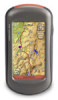
Garmin Oregon 450 Owner's Manual
Garmin Oregon 450 Manual
 |
UPC - 753759100537
View all Garmin Oregon 450 manuals
Add to My Manuals
Save this manual to your list of manuals |
Garmin Oregon 450 manual content summary:
- Garmin Oregon 450 | Owner's Manual - Page 1
OREGON® series 450, 450t, 550, 550t owner's manual - Garmin Oregon 450 | Owner's Manual - Page 2
or improvements. Visit the Garmin Web site (www.garmin.com) for current updates and supplemental information concerning the use and operation of this and other Garmin products. Garmin® , the Garmin logo, Oregon® , and BlueChart® g2 are trademarks of Garmin Ltd. or its subsidiaries, registered - Garmin Oregon 450 | Owner's Manual - Page 3
Introduction Warning See the Important Safety and Product Information guide in the product box for product warnings and other important information. This manual provides instructions for using the following products: • Oregon 450 and 450t • Oregon 550 and 550t Tips and Shortcuts • Touch or to - Garmin Oregon 450 | Owner's Manual - Page 4
serial number of your Oregon is located in the battery compartment. Remove batteries as indicated on page 2. ii Optional Accessories For a list of available accessories and maps, refer to the Garmin Web site at http://buy.garmin.com. Caring for the Oregon Cleaning the Case Use a cloth dampened with - Garmin Oregon 450 | Owner's Manual - Page 5
i Manual Conventions i Product Registration i Contact Garmin ii Optional Accessories ii Caring for the Oregon ii Getting Started 1 Battery Information 2 Turning the Oregon On and Off 2 Adjusting the Backlight Level 3 Acquiring GPS Satellite Signals 3 Locking the Screen 3 Basic Navigation - Garmin Oregon 450 | Owner's Manual - Page 6
of Contents Other Tools 21 Monitoring Satellite Reception 22 GPS Games 23 Geocaches 23 Wherigo 23 Customizing the Oregon.. 24 Changing the Profile 24 Setting Up Profiles 24 Using System Setup 25 Customizing the Display.......... 26 Map Setup 26 Tracks Setup 27 Customizing the Main Menu - Garmin Oregon 450 | Owner's Manual - Page 7
Getting Started Power key Touchscreen Getting Started Camera lens (550 and 550t) Battery cover Mounting spine Latch Mini-USB connector (under weather cap) Oregon Series Owner's Manual 1 - Garmin Oregon 450 | Owner's Manual - Page 8
Lift the latch, and remove the battery cover. Battery cover Latch To select the battery type: 1. Touch Setup > System > Battery Type. 2. Touch Alkaline, Lithium, or Rechargeable NiMH. Long-Term Storage Remove the batteries when you do not plan to use the Oregon for several months. Stored data is - Garmin Oregon 450 | Owner's Manual - Page 9
the brightness levels. See (page 26) to change the backlight timeout. Getting Started Acquiring GPS Satellite Signals Before the Oregon can find your current location and navigate a route, you must acquire GPS signals. 1. Go outdoors to an open area, away from tall buildings and trees. 2. Turn - Garmin Oregon 450 | Owner's Manual - Page 10
Navigation Basic Navigation Accessing Applications from the Main Menu You can access all Oregon applications from the Main menu. Main Menu Touch or to access additional applications. Creating Waypoints Waypoints are locations you record and store in the Oregon 13. 4 Oregon Series Owner's Manual - Garmin Oregon 450 | Owner's Manual - Page 11
Coordinates-enter the coordinates of a location. Basic Navigation • All POI (Points of Interest)-if supported by the preloaded or optional mapping, various Points of Interest may be listed. • . 5. Touch > Compass. 6. Use the compass to navigate to your destination. Oregon Series Owner's Manual 5 - Garmin Oregon 450 | Owner's Manual - Page 12
on page 9. To navigate to a point on the map: 1. Touch Map. 2. Touch a point on the map. 3. Touch the information button at the top of the screen. Information button 4. Touch Go > > Compass. 5. Use the compass to navigate to your destination as indicated on page 9. 6 Oregon Series Owner's Manual - Garmin Oregon 450 | Owner's Manual - Page 13
as indicated on page 9. Stopping Navigation To stop navigating, touch Where To? > Stop Navigation. Using the Map To use the map: 1. Touch Map. Your current location is indicated by a location marker . 2. Touch or to zoom. 3. Touch and drag the screen to pan the map. Oregon Series Owner's Manual 7 - Garmin Oregon 450 | Owner's Manual - Page 14
Basic Navigation Zoom range Zoom buttons Location marker Information button Map Page To review detailed information about a point on the map: 1. If necessary, pan to the location you want to review. 2. Touch the location. 3. Touch the information button at the top of the screen for additional - Garmin Oregon 450 | Owner's Manual - Page 15
a higher speed, such as traveling in an automobile, the compass uses GPS signals to determine your direction. To turn the electronic compass off, see page 31. To ensure maximum accuracy, hold the compass level when navigating. To open the Compass page: Touch Compass. Oregon Series Owner's Manual 9 - Garmin Oregon 450 | Owner's Manual - Page 16
Basic Navigation Calibrating the Compass Calibrate the distances, experiencing temperature changes greater than 20°F (11°C), or changing the batteries. To calibrate the electronic compass: 1. Touch Setup > Heading > Press , touch OK, and repeat the process. 10 Oregon Series Owner's Manual - Garmin Oregon 450 | Owner's Manual - Page 17
, see page 31. Direction you are currently traveling Bearing to destination Bearing Pointer Basic Navigation The bearing pointer points to your destination, regardless of the direction you are moving. course pointer provides an indication of drift (right or left) Oregon Series Owner's Manual 11 - Garmin Oregon 450 | Owner's Manual - Page 18
destination" to compensate for deviation and to get back on course. This is most useful if you are navigating on water or there are no major obstacles in your path. It also helps you avoid hazards to 1. On the Compass page, touch a data field. 2. Touch a data type. 12 Oregon Series Owner's Manual - Garmin Oregon 450 | Owner's Manual - Page 19
the comment, the location, the elevation, and the depth of the waypoint. On the Oregon 550 or 550t, you can change the picture. You can also use the Waypoint Manager > Delete All Waypoints > Yes. NOTE: On the Oregon 550 or 550t, if you have selected a picture for a waypoint and then you delete the - Garmin Oregon 450 | Owner's Manual - Page 20
Creating Routes You can create and store up to 50 routes. To create and navigate a new route: 1. Touch Route Planner > > - Garmin Oregon 450 | Owner's Manual - Page 21
. To record your tracks: 1. Touch Setup > Tracks > Track Log. 2. Touch Do Not Record; Record, Do Not Show; or Record, Show On Map. If you select Record, Show On Map, a line on the Map page indicates your track. For more information on Tracks setup, see page 27. Oregon Series Owner's Manual 15 - Garmin Oregon 450 | Owner's Manual - Page 22
view your current track: Touch Track Manager > Current Track. • View Map-shows your current track on the map. • Elevation Plot-shows the elevation plot (page 17) for your Manager page. You can view the tracks on the map, view elevation plots, or navigate the track. 16 Oregon Series Owner's Manual - Garmin Oregon 450 | Owner's Manual - Page 23
Oregon 450t and 550t have a 3D view. Other Oregon models require DEM (digital elevation model) data that can be found in some Garmin topographic cartography. Go to http://buy.garmin.com for compatible map elevation data, touch a point on the plot. The time, the Oregon Series Owner's Manual 17 - Garmin Oregon 450 | Owner's Manual - Page 24
the screen. 3. Select the data type from the list of options. Sharing Information Wirelessly The Oregon can wirelessly share waypoints, routes, tracks, and geocaches with another wirelessenabled Garmin recreational device. 1. Place the units within 10 feet (3 meters) of each other. 2. On the Main - Garmin Oregon 450 | Owner's Manual - Page 25
can take pictures with the Oregon 550 and 550t. The location is saved with the picture. You can navigate to the location like a on the camera. 5. To manually focus the camera, touch and hold until the white focus frame turns green. Oregon Series Owner's Manual Additional Tools 6. Release the to - Garmin Oregon 450 | Owner's Manual - Page 26
USB cable. Follow the on-screen directions to upload or download pictures. Viewing Images The Oregon can display pictures stored on the Oregon or on a microSD™ card. 1. Copy .jpg images from your computer to the Oregon. You can load them directly to the Garmin drive or create a new folder on the - Garmin Oregon 450 | Owner's Manual - Page 27
Main menu: • Calendar-use a calendar. • Calculator-use a calculator. • Sun and Moon-view sunrise and sunset times along with the moon phase. • Alarm Clock-set your Oregon to sound an alarm. You can also set the unit to turn on at a specific time - Garmin Oregon 450 | Owner's Manual - Page 28
, refer to Trail Tech at www.garmin.com. • Sight N' Go-point the unit toward an object to lock in the direction and navigate to it. Follow the on-screen instructions. Monitoring Satellite Reception The Satellite page shows your current location, the GPS accuracy, your current elevation, satellite - Garmin Oregon 450 | Owner's Manual - Page 29
site supports the transfer of geocache sites to your Oregon, and, after registering and installing the Garmin Communicator plug-in from www.garmin.com/products /communicator, you can download geocaches directly to your Oregon. GPS Games To navigate to a geocache using Geocaches: 1. Touch Geocaches - Garmin Oregon 450 | Owner's Manual - Page 30
the Profile Profiles are a collection of settings that allow you to optimize your Oregon from one type of use to another, such as moving from recreational use to is not possible to delete your current profile. 1. Touch Setup > Profiles. 2. Touch a profile > Delete. 24 Oregon Series Owner's Manual - Garmin Oregon 450 | Owner's Manual - Page 31
Augmentation System), or Demo Mode (GPS off). For information about WAAS, go to www.garmin.com/aboutGPS /waas.html. Language-select the text language on the Oregon. Changing the text language does not change the language of user-entered data or map data, such as street names. Battery Type-select - Garmin Oregon 450 | Owner's Manual - Page 32
your own, or crop and use a photo. Battery Save-shuts off the display after the backlight timeout Garmin\scrn folder on the Oregon drive. Map Setup On the Main menu, touch Setup > Map. Orientation-select how the map map. When Off is selected, you must zoom in or out manually. 26 Oregon Series Owner - Garmin Oregon 450 | Owner's Manual - Page 33
the map. Showing more detail may cause the map to redraw more slowly. Map Information-select the box to enable or disable a map. This can be helpful if several maps are loaded on the Oregon. archive method to organize your tracks. Tracks are saved and cleared Oregon Series Owner's Manual 27 - Garmin Oregon 450 | Owner's Manual - Page 34
Customizing the Oregon automatically based on the user setting. Customizing the Main Menu You can rearrange applications Lock On Road-lock the current location marker on the nearest road, compensating for variances in map position accuracy (requires routable maps). 28 Oregon Series Owner's Manual - Garmin Oregon 450 | Owner's Manual - Page 35
the Oregon Off Road Transitions-select a transition method for routing off roads. • Auto-automatically routes you to the next point. • Manual-allows locations on or off. Light Sectors-turn the sector in which a navigational light is visible on or off. Selecting Auto causes some light sectors to - Garmin Oregon 450 | Owner's Manual - Page 36
Customizing the Oregon Marine Alarm Setup-turn marine alarms on or off. • Anchor Drag Alarm-set an alarm to sound when you temperature in degrees Celsius or degrees Fahrenheit. Pressure-select barometric pressure units in inches (Hg), millibars, or hectopascals. 30 Oregon Series Owner's Manual - Garmin Oregon 450 | Owner's Manual - Page 37
Customizing the Oregon Position Format Use the default settings unless you are using a map or chart that specifies a different position format. To change the position Compass-select Auto to switch from an electronic compass to a GPS compass when you are travelingat Oregon Series Owner's Manual 31 - Garmin Oregon 450 | Owner's Manual - Page 38
use the GPS compass. Calibrate-calibrate the compass (page 10). Altimeter Setup Touch Setup > Altimeter. Auto Calibration-allow the altimeter to self-calibrate each time you turn the Oregon on. . • Ambient Pressure-records ambient pressure changes over a period of time. Oregon Series Owner's Manual - Garmin Oregon 450 | Owner's Manual - Page 39
display your pedaling cadence. When connected to the appropriate Garmin device, the heart rate and bike cadence values are listed as data-field options on the Map page, the Compass page, and the trip computer. Pairing is connecting your Oregon with wireless sensors, such as a heart rate monitor or - Garmin Oregon 450 | Owner's Manual - Page 40
> Heart Rate Monitor (or Bike Cadence Sensor) > Off. Reset the Device 1. Touch Setup > Reset. 2. Touch an item to reset it. Viewing Your Oregon Information On the Main menu, touch Setup > About to view the Oregon software version, the unit ID number, the GPS software version, and legal information - Garmin Oregon 450 | Owner's Manual - Page 41
can rupture at high temperatures. Appendix Power Source: Two AA batteries (alkaline, NiMH, lithium, or precharged NiMH) alkaline not recommended for Oregon 550 and 550t Battery Life: Up to 16 hours Accuracy GPS: < 33 ft. (10 m) 95% typical* *Subject to accuracy degradation to 100 m 2DRMS - Garmin Oregon 450 | Owner's Manual - Page 42
NMEA 0183 Data Storage Life: Indefinite; no memory battery required Map Storage: Internal or microSD Card Performance Receiver: more than 12 channel WAAS enabled/High sensitivity Acquisition Times: < 1 second (warm start) < 33 seconds (cold start) < 36 seconds (autolocate) Update Rate: 1/second - Garmin Oregon 450 | Owner's Manual - Page 43
, the memory cards can be used to store files such as images, cartridges, geocaches, routes, waypoints, and custom POIs. Go to http://buy. garmin.com for compatible map products. To install or remove a microSD card: 1. Lift the latch on the back of the Oregon (page 2), and remove the battery cover - Garmin Oregon 450 | Owner's Manual - Page 44
the file. 3. Select Edit > Copy. 4. Open the "Garmin" or memory card drive/volume. 5. Select Edit > Paste. Before transferring data to or from a Web site directly to the Oregon, install the Garmin Communicator plug-in from www.garmin.com /products/communicator. 38 Oregon Series Owner's Manual - Garmin Oregon 450 | Owner's Manual - Page 45
Series Owner's Manual Appendix 4. Paste the file into the Garmin or the microSD card/volume. To delete a file from the Oregon or microSD card: 1. Open the Garmin or SD card drive/volume. 2. Highlight the file and press the Delete key on your computer keyboard. Optimizing Battery Life Use premium - Garmin Oregon 450 | Owner's Manual - Page 46
of maximum level for a prolonged period of time will significantly decrease battery life. • Select a shorter backlight timeout (page 26). • Turn tones Battery Save (page 26). • If you plan on using the Oregon extensively in your automobile, consider purchasing a vehicle power cable (http://buy.garmin - Garmin Oregon 450 | Owner's Manual - Page 47
approximately 30 seconds. 2. Follow the instructions on the screen until "Calibration is complete" appears. 2. Slide the clip up until it locks in place. To remove the carabiner clip, lift the bottom of the clip and slide the carabiner clip off the mounting spine. Oregon Series Owner's Manual 41 - Garmin Oregon 450 | Owner's Manual - Page 48
BY USING THE OREGON, YOU AGREE TO BE BOUND BY THE TERMS AND CONDITIONS OF THE FOLLOWING SOFTWARE LICENSE AGREEMENT. PLEASE READ THIS AGREEMENT CAREFULLY. Garmin Ltd. and its subsidiaries ("Garmin") grant you or the export control laws of any other applicable country. Oregon Series Owner's Manual - Garmin Oregon 450 | Owner's Manual - Page 49
accessories ii active route 15 advanced map setup 27 alarms, marine 30 altimeter calibration 33 setup 32 ambient pressure 32 area calculation 20 automotive mode 26 auto zoom 26 avoidance setup 29 B background dashboard 21 screen 26 backlight 3 timeout 26 barometer mode 32 battery 2 optimal battery - Garmin Oregon 450 | Owner's Manual - Page 50
Index G Garmin serial 25 Garmin spanner 25 geocaches 23 GPS setting 25 grid north 31 guidance method 28 H heart rate monitor 33, 34 I images viewing 20 interface 25 L language 25 light sectors 29 lock on road 28 lock screen 3 M magnetic north 31 map information 7 map setup 26 marine settings 29 44 - Garmin Oregon 450 | Owner's Manual - Page 51
Index share wirelessly 18 sight N' go 22 spanner, Garmin 25 spot soundings 29 stop navigating 7 stopwatch 22 T text out 25 text size, maps 27 timeout, backlight 26 time zone 30 tones 25 tracks recording 27 setup 27 track up 26 trip computer 21 true north 31 U unlock screen 3 V variable elevation 32 - Garmin Oregon 450 | Owner's Manual - Page 52
For the latest free software updates (excluding map data) throughout the life of your Garmin products, visit the Garmin Web site at www.garmin.com. © 2009-2010 Garmin Ltd. or its subsidiaries Garmin International, Inc. 1200 East 151st Street, Olathe, Kansas 66062, USA Garmin (Europe) Ltd. Liberty
-
 1
1 -
 2
2 -
 3
3 -
 4
4 -
 5
5 -
 6
6 -
 7
7 -
8
-
9
-
10
-
11
-
12
-
13
-
14
-
15
-
16
-
17
-
18
-
19
-
20
-
21
-
22
-
23
-
24
-
25
-
26
-
27
-
28
-
29
-
30
-
31
-
32
-
33
-
34
-
35
-
36
-
37
-
38
-
39
-
40
-
41
-
42
-
43
-
44
-
45
-
46
-
47
-
48
-
49
-
50
-
51
-
52
 |
 |
OREGON
®
series
owner’s manual
450, 450t, 550, 550t