Garmin echoMAP 70s Owner's Manual
Garmin echoMAP 70s Manual
 |
View all Garmin echoMAP 70s manuals
Add to My Manuals
Save this manual to your list of manuals |
Garmin echoMAP 70s manual content summary:
- Garmin echoMAP 70s | Owner's Manual - Page 1
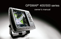
GPSMAP® 400/500 series owner's manual - Garmin echoMAP 70s | Owner's Manual - Page 2
written consent of Garmin. Garmin hereby grants permission to download a single copy of this manual onto a hard drive Garmin Web site (www.garmin.com) for current updates and supplemental information concerning the use and operation of this and other Garmin products. Garmin®, the Garmin logo, GPSMAP - Garmin echoMAP 70s | Owner's Manual - Page 3
GPSMAP 556/556s Tips and Shortcuts • Press HOME from any screen to return to the Home screen. • Press MENU from any of the main screens to access advanced settings. • Press and release the Power key to adjust the display settings. Manual Conventions In this manual, when you are instructed GPS - Garmin echoMAP 70s | Owner's Manual - Page 4
Contact Garmin iv Getting Started 1 Unit Overview 1 Turning the Unit On or Off 2 Initializing Unit Settings 2 Adjusting the Backlight 3 Using the Keypad 4 Acquiring GPS Satellite Data 39 Viewing Other Vessels 41 Automatic Identification System 41 GPSMAP 400/500 Series Owner's Manual - Garmin echoMAP 70s | Owner's Manual - Page 5
Sonar 57 Understanding the Full Screen 57 Understanding the Split Frequency Screen 58 Understanding The Split Zoom Screen 58 Understanding the Depth Distress Calls Initiated from a VHF Radio 64 GPSMAP 400/500 Series Owner's Manual Introduction Man-Overboard Distress Calls Initiated from the - Garmin echoMAP 70s | Owner's Manual - Page 6
.8200 or (800) 800.1020. In the UK, contact Garmin (Europe) Ltd. by phone at 0808 2380000. In Europe, go to www.garmin.com/support and click Contact Support for in-country support information, or contact Garmin (Europe) Ltd. by phone at +44 (0) 870.8501241. iv GPSMAP 400/500 Series Owner's Manual - Garmin echoMAP 70s | Owner's Manual - Page 7
Unit Overview GPSMAP 526/556 Getting Started NMEA 2000® Power/Data External GPS antenna GPSMAP 421/451/ 521/551 Power/Data NMEA 2000 GPSMAP 400/500 Series Owner's Manual External GPS antenna Getting Started POWER/ BACKLIGHT RANGE (-/+) ROCKER MARK SELECT MENU HOME SD card slot GPSMAP 526 - Garmin echoMAP 70s | Owner's Manual - Page 8
to use for location readings. Time Format-specify whether you want the time shown in a 12‑hour, 24‑hour, or UTC (Universal Time Coordinated) format. 2 GPSMAP 400/500 Series Owner's Manual - Garmin echoMAP 70s | Owner's Manual - Page 9
(page 56). If a water speed wheel is detected, a message will ask if you want to calibrate it now. Select Yes or No. GPSMAP 400/500 Series Owner's Manual Getting Started Adjusting the Backlight 1. Press and release the Power key. 2. Press left or right on the Rocker to adjust the brightness. To - Garmin echoMAP 70s | Owner's Manual - Page 10
menus, highlight fields, and enter data. MARK-Press to mark a waypoint. SELECT-Press to select highlighted items. HOME-Press to return to the Home screen. GPSMAP 400/500 Series Owner's Manual - Garmin echoMAP 70s | Owner's Manual - Page 11
information about GPS, visit the Garmin Web site at www.garmin.com/aboutGPS. Using Simulator Mode Simulator mode turns the GPS receiver , and position. Inserting and Removing SD Cards Your unit supports Secure Digital (SD) cards. Insert optional BlueChart® g2 GPSMAP 400/500 Series Owner's Manual 5 - Garmin echoMAP 70s | Owner's Manual - Page 12
update to the most-current version by clicking Help > Check for Software Updates, or check the Garmin Web site at www.garmin.com supports Fishing charts. • Sonar-set up and access sonar information (page 57). Note: You must have an "s" series unit (such as a GPSMAP 526s) with a connected transducer - Garmin echoMAP 70s | Owner's Manual - Page 13
are available if you use a BlueChart g2 Vision SD card or if your built-in map supports Fishing charts. • Fishing Chart-provides a view of the chart with enhanced bottom contours and without chart, from the Home screen, select Charts > Navigation Chart. GPSMAP 400/500 Series Owner's Manual 7 - Garmin echoMAP 70s | Owner's Manual - Page 14
Using Charts Your boat Exposed wreck Light Exposed rock Tide station Beacon Marina services Zoom scale Navigation Chart with g2 Vision Navigation Chart Menu To access Bars-show or hide cruising, navigation, fishing, fuel, or sailing numbers. Data bars 8 GPSMAP 400/500 Series Owner's Manual - Garmin echoMAP 70s | Owner's Manual - Page 15
• Cruising-turn the GPS Speed, GPS Heading, Depth, and GPS Position data bar on or off. Select Data Bar Setup to configure the data shown on the screen. use graphic symbols to denote map features that follow the standards for USA and international charts. GPSMAP 400/500 Series Owner's Manual 9 - Garmin echoMAP 70s | Owner's Manual - Page 16
to which you want to go. 4. Press SELECT. 5. Select Navigate To. 6. Select Go To (or Guide To when using a preprogrammed BlueChart g2 Vision card for Automatic Guidance). 7. Follow the colored line on the the number represents that distance on the map. 10 GPSMAP 400/500 Series Owner's Manual - Garmin echoMAP 70s | Owner's Manual - Page 17
item 2. Select the item. If more than one item is in the area, select Review, and then select the item. Using Charts Viewing Tide-Station Information Tide-station information on the chart (page 20). Service Points-turns marine service points on or off. GPSMAP 400/500 Series Owner's Manual 11 - Garmin echoMAP 70s | Owner's Manual - Page 18
display. • North Up-sets the top of the map display to a north heading. • Head Up-sets the map display to the current track heading. 12 GPSMAP 400/500 Series Owner's Manual - Garmin echoMAP 70s | Owner's Manual - Page 19
Vision SD card. • Vehicle Icon-allows you to select a boat or triangle that is large, medium, or small as your boat icon on the chart. GPSMAP 400/500 Series Owner's Manual 13 - Garmin echoMAP 70s | Owner's Manual - Page 20
options from the Perspective 3D screen, select MENU. Waypoints & Tracks-view, add, and configure waypoints and tracks. • Tracks-turn tracks on or off (page 28). GPSMAP 400/500 Series Owner's Manual - Garmin echoMAP 70s | Owner's Manual - Page 21
automatic guidance (Guide To). Using Mariner's Eye 3D A BlueChart g2 Vision SD card offers Mariner's Eye 3D that provides a detailed three-dimensional view from above and behind the boat (according to your course), and provides a visual navigation GPSMAP 400/500 Series Owner's Manual Using Charts - Garmin echoMAP 70s | Owner's Manual - Page 22
Colors) Range Rings-toggles the range rings on or off to provide distance measurement. Safe Depth-adjusts the depth at which red indicates dangerous depths. GPSMAP 400/500 Series Owner's Manual - Garmin echoMAP 70s | Owner's Manual - Page 23
routes (Route To), but does not affect automatic guidance (Guide To). Using Fish Eye 3D Using the depth contour lines sonar is present)-turns a cone that shows the area covered by your transducer on or off. Fish Symbols (only available if sonar is present)- GPSMAP 400/500 Series Owner's Manual 17 - Garmin echoMAP 70s | Owner's Manual - Page 24
water and the land at a specified opacity. The higher you set the percentage, the more the satellite photos will cover both land and water. 18 GPSMAP 400/500 Series Owner's Manual - Garmin echoMAP 70s | Owner's Manual - Page 25
yourself with a marina or a harbor prior to arrival. Photo Overlay Off Land Only Photo Overlay Photo Overlay at 50% Photo Overlay at 100% GPSMAP 400/500 Series Owner's Manual Aerial Photo Note: Use the Range (-/+) keys to zoom in and out while viewing the aerial photo on the full screen. 19 - Garmin echoMAP 70s | Owner's Manual - Page 26
the Rocker to highlight a camera icon with the pointer, and select Aerial Photo or Review. Perspective Overhead Animated Tide and Current Indicators You can view indicators for animated tide station the station indicator. Tide Station with Falling Tide 20 GPSMAP 400/500 Series Owner's Manual - Garmin echoMAP 70s | Owner's Manual - Page 27
coastal roads and POIs such as restaurants, lodging, local attractions and more. For instructions on searching for, and navigating to, these POIs, see the "Where To?" information. See page 50 for instructions on setting up Automatic Guidance for your boat. GPSMAP 400/500 Series Owner's Manual 21 - Garmin echoMAP 70s | Owner's Manual - Page 28
/Sonar screen, like the Sonar screen, is only available when using a sonar capable unit with a transducer attached. Use the Chart/Sonar screen to view the Navigation chart, Fishing chart, Mariner's Eye 3D, screen Sonar screen Navigation/Sonar Combination 22 GPSMAP 400/500 Series Owner's Manual - Garmin echoMAP 70s | Owner's Manual - Page 29
three methods: Go To, Route To, or Guide To. • Go To-takes you directly to the services. NOTE: This feature may not be available in all areas. To begin navigating: 1. From the Home screen, select Where To?. 2. Select the category to which you want to navigate. GPSMAP 400/500 Series Owner's Manual - Garmin echoMAP 70s | Owner's Manual - Page 30
location on a chart. 4. Select Navigate To. 5. Select Go To. OR Select Guide To when using a preprogrammed BlueChart g2 Vision card to use Automatic Guidance. 6. Follow To > Go To or Route To (or Guide To when using a preprogrammed BlueChart g2 Vision card). GPSMAP 400/500 Series Owner's Manual - Garmin echoMAP 70s | Owner's Manual - Page 31
chart. 2. Select Review. (The Review button is only shown when more than one waypoint is in the vicinity.) 3. Select the button for the waypoint you want to edit. 4. Select Move. 5. Press SELECT to save the new location, or press MENU to cancel the move. GPSMAP 400/500 Series Owner's Manual 25 - Garmin echoMAP 70s | Owner's Manual - Page 32
(page 38), celestial (page 38), chart notes, or local services information near the cursor. To measure the distance and bearing of waypoint or the MOB you want to delete. 3. Select Review > Delete (The Review button is only shown when more than one waypoint is in GPSMAP 400/500 Series Owner's Manual - Garmin echoMAP 70s | Owner's Manual - Page 33
BlueChart g2 Vision card): 1. From the Navigation chart, select your destination. 2. Select Navigate To > Guide To. Your route is calculated. NOTE: You can change the automatic guidance path to a route by use the chart or turn list to edit the route turns. GPSMAP 400/500 Series Owner's Manual 27 - Garmin echoMAP 70s | Owner's Manual - Page 34
Midnight, if shown) or Entire Log. 3. To name the track, change the color of the track, or save it as a route, select Edit Track. 28 GPSMAP 400/500 Series Owner's Manual - Garmin echoMAP 70s | Owner's Manual - Page 35
records the track log, replacing the oldest track data with new data. Record Interval-defines the frequency at which the track plot is recorded. Recording more-frequent plots is more accurate but fills interval. Track Color-sets the color of the track plot. GPSMAP 400/500 Series Owner's Manual 29 - Garmin echoMAP 70s | Owner's Manual - Page 36
g2 Vision-compatible Garmin GPS units. Navigating with a Garmin Autopilot When you start any type of navigation (Go To, Route To, Guide To, or Follow Track), if you are connected to a compatible Garmin autopilot, you are prompted to engage the autopilot. GPSMAP 400/500 Series Owner's Manual - Garmin echoMAP 70s | Owner's Manual - Page 37
Numbers You can view and customize numerical data including depth, GPS information, and navigation information. You can customize the number of the Home screen, select Information > Dashboard > Numbers. GPSMAP 400/500 Series Owner's Manual To customize the Numbers screen: 1. From the Home screen - Garmin echoMAP 70s | Owner's Manual - Page 38
and Engine Gauges Viewing Engine Gauges You must be connected to a NMEA 2000 network capable of sensing engine data to view engine gauges. See the GPSMAP 400/500 Series Installation Instructions for details. 32 GPSMAP 400/500 Series Owner's Manual - Garmin echoMAP 70s | Owner's Manual - Page 39
operating maximum range. 1. From the Home screen, select Information > Dashboard > Engine > MENU > Gauge Setup > Set Gauge Limits. GPSMAP 400/500 Series Owner's Manual Viewing Information 2. Select a gauge. 3. Select Gauge Limits > Custom. 4. Select the gauge limit you want to set (Scale Min - Garmin echoMAP 70s | Owner's Manual - Page 40
Selecting the Engines Shown in Gauges" (following section). Selecting the Engines Shown in Gauges You must manually select the number of engines shown in the engine gauges (page 34) before you can select fuel level (numeric) or by individual tank level (graphic). GPSMAP 400/500 Series Owner's Manual - Garmin echoMAP 70s | Owner's Manual - Page 41
. An estimate of the fuel added appears. Adjust if necessary. • Set Total Fuel Onboard-select to specify the total fuel in your tanks. Select Done. GPSMAP 400/500 Series Owner's Manual 35 - Garmin echoMAP 70s | Owner's Manual - Page 42
and a GPS antenna; or a wind sensor and a GPS antenna; or a wind sensor, a water-speed sensor, and a heading sensor. 1. From the Home screen, select Information > Dashboard > Wind > MENU > Wind Type. 2. Select Apparent Wind, True Wind or Ground Wind. 36 GPSMAP 400/500 Series Owner's Manual - Garmin echoMAP 70s | Owner's Manual - Page 43
from a heading (or magnetic) sensor, and GPS heading data is calculated by your chartplotter GPS. From the Home screen, select Information > Dashboard tide station. Tide-station information is shown. Select Change Date > Manual to view tide information for a different date. Select Show Report to - Garmin echoMAP 70s | Owner's Manual - Page 44
, the chartplotter shows celestial information for the present date and time. From the Home screen, select Information > Celestial. Select Change Date > Manual to view current-station information for a different date. Select Show Report to view the Current Prediction Report for the selected station - Garmin echoMAP 70s | Owner's Manual - Page 45
SD card. GPSMAP 400/500 Series Owner's Manual Viewing Information 2. Check your MapSource version on the computer by clicking Help > About MapSource. If the version is older than 6.12.2, update to the most-current version by clicking Help > Check for Software Updates, or check the Garmin Web site - Garmin echoMAP 70s | Owner's Manual - Page 46
NMEA 2000 network: 1. Connect the unit to a NMEA 2000 network. (Refer to the GPSMAP 400/500 Installation Instructions.) 2. From the Home screen, select Information > User Data > Data Transfer > Network. > User Data > Data Transfer > Save To Card. 40 GPSMAP 400/500 Series Owner's Manual - Garmin echoMAP 70s | Owner's Manual - Page 47
, and insert it into an SD card reader attached to a computer. 5. From Windows® Explorer, open the Garmin\UserData folder on the SD card. 6. Copy the appropriate .ADM file on the card, and paste it to AIS) enables you to identify and track other vessels. GPSMAP 400/500 Series Owner's Manual 41 - Garmin echoMAP 70s | Owner's Manual - Page 48
each vessel includes the Maritime Mobile Service Identity (MMSI), the location, the GPS speed, the GPS heading, the time that has receive a SART transmission, a distress signal alarm appears. Select Review > Go To to begin navigation to the SART transmission. GPSMAP 400/500 Series Owner's Manual - Garmin echoMAP 70s | Owner's Manual - Page 49
disappears from the chart or the 3D chart view. GPSMAP 400/500 Series Owner's Manual Viewing Information AIS-SART transmission. You can select a true emergency. You can disable these test symbols and alerts (page 44) AIS-SART transmission test lost. Heading and Projected Course of Activated - Garmin echoMAP 70s | Owner's Manual - Page 50
test alerts and symbols in crowded areas such as marinas, AIS-SART test alerts ignored by default. To test an AIS SART device, you must enable the chartplotter to receive test alerts. From the Home screen, select Configure > Other Vessels > AIS SART Test. 44 GPSMAP 400/500 Series Owner's Manual - Garmin echoMAP 70s | Owner's Manual - Page 51
a BlueChart g2 Vision SD card or if your built-in map supports Fishing charts. 1. From the Home screen, select Charts. 2. Select GPS speed, GPS heading, and other information that is reported about a targeted AIS vessel. 1. From the Home screen, select Charts. GPSMAP 400/500 Series Owner's Manual - Garmin echoMAP 70s | Owner's Manual - Page 52
charts are available if you use a BlueChart g2 Vision SD card or if your built-in map supports Fishing charts. 1. From the Home screen, select Charts. 2. Select Navigation Chart, Fishing Chart, card or if your built-in map supports Fishing charts. 46 GPSMAP 400/500 Series Owner's Manual - Garmin echoMAP 70s | Owner's Manual - Page 53
, Perspective 3D, or Mariner's Eye 3D. 3. Select MENU > Other Vessels > AIS List. Making a Call to an AIS Target See "Calling an AIS Target" (page 66). GPSMAP 400/500 Series Owner's Manual Viewing Information 47 - Garmin echoMAP 70s | Owner's Manual - Page 54
update the system software or troubleshooting tool. A Garmin Product Support representative may ask you to use this feature to retrieve data about your chartplotter. Event Log-displays a list of system events. Select an event to view additional information. 48 GPSMAP 400/500 Series Owner's Manual - Garmin echoMAP 70s | Owner's Manual - Page 55
the Cruising data bar (page 9). Changing the System Language To change the system language, from the Home screen, select Configure > Preferences > Language. Select the language. GPSMAP 400/500 Series Owner's Manual 49 - Garmin echoMAP 70s | Owner's Manual - Page 56
speed sensor) and GPS (from the calculated GPS speed). Auto Guidance Guide To. 6. Review the placement of the Auto Guidance line. Determine whether the line safely avoids known obstacles, and whether the turns enable efficient travel. 7. Complete an action: 50 GPSMAP 400/500 Series Owner's Manual - Garmin echoMAP 70s | Owner's Manual - Page 57
review Garmin software. • NMEA Standard-supports the input or output of standard NMEA 0183 data, DSC, and sonar NMEA input support for the DPT, MTW, and VHW sentences. • NMEA High Speed-supports the input or output of standard 0183 data for most AIS receivers. GPSMAP 400/500 Series Owner's Manual - Garmin echoMAP 70s | Owner's Manual - Page 58
(if supported)-configures the input/output format for serial port 2 to use when connecting your chartplotter to external NMEA devices, a computer, or other Garmin devices. NMEA > Communications > NMEA 2000 Setup > Label Devices > Change Tank Labels. 52 GPSMAP 400/500 Series Owner's Manual - Garmin echoMAP 70s | Owner's Manual - Page 59
by a specified distance. Setting System Alarms To set a system alarm from the Home screen, select Configure > Alarms > System. Clock-set an alarm using the system (GPS) clock. The unit must be on for the clock alarm to work. GPSMAP 400/500 Series Owner's Manual 53 - Garmin echoMAP 70s | Owner's Manual - Page 60
voltage. GPS Accuracy-set an alarm to sound when the GPS location accuracy Temp-set an alarm to sound when the transducer reports a temperature that is 2°F (1.1°C) above or to an external fuel sensor, such as the Garmin GFS 10. To enable the Total Fuel Onboard GPSMAP 400/500 Series Owner's Manual - Garmin echoMAP 70s | Owner's Manual - Page 61
keel, making it possible to measure depth from the bottom of the keel instead of from the transducer location. Enter a positive number to offset for a keel. Enter a negative number to compensate for continue to get the message, contact Garmin Product Support. GPSMAP 400/500 Series Owner's Manual 55 - Garmin echoMAP 70s | Owner's Manual - Page 62
Settings. 2. Select Yes to restore all factory settings, or select No to cancel. The unit reboots and prompts you to adjust unit settings (page 2). 56 GPSMAP 400/500 Series Owner's Manual - Garmin echoMAP 70s | Owner's Manual - Page 63
the Full Screen Select the Full Screen option to view a full-screen graph of the transducer's sonar readings. From the Home screen, select Sonar > Full Screen. Depth Temperature Speed Suspended targets Transducer frequency Full Screen Using Sonar Range GPSMAP 400/500 Series Owner's Manual 57 - Garmin echoMAP 70s | Owner's Manual - Page 64
data from the graph and a zoomed in portion on the same screen. From the Home screen, select Sonar > Split Zoom. Depth, temperature, and speed Range Frequencies Split Frequency 58 Zoomed depth scale Zoom level Transducer frequency Zoom window Range Split Zoom GPSMAP 400/500 Series Owner's Manual - Garmin echoMAP 70s | Owner's Manual - Page 65
log. Depth Using Sonar Understanding the Temp Log Screen If you are using a temperature-capable transducer, the Temp Log screen keeps a graphic log of temperature readings over time. The current temperature scrolls to the left as information is received. GPSMAP 400/500 Series Owner's Manual 59 - Garmin echoMAP 70s | Owner's Manual - Page 66
scrolls from right to left (Ultrascroll™, Fast, Medium, or Slow). If using a speed-capable transducer, select Auto to have the scroll speed automatically adjust to the water speed of your boat. setting. Almost all strong returns are highlighted in white. GPSMAP 400/500 Series Owner's Manual - Garmin echoMAP 70s | Owner's Manual - Page 67
detail, increase the gain. If the screen is cluttered, decrease the gain. GPSMAP 400/500 Series Owner's Manual Using Sonar Frequency-when using a dual frequency transducer, select how the frequencies appear on-screen (200kHz, 50kHz, Dual, or Auto). Zoom-zoom in to a section of the full screen. The - Garmin echoMAP 70s | Owner's Manual - Page 68
The chartplotter can transfer your GPS position to your radio. If your radio is capable, GPS position information is transmitted with Garmin NMEA Garmin NMEA VHF Radio VHF Radio 0183 VHF Radio 2000 VHF Radio X X X X X X X X X X X X X X X 62 GPSMAP 400/500 Series Owner's Manual - Garmin echoMAP 70s | Owner's Manual - Page 69
Use the Rocker to enter the Maritime Mobile Service Identity (MMSI) number of the vessel, and you receive a DSC distress call: 1. Select Review to view details about the call. 2. only available if you are using a Garmin NMEA 2000-compatible VHF radio. • GPSMAP 400/500 Series Owner's Manual 63 - Garmin echoMAP 70s | Owner's Manual - Page 70
send the distress call. For information on placing distress calls from your Garmin radio, see your Garmin VHF Radio Owner's Manual. For information on activating navigation to a man-overboard location, see call. • Select Clear Report to delete the call report. GPSMAP 400/500 Series Owner's Manual - Garmin echoMAP 70s | Owner's Manual - Page 71
from the list > Edit. GPSMAP 400/500 Series Owner's Manual Digital Selective Calling 3. Select Trail Call When you connect your Garmin chartplotter to a Garmin VHF NMEA 2000-compatible DSC channel is limited to those channels that are available in all frequency bands: 6, 8, 9, 10, 13, 15, 16, 17, - Garmin echoMAP 70s | Owner's Manual - Page 72
to call from the list. 3. Select Review > Call with Radio. 4. Select Send to send the information about the call to the radio. 5. On your Garmin VHF radio, select Call. Calling an AIS about the call to the radio. 4. On your Garmin VHF radio, select Call. 66 GPSMAP 400/500 Series Owner's Manual - Garmin echoMAP 70s | Owner's Manual - Page 73
55ºC) Appendix Performance Receiver: High-sensitivity, 14 parallel channel, WAAS-capable receiver: GPSMAP 421/421s GPSMAP 451/451s GPSMAP 521/521s GPSMAP 551/551s High-sensitivity, 12 parallel channel, WAAS-capable receiver: GPSMAP 526/526s GPSMAP 556/556s GPSMAP 400/500 Series Owner's Manual 67 - Garmin echoMAP 70s | Owner's Manual - Page 74
: 50/200 kHz (dual frequency and 1 kW) Depth: 2,500 ft. (762 m) (1 kW), 1,500 ft. (457 m)** *1 kW transducers are supported by the GPSMAP 526s and 556s units only. **Depth capacity is dependent on water salinity, bottom type, and other water conditions. 68 GPSMAP 400/500 Series Owner's Manual - Garmin echoMAP 70s | Owner's Manual - Page 75
Support if the problem persists. Can't Write User Card, Card Is Read-Only-the SD card in your unit contains data copy protection. Card Needed-Your unit needs to have an SD card inserted into the SD card slot in order to perform the function you requested. GPSMAP 400/500 Series Owner's Manual - Garmin echoMAP 70s | Owner's Manual - Page 76
Database Error-internal problem with the unit. Contact your dealer or Garmin Product Support to have the unit serviced. Deep Water the sky. NMEA Depth Is Below Transducer-you must enter an appropriate Keel Offset for the transducer (page 55). No Waypoints/Routes/ GPSMAP 400/500 Series Owner's Manual - Garmin echoMAP 70s | Owner's Manual - Page 77
to needs a software update. Sonar Timeout-there is an internal problem with the unit. Contact your dealer or Garmin Product Support to have the unit serviced. Sonar Service Lost-the a temperature above, below, inside, or outside the specified values. GPSMAP 400/500 Series Owner's Manual 71 - Garmin echoMAP 70s | Owner's Manual - Page 78
insert it into an SD card reader that is attached to a computer. 2. From Windows Explorer, open the Garmin\scrn folder on the SD card. 3. Copy the appropriate .BMP file on the card and paste it to for antireflective coatings) and a clean, lint-free cloth. 72 GPSMAP 400/500 Series Owner's Manual - Garmin echoMAP 70s | Owner's Manual - Page 79
/556s To connect one of these chartplotter to an existing NMEA 2000 network and to see a list of supported NMEA 2000 PGN numbers, see the GPSMAP 400/500 Series Installation Instructions. Appendix Software License Agreement BY USING THE UNIT, YOU AGREE TO BE BOUND BY THE TERMS AND CONDITIONS OF THE - Garmin echoMAP 70s | Owner's Manual - Page 80
collision 56 deep water 54 engine gauge 33 fish 54 fuel 54 GPS accuracy 54 navigation 53 off course 53 safe-zone 56 shallow water 31 compass rose 12 Compass Tape 9 contact information, Garmin iv coordinates, grid creating waypoints using 25 course up GPSMAP 400/500 Series Owner's Manual - Garmin echoMAP 70s | Owner's Manual - Page 81
frequency 61 Fuel Capacity 56 fuel gauge 35 full screen, sonar 57 fuse 68 G gain 61 Garmin Data Transfer 51 go to 23 GPS 5, 48, 68 GPS heading 37 Grid (North) 49 grid coordinates creating waypoints using 25 ground wind 36 guide Size 13 GPSMAP 400/500 Series Owner's Manual Navaid Type - Garmin echoMAP 70s | Owner's Manual - Page 82
45 DSC 65 transducer dual frequency 61 transferring data 39, 40 True (north) 49 true wind 36 turn the unit off 2 Turn Transition 50 U unit ID number 48 units of measure 49 user data backing up 40 clearing 39 transferring 40 viewing 39 V Vehicle Icon 13 version (software) 48 VHF radio - Garmin echoMAP 70s | Owner's Manual - Page 83
4x 61 manual 61 split 61 GPSMAP 400/500 Series Owner's Manual Index 77 - Garmin echoMAP 70s | Owner's Manual - Page 84
the latest free software updates (excluding map data) throughout the life of your Garmin products, visit the Garmin Web site at www.garmin.com. March 2012 © 2010-2012 Garmin Ltd. or its subsidiaries Garmin International, Inc. 1200 East 151st Street, Olathe, Kansas 66062, USA Garmin (Europe) Ltd
-
 1
1 -
 2
2 -
 3
3 -
 4
4 -
 5
5 -
 6
6 -
 7
7 -
8
-
9
-
10
-
11
-
12
-
13
-
14
-
15
-
16
-
17
-
18
-
19
-
20
-
21
-
22
-
23
-
24
-
25
-
26
-
27
-
28
-
29
-
30
-
31
-
32
-
33
-
34
-
35
-
36
-
37
-
38
-
39
-
40
-
41
-
42
-
43
-
44
-
45
-
46
-
47
-
48
-
49
-
50
-
51
-
52
-
53
-
54
-
55
-
56
-
57
-
58
-
59
-
60
-
61
-
62
-
63
-
64
-
65
-
66
-
67
-
68
-
69
-
70
-
71
-
72
-
73
-
74
-
75
-
76
-
77
-
78
-
79
-
80
-
81
-
82
-
83
-
84
 |
 |
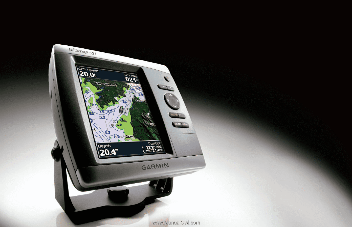
GPSMAP
®
400/500 series
owner’s manual