Kenwood DNN770HD Navigation
Kenwood DNN770HD Manual
 |
View all Kenwood DNN770HD manuals
Add to My Manuals
Save this manual to your list of manuals |
Kenwood DNN770HD manual content summary:
- Kenwood DNN770HD | Navigation - Page 1
CONNECTED NAVIGATION SYSTEM DNN990HD DNN770HD GPS NAVIGATION INSTRUCTION MANUAL © IM365_Nav_K_En_00 - Kenwood DNN770HD | Navigation - Page 2
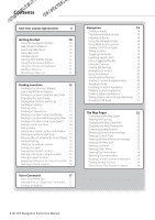
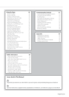
the Map 23 Viewing the Next Turn 23 Viewing Junctions 23 Viewing Traffic Alerts 23 Viewing Trip Information 23 Resetting Trip Information 24 Viewing Current Location Information 24 Finding Nearby Services 24 Directions to Your Current Location 24 2 GPS Navigation Instruction Manual - Kenwood DNN770HD | Navigation - Page 3
the Software 33 Updating the Map Data 33 Safety Cameras 33 Custom POIs (Points of Interest) 34 Finding Custom POIs 34 Traffic Information 29 Traffic Subscription Activation 29 Understanding Traffic 29 Traffic Data Using INRIX Traffic Service 29 About the Traffic Icon 29 Traffic - Kenwood DNN770HD | Navigation - Page 4
or "your"), on the one hand, and Garmin and its licensors (including their licensors and 4 GPS Navigation Instruction Manual suppliers) and affiliated companies on the other hand. IMPORTANT: CAREFULLY READ THIS LICENSE BEFORE USING THIS PRODUCT. INSTALLING, COPYING, OR OTHERWISE USING THIS PRODUCT - Kenwood DNN770HD | Navigation - Page 5
are specifically authorized by Garmin in writing to rent Garmin will be uninterrupted or error-free. Disclaimer of Warranty. GARMIN to any products, services, processes, hypertext links connection with any use or possession by you of the Product (including the Data). Canadian Map Data. The Map - Kenwood DNN770HD | Navigation - Page 6
contained in the Map Data, the traffic location codes are © 2010 Telstra Corporation Limited and its licensors. Term. This Agreement is effective until such time 6 GPS Navigation Instruction Manual as (i) if applicable, your subscription term is either terminated (by you or by Garmin) or expires - Kenwood DNN770HD | Navigation - Page 7
from or in connection with the Data III (JUN 1987) (civilian agency technical data and noncommercial computer software clause); and/or FAR 12.211 and FAR 12.212 (commercial West Randolph Street, Chicago, Illinois 60606 USA. Garmin® is a trademark of Garmin Ltd. or its subsidiaries, registered in the - Kenwood DNN770HD | Navigation - Page 8
that the Traffic Data will operate properly as integrated and interfaced with the Garmin product. In addition, NAVTEQ (and its affiliates) and Garmin Ltd. (and its subsidiaries) make no warranty with regard to the reliability, 8 GPS Navigation Instruction Manual accuracy, exhaustiveness, and - Kenwood DNN770HD | Navigation - Page 9
or applying rights similar to those customarily claimed by the United States government, this Data is a "commercial item" as that term is defined at 48 C.F.R. ("FAR") 2.101, is licensed in accordance with this Agreement, and the Traffic Data delivered or otherwise furnished shall be marked and - Kenwood DNN770HD | Navigation - Page 10
. You can select some icons to change settings or view additional information. GPS signal status. Current time. ➋ • Select ➊ to access the navigation system. • When navigating, ➋ displays Kenwood audio. When using audio, this displays navigation information. 10 GPS Navigation Instruction Manual - Kenwood DNN770HD | Navigation - Page 11
, your system has acquired satellite signals. Viewing GPS Satellite Signals For more information about GPS, go to www .garmin.com/aboutGPS. Select . Using the On-Screen Buttons • Select to return to the main menu. • Hold to quickly return to the main menu. • Select or to see more choices. • Hold - Kenwood DNN770HD | Navigation - Page 12
methods for finding locations. The detailed maps loaded in your navigation system contain locations, such as restaurants, hotels, and auto services. You can use categories to browse for ? > Searching Near. 2 Select an option. 3 If necessary, select a location. 12 GPS Navigation Instruction Manual - Kenwood DNN770HD | Navigation - Page 13
must subscribe to the Fuel Price service, and your device must be connected via Wi-Fi to access connected services. This feature is not available in all areas. You can find nearby fuel stations and compare fuel prices. 1 Select Where To? > Categories > Fuel Prices. 2 If necessary, select > Fuel Type - Kenwood DNN770HD | Navigation - Page 14
Coordinates. 2 If necessary, select > Format, select the correct coordinate format for the type of map you are using, and select Save. 3 Select the latitude coordinate. 4 Enter the new coordinate, Recently Found. The location is saved as "Home" in the Saved menu. 14 GPS Navigation Instruction Manual - Kenwood DNN770HD | Navigation - Page 15
Yes. Finding Parking 1 Select Where To? > Categories > Parking. 2 Select a parking location. 4 Select an area on the map. The receiving satellite signals, you can use the GPS to set a simulated location. 1 Select Settings > Navigation. 2 Select GPS Simulator. 3 From the main menu, select View Map - Kenwood DNN770HD | Navigation - Page 16
Map Symbol. 7 Edit the information. 8 Select Done. Assigning Categories to a Saved Location You can add custom categories to organize your saved locations. ⁄ • Categories appear in the saved locations menu to the saved locations to delete, and select Delete. 16 GPS Navigation Instruction Manual - Kenwood DNN770HD | Navigation - Page 17
to use your device by saying words and commands. The Voice Command menu provides voice prompts and a list of available commands (DNN990HD). ⁄ list of locations appears. 4 Say the line number. 5 Say Navigate. Finding an Address 1 Press Voice Command button. 2 Say Find Address. 3 Speak the entire - Kenwood DNN770HD | Navigation - Page 18
for map and navigation features, select . Using Multi-touch Controls You can use multi-touch controls to change the map view while using the navigation map. • Pinch two fingers together on the screen to zoom out. • Spread two fingers on the screen to zoom in. 18 GPS Navigation Instruction Manual - Kenwood DNN770HD | Navigation - Page 19
the Route From the map, select . Updating Speed Limits NOTICE The speed limit icon feature is for information only and does not replace the driver's responsibility to abide by all posted speed limit signs and to use safe driving judgment at all times. Garmin and JVC KENWOOD will not be responsible - Kenwood DNN770HD | Navigation - Page 20
service. 6 Select Go! Avoiding Road Features 1 Select Settings > Navigation > Avoidances. 2 Select the road features to avoid on your routes, and select Save. 20 GPS Navigation Instruction Manual is shaded on the map. 6 Select Done. Avoiding a Road 1 Select Settings > Navigation > Custom Avoidances. - Kenwood DNN770HD | Navigation - Page 21
mode. 1 Select Settings > Navigation. 2 Select Calculation Mode > Off Road > Save. The route will be calculated as a straight line to the location. Taking a Detour Around Specified Areas You can take a detour for a specified distance along your route or detour around specific roads. This is useful - Kenwood DNN770HD | Navigation - Page 22
. 2 Select an icon, and select OK. 3 Select . 4 Select a different icon. Removing Buttons from the Map You can remove all buttons from the right side of the map. 1 Select Settings > Map & Vehicle > Map Buttons. 2 Select an icon, and touch OK. 3 Select Save. 22 GPS Navigation Instruction Manual - Kenwood DNN770HD | Navigation - Page 23
junction appears for junction on major roadways. Viewing the Entire Route on the Map 1 While navigating a route, select the navigation bar at the top of the map. 2 Select > Map. Viewing the Next Turn While navigating a route, a preview of the next turn, lane change, or other maneuver appears in - Kenwood DNN770HD | Navigation - Page 24
. 1 From the map, select > Where Am I?. 2 Select a category. Directions to Your Current Location If you need to tell another person how to get to your current location, your device can give you a list of directions. Select Apps > Where Am I? > > Directions to Me. 24 GPS Navigation Instruction Manual - Kenwood DNN770HD | Navigation - Page 25
Apps The Apps on your navigation system provide access to premium connectivity like Real-time Traffic, Fuel Prices, Dynamic Parking, Real-Time Traffic Camera, Movie Times and more. The coverage of these services depends on availability in your region. For details, see other Kenwood system manuals - Kenwood DNN770HD | Navigation - Page 26
traveled. Mileage reports are created automatically when you stop or complete routes. Viewing a Mileage Report You can view the 20 most-recent mileage reports. 1 Select Apps > ecoRoute™ > Mileage Report. 2 Select a report. To reset all report data, select Reset. 26 GPS Navigation Instruction Manual - Kenwood DNN770HD | Navigation - Page 27
Exporting a Mileage Report 1 Connect a USB mass storage device to your Kenwood unit. 2 Select Apps > ecoRoute > Mileage Report. 3 Select Export to export and save the reports to the USB mass storage device. Setting Routes that Use Less Fuel 1 Select Settings > Navigation > Calculation Mode. 2 Select - Kenwood DNN770HD | Navigation - Page 28
, you must subscribe to the Movie Time service, and your device must be connected via W-Fi to access connected services. This feature is not available in all areas. 1 Select Apps > Movie Times. 2 Select > Select Day. 3 Select a Movie Title or Theater Name. 28 GPS Navigation Instruction Manual - Kenwood DNN770HD | Navigation - Page 29
areas, go to www.garmin.com/kenwood. Traffic Data Using INRIX Traffic Service You can purchase a traffic subscription to receive traffic data using INRIX Traffic Service. When your navigation system is connected to INRIX and within a traffic coverage area, your system will begin displaying traffic - Kenwood DNN770HD | Navigation - Page 30
Traffic Data The traffic legend explains the icons and colors used on the traffic map. 1 From the map, select . 2 Select Traffic Legend. Taking an Alternate Route 1 While navigating an automobile route, select . 2 Select Alternate Route. 3 Select a route. 30 GPS Navigation Instruction Manual - Kenwood DNN770HD | Navigation - Page 31
avoid specific roads or areas. • Advanced Detours-sets the length of a detour. • Safe Mode-disables all functions that require significant operator attention and could become a distraction while driving. • GPS Simulator-stops the device from receiving a GPS signal, and saves battery power. Adjusting - Kenwood DNN770HD | Navigation - Page 32
on several other software features. ⁄ • You need this information when you update the system software or purchase additional map data (page 33 to the factory default values. 1 Select Settings. 2 If necessary, select a settings category. 3 Select > Restore. 32 GPS Navigation Instruction Manual - Kenwood DNN770HD | Navigation - Page 33
installation of the software update. Updating the Map Data You can purchase updated map data from Garmin or ask your Kenwood dealer or Kenwood service center for details. 1 Go to www.garmin.com/Kenwood. 2 Select Order Map Updates for your Kenwood unit. 3 Follow the Web site instructions to update - Kenwood DNN770HD | Navigation - Page 34
at www.garmin.com/products /poiloader. Refer to the POI Loader Help file for more information; click Help to open the Help file. ⁄ • Each time you load custom POIs to the navigation system, any other custom POIs already saved in the system will be overwritten. 34 GPS Navigation Instruction Manual - Kenwood DNN770HD | Navigation - Page 35
- Kenwood DNN770HD | Navigation - Page 36
For the latest free software updates (excluding map data) throughout the life of your Garmin products, visit the Garmin Web site at www.garmin.com/Kenwood. © 2012 Garmin Ltd. or its subsidiaries Garmin International, Inc. 1200 East 151st Street, Olathe, Kansas 66062, USA Garmin (Europe) Ltd. Liberty
-
 1
1 -
 2
2 -
 3
3 -
 4
4 -
 5
5 -
 6
6 -
 7
7 -
8
-
9
-
10
-
11
-
12
-
13
-
14
-
15
-
16
-
17
-
18
-
19
-
20
-
21
-
22
-
23
-
24
-
25
-
26
-
27
-
28
-
29
-
30
-
31
-
32
-
33
-
34
-
35
-
36
 |
 |

CONNECTED NAVIGATION SYSTEM
DNN990HD
DNN770HD
GPS NAVIGATION
INSTRUCTION MANUAL
©
IM365_Nav_K_En_00