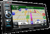
Kenwood DNX690HD User Manual
Kenwood DNX690HD Manual
 |
View all Kenwood DNX690HD manuals
Add to My Manuals
Save this manual to your list of manuals |
Kenwood DNX690HD manual content summary:
- Kenwood DNX690HD | User Manual - Page 1
GPS NAVIGATION SYSTEM DNX890HD DNX690HD DNX570HD DNX5080EX GPS NAVIGATION INSTRUCTION MANUAL © IM366_Nav_K_00 - Kenwood DNX690HD | User Manual - Page 2
the Map 22 Viewing the Next Turn 22 Viewing Junctions 22 Viewing Traffic Alerts 22 Viewing Trip Information 22 Resetting Trip Information 23 Viewing Current Location Information 23 Finding Nearby Services 23 Directions to Your Current Location 23 2 GPS Navigation Instruction Manual - Kenwood DNX690HD | User Manual - Page 3
33 Changing the Navigation Settings 33 Adjusting the Display Settings 33 Route Preferences 33 Updating the Time Settings 34 Setting the Languages 34 Adding Security 34 Device and Privacy Settings 34 Restoring Settings 34 Appendix 35 Updating the Software 35 Updating the Map Data - Kenwood DNX690HD | User Manual - Page 4
. The Software and Data are provided under the following license and are subject to the following terms and conditions which are agreed to by End User ("you" or "your"), on the one hand, and Garmin and its licensors (including their licensors and 4 GPS Navigation Instruction Manual suppliers) and - Kenwood DNX690HD | User Manual - Page 5
Data or server will be uninterrupted or error-free. Disclaimer of Warranty. GARMIN AND , services, processes, hypertext links to third parties or other Data by Data). Canadian Map Data. The Map Data for Canada may include or reflect data of licensors, including Her Majesty and Canada Post. Such data - Kenwood DNX690HD | User Manual - Page 6
Map Data, the traffic location codes are © 2010 Telstra Corporation Limited and its licensors. Term. This Agreement is effective until such time 6 GPS Navigation Instruction Manual as (i) if applicable, your subscription term is either terminated (by you or by Garmin the International Sale of Goods, - Kenwood DNX690HD | User Manual - Page 7
Data provided to you hereunder. Government End Users. If End User software definition), DFARS 27.7202-1 (DOD policy on commercial computer software), FAR 52.227-19 (JUN 1987) (commercial computer software data and noncommercial computer software Garmin Garmin® is a trademark of Garmin of Garmin. - Kenwood DNX690HD | User Manual - Page 8
that the Traffic Data will operate properly as integrated and interfaced with the Garmin product. In addition, NAVTEQ (and its affiliates) and Garmin Ltd. (and its subsidiaries) make no warranty with regard to the reliability, 8 GPS Navigation Instruction Manual accuracy, exhaustiveness, and - Kenwood DNX690HD | User Manual - Page 9
is a commercial item as defined in FAR 2.101 and is subject to the NAVTEQ Traffic™ End User License Agreement under which this Data was provided. © 2011 NAVTEQ; © 2011 Traffic.com - All rights reserved. If the Contracting Officer, federal government agency, or any federal official refuses to use - Kenwood DNX690HD | User Manual - Page 10
status bar icons display information about features on the device. You can select some icons to change settings or view additional information. GPS signal status. Current time. Smartphone Link status (appears when connected to Smartphone Link). See (page 24). 10 GPS Navigation Instruction Manual - Kenwood DNX690HD | User Manual - Page 11
. When at least one of the bars is green, your system has acquired satellite signals. Viewing GPS Satellite Signals For more information about GPS, go to www .garmin.com/aboutGPS. Select . Using the On-Screen Buttons • Select to return to the main menu. • Hold to quickly return to the main menu - Kenwood DNX690HD | User Manual - Page 12
a location. Changing the Search Area By default, your device finds locations closest to your current location. You can find a location near another city or location. 1 Select Where To? > Searching Near. 2 Select an option. 3 If necessary, select a location. 12 GPS Navigation Instruction Manual - Kenwood DNX690HD | User Manual - Page 13
fuel stations and compare fuel prices. 1 Select Where To? > Categories > Fuel Prices. 2 If necessary, select > Fuel Type, select a fuel type, and select Save. 3 Select a fuel station. Finding an Address ⁄ • The order of the steps may change depending on the map data loaded on your device. 1 Select - Kenwood DNX690HD | User Manual - Page 14
7 Select View on Map. Finding a Location by Browsing the Map Before you can find places included in the map data, such as restaurants, hospitals, and fuel stations, you must enable the map layer for places along The location is saved as "Home" in the Saved menu. 14 GPS Navigation Instruction Manual - Kenwood DNX690HD | User Manual - Page 15
Places Select Where To? > Recent > > Clear > Yes. Finding Parking 1 Select Where To? > Categories > Parking. 2 Select a parking location. 4 Select an area on the map. The address of the location appears at the bottom of the screen. 5 Select the location description. 6 Select Set Location. Saving - Kenwood DNX690HD | User Manual - Page 16
To assign categories to the Favorite, select Categories. • To change the symbol used to mark the Favorite on a map, select Change Map Symbol. 7 Edit the information. 8 Select Done. Assigning the box next to the saved locations to delete, and select Delete. 16 GPS Navigation Instruction Manual - Kenwood DNX690HD | User Manual - Page 17
Select Routes. 4 Use the on-screen buttons to select a route. 5 guides you to the destination with voice prompts, arrows on the map, and directions at the top of the map. If you depart from the original route, the device recalculates the route and provides new directions. Using the Navigation Map - Kenwood DNX690HD | User Manual - Page 18
map, select . 18 GPS Navigation Instruction Manual Updating Speed Limits NOTICE The speed limit icon feature is for information only and does not replace the driver's responsibility to abide by all posted speed limit signs and to use safe driving judgment at all times. Garmin and JVC KENWOOD will - Kenwood DNX690HD | User Manual - Page 19
Using Find Ahead When upcoming exits do not have needed services, you can search farther ahead on your route. 1 While navigating a route, from the map select > Exit Services. 2 Select an exit service tab that does not have an upcoming service match. 3 Select Find Ahead. 4 Select > to see more exits - Kenwood DNX690HD | User Manual - Page 20
roads, or poor road conditions. 1 Select a destination, and select Go! (page 12). 2 From the map, select > Detour 3 Select Next .5mi on Route, Next 2mi on Route, Next 5mi on Route, or Detour by Road(s) on Route. 4 If necessary, select a road to detour around. 20 GPS Navigation Instruction Manual - Kenwood DNX690HD | User Manual - Page 21
2 Select the Trip Log check box. Changing the Map Data Field 1 From the map, select the data field in the lower left-hand corner. 2 Select a type of data to display. 3 Select Save. Changing the Map Perspective 1 Select Settings > Map & Vehicle > Driving Map View. 2 Select an option: • Select Track - Kenwood DNX690HD | User Manual - Page 22
While you navigate a route, a traffic alert may appear. Select the alert to view more information. Viewing Trip Information The trip information page displays your present speed and provides statistics about your trip. From the map, select > Trip Computer. 22 GPS Navigation Instruction Manual - Kenwood DNX690HD | User Manual - Page 23
the map, select > Trip Computer. 2 Select > Reset All. 3 Select an option: • When not navigating a route, select Select All to reset every data field, except the speedometer, on the page. • Select Reset Trip Data to reset the information on the trip computer. • Select Reset Max. Speed to reset the - Kenwood DNX690HD | User Manual - Page 24
access to Garmin Live Services. Garmin Live Services provides free and subscription-based plans to view live data on your device, such as traffic data, weather, and fuel prices. Saved locations and recently found locations are synchronized with your phone each time your navigation system connects - Kenwood DNX690HD | User Manual - Page 25
Garmin Live Services. A list of services and subscription prices appears. 3 Select a service. 4 Select the price. 5 Select Subscribe. 6 Follow the on-screen instructions. About ecoRoute The ecoRoute™ feature calculates your vehicle fuel economy, carbon footprint, and the fuel price of navigating - Kenwood DNX690HD | User Manual - Page 26
mileage reports. 1 Select Apps > ecoRoute™ > Mileage Report. 2 Select a report. To reset all report data, select Reset. Resetting Your Score You can restart your current ecoChallenge. 1 Select Apps > ecoRoute > ecoChallenge. 2 Select > Reset. 3 Select Yes. 26 GPS Navigation Instruction Manual - Kenwood DNX690HD | User Manual - Page 27
supported phone running Smartphone Link (page 24). This feature is not available in all areas. You can view messages from myGarmin, such as notifications for software and map updates -coded radar map of current weather conditions, as well as a weather icon on the map. The weather icon changes to show - Kenwood DNX690HD | User Manual - Page 28
trip. 3 Select . 4 Select an option: • Select Rename Trip. • Select Edit Destinations to add and delete locations, or to change the order of locations. • Select Delete Trip. • Select Optimize Order to arrange the stops on your trip in the most-efficient order. 28 GPS Navigation Instruction Manual - Kenwood DNX690HD | User Manual - Page 29
not available in all areas. You can find detailed parking information, in cluding parking availability in nearby garages, and pricing information. 1 Select Apps > Parking. 2 Select a parking location. Viewing the World Map Select Apps > World Clock > . Nighttime hours appear in the shaded area of - Kenwood DNX690HD | User Manual - Page 30
Red Gray Description Meaning Low severity Traffic is flowing normally. Medium severity Traffic is slightly congested. High severity Traffic is heavily congested or stopped. No data Traffic data has not updated. 30 GPS Navigation Instruction Manual - Kenwood DNX690HD | User Manual - Page 31
the current traffic and automatically optimizes the route for the shortest time. If a severe traffic delay occurs on your route while you are navigating, your navigation system automatically recalculates the route. The traffic icon changes color to indicate the severity of traffic conditions on your - Kenwood DNX690HD | User Manual - Page 32
you can view a traffic camera, you must save a traffic camera. 1 Select Apps > myCameras. 2 Select a camera. Adding a Traffic Subscription You can purchase traffic subscriptions for other regions or countries. Go to www.garmin.com /kenwood for more information. 32 GPS Navigation Instruction Manual - Kenwood DNX690HD | User Manual - Page 33
be included on the map. • Map Layers: Sets the data that appears on the map. • Dashboards: Sets the map dashboard layout. • myMaps: Sets which installed maps the device uses. Enabling Maps 1 Select Settings > Map & Vehicle > myMaps. 2 Select a map. Changing the Navigation Settings Select Settings - Kenwood DNX690HD | User Manual - Page 34
Navigation > Safe Mode. • Safe Mode-turn software features. ⁄ • You need this information when you update the system software or purchase additional map data factory default values. 1 Select Settings. 2 If necessary, select a settings category. 3 Select > Restore. 34 GPS Navigation Instruction Manual - Kenwood DNX690HD | User Manual - Page 35
installation of the software update. Updating the Map Data You can purchase updated map data from Garmin or ask your Kenwood dealer or Kenwood service center for details. 1 Go to www.garmin.com/Kenwood. 2 Select Order Map Updates for your Kenwood unit. 3 Follow the Web site instructions to update - Kenwood DNX690HD | User Manual - Page 36
at www.garmin.com/products /poiloader. Refer to the POI Loader Help file for more information; click Help to open the Help file. ⁄ • Each time you load custom POIs to the navigation system, any other custom POIs already saved in the system will be overwritten. 36 GPS Navigation Instruction Manual - Kenwood DNX690HD | User Manual - Page 37
English 37 - Kenwood DNX690HD | User Manual - Page 38
For the latest free software updates (excluding map data) throughout the life of your Garmin products, visit the Garmin Web site at www.garmin.com/Kenwood. © 2012 Garmin Ltd. or its subsidiaries Garmin International, Inc. 1200 East 151st Street, Olathe, Kansas 66062, USA Garmin (Europe) Ltd. Liberty
-
 1
1 -
 2
2 -
 3
3 -
 4
4 -
 5
5 -
 6
6 -
 7
7 -
8
-
9
-
10
-
11
-
12
-
13
-
14
-
15
-
16
-
17
-
18
-
19
-
20
-
21
-
22
-
23
-
24
-
25
-
26
-
27
-
28
-
29
-
30
-
31
-
32
-
33
-
34
-
35
-
36
-
37
-
38
 |
 |

GPS NAVIGATION SYSTEM
DNX890HD
DNX690HD
DNX570HD
DNX5080EX
GPS NAVIGATION
INSTRUCTION MANUAL
©
IM366_Nav_K_00