Magellan GPS 315 User Manual
Magellan GPS 315 Manual
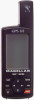 |
UPC - 763357101522
View all Magellan GPS 315 manuals
Add to My Manuals
Save this manual to your list of manuals |
Magellan GPS 315 manual content summary:
- Magellan GPS 315 | User Manual - Page 1
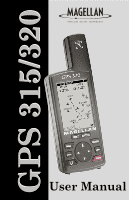
GPS 315/320 User Manual - Magellan GPS 315 | User Manual - Page 2
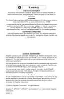
ACCESSORIES Use only Magellan cables and antennas; the use of non-Magellan cables and antennas may severely degrade performance or damage the receiver, and will void the warranty. LICENSE AGREEMENT Magellan grants you, the purchaser, the right to use the software supplied in and with MAGELLAN GPS - Magellan GPS 315 | User Manual - Page 3
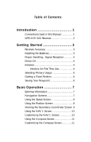
Conventions Used in this Manual 1 GPS 315/320 Receiver 2 Getting Started 3 Receiver Accuracy 3 Installing the Batteries 3 Proper Handling - Signal Reception 4 Power On 4 Initialize 4 Initialize for First Time Use 4 Selecting Primary Usage 5 Getting a Fixed Position 6 Saving Your Waypoint - Magellan GPS 315 | User Manual - Page 4
19 Setting the Speed Average 19 Using the Time Screen 20 Selecting Time Format 20 Resetting Elapsed Time 21 Reference 22 Working with Waypoints 23 Creating a User Waypoint 24 Editing a User Waypoint 24 Creating/Editing/Deleting a Message in a User Waypoint 25 Saving Changes to a Selected - Magellan GPS 315 | User Manual - Page 5
at the End of a Route 32 Deleting a Waypoint in a Route ........ 32 Saving a Route 32 Activating/Deactivating a Route ....... 32 Reversing a Route 33 Using Plot View in a Route 33 Deleting a Route 33 Working with TrackRoute 34 Auxiliary Functions 35 Working with Sun/Moon and Fish/Hunt .. 35 - Magellan GPS 315 | User Manual - Page 6
Light Timer 45 Selecting the Beeper 45 Selecting Personalize 45 Selecting Clear Memory 46 Selecting NMEA 46 Selecting Baud Rate 47 Connecting to DGPS 48 Troubleshooting 49 Commonly Asked Questions 50 Contacting Magellan 51 Shipping Your Receiver 51 NMEA Data Messages 52 iv - Magellan GPS 315 | User Manual - Page 7
Available Datums 58 Specifications 59 Attaching the Wrist Lanyard ..... 60 Accessories 61 Glossary 62 Index 66 v - Magellan GPS 315 | User Manual - Page 8
vi - Magellan GPS 315 | User Manual - Page 9
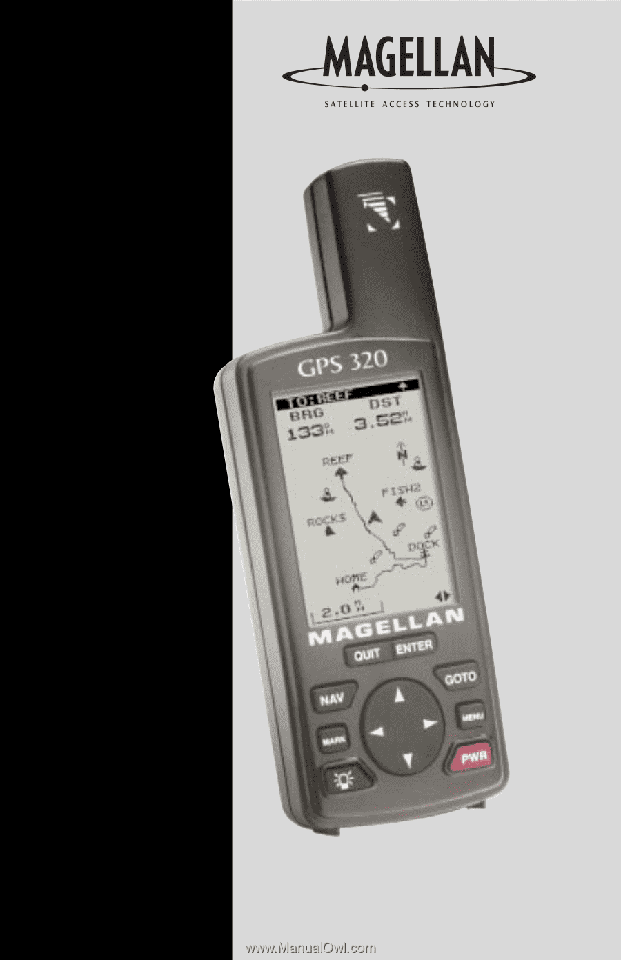
you want set in the receiver. The Troubleshooting chapter gives you a problem and answer series to guide you. The final chapter, Glossary, defines terms that may be unfamiliar to you. The manual is to be used with either the GPS 315 or the GPS 320. These differ in that the GPS 315 has a database of - Magellan GPS 315 | User Manual - Page 10
enter information and scroll through menus. The ENTER key confirms data entries or menu selections. The GOTO key creates a direct route to any waypoint stored in memory. The MENU accesses waypoint, route and setup functions. The PWR key turns the receiver on and off. 2 Magellan GPS 315/GPS 320 - Magellan GPS 315 | User Manual - Page 11
, and replace the cover. - + + - Replace the screw and turn the ring clockwise until the battery door is held in place securely. Avoid overtightening the battery door screw. Once the batteries have been removed, the receiver loses time and date after 20 minutes. Magellan GPS 315/GPS 320 3 - Magellan GPS 315 | User Manual - Page 12
receiver has already been initialized. The other steps in this procedure are not required. PWR INITIALIZE screen ENTER Select region ENTER Select area ENTER Enter * elevation ENTER Enter time ENTER Enter date ENTER * If you do not know your elevation, press ENTER . 4 Magellan GPS 315 - Magellan GPS 315 | User Manual - Page 13
will appear on your receiver. The following chart shows the terminology that your receiver uses while in land or marine mode. For purposes of this manual, it will be assumed that the receiver is in the KM/KPH Marine SOG BRG DST COG VMG CTS ETA ETE XTE Waypoint NM/KNOTS Magellan GPS 315/GPS 320 5 - Magellan GPS 315 | User Manual - Page 14
your current position to any waypoint in the receiver's memory. GOTO Select category ENTER Select waypoint ENTER This completes the Getting Started section. The following Basic Operation section will familiarize you with the NAV screens and more detailed functions. 6 Magellan GPS 315/GPS 320 - Magellan GPS 315 | User Manual - Page 15
, you can use the NAV or QUIT to step through the sequence of NAV screens. All screens, except STATUS and POSITION screens, can be disabled by turning them off in the NAV SCREENS portion of SETUP. The TIME screen default is off and can be turned on in SETUP as well. Magellan GPS 315/GPS 320 7 - Magellan GPS 315 | User Manual - Page 16
receiver has computed a fixed position, the STATUS screen will be replaced by the POSITION screen. Using the Status Screen The STATUS screen gives you the general well-being of your receiver by showing you satellite status, signal strengths and battery the circle is 90˚. 8 Magellan GPS 315/GPS 320 - Magellan GPS 315 | User Manual - Page 17
averaging, the receiver continuously takes fixes to create an average. Once you begin moving, averaging stops automatically. Viewing the Secondary Coordinate Screen From the POSITION screen, use the left/right ARROWs to view the Second Coordinate System access screen. Magellan GPS 315/GPS 320 9 - Magellan GPS 315 | User Manual - Page 18
BLANK Figure A. Select the data field to appear on the NAV 1 screen. Using the NAV 1 Screen The NAV 1 screen data that you prefer to view. From NAV 1 screen MENU Select CUSTOMIZE ENTER Choose field ENTER FIG. A Select data type ENTER QUIT 10 Magellan GPS 315/GPS 320 - Magellan GPS 315 | User Manual - Page 19
Using the Compass Screen As well as displaying the customizable navigation data, the COMPASS screen provides a pointer navigation data that you prefer to view. From COMPASS screen MENU Select CUSTOMIZE ENTER Choose field ENTER FIG. B Change field ENTER QUIT Magellan GPS 315/GPS 320 When - Magellan GPS 315 | User Manual - Page 20
NAV 2 Screen The NAV 2 screen can be changed to show the navigation data that you prefer to view. From NAV 2 screen MENU Select CUSTOMIZE ENTER Figure A. Select the data field to appear on the NAV 2 screen. Choose field ENTER FIG. A Change field ENTER QUIT 12 Magellan GPS 315/GPS 320 - Magellan GPS 315 | User Manual - Page 21
Can be changed by using the left/right arrows. The scale ranges from .1 to 200 miles. Track History Automatically records where you have been. PAN-N-SCAN, an additional feature, allows you to scroll through the PLOT screen enabling you to create waypoints and GOTOs. Magellan GPS 315/GPS 320 13 - Magellan GPS 315 | User Manual - Page 22
crumbs" from your starting point as you travel. This is useful when you want to return to your starting point. From PLOT screen MENU Select TRACK HIST ENTER Change field ENTER Clearing Track History From PLOT MENU Select screen CLR TRACK ENTER Select ENTER 14 Magellan GPS 315/GPS 320 - Magellan GPS 315 | User Manual - Page 23
PLOT screen MENU Select PLOT SETUP ENTER Select ORIENTATION ENTER FIG. A Select orientation ENTER Turning Plot Rings On or Off. You may want to estimate the distance to a point on the MINUTES 10 MINUTES Figure B. You can choose from OFF, 1, 2, 5 and 10 minutes. Magellan GPS 315/GPS 320 15 - Magellan GPS 315 | User Manual - Page 24
at which the waypoints appear on the DATA/SHOW DATA, you can turn these fields on or off. From PLOT screen MENU Select HIDE DATA or SHOW DATA ENTER Depending on which has been selected previously, you may need to select SHOW DATA to bring the fields into view. 16 Magellan GPS 315/GPS 320 - Magellan GPS 315 | User Manual - Page 25
Using the Road Screen The ROAD screen displays four customizable navigation data fields, at the top of the screen, and shows your position on the desired route. Destination VMG ---KT CTS ---°m BLANK Figure B. You can choose from BRG, DST, SOG, COG, VMG, CTS and blank. Magellan GPS 315/GPS 320 17 - Magellan GPS 315 | User Manual - Page 26
of speed over ground (SOG). WARNING RESET ODOMETER TO 000? YES NO Figure A. Select "Yes" to reset the odometer. Resetting the Odometer You may want to reset the Odometer field to zero. From SPEED screen MENU Select ODOM RESET ENTER FIG. A Select yes or no ENTER 18 Magellan GPS 315/GPS 320 - Magellan GPS 315 | User Manual - Page 27
ENTER Select yes or no ENTER Setting the Speed Average You may want to reset the Speed Average field in your receiver. From SPEED screen MENU Select SPEED AVG ENTER FIG. B Select time ENTER or 1 hour. TRIP option is for averaging speed over the entire trip. Magellan GPS 315/GPS 320 19 - Magellan GPS 315 | User Manual - Page 28
The default for the TIME screen is off. All data shown on the TIME screen applies to the route you are navigating in. Using the Time Screen The TIME screen displays the current time, estimated time enroute, UTM is chosen you will not be prompted to make the time change. Magellan GPS 315/GPS 320 - Magellan GPS 315 | User Manual - Page 29
have completed the basic operation for your receiver. From the information provided, you can now navigate from place to place quickly and easily. The following chapters provide you with additional information on using your receiver that build on what you have learned. Magellan GPS 315/GPS 320 21 - Magellan GPS 315 | User Manual - Page 30
waypoints (known as User waypoints) or use the waypoints already in the receiver's memory (NonUser waypoints). You can store up to 500 user positions which can be used to build routes for navigation. As stated earlier in the user manual, the GPS 315 has a database of worldwide cities and the GPS 320 - Magellan GPS 315 | User Manual - Page 31
of the User and Non-User waypoints. You can store up to 10 Non-User waypoint categories. WPT Types User Non-User Available Functions • Create • Edit • Delete • Project • Sort • Find • Project • Sort The chart below shows the differences between the GPS 315 and GPS 320. GPS 315 Worldwide major - Magellan GPS 315 | User Manual - Page 32
ENTER Select User category ENTER Select waypoint MENU Select EDIT WPT FIG. A ENTER Editing Waypoint Fields. Follow the instructions on selecting a waypoint and use the following to edit the desired fields. FIG. B Select data field ENTER Make changes ENTER 24 Magellan GPS 315/GPS 320 - Magellan GPS 315 | User Manual - Page 33
the data fields shown in the above screen except the FROM waypoint. In the G.C. (Great Circle) BRG/DST field, you can input the bearing and distance into the data fields in order to compute the projection. You can also input information into the coordinate fields. Magellan GPS 315/GPS 320 25 - Magellan GPS 315 | User Manual - Page 34
Continue until the name is found. Finding a Non-User Waypoint To simplify your search for a waypoint, you can find it using the smart scroll function. From any NAV screen Select MENU WAYPOINTS ENTER Select category ENTER MENU ENTER Find waypoint Select FIND 26 Magellan GPS 315/GPS 320 - Magellan GPS 315 | User Manual - Page 35
the receiver which replace all waypoints in the receiver. The default waypoints that came with the receiver can be restored at any time. Don't worry about losing the waypoints that came with the receiver, they are available on the CD for retransmission to the receiver. Magellan GPS 315/GPS 320 27 - Magellan GPS 315 | User Manual - Page 36
set a GOTO by: From PLOT screen Select MENU PAN-N-SCAN ENTER Move crosshair GOTO Select ENTER yes or no When the crosshair is over the waypoint icon, the waypoint name is displayed at the top of the screen. 28 Magellan GPS 315/GPS 320 - Magellan GPS 315 | User Manual - Page 37
will be created and given a name in the format of BXXPxx. XX is the BACKTRACK number and xx is the waypoint number ranging from 01 to 31. For example, your first backtrack will read B01P01. The backtrack waypoints will be listed in the menu just as other waypoints. Magellan GPS 315/GPS 320 29 - Magellan GPS 315 | User Manual - Page 38
waypoint in the multi-leg route. MENU INSERT SAVE ROUTE WAYPOINTS ROUTES SETUP SUN/MOON FISH/HUNT CONTRAST ALARM/MSG Figure B. Use this waypoint ENTER * You can combine waypoints of different categories in the same route. The receiver will display the selected waypoint Magellan GPS 315/GPS 320 - Magellan GPS 315 | User Manual - Page 39
Select category ENTER Select waypoint ENTER or MENU Select REPLACE ENTER SAVE ROUTE LEG BRG DST 30˚m 10 M I Figure D. You can add to an already existing route by highlighting the next available dotted line. Select category ENTER Select waypoint ENTER Magellan GPS 315/GPS 320 31 - Magellan GPS 315 | User Manual - Page 40
on which was chosen previously. 32 Adding a Waypoint at the End of a Route. You may be navigating using the home to campsite route and find a turn on) the home to campsite route and begin navigating. MENU Select ROUTES Select route MENU Select FIG. ACTIVATE C ENTER Magellan GPS 315/GPS 320 - Magellan GPS 315 | User Manual - Page 41
deactivate (turn off ) using your home to campsite route, you decide you no longer want to visit those sites. You can delete the route from your receiver WAYPOINTS ROUTES SETUP SUN/MOON FISH/HUNT CONTRAST ALARM/MSG Figure E. Use this menu for accessing Plot View in a route. Magellan GPS 315/GPS 320 - Magellan GPS 315 | User Manual - Page 42
Working with TrackRoute TrackRoute (previously called Map 'N Track in the receiver point to the last track point, making a reverse BACKTRACK. This turns the Track History logging off to keep from overwriting track points in receiver to skip 1 or more of these legs. 34 Magellan GPS 315/GPS 320 - Magellan GPS 315 | User Manual - Page 43
. SUN/MOON AT: POS ON: 23MAR98 FISH/HUNT EXCELLENT FROM 06:15AM TO 07:45 AM FROM 10:24PM TO 11:58PM GOOD FROM 04:12PM TO 07:40PM FROM 06:37AM TO 10:05AM Figure B. You can change the location (AT) and/or the date (ON) for the calculation. Magellan GPS 315/GPS 320 35 - Magellan GPS 315 | User Manual - Page 44
more than 300 miles from your actual present position. Selecting Contrast You may want to change the contrast of your receiver. You can adjust the brightness depending on your preference. From any screen MENU Select CONTRAST ENTER FIG. B Adjust contrast ENTER 36 Magellan GPS 315/GPS 320 - Magellan GPS 315 | User Manual - Page 45
set an alarm. The receiver has five types of alarms: Anchor alarm, Arrival alarm, XTE alarm, Proximity alarm and GPS Fix alarm. To access when the GPS position is at a distance greater than the distance you have chosen. The alarm will sound until turned off or 500 feet. Magellan GPS 315/GPS 320 37 - Magellan GPS 315 | User Manual - Page 46
message you have inputted for the waypoint. The alarm will sound until turned off. Default setting: OFF WPT GPS position is off your set course by the distance you have chosen. The alarm will sound until turned off or the condition is corrected. Default setting: OFF 38 Magellan GPS 315/GPS 320 - Magellan GPS 315 | User Manual - Page 47
turned off. Default setting: OFF Figure D. You can select any saved waypoint to list on the Proximity waypoint screen. Due to government imposed Selective Availability, alarm limit values under 100 feet may have errors. Do not rely on this feature for precise navigation. Magellan GPS 315/GPS 320 - Magellan GPS 315 | User Manual - Page 48
information. Selecting GPS Fix Alarm The GPS Fix alarm allows the Poor GPS alarm to be turned off. Therefore, when the GPS reception is use the CLEAR MSG to delete the messages. While viewing Select FIG. Alarm/Msg screen CLEAR MSG ENTER D Select yes or no ENTER 40 Magellan GPS 315/GPS 320 - Magellan GPS 315 | User Manual - Page 49
. SETUP INITIALIZE NAV SCREENS COORD SYSTEM MAP DATUM ELEV MODE TIME FORMAT NAV UNITS NORTH REF LIGHT TIMER BEEPER PERSONALIZE CLEAR MEMORY NMEA BAUD RATE SIMULATE Figure F. If you need to initialize again, make this selection. The default for the TIME screen is off. Magellan GPS 315/GPS 320 41 - Magellan GPS 315 | User Manual - Page 50
Figure A. You can turn NAV screens on or , Irish, Swiss, Swedish, Finnish, German, French, MGRS and User Grid. Selecting a Coordinate System A coordinate system is provided for you the receiver to use position coordinates in the same map datum that is used by your maps. 42 Magellan GPS 315/GPS 320 - Magellan GPS 315 | User Manual - Page 51
receiver will ask for elevation. WELPETVNMAOMDEES O3FDF O2ND Figure E. You can choose from 2D or 3D. WELPETVNAATMIOENS OFF 0000FT ON Figure F. If you are at sea level, you can use 2D because your elevation is zero. FIG. F Input elevation ENTER Default setting: 3D Magellan GPS 315/GPS 320 43 - Magellan GPS 315 | User Manual - Page 52
to true north (good, if you are using a map) or back to magnetic north (default, good to use if you are using a compass), or mils true or mils mag under SETUP. MENU Select SETUP Select ENTER NORTH REF ENTER FIG. D Select reference ENTER Default setting: MAGNETIC 44 Magellan GPS 315/GPS 320 - Magellan GPS 315 | User Manual - Page 53
light on, it remains lit. With the next key press, the light turns on again for 30 seconds. This continues until you turn the light or the receiver off. BEEPER OFF KEYS ONLY ALARM ONLY KEYS /ALARM Figure F. You can choose from OFF, KEYS ONLY, ALARM ONLY and KEYS/ALARM. Magellan GPS 315/GPS 320 45 - Magellan GPS 315 | User Manual - Page 54
all memory, the receiver will clear everything and power itself off. Selecting NMEA Your receiver can be set to output GPS data to interface with your personal computer. MENU Select SETUP ENTER Select NMEA ENTER FIG. B Select NMEA ENTER Default setting: OFF 46 Magellan GPS 315/GPS 320 - Magellan GPS 315 | User Manual - Page 55
Selecting Baud Rate Connection to external devices requires that the baud rate of the data being sent or received by the receiver be matched to the baud rate of the external device. MENU FIG. C You can choose from 1200, 4800, 9600 and 19200 baud. Default: 4800 baud Magellan GPS 315/GPS 320 47 - Magellan GPS 315 | User Manual - Page 56
with the DBR-2 or DBR-3, you must use a null modem (Radio Shack P/N: 26-264A) and a gender changer (Radio Shack P/N: 26-280A) to connect the GPS receiver properly. This is due to the pinout being the opposite of the DB9 connector configuration for a PC connection. 48 Magellan GPS 315/GPS 320 - Magellan GPS 315 | User Manual - Page 57
the map legend. See Map Datum under Reference for instructions on selecting the map datum in your receiver. 2. Check your LAT/LON format. Make sure that the format selected in COORDINATE SYSTEM (DEG/MIN/SEC or DEG/MIN.MM) is in the same format as the map you are using. Magellan GPS 315/GPS 320 49 - Magellan GPS 315 | User Manual - Page 58
, the battery life is diminished. Why is the time and date incorrect after I replace the batteries? If the batteries are removed for 20 minutes or more, the receiver will lose the time and date. The receiver will collect time and date soon after tracking a satellite. 50 Magellan GPS 315/GPS 320 - Magellan GPS 315 | User Manual - Page 59
Court San Dimas, CA 91773 ATTN: Warranty/Repair Shipping Your Receiver When shipping your receiver by air, loosen the battery door screw by turning the screw by 1/2 turn. This will prevent damage to the receiver's water seal during shipping due to pressure differences. Magellan GPS 315/GPS 320 51 - Magellan GPS 315 | User Manual - Page 60
Data status, cross track error, direction to steer, origin, destination landmark, landmark location, bearing to destination, and velocity toward the destination. Time, latitude, longitude, speed, heading, and date. Track (magnetic and true) and groundspeed (knots and KPH). 52 Magellan GPS 315/GPS - Magellan GPS 315 | User Manual - Page 61
, True 8-9 Bearing, Magnetic 10-11Distance, naut. miles 12 Waypoint identifier GLL Geographic Position - Latitude/Longitude 1 2 3 4 5 6 GLL,1111.11,a,yyyyy.yy,a,hhmmss.ss,A*hh 1-2 Latitude, N/S 2-3 Longitude, E/W 4 UTC of position 6 Status A = Data valid Magellan GPS 315/GPS 320 53 - Magellan GPS 315 | User Manual - Page 62
hh 1 Status: A = Data valid V = Loran-C Blink waypoint 8-9 Bearing origin to destination, M/T 10 Destination waypoint ID 11-12 Bearing, present position to destination, Magnetic or True 13-14 Heading to steer to destination waypoint, Magnetic or True 54 Magellan GPS 315/GPS 320 - Magellan GPS 315 | User Manual - Page 63
is not used 14 Differential reference station ID, 0000-1023 GLL Geographic Position - Latitude/Longitude 1 2 3 4 5 6 GLL,1111.11,a,yyyyy.yy,a,hhmmss.ss,A*hh 1-2 Latitude, N/S 2-3 Longitude, E/W 4 UTC of position 6 Status A = Data valid V = Data not valid Magellan GPS 315/GPS 320 55 - Magellan GPS 315 | User Manual - Page 64
GPS receiver operating mode, satelites used in the navigation solution reported by the $--GGA sentence, and DOP values. 1 2 3 45 67 GSA,a,x,xx,xx,xx,xx,xx,xx,xx,xx,xx,xx,xx,xx,x.x,x.x,x.x*hh, 1 Mode: M=Manual sets when less than four sets are transmitted. 56 Magellan GPS 315/GPS 320 - Magellan GPS 315 | User Manual - Page 65
yy,a,x.x,x.x,x.x,A *hh 1 Data Status (A = valid, the destination waypoint.) 14 Magellan receivers may not output all of the information listed for a particular format. A complete copy of the NMEA specifications can be obtained from: NMEA, PO Box 3435 New Bern, NC 28564-3435 Magellan GPS 315/GPS 320 - Magellan GPS 315 | User Manual - Page 66
) GUNSG G. Segara TIMBA Timbalai GUNSR TOKYO Tokyo HAWAI Hawaii USER DEFINED HERAT Herat North VOIRO HJORS Hjorsey 1955 WGS72 World Geodetic System HUTZU Hu-tzu-shan 1972 INDIA Indian (India, Nepal) YACAR Yacare IRAN Iran 58 ZANDE Zanderij Magellan GPS 315/GPS 320 - Magellan GPS 315 | User Manual - Page 67
Housing Waterproof (Battery compartment is splashproof ) Temp. Range: Operating 14˚F to 140˚F to (-10˚C to 60˚C) Storage -40˚F to 167˚F (-40˚C to 75˚C) Power: Source 2 AA alkaline or lithium batteries or 9-16 VDC with power cable Battery Life Up to 15 hours Magellan GPS 315/GPS 320 59 - Magellan GPS 315 | User Manual - Page 68
Attaching the Wrist Lanyard The lanyard for your GPS receiver can be easily attached by inserting the small loop of the lanyard through the ring provided on the battery door locking screw and then looping the other end of the lanyard strap through the small loop. 60 Magellan GPS 315/GPS 320 - Magellan GPS 315 | User Manual - Page 69
GPS data management software. Instructional Video: A video in VHS format that provides you with instructions on how to use and operate your receiver. Differential Beacon Receiver (DBR-3): Connects to your receiver to receive differential corrections (DGPS) for 5-10 meter accuracy. Magellan GPS 315 - Magellan GPS 315 | User Manual - Page 70
using can be found in the legend of the map. If you are unsure of which datum to use, use WGS84. Default The value or setting automatically chosen by the unit unless otherwise directed. Can be changed in Setup. DST Distance. Distance from position to destination. 62 Magellan GPS 315/GPS 320 - Magellan GPS 315 | User Manual - Page 71
a starting (FROM) waypoint and a destination (TO) waypoint. A route may consist of 1 or more legs. A route that is from waypoint A to waypoint B to waypoint C to waypoint D has three legs with the first being from waypoint A to waypoint B. B A Leg 1 Leg 2 D Leg 3 C Magellan GPS 315/GPS 320 63 - Magellan GPS 315 | User Manual - Page 72
to UTMs. Used with GRB36 datum. Position coordinates as computed by the GPS receiver. Speed Over Ground. The speed at which the receiver is moving. Turn. Degrees or direction to turn. The direction to are moving towards the destination and the distance remaining. 64 Magellan GPS 315/GPS 320 - Magellan GPS 315 | User Manual - Page 73
is obtained by entering data, editing data, calculating data or saving a current position. Used to create routes. Cross Track Error. The distance, left or right, of the desired courseline. The courseline is a straight line from your present position to your destination. Magellan GPS 315/GPS 320 65 - Magellan GPS 315 | User Manual - Page 74
see Time and Date Datums see Map Datums Demo Mode see Simulate DGPS 9 DGPS conection 48 Differences GPS 315/320 1 Disabling NAV Screens 41 E Elapsed time 21 Elevation 9; 43 Entering Information 7 Estimated Position Error 9 F Fish/Hunt 35 Fixed navaid 1, 62 Fixed Position 6 Magellan GPS 315/ GPS 320 - Magellan GPS 315 | User Manual - Page 75
45 Plot Rings 15 Plot Scales 16 Plot screen 13 Plotter 15 Population of cities 24 Position fix 6; troubleshooting 49 Position screen 9 Power On 4 Primary Usage 5 Projecting a Waypoint 25 Proximity alarm 39 R Receiver size 59 Reception 4 Road screen 17; customize 17 Magellan GPS 315/ GPS 320 67 - Magellan GPS 315 | User Manual - Page 76
26; deleting a message 25; editing a message 25; finding a non-user waypoint 26; functions 23; naming 6; saving 6, 25; sorting a waypoint 26 Weight, receiver 59 X XTE see Cross Track Error XTE alarm see Cross Track Error alarm U Universal Time Coordinated (UTC) 20, 44 68 Magellan GPS 315/ GPS 320 - Magellan GPS 315 | User Manual - Page 77
- Magellan GPS 315 | User Manual - Page 78
960 Overland Court, San Dimas, CA 91773 (909) 394-5000 630321 C
-
 1
1 -
 2
2 -
 3
3 -
 4
4 -
 5
5 -
 6
6 -
 7
7 -
8
-
9
-
10
-
11
-
12
-
13
-
14
-
15
-
16
-
17
-
18
-
19
-
20
-
21
-
22
-
23
-
24
-
25
-
26
-
27
-
28
-
29
-
30
-
31
-
32
-
33
-
34
-
35
-
36
-
37
-
38
-
39
-
40
-
41
-
42
-
43
-
44
-
45
-
46
-
47
-
48
-
49
-
50
-
51
-
52
-
53
-
54
-
55
-
56
-
57
-
58
-
59
-
60
-
61
-
62
-
63
-
64
-
65
-
66
-
67
-
68
-
69
-
70
-
71
-
72
-
73
-
74
-
75
-
76
-
77
-
78
 |
 |
GPS 315/320
GPS 315/320
User Manual