Magellan Triton 1500 Triton User Manual Addendum - English, French, Spanish
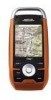
Magellan Triton 1500 - Hiking GPS Receiver Manual
 |
UPC - 763357117592
View all Magellan Triton 1500 manuals
Add to My Manuals
Save this manual to your list of manuals |
Magellan Triton 1500 manual content summary:
- Magellan Triton 1500 | Triton User Manual Addendum - English, French, Spanish - Page 1
Triton User Manual Addendum This addendum applies to Triton GPS receivers that have a software version that is equal to or higher then the ones listed. Triton 300 Triton 400 Triton 500 Triton 1500 Triton 2000 01.90.00.0279 01.74.00.0278 01.92.00.0283 01.53.00.0134 01.68.00.0138 The Main Menu and - Magellan Triton 1500 | Triton User Manual Addendum - English, French, Spanish - Page 2
system. User Defined Map Datum. (Advanced Users) You can set a user-defined map datum for your Triton. When selecting a user datum, you will be presented with options to define its parameters. To set a User Map Datum, press MENU from any navigational screen. Select View > Settings > Navigation - Magellan Triton 1500 | Triton User Manual Addendum - English, French, Spanish - Page 3
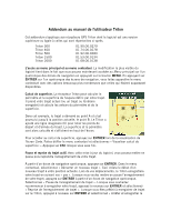
Triton Cet addendum s'applique aux récepteurs GPS Triton dont le logiciel est une version supérieure ou égale à celles qui sont répertoriées ci-après. Triton 300 Triton 400 Triton 500 Triton 1500 Triton votre trajet. À partir d'un écran de navigation quelconque, appuyez sur ENTRER. Dans le menu - Magellan Triton 1500 | Triton User Manual Addendum - English, French, Spanish - Page 4
de la grille d'utilisateur. L'écran Navigation s'affiche avec la grille d'utilisateur donnée de carte définie par l'utilisateur pour votre Triton. Lorsque vous sélectionnez une donnée de carte, que vous définissez une position personnalisée, la portion GPS du récepteur est désactivée et l'écran est - Magellan Triton 1500 | Triton User Manual Addendum - English, French, Spanish - Page 5
destination (D). En outre, si vous changez d'avis, vous pouvez lui indiquer d'aller à une destination précédente, dans notre cas (C). Pendant qu'un itinéraire multiple est actif, appuyez sur ENTRER pour faire afficher le menu contextuel. Sélectionnez « Aller à suivant » ou « Aller à précédent » pour - Magellan Triton 1500 | Triton User Manual Addendum - English, French, Spanish - Page 6
Apéndice del Manual del Usuario de Triton Este apéndice sirve para los receptores GPS Triton cuya versión de software sea igual o más actualizada que las que aparecen en la siguiente lista. Triton 300 Triton 400 Triton 500 Triton 1500 Triton 2000 01.90.00.0279 01.74.00.0278 01.92.00.0283 01.53.00 - Magellan Triton 1500 | Triton User Manual Addendum - English, French, Spanish - Page 7
ubicación actual. Cuando configure una posición personalizada, la parte GPS del receptor estará deshabilitada y la pantalla estará establecida en y desea ir allí, en vez de realizar toda la ruta. Puede indicarle al Triton que se dirija al siguiente destino (C) y repetir el proceso para ir al pró - Magellan Triton 1500 | Triton User Manual Addendum - English, French, Spanish - Page 8
©2009 MiTAC International Corporation. The Magellan logo, Magellan, and Triton are registered trademarks of MiTAC International Corporation. All rights reserved. All other trademarks and registered trademarks are property of their respective owners. 604-0268-001 A
-
 1
1 -
 2
2 -
 3
3 -
 4
4 -
 5
5 -
 6
6 -
 7
7 -
8
 |
 |
Triton User Manual Addendum
This addendum applies to Triton GPS receivers that have a software version that is equal
to or higher then the ones listed.
Triton 300
01.90.00.0279
Triton 400
01.74.00.0278
Triton 500
01.92.00.0283
Triton 1500
01.53.00.0134
Triton 2000
01.68.00.0138
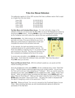
The Main Menu and Contextual Menu Access.
The most noticeable change in the
software is that you can now access the
Main Menu
on any of the Navigational screens by
pressing the
MENU
button.
Pressing
ENTER
on any of the Navigational screens brings
up the contextual menu with many more options then were previously available.
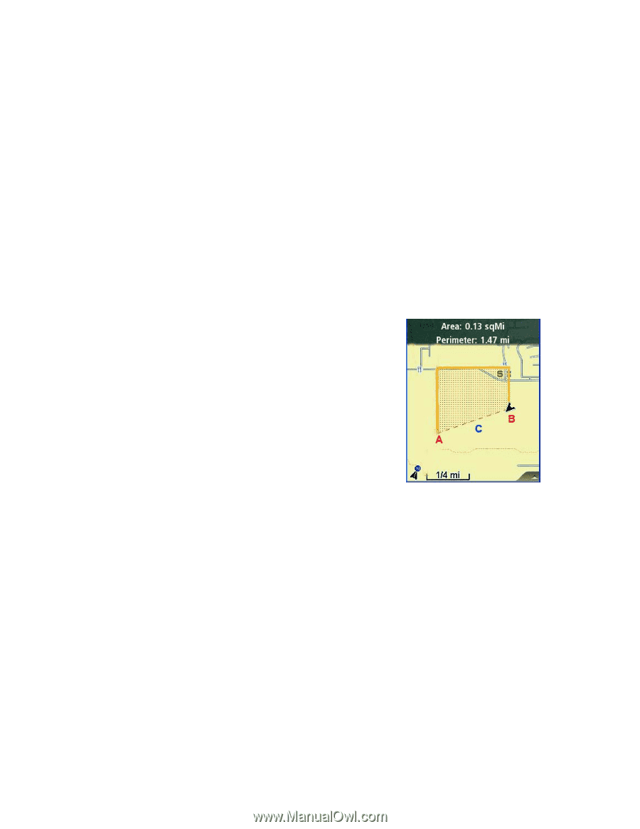
Area Calculation.
The Triton receiver can calculate the
perimeter and area of the space defined by your track.
It
takes your current track (or a saved track or route) and
computes the values for the perimeter and area.
In this example, the track was started at point A and
continued around to it’s current location, point B.
The
Triton has added an imaginary line ( C ) to connect the start
and end points of the track.
The Area and Perimeter are
then computed and displayed at the top of the screen.
To access area calculation, press
ENTER
while viewing the
Map
screen.
Scroll down the contextual menu and select “View Area Calculation”.
Press
ESC
when you are done.
Pause and Resume Active Track.
With this software update you can pause and then
resume recording your track.
From any navigational screen press
ENTER
.
On the contextual menu, select “Start New
Track”.
This will initiate a new track beginning at your current location.
As you move,
the Triton will record your track, following your “footsteps”.
When you want to pause the
recording of your track, press
ENTER
from any navigational screen.
Select “Pause Track
Record”.
When you want to begin recording your track again, select
ENTER
again and
select “Resume Track Record”.
When you are ready to save the track to the Triton, press
ENTER
again and select “Stop & Save Track”.
The track Info screen is displayed with
the option of assigning a name to the saved track (“Trail”).
User Grid.
(Advanced Users)
You can set a user grid as the Coordinate System for your
Triton.
When selecting User Grid, you will be presented with options to define the
parameters of the User Grid.