Magellan Triton 300 Manual - English
Magellan Triton 300 - Hiking GPS Receiver Manual
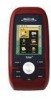 |
UPC - 763357118223
View all Magellan Triton 300 manuals
Add to My Manuals
Save this manual to your list of manuals |
Magellan Triton 300 manual content summary:
- Magellan Triton 300 | Manual - English - Page 1
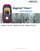
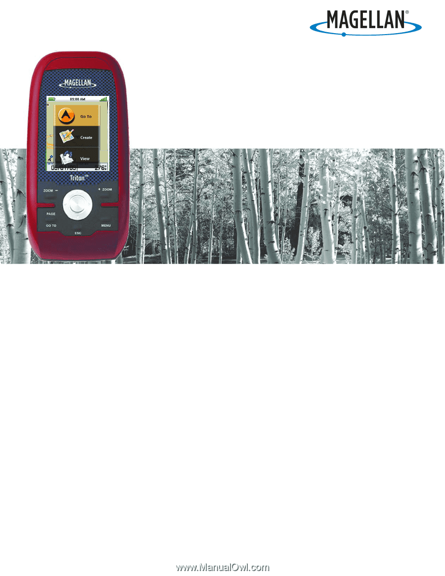
Magellan® Triton™ User Manual Magellan Triton 300 Magellan Triton 400 Magellan Triton 500 960 Overland Court, San Dimas, CA 91773 - Magellan Triton 300 | Manual - English - Page 2
, like buildings and large trees. USE PROPER ACCESSORIES Use only Magellan cables and antennas; the use of non-Magellan cables and antennas may severely degrade performance or damage the receiver, and will void the warranty. No part of this guide may be reproduced or transmitted in any form - Magellan Triton 300 | Manual - English - Page 3
in accordance with the instructions, may cause harmful receiver is connected. • Consult the dealer or an experienced radio/TV technician for help. user's authority to operate this equipment. The Magellan Triton must be installed and operated at a distance no closer then 8 inches (20 cm) from the user - Magellan Triton 300 | Manual - English - Page 4
the Magellan website (www.magellanGPS.com) for product updates and additional information. Maximum normal use temperature is 66°C. © 2009 MiTAC International Corporation. The Magellan logo, Magellan and Magellan Triton are registered trademarks of MiTAC International Corporation. 604-0264-001 A iii - Magellan Triton 300 | Manual - English - Page 5
12 Accessing the Map Screen Contextual Menu 13 Accessing the Compass or Speedometer Screen Contextual Menu 13 Map Screen ...13 Current Location Screen 13 Large Data Screen 14 Speedometer Screen 14 Resetting the Odometer 14 Resetting the Trip Odometer 14 Table of Contents Magellan Triton 1 - Magellan Triton 300 | Manual - English - Page 6
Page (assigns which navigation screens are displayed 30 Display Page 30 Map Page ...30 Sensors Page (Magellan Triton 500 31 Alarms Page ...31 Waypoints ...32 Waypoint Detail Screen Overview 32 Creating Waypoints 33 Creating a Current Location Waypoint from the Map Screen 33 Table of Contents - Magellan Triton 300 | Manual - English - Page 7
38 Clearing Memory 39 Restoring Factory Settings 39 Setting Connectivity 39 Getting Software Version Information 40 Viewing Copyright Information 40 Personalizing Magellan Triton 40 Performing Diagnostic Checks 40 Geocache Waypoints ...42 Creating a Geocache Waypoint 42 Editing a Saved - Magellan Triton 300 | Manual - English - Page 8
50 Creating a Trail (Alternate method 50 Activating a Trail 50 Deleting a Trail 51 Deleting a Trail (Alternate Method 51 Duplicating a Trail 52 Reversing a Trail 52 Hiding/Showing a Trail 52 Activating a Backtrack Route 53 Clearing Track 53 Places ...54 Go To a Place Waypoint (base map 54 - Magellan Triton 300 | Manual - English - Page 9
of the Magellan Triton GPS receiver. The Magellan Triton was designed for the outdoor enthusiast with all the features needed to make your outdoor adventures safe and enjoyable. Be sure to register your Magellan Triton at www.magellangps.com to be kept informed of possible software updates and new - Magellan Triton 300 | Manual - English - Page 10
E F G D I H Magellan Triton A Backlight Button B Power Button C Zoom - (Zoom out) Button D Zoom + (Zoom in) Button E ENTER Button / Cursor Control F PAGE / GO TO Button G Esc (Escape) Button H Menu Button I SD Card Slot (under protective rubber cover) [Magellan Triton 400 & 500 only] Overview 2 - Magellan Triton 300 | Manual - English - Page 11
Internal memory or Secure Digital (SD) Card (optional accessory) Built-in multidirectional patch Nine direct-access keys 14° to 140°F (-10° to 60°C) PERFORMANCE Receiver Acquisition Time Update Rate Accuracy Languages Coordinate Systems SiRF Star III™ 20 channels, WAAS/EGNOS Hot: 20 seconds, Cold - Magellan Triton 300 | Manual - English - Page 12
Battery Life for other tips on extending the Triton's battery life. Note: maximum backlight intensity will be computed from information from the GPS satellites so there is no requirement for select the correct time zone. 1. From the Map screen press MENU. 2. Select View. 3. Select Settings. - Magellan Triton 300 | Manual - English - Page 13
a preset interval when no keys have been pressed. Waking up the Triton from Sleep Mode 1. Press any key and the Triton will wake up, turning the backlight on to the previous setting. Setting the Backlight Timer 1. From the Map screen, press MENU. 2. Select View. 3. Select Settings. 4. Select Volume - Magellan Triton 300 | Manual - English - Page 14
on a detailed map that has been loaded on an optional SD card (400 & 500) or into the Magellan Triton. The Trail option displays trails that you have saved previously. You can select the trail that you would like to follow from the list. (A Trail is a saved track.) The Geocache option allows you - Magellan Triton 300 | Manual - English - Page 15
of the base maps and detail maps (if any optional detail maps are installed), that can be used. The Media option contains the functions for taking and viewing photographs and movie clips. Other functions of the Media option are creating audio clips and playing MP3 music files. (Magellan Triton 400 - Magellan Triton 300 | Manual - English - Page 16
, can be purchased and downloaded from the Magellan Store and installed using the optional National Geographic software. Magellan Triton 300 installs the National Geographic maps into their internal memory, while Magellan Triton 400 and 500 stores the maps on an SD card. Once loaded, you will need - Magellan Triton 300 | Manual - English - Page 17
conserve the battery life in your Magellan Triton. Turn off backlight during daytime use. 1. Press the Backlight button (top left side of the receiver) to cycle through the backlight the electronic compass if GPS fix is available. (Magellan Triton 500) 1. Press MENU. 2. Select View. Fundamentals 9 - Magellan Triton 300 | Manual - English - Page 18
. 2. Select POWER ONLY from the options menu that is displayed. Connect to Vehicle Power Adapter (optional accessory). 1. Connect the Magellan Triton to the optional vehicle power adapter. 2. Select POWER ONLY from the options menu that is displayed. For optimal performance, use only brand name - Magellan Triton 300 | Manual - English - Page 19
Navigation screens provide you with information to assist you in your journeys. CM PAGE C ESC OC Magellan Triton 500 only C Customizable screen O Optional screen* M Contextual menu All screens (except the Map screen) can be turned on or off in the Profile settings. C M * These screens are - Magellan Triton 300 | Manual - English - Page 20
Select the data type desired from the list shown and press ENTER. 4. The Triton will return to the original screen with the data field customized to display the information selected. Contextual Menus The Map screen, the Compass screen and the Speedometer screen, have contextual menus associated with - Magellan Triton 300 | Manual - English - Page 21
arrow cursor along with map detail information provided from the base map. (If you have an optional Detail Map loaded and are in an area covered by the detailed map, the map information from the detailed map will be displayed.) Waypoints (user-created or preloaded in the map) will be displayed by - Magellan Triton 300 | Manual - English - Page 22
times that you need to position the Magellan Triton at a distance but still need reset following these instructions. Resetting the Odometer 1. While viewing the Speedometer screen, press MENU. 2. Select Reset Odometer. 3. The Speedometer screen is displayed with the odometer reset to zero. Resetting - Magellan Triton 300 | Manual - English - Page 23
the Strip Compass, the Road Compass is turned off by default but can be turned on following these instructions. Turning on the Strip and Road Compass Screens 1. From the Map screen, press MENU. 2. Select View. 3. Select Profiles. 4. Select the desired profile. 5. On the Info page, scroll down to - Magellan Triton 300 | Manual - English - Page 24
The Altimeter / Barometer Screen (Magellan Triton 500) The Altimeter / Barometer screen displays your current elevation bottom of the screen as colored bars. The numbers indicate the GPS satellite ID while "W" indicates WAAS (Wide Area Augmentation System) satellites. There are also two customizable - Magellan Triton 300 | Manual - English - Page 25
or dashes. Time to End Time to End measures how much time it will take the user to arrive at the final destination point in a route based on how fast the user is currently moving. If the user stops moving or moves in a counterproductive direction, this number will zero out. If no Go To - Magellan Triton 300 | Manual - English - Page 26
appear blank or dashes. Accuracy Accuracy calculates the margin of error the user can expect based on their satellite reception. The smaller the number is, the better and other GPS receivers too close in proximity. Velocity Made Good (VMG) Velocity Made Good calculates how fast the user is closing - Magellan Triton 300 | Manual - English - Page 27
in the Magellan Triton and it has a special contextual menu that can access the commonly used functions. This makes understanding the Map screen and all of the functions that can be performed directly from this screen an important part of getting the most out of your receiver. Map Screen Overview - Magellan Triton 300 | Manual - English - Page 28
the pan icon will appear. 2. Continue using the cursor control to move the pan icon to the location on the map that you want to save as a waypoint. 3. Press ENTER. 4. Select Create Waypoint. 5. Edit the waypoint as desired. Use the cursor control UP or DOWN to highlight the field you want to - Magellan Triton 300 | Manual - English - Page 29
and Set Times 1. Select the position you want to view. If you want to view a position other than your present position, pan around the map with the cursor control to select the desired position. 2. Press ENTER. 3. Scroll down the contextual menu to select Local Info. 4. Press ENTER. 5. Select Sun - Magellan Triton 300 | Manual - English - Page 30
to highlight OK and press ENTER. Special Pan Functions Creating a Go To Route from the Map Screen 1. Select the position you want to Go To by panning around the map with the cursor control. (Note as you pan around the map the header of the Map screen changes to provide some information about the - Magellan Triton 300 | Manual - English - Page 31
ENTER. Backtrack Route As you travel, the Magellan Triton drops electronic breadcrumbs (track) to display your travels. If you want to return to your starting point following the exact same path you took, you would create a backtrack route. Creating a Backtrack Route 1. Press ENTER. 2. Scroll down - Magellan Triton 300 | Manual - English - Page 32
on the map can be turned off, show only the icons or show both the icons and their name. Geocache waypoints on the map can be turned or Feet. (Magellan Triton 500 only) Choose between kPa, Millibar, inHg or mmHg. Resetting Speed and Odometers From the Map screen you can reset the odometer, the - Magellan Triton 300 | Manual - English - Page 33
Changing Map Units of Measure 1. Press ENTER. 2. Scroll down the contextual menu to highlight Reset... . 3. Press ENTER. 4. Use the UP and DOWN portion of the cursor control to highlight the item (or all) that you want to reset. 5. Press ENTER. Map Screen 25 - Magellan Triton 300 | Manual - English - Page 34
Using the Keyboard Entering alphanumeric characters into the Magellan Triton is done by the use of the keyboard. Key Types Alphanumeric Color Light Blue Sample Description Enters the alpha, numeric or symbol character selected. Cursor - Magellan Triton 300 | Manual - English - Page 35
Extended Character Select Medium Blue Numeric Select Blue Alpha Select Blue Delete Medium Blue Changes the available characters to extended characters. Changes the available characters to numeric characters. Changes the available characters to alphabetic characters. Deletes the character to - Magellan Triton 300 | Manual - English - Page 36
Shift Key Medium Blue Return Medium Blue Accept Green Cancel Red With alphabetic characters shown, shifts between upper and lower case characters. With extended characters shown, shifts between two character sets. Not functional when numeric or symbol characters are displayed. Adds a - Magellan Triton 300 | Manual - English - Page 37
date for the Magellan Triton since the date is automatically received from the GPS satellite. Text Size Limitations Single-line fields: 50 characters. Multi-line fields (notes, comments, hints): 1024 characters. Page Selection Some screens like the Waypoint and Geocache Information screens, have - Magellan Triton 300 | Manual - English - Page 38
Profiles The Magellan Triton gives you the means to set up three profiles; Hiking, Marine and Geocaching. Each profile you want to use from the Active Profile drop- down menu. Editing a Profile 1. From the Map screen press MENU. 2. Select View. 3. Select Profiles. 4. Select the profile you want to - Magellan Triton 300 | Manual - English - Page 39
Sets the amount of detailed information that is displayed on the map. Sensors Page (Magellan Triton 500) ELECTRONIC COMPASS BAROMETER On, Off On, Off Turns the electronic compass on or off. Turns the barometer on or off. Alarms Page GPS FIX On, Off ALARM TONE ALARM VOLUME BEEPER VOLUME Beep - Magellan Triton 300 | Manual - English - Page 40
Magellan Triton has three different classifications for waypoints; User-Created, Place and Geocache waypoints. User-created waypoints are waypoints you define. This can be done by saving your current location, picking a point on the map SD card and not in the Triton's internal memory. Waypoints 32 - Magellan Triton 300 | Manual - English - Page 41
the proximity alarm on or off. 6. Select the icon to save the waypoint. Creating a Current Location Waypoint Using the Triton Menu 1. While viewing the Map screen, press MENU. 2. Select Create. 3. Select Waypoint. 4. Select Current Location. 5. The Waypoint Details screen is displayed with the - Magellan Triton 300 | Manual - English - Page 42
7. Select the icon to save the waypoint. Creating a Waypoint from a Point on the Map Using the Triton Menu 1. While viewing the Map screen, press MENU. 2. Select Create. 3. Select Waypoint. 4. Select Point on Map. 5. The Map screen is displayed. Use the arrow keypad to move the pan cursor to the - Magellan Triton 300 | Manual - English - Page 43
a Custom Waypoint Using the Triton Menu 1. While viewing the Map screen, press MENU. 2. Select Create. 3. Select Waypoint. 4. Select Coordinates. 5. The Waypoint Details screen is displayed with the latitude and longitude for your current location or the pan cursor position. 6. Select - Magellan Triton 300 | Manual - English - Page 44
to set the proximity alarm on or off. 10. Press ESC to save the waypoint. (Pressing ENTER will create a Go To route to that waypoint.) Deleting a Saved Waypoint 1. From the Map screen, press MENU. 2. Select Go To. 3. Select Waypoint. 4. Change the order that the waypoints are displayed, if needed - Magellan Triton 300 | Manual - English - Page 45
TO button to display the Options page. 8. Select Delete Waypoint. 9. Confirm the deletion by selecting Yes. Deleting All Saved Waypoints 1. From the Map screen, press MENU. 2. Select Go To. 3. Select Waypoint. 4. Highlight any waypoint in the list of waypoints. 5. When a waypoint name is highlighted - Magellan Triton 300 | Manual - English - Page 46
Selects the coordinate system to be used for displaying position. Selects the map datum to be used. The Map Datum used by the Magellan Triton should match the map datum that is being used on paper charts. Customizes the receiver to use magnetic north or true north. Setting Volume and Brightness - Magellan Triton 300 | Manual - English - Page 47
stored in the receiver and cannot be undone. 1. From the Map screen press MENU. 2. Select View. 3. Select Settings. 4. Select Memory. 5. Select Clear Memory. 6. Select the green checkmark to confirm. Restoring Factory Settings Use this option with caution. You will need to reset any profiles or - Magellan Triton 300 | Manual - English - Page 48
Software Version Information 1. From the Map screen press MENU. 2. Select View. 3. Select Settings. 4. Select About. 5. Select Version. 6. Press ESC to return to the About Menu. Viewing Copyright Information 1. From the Map About Menu. Personalizing Magellan Triton 1. From the Map screen press MENU. - Magellan Triton 300 | Manual - English - Page 49
6. Follow the displayed instructions for each test. 7. Press ESC to return to the Diagnostics Menu. Settings 41 - Magellan Triton 300 | Manual - English - Page 50
with GPS users. People will hide caches ("treasures") and record the latitude and longitude for the cache. They post these locations on geocaching web sites that can be found on the internet. You then enter these geocache waypoints into your Magellan Triton either by creating a geocache waypoint - Magellan Triton 300 | Manual - English - Page 51
Details page. 9. Press ESC to exit. (Pressing ENTER will create a Go To route to that waypoint.) Deleting a Saved Geocache Waypoint 1. From the Map screen, press MENU. 2. Select Go To. 3. Select Geocache. 4. Change the order that the geocache waypoints are displayed, if needed, or search for - Magellan Triton 300 | Manual - English - Page 52
the Options page. 8. Select Delete Waypoint. 9. Confirm the deletion by selecting Yes. Deleting All Saved Geocache Waypoints 1. From the Map screen, press MENU. 2. Select Go To. 3. Select Geocache. 4. Highlight any waypoint in the list of waypoints. 5. When a waypoint name is highlighted press MENU - Magellan Triton 300 | Manual - English - Page 53
create a Go To route by selecting the waypoint for the scenic area as the destination. The Magellan Triton would then plot a straight line from your location to the destination waypoint and provide you with updated To. Creating a Go To Route to a Saved User-Created Waypoint. 1. From the Map screen - Magellan Triton 300 | Manual - English - Page 54
you are looking for.) 7. Highlight the waypoint you want to go to from the list of waypoints and press ENTER. Creating a Go To Route to a Geocache Waypoint 1. From the Map screen press MENU. (Alternate Method: Press and hold the GO TO button while the present position cursor is displayed on the - Magellan Triton 300 | Manual - English - Page 55
saved user-created waypoints and press ENTER. Geocache: Select a waypoint from the list of saved geocache waypoints and press ENTER. Place: Select the map to the deletion. (This does not remove the waypoint from the Triton's memory, only from the route.) Viewing the route: Select the View icon in - Magellan Triton 300 | Manual - English - Page 56
enter the first few characters for a route you want to search for.) 5. Highlight the route and press ENTER. Deleting a Multileg Route 1. From the Map screen press MENU. 2. Select Go To. 3. Select Route. 4. If needed, change the order that the waypoints are displayed or search for a waypoint. (Select - Magellan Triton 300 | Manual - English - Page 57
times. In the graphical area you can use the arrow keys to see the elevation for a specific position indicated by the dot icon. 1. From the Map screen press MENU. 2. Select Go To. 3. Select Route. 4. Change the order that the saved routes are displayed if needed or do a search on a route. (Select - Magellan Triton 300 | Manual - English - Page 58
backtrack route with, clear the track memory (described in this chapter) before beginning the hike. Trails are displayed on the Map screen as dotted lines. Creating a Trail Once you begin traveling with the Magellan Triton, it will begin to store track information. If you want to save this track to - Magellan Triton 300 | Manual - English - Page 59
color icon to the left of the trail name. Deleting a Trail 1. From the Map screen press MENU. 2. Select Go To. 3. Select Trail. 4. Change the order that the trails are displayed if needed or do a search on a trail. (Select the Search field under the Select Trail header. Select the order you want the - Magellan Triton 300 | Manual - English - Page 60
Select the green checkmark to save the trail. Reversing a Trail 1. From the Map screen press MENU. 2. Select Go To. 3. Select Trail. 4. Change the order that the trails are displayed, if needed, or search for a trail. (Select the Search field under the Select Trail header. Select the order you want - Magellan Triton 300 | Manual - English - Page 61
Trail or Show Trail. Activating a Backtrack Route Many might consider a Backtrack route as the most important function in a handheld GPS receiver. Being able to quickly create a route back to your starting point is not only handy for normal outdoor adventures as a trail. 1. From the Map screen press - Magellan Triton 300 | Manual - English - Page 62
are waypoints that are part of the base map that is installed in your Magellan Triton. These waypoints can't be deleted or duplicated but they can be used as the destination for a Go To route or a multileg route. Places are categorized as roads, world maps, waterways or city centers. When searching - Magellan Triton 300 | Manual - English - Page 63
, press MENU. 2. Select Go To. 3. Select Place. 4. From the Select Map display, select the background map or the detailed map for the waypoint. (If you do not have any detailed maps loaded, Background Maps will be the only option.) 5. Select the category or All Categories. 6. Select the subcategory - Magellan Triton 300 | Manual - English - Page 64
, press MENU. 2. Select Go To. 3. Select Place. 4. From the Select Map display, select the background map or the detailed map for the waypoint. (If you do not have any detailed maps loaded, Background Maps will be the only option.) 5. Select the category or All Categories. 6. Select the subcategory - Magellan Triton 300 | Manual - English - Page 65
Media Before using any of the media options you need install an optional SD card in the SD card slot located on the right side of the Magellan Triton. Browsing Photographs 1. Press MENU. 2. Select View. 3. Select Media. 4. Select the Sort button at the top to choose how the images will be sorted -
-
 1
1 -
 2
2 -
 3
3 -
 4
4 -
 5
5 -
 6
6 -
 7
7 -
8
-
9
-
10
-
11
-
12
-
13
-
14
-
15
-
16
-
17
-
18
-
19
-
20
-
21
-
22
-
23
-
24
-
25
-
26
-
27
-
28
-
29
-
30
-
31
-
32
-
33
-
34
-
35
-
36
-
37
-
38
-
39
-
40
-
41
-
42
-
43
-
44
-
45
-
46
-
47
-
48
-
49
-
50
-
51
-
52
-
53
-
54
-
55
-
56
-
57
-
58
-
59
-
60
-
61
-
62
-
63
-
64
-
65
 |
 |
960 Overland Court, San Dimas, CA
91773
Magellan
®
Triton
™
User Manual
Magellan Triton 300
Magellan Triton 400
Magellan Triton 500