Nextar S3 S3 Software Manual - v2
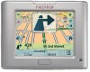
Nextar S3 - S3 3.5 Inch Touch Screen GPS Navigation System Manual
 |
UPC - 714129921541
View all Nextar S3 manuals
Add to My Manuals
Save this manual to your list of manuals |
Nextar S3 manual content summary:
- Nextar S3 | S3 Software Manual - v2 - Page 1
- Nextar S3 | S3 Software Manual - v2 - Page 2
Contents 1 - Getting Started 2 Driver Warning ...2 Main Map ...3 Map Views ...4 Route Summary...4 Cancel Route ...5 2 - Select Driving Directions...16 Avoid Roads ...17 Detour ...19 Map Browsing ...20 Walking Mode ...20 Map Selection ...21 4 - Configurations 22 Settings Menus ... - Nextar S3 | S3 Software Manual - v2 - Page 3
features and functions have made the GPS the essential guide for every traveler - whether in the car, on foot or by bike. Driver Warning • Driver Warning - When you start the navigation, the Driver Warning screen appears. Please take a moment to review the information provided before tapping the - Nextar S3 | S3 Software Manual - v2 - Page 4
address number, speed and altitude. 7 The red GPS receiver means that a reliable GPS signal is not yet located. The green GPS receiver means that a reliable GPS signal is located and that you are ready to navigate. 8 These icons display your power source. 9 Tap this icon to set your QuickNav - Nextar S3 | S3 Software Manual - v2 - Page 5
. Last known location when GPS signal is unreliable. Generated route Location Point on Main Map You can drag the map to a specific point and tap the desired location directly on the Main Map screen in both 2D and 3D map view. This feature is useful when you want to navigate to a specific point on - Nextar S3 | S3 Software Manual - v2 - Page 6
Cancel Route • From the Manage Route menu, tap the Cancel Route button. The current navigation stops and it clears the route. You can only cancel a route after a destination has been set. 5 - Nextar S3 | S3 Software Manual - v2 - Page 7
Navigation menu, tap the New Address button. The Address Search Mode screen appears, allowing you to choose how you want to enter address information. For example, if you select City first, the first address screen When a United States map is selected, the first address screen is always Select State. - Nextar S3 | S3 Software Manual - v2 - Page 8
motorway, and the map of Germany when traveling on local roads of Germany. Screen Buttons The following buttons appear on many of the navigation screens. When you and numbers. The operating system installed on the device must be able to support these characters. Note: The GPS lets you search for - Nextar S3 | S3 Software Manual - v2 - Page 9
the quickest. Go - When you tap the Go button, it calculates the route to your selected destination. Figure 6 - Show on Map Demo - Tap the icon to start navigating a simulated route. Note: Route generation excludes any detours, stops or delays along the route. Actions Tap the Actions button to - Nextar S3 | S3 Software Manual - v2 - Page 10
the GPS to guide you to a shopping center, hotel, restaurant, or gas station. Many categories have subcategories to provide for an even greater list of choices. For example, Fuel Automobile service screen, where you can search by entering text in the POI Name field. The Smart Search System - Nextar S3 | S3 Software Manual - v2 - Page 11
most common POI categories. Figure 8 - Most Common POI Categories Tap More to display the Point of Interest screen, where you can search through the entire list of POI categories. Show or Hide Symbol on Map You can select or clear the checkmarks next to a POI entry to show or hide the POI - Nextar S3 | S3 Software Manual - v2 - Page 12
address information and phone number (where available). QuickNav You can set a QuickNav destination so that every time you tap the icon on the Main Map screen, it automatically calculates the route to this destination for you. When you tap the QuickNav button for the first time, you must select - Nextar S3 | S3 Software Manual - v2 - Page 13
Recent Place From the Navigation menu, tap this button to select an existing destination from a list the Actions button. Tap the Delete Item button to delete an entry on the Recent Locations screen. • Clear the recent location list - Tap the Actions button. Tap the Clear List button to clear all - Nextar S3 | S3 Software Manual - v2 - Page 14
are stored if not assigned to a group. This folder cannot be deleted. Going to a Favorite Location From the Navigation menu, tap this button to display the screen containing your favorite groups. Select a group, for example Restaurants. It automatically displays a list of stored locations for the - Nextar S3 | S3 Software Manual - v2 - Page 15
You can check or clear the checkmarks next to a favorite entry to show or hide the Favorites symbol on the Main Map screen. Creating a Favorite Group From the Favorites screen, tap this button to add, edit, or delete groups. Enter a group name and select a group icon. Figure 14 - Adding a Favorites - Nextar S3 | S3 Software Manual - v2 - Page 16
as the point of origin - Tap the As Starting Point button to designate the selected address as the route origin. • Show on map - Tap to see the selected address on the map. • Edit a favorite location - Tap the Actions button. Tap the Edit Fav. Location button to change the name, comment, or group - Nextar S3 | S3 Software Manual - v2 - Page 17
to the selected destination. It continuously updates the Turn-by-Turn screen to display the most current instructions as you navigate the route. Figure 16 - Turn-by Remaining (ETR). Tap to display the next turn on the Main Map screen, including the street name, the distance to the turn, and the - Nextar S3 | S3 Software Manual - v2 - Page 18
, or unsafe streets. From the Manage Route menu, tap the Avoid Roads button. The Avoid Roads screen appears, displaying predefined road groups. Figure 17 - Predefined Road Groups The GPS provides the following predefined road groups: • Ferries - The default value is to avoid • Gated Communities - Nextar S3 | S3 Software Manual - v2 - Page 19
you tap My Roads to Avoid or a road group, the GPS displays the group screen, which lets you designate roads to avoid. From this screen, you can use the Allow or Avoid buttons to include or The road is displayed on the Show on Map screen. Tap the Avoid button. Figure 20 - Adding a Road to Avoid 18 - Nextar S3 | S3 Software Manual - v2 - Page 20
. • Show on Map - Tap to show the map with the displayed destination for you to review before creating a route. • Information - Tap to display the location's address information. Detour From the Manage Route menu, tap the Detour button. The Detour screen lets you instruct the GPS to create a detour - Nextar S3 | S3 Software Manual - v2 - Page 21
located the street destination, you can tap that point on the map. A popup menu appears. Tap Go There to navigate to the selected point. You can reconnect to GPS, by going to the Options&Settings menu and tapping the GPS Navigation button. Walking Mode Walking Mode lets you travel as a Walking - Nextar S3 | S3 Software Manual - v2 - Page 22
button to change the selected map to another map saved on your SD memory card. Figure 23 - Select a Map The GPS immediately implements the selected map for all navigation features. If it is the first time that you are using a map, an End-User Agreement License (EULA) screen appears. Read it and then - Nextar S3 | S3 Software Manual - v2 - Page 23
configure the system settings and car exceeds the speed limit. Notifies you when it recalculates your route. For example, when you miss a turn. Warns that the GPS signal is too low and unreliable for navigation. GPS Not Found Drive Carefully Alerts you if the GPS signal is lost, or if the power - Nextar S3 | S3 Software Manual - v2 - Page 24
receives data from a built-in GPS receiver or an external GPS receiver, connected to your navigation device through Bluetooth® Wireless Technology, to pinpoint your location. Your vehicle's location and position are constantly updated unless you are working in the Browsing Map mode or you tap the - Nextar S3 | S3 Software Manual - v2 - Page 25
Map mode, it automatically disconnects from the GPS receiver. GPS Troubleshooting Signal too low When you first start, you may hear the "Signal too low" message. This message means that your navigation device hasn't yet located a reliable GPS signal. Check that your device is connected to a power - Nextar S3 | S3 Software Manual - v2 - Page 26
to specify the measurement system you would like to screen. Increases the size of street names to make the map easier to read. Displays the navigation popup menu when tapping on a map location. When selected, the zoom is speed dependent. The map zooms out at higher speeds, displaying a larger map - Nextar S3 | S3 Software Manual - v2 - Page 27
About Displays the QuickNav button, which you tap to navigate to a pre-selected location Displays the Volume Control bar. Displays whether a reliable GPS signal has been located. Displays if your device is plugged in or running on battery power. Displays estimated time of arrival. Displays the Menu - Nextar S3 | S3 Software Manual - v2 - Page 28
23 GPS Troubleshooting • 23 Groups • 13 H Help • 26 K Keyboard Command Keys • 6 L Language Settings • 22, 28 Location Icons • 4 Location Point on Main Map • 4 Look & Feel Settings • 22 M Main Map • 3 Main Map Icons • 3 Map Browsing • 19 Map Selection • 20 Map Settings • 25 Map Views • 4 N Navigate - Nextar S3 | S3 Software Manual - v2 - Page 29
may not represent the actual screen on production unit sold to consumers. Mapping database copyright © 2006 NAVTEQ ™. NAVTEQ ON BOARD ™ is a trademark of NAVTEQ ™ For Free instruction books, information on this product its operation and accessories, visit us on the web at: www.nextar.com Or write to
-
 1
1 -
 2
2 -
 3
3 -
 4
4 -
 5
5 -
 6
6 -
 7
7 -
8
-
9
-
10
-
11
-
12
-
13
-
14
-
15
-
16
-
17
-
18
-
19
-
20
-
21
-
22
-
23
-
24
-
25
-
26
-
27
-
28
-
29
 |
 |
