Pioneer AVIC-F90BT Owner's Manual - Page 165
Positioning technology, Appendix
 |
UPC - 012562897271
View all Pioneer AVIC-F90BT manuals
Add to My Manuals
Save this manual to your list of manuals |
Page 165 highlights
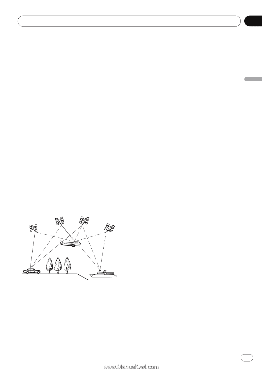
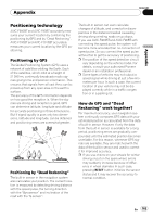
Appendix Appendix Appendix Positioning technology AVIC-F900BT and AVIC-F90BT accurately measures your current location by combining the positioning by GPS and by "Dead Reckoning". AVIC-F700BT and AVIC-F7010BT accurately measures your current location by the GPS positioning. Positioning by GPS The Global Positioning System (GPS) uses a network of satellites orbiting the Earth. Each of the satellites, which orbit at a height of 21 000 km, continually broadcasts radio signals giving time and position information. This ensures that signals from at least three can be picked up from any open area on the earth's surface. The accuracy of the GPS information depends on how good the reception is. When the signals are strong and reception is good, GPS can determine latitude, longitude and altitude for accurate positioning in three dimensions. But if signal quality is poor, only two dimensions, latitude and longitude, can be obtained and positioning errors are somewhat greater. Positioning by "Dead Reckoning" The built-in sensor in the navigation system also calculates your position. The current location is measured by detecting driving distance with the speed pulse, the turning direction with the "Gyrosensor" and inclination of the road with the "G sensor". The built-in sensor can even calculate changes of altitude, and corrects for discrepancies in the distance traveled caused by driving along winding roads or up slopes. If you use AVIC-F900BT and AVIC-F90BT with connecting the speed pulse, the system will become more accurate than no connection of speed pulse. So you connect the speed pulse without fail to get the accuracy of positioning. p The position of the speed detection circuit vary depending on the vehicle model. For details, consult your authorized Pioneer dealer or an installation professional. p Some types of vehicles may not output a speed signal while driving at just a few kilometers per hour. In such a case, the current location of your vehicle may not be displayed correctly while in a traffic congestion or in a parking lot. How do GPS and "Dead Reckoning" work together? For maximum accuracy, your navigation system continually compares GPS data with your estimated position as calculated from the data of built-in sensor. However, if only the data from the built-in sensor is available for a long period, positioning errors are gradually compounded until the estimated position becomes unreliable. For this reason, whenever GPS signals are available, they are matched with the data of the built-in sensor and used to correct it for improved accuracy. p If you use chains on your wheels for winter driving or put on the spare wheel, errors may suddenly increase because of difference in wheel diameter. In such case, pressing RESET button initialize the sensor status and it may recover the accuracy to normal condition. En 165
-
 1
1 -
2
-
3
-
4
-
5
-
6
-
7
-
8
-
9
-
10
-
11
-
12
-
13
-
14
-
15
-
16
-
17
-
18
-
19
-
20
-
21
-
22
-
23
-
24
-
25
-
26
-
27
-
28
-
29
-
30
-
31
-
32
-
33
-
34
-
35
-
36
-
37
-
38
-
39
-
40
-
41
-
42
-
43
-
44
-
45
-
46
-
47
-
48
-
49
-
50
-
51
-
52
-
53
-
54
-
55
-
56
-
57
-
58
-
59
-
60
-
61
-
62
-
63
-
64
-
65
-
66
-
67
-
68
-
69
-
70
-
71
-
72
-
73
-
74
-
75
-
76
-
77
-
78
-
79
-
80
-
81
-
82
-
83
-
84
-
85
-
86
-
87
-
88
-
89
-
90
-
91
-
92
-
93
-
94
-
95
-
96
-
97
-
98
-
99
-
100
-
101
-
102
-
103
-
104
-
105
-
106
-
107
-
108
-
109
-
110
-
111
-
112
-
113
-
114
-
115
-
116
-
117
-
118
-
119
-
120
-
121
-
122
-
123
-
124
-
125
-
126
-
127
-
128
-
129
-
130
-
131
-
132
-
133
-
134
-
135
-
136
-
137
-
138
-
139
-
140
-
141
-
142
-
143
-
144
-
145
-
146
-
147
-
148
-
149
-
150
-
151
-
152
-
153
-
154
-
155
-
156
-
157
-
158
-
159
-
 160
160 -
 161
161 -
 162
162 -
 163
163 -
 164
164 -
 165
165 -
 166
166 -
 167
167 -
 168
168 -
 169
169 -
 170
170 -
171
-
172
-
173
-
174
-
175
-
176
-
177
-
178
-
179
-
180
-
181
-
182
-
183
-
184
-
185
-
186
-
187
-
188
-
189
-
190
-
191
-
192
 |
 |