Pioneer AVIC-Z130BT Owner's Manual - Page 27
Types of the road stored in, the map database, Operating the map screen, How to use the map - reviews
 |
UPC - 884938127806
View all Pioneer AVIC-Z130BT manuals
Add to My Manuals
Save this manual to your list of manuals |
Page 27 highlights
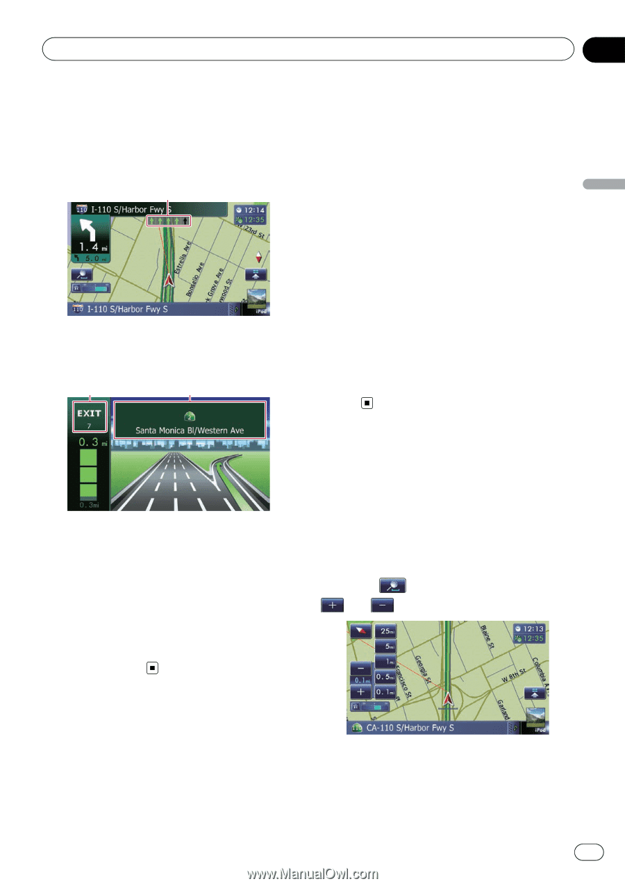
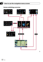
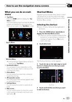
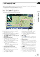
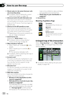
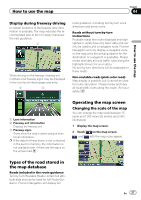
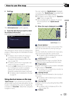
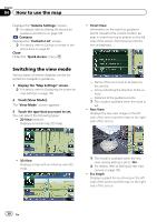
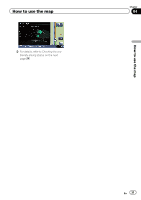
How to use the map Chapter 04 How to use the map Display during freeway driving In certain locations of the freeway, lane information is available. The map indicates the recommended lane to be in to easily maneuver the next guidance. 1 While driving on the freeway, freeway exit numbers and freeway signs may be displayed in the vicinity of interchanges and exits. 2 3 route guidance, including turn-by-turn voice directions and arrow icons. Roads without turn-by-turn instructions Routable roads (the route displayed and highlighted in violet) have only basic data and can only be used to plot a navigable route. Pioneer Navigation will only display a navigable route on the map (only the arrival guidance for the destination or a waypoint is available). Please review and obey all local traffic rules along the highlighted route for your safety. No turn-by-turn directions will be displayed on these roads. Non routable roads (pink color road) Map display is possible, but it cannot be used for route calculation. Please review and obey all local traffic rules along this route. (For your safety.) 1 Lane information 2 Freeway exit information Displays the freeway exit. 3 Freeway signs These show the road number and give directional information. p If the data for these items is not contained in the built-in memory, the information is not available even if there are the signs on the actual road. Operating the map screen Changing the scale of the map You can change the map scale between 25 yards and 1 000 miles (25 meters and 2 000 kilometers). 1 Display the map screen. 2 Touch on the map screen. and with the map scale appear. Types of the road stored in the map database Roads included in the route guidance Turn by Turn Routable Roads contain full attribute data and can be used for full Route Guidance. Pioneer Navigation will display full En 27
-
 1
1 -
2
-
3
-
4
-
5
-
6
-
7
-
8
-
9
-
10
-
11
-
12
-
13
-
14
-
15
-
16
-
17
-
18
-
19
-
20
-
21
-
 22
22 -
 23
23 -
 24
24 -
 25
25 -
 26
26 -
 27
27 -
 28
28 -
 29
29 -
 30
30 -
 31
31 -
 32
32 -
33
-
34
-
35
-
36
-
37
-
38
-
39
-
40
-
41
-
42
-
43
-
44
-
45
-
46
-
47
-
48
-
49
-
50
-
51
-
52
-
53
-
54
-
55
-
56
-
57
-
58
-
59
-
60
-
61
-
62
-
63
-
64
-
65
-
66
-
67
-
68
-
69
-
70
-
71
-
72
-
73
-
74
-
75
-
76
-
77
-
78
-
79
-
80
-
81
-
82
-
83
-
84
-
85
-
86
-
87
-
88
-
89
-
90
-
91
-
92
-
93
-
94
-
95
-
96
-
97
-
98
-
99
-
100
-
101
-
102
-
103
-
104
-
105
-
106
-
107
-
108
-
109
-
110
-
111
-
112
-
113
-
114
-
115
-
116
-
117
-
118
-
119
-
120
-
121
-
122
-
123
-
124
-
125
-
126
-
127
-
128
-
129
-
130
-
131
-
132
-
133
-
134
-
135
-
136
-
137
-
138
-
139
-
140
-
141
-
142
-
143
-
144
-
145
-
146
-
147
-
148
-
149
-
150
-
151
-
152
-
153
-
154
-
155
-
156
-
157
-
158
-
159
-
160
-
161
-
162
-
163
-
164
-
165
-
166
-
167
-
168
-
169
-
170
-
171
-
172
-
173
-
174
-
175
-
176
-
177
-
178
-
179
-
180
-
181
-
182
-
183
-
184
-
185
-
186
-
187
-
188
-
189
-
190
-
191
-
192
-
193
-
194
-
195
-
196
-
197
-
198
-
199
-
200
-
201
-
202
-
203
-
204
-
205
-
206
-
207
-
208
-
209
-
210
-
211
-
212
-
213
-
214
-
215
-
216
-
217
-
218
-
219
-
220
-
221
-
222
-
223
-
224
-
225
-
226
-
227
-
228
-
229
-
230
-
231
-
232
 |
 |