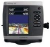
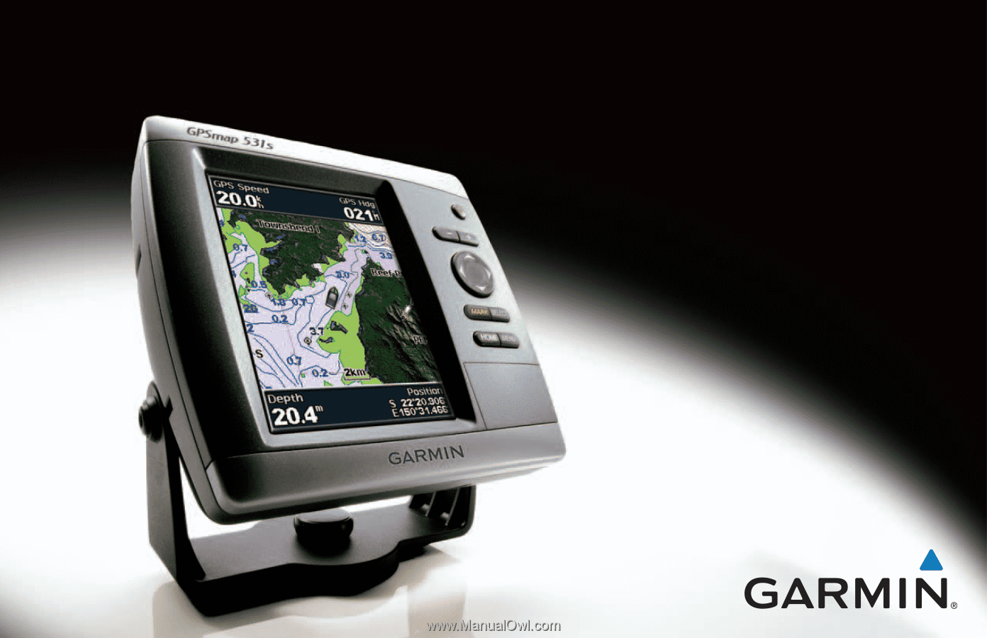
Garmin GPSMAP 541s Owner's Manual
Garmin GPSMAP 541s - Marine GPS Receiver Manual
 |
UPC - 753759096045
View all Garmin GPSMAP 541s manuals
Add to My Manuals
Save this manual to your list of manuals |
Garmin GPSMAP 541s manual content summary:
- Garmin GPSMAP 541s | Owner's Manual - Page 1
GPSMAP® 400/500 series owner's manual - Garmin GPSMAP 541s | Owner's Manual - Page 2
as expressly provided herein, no part of this manual may be reproduced, copied, transmitted, disseminated, downloaded Garmin Web site (www.garmin.com) for current updates and supplemental information concerning the use and operation of this and other Garmin products. Garmin®, the Garmin logo, GPSMAP - Garmin GPSMAP 541s | Owner's Manual - Page 3
6. • Using the Navigation Chart: page 8. • Changing the Chart Settings: page 12. • Navigating to a Destination: page 27 • Creating and Using Waypoints: page 29. • Configuring System Settings: page 41. • Using Sonar: page 50. • Alarms and Messages: page 71. GPSMAP 400/500 Series Owner's Manual i - Garmin GPSMAP 541s | Owner's Manual - Page 4
with a Garmin Autopilot 33 Viewing Information 34 Viewing a Compass 34 Viewing Numbers 34 Viewing Trip Information 35 Viewing Fuel Gauges 35 Viewing Tide-station Information 36 Viewing Current Information 36 Viewing User Data 37 Viewing Other Vessels 40 GPSMAP 400/500 Series Owner's Manual - Garmin GPSMAP 541s | Owner's Manual - Page 5
Sonar 52 Advanced Sonar Settings 53 Using Digital Selective Calling (DSC 55 Using the Chartplotter with a VHF Radio 55 Adding a DSC Contact 56 Viewing the DSC List 56 Receiving License Agreement 76 XM Satellite Radio Service Agreement 76 Index 77 GPSMAP 400/500 Series Owner's Manual iii - Garmin GPSMAP 541s | Owner's Manual - Page 6
.8200 or (800) 800.1020. In the UK, contact Garmin (Europe) Ltd. by phone at 0808 2380000. In Europe, go to www.garmin.com/support and click Contact Support for in-country support information, or contact Garmin (Europe) Ltd. by phone at +44 (0) 870.8501241. iv GPSMAP 400/500 Series Owner's Manual - Garmin GPSMAP 541s | Owner's Manual - Page 7
Unit Overview Getting Started GPSMAP 536/546 NMEA 2000 Power/Data External GPS antenna GPSMAP 531 GPSMAP 400/500 Series Owner's Manual Getting Started POWER/ BACKLIGHT RANGE (-/+) ROCKER MARK SELECT MENU HOME SD card slot GPSMAP 546 shown 1 - Garmin GPSMAP 541s | Owner's Manual - Page 8
Getting Started NMEA 2000® XM antenna with audio adapter External GPS antenna Power/Data GPSMAP 530/535/540/545 External GPS antenna GXM 31 antenna Power/Data GPSMAP 430x/440x 2 GPSMAP 441/541 GPSMAP 430/431/440 GPSMAP 400/500 Series Owner's Manual - Garmin GPSMAP 541s | Owner's Manual - Page 9
the unit, press and hold the Power key. Home Screen GPSMAP 400/500 Series Owner's Manual Getting Started Initializing Unit Settings The first 0183 devices connected to a serial port, specify which ports are connected. AIS Receiver (is not available if you select None for NMEA Devices)-Select Yes if - Garmin GPSMAP 541s | Owner's Manual - Page 10
available if you are receiving NMEA sonar depth data. Select Yes GPSMAP 535, 536, 545, and 546). To switch between Day mode and Night mode: 1. Press and release the Power key. 2. Select Color Mode. 3. Press left or right on the Rocker to switch between modes. 4 GPSMAP 400/500 Series Owner's Manual - Garmin GPSMAP 541s | Owner's Manual - Page 11
the Keypad GPSMAP 400/500 Series Owner's Manual POWER/ BACKLIGHT RANGE (-/+) ROCKER MARK SELECT MENU HOME Getting Started POWER/BACKLIGHT-Press and hold to turn the unit on or off. Press and release to adjust the backlight and day and night modes. RANGE (-/+)-Press to adjust the range of the sonar - Garmin GPSMAP 541s | Owner's Manual - Page 12
the access door and press the SD card in until it clicks. Press the card in again and release it to eject it from the chartplotter. 6 GPSMAP 400/500 Series Owner's Manual - Garmin GPSMAP 541s | Owner's Manual - Page 13
Help > Check for Software Updates, or check the Garmin Web site at www.garmin.com. Getting Started • Sonar-set up and access sonar information (page 50). Note: You must have an "s" series unit (such as a GPSMAP 441s) with a connected transducer or have a connection to a Garmin sounder via CANet to - Garmin GPSMAP 541s | Owner's Manual - Page 14
to view map information, and as a navigational aid. To access a Navigation chart, from the Home screen, select Charts > Navigation Chart. Your boat Exposed wreck Light Exposed rock Tide station Beacon Marina services Zoom scale Navigation Chart with g2 Vision GPSMAP 400/500 Series Owner's Manual - Garmin GPSMAP 541s | Owner's Manual - Page 15
to your destination (only available while navigating). Data Bars-show or hide cruising, navigation, fishing, fuel, or sailing numbers. GPSMAP 400/500 Series Owner's Manual Using Charts Data bars • Cruising-turn the GPS Speed, GPS Heading, Depth, and GPS Position data bar on or off. Select - Garmin GPSMAP 541s | Owner's Manual - Page 16
and cable areas. Navigating to a Point on the Chart 1. From the Home screen, select Charts. 2. Select Navigation Chart, Fishing Chart, or Split Navigation Chart. 3. Use the Rocker to select the point on the chart to which you want to go. 4. Press SELECT. 10 GPSMAP 400/500 Series Owner's Manual - Garmin GPSMAP 541s | Owner's Manual - Page 17
stop panning, press MENU, and then select Stop Panning. Zooming In and Out on the Map The Range (-/+) keys control the zoom level, indicated by the scale at the bottom of the Navigation chart ( ). The bar under the number represents that distance on the map. GPSMAP 400/500 Series Owner's Manual 11 - Garmin GPSMAP 541s | Owner's Manual - Page 18
marine service points on or off. NOTE: This feature may not be available in all areas. Roses-displays a compass rose around your boat, indicating compass direction. True wind or apparent wind direction displays if the unit is connected to a compatible marine wind sensor. GPSMAP 400/500 Series Owner - Garmin GPSMAP 541s | Owner's Manual - Page 19
map display to a north heading. • Head Up-sets the map display to the current track heading. • Course Up-sets the map so the direction of navigation is always up. The heading line appears vertically on the screen if shown. Wind direction indicator Compass rose GPSMAP 400/500 Series Owner's Manual - Garmin GPSMAP 541s | Owner's Manual - Page 20
) on or off. • Light Sectors-turns the sector in which a navigational light is visible on or off. Selecting Auto filters out light sectors, depending maps cover. • Photo Points-turns camera icons (page 21) on or off when using a BlueChart g2 Vision SD card. GPSMAP 400/500 Series Owner's Manual - Garmin GPSMAP 541s | Owner's Manual - Page 21
additional settings (page 9). Using Charts Using Perspective 3D Perspective 3D is a visual navigation aid that provides a view from above and behind the boat (according to your course). This & Tracks-view, add, and configure waypoints and tracks. GPSMAP 400/500 Series Owner's Manual 15 - Garmin GPSMAP 541s | Owner's Manual - Page 22
if the chartplotter is navigation aid. This view is helpful when navigating tricky shoals, reefs, bridges, or channels, and is beneficial when trying to identify entry and exit routes in unfamiliar harbors or anchorages. Mariner's Eye 3D Navigation Chart 16 GPSMAP 400/500 Series Owner's Manual - Garmin GPSMAP 541s | Owner's Manual - Page 23
-Turns hazard colors on or off. The Off setting shows the land as seen from the water. The On setting indicates shallow water and land with a color scale. Blue indicates deep water, yellow is shallow water, and red is very shallow water. GPSMAP 400/500 Series Owner's Manual Mariner's Eye 3D (Water - Garmin GPSMAP 541s | Owner's Manual - Page 24
(Guide To). Sonar Cone (only available if sonar is present)-turns a cone that shows the area covered by your transducer on or off. Fish Symbols (only available if sonar off. Data Bars-show or hide cruising, navigation, fishing, fuel, or sailing numbers (page 9). GPSMAP 400/500 Series Owner's Manual - Garmin GPSMAP 541s | Owner's Manual - Page 25
lights, and obstructions. For settings and options related to Full Screen Map, Waypoints & Tracks, Other Vessels, and Data Bars, see "Navigation Chart Menu" on page 9. To customize the appearance of the the satellite photos will cover both land and water. GPSMAP 400/500 Series Owner's Manual 19 - Garmin GPSMAP 541s | Owner's Manual - Page 26
Photo Overlay at 100% Aerial Photo Note: Use the Range (-/+) keys to zoom in and out while viewing the aerial photo on the full screen. GPSMAP 400/500 Series Owner's Manual - Garmin GPSMAP 541s | Owner's Manual - Page 27
The Chart/Sonar screen, like the Sonar screen, is only available when using a sonar-capable unit with a transducer attached. Use the Chart/Sonar screen to view the Navigation chart, Fishing chart, Mariner's Eye 3D, or Fish Eye 3D and sonar at the same time. GPSMAP 400/500 Series Owner's Manual 21 - Garmin GPSMAP 541s | Owner's Manual - Page 28
Service Identity (MMSI), the location, the GPS speed, the GPS heading, the time that has elapsed since the last position of the vessel was reported, the nearest approach, and the time to the nearest approach. Sonar screen Navigation/Sonar on the Navigation Chart GPSMAP 400/500 Series Owner's Manual - Garmin GPSMAP 541s | Owner's Manual - Page 29
transmission from the vessel has been lost, and the chartplotter displays a message banner asking whether the vessel should continue a 3D chart view. The length of the projected course line is based on the value of the projected heading setting (page 25). If GPSMAP 400/500 Series Owner's Manual 23 - Garmin GPSMAP 541s | Owner's Manual - Page 30
provided, the projected course of the target is calculated based on the course over ground information. Activated target Projected Mariner's Eye 3D are available with a preprogrammed BlueChart g2 Vision data card. 1. From the Home screen, select Charts. 24 GPSMAP 400/500 Series Owner's Manual - Garmin GPSMAP 541s | Owner's Manual - Page 31
with a preprogrammed BlueChart g2 Vision data card. 1. From the Home screen, select Charts. 2. Select Navigation Chart, Fishing Chart, Perspective 3D, or Mariner's Eye 3D. 3. Use the Rocker to select the AIS vessel. 4. Select AIS Vessel > Deactivate. GPSMAP 400/500 Series Owner's Manual 25 - Garmin GPSMAP 541s | Owner's Manual - Page 32
chart and Mariner's Eye 3D are available with a preprogrammed BlueChart g2 Vision data card. 1. From the Home screen, select Charts. 2. Select Navigation Chart, Fishing Chart, Perspective 3D, or Mariner's Eye 3D. 3. Select MENU > Other Vessels > AIS List. 26 GPSMAP 400/500 Series Owner's Manual - Garmin GPSMAP 541s | Owner's Manual - Page 33
to a Destination You can search for, and navigate to, waypoints, routes, tracks, and services such as nearby fuel, repairs, and ramps. To begin navigating: 1. From the Home screen, select Where To?. 2. Select the category to which you want to navigate. GPSMAP 400/500 Series Owner's Manual 27 - Garmin GPSMAP 541s | Owner's Manual - Page 34
at least a portion of the name of your destination. 3. Press SELECT to view the 50 nearest destinations that contain your search criteria. 4. Select the location > Navigate To > Go To or Route To (or Guide To when using a preprogrammed BlueChart g2 Vision card). GPSMAP 400/500 Series Owner's Manual - Garmin GPSMAP 541s | Owner's Manual - Page 35
GPSMAP 431/441/531/541/536/546, including "s" models) with a user-defined name, symbol, depth, water temperature, and comment for each waypoint. To create a new waypoint: 1. From the Home screen, select Charts > Navigation Chart. 2. Use the map > Waypoints. GPSMAP 400/500 Series Owner's Manual 29 - Garmin GPSMAP 541s | Owner's Manual - Page 36
map pointer ( ) to select the initial location at which you want to start the new route. If you select Use Waypoint List, select the first waypoint on the route. 4. Choose the location of the first turn and press SELECT. Repeat until the route is complete. 30 GPSMAP 400/500 Series Owner's Manual - Garmin GPSMAP 541s | Owner's Manual - Page 37
when using a preprogrammed BlueChart g2 Vision card): 1. From the Navigation chart, select your destination. 2. Select Navigate To > Guide To. Your route is calculated. NOTE: You can change the > Tracks > On. A trailing line on the chart indicates your track. GPSMAP 400/500 Series Owner's Manual 31 - Garmin GPSMAP 541s | Owner's Manual - Page 38
• Distance-records the track based on a distance between points. • Time-records the track based on a time interval. • Resolution-records the track plot based on a variance from your -sets the value of the interval. Track Color-sets the color of the track plot. GPSMAP 400/500 Series Owner's Manual - Garmin GPSMAP 541s | Owner's Manual - Page 39
g2 Vision-compatible Garmin GPS units. Navigating with a Garmin Autopilot When you start any type of navigation (Go To, Route To, Guide To, or Follow Track), if you are connected to a compatible Garmin autopilot, you are prompted to engage the autopilot. GPSMAP 400/500 Series Owner's Manual 33 - Garmin GPSMAP 541s | Owner's Manual - Page 40
. Viewing Numbers You can view and customize numerical data including depth, GPS information, and navigation information. You can customize the number of fields shown and the type select Information > Dashboard > Numbers. 2. Press MENU and select Configure. 34 GPSMAP 400/500 Series Owner's Manual - Garmin GPSMAP 541s | Owner's Manual - Page 41
to show in each field. Viewing Information Viewing Trip Information From the Home screen, select Information > Dashboard > Trip. GPSMAP 400/500 Series Owner's Manual To reset the trip information, maximum speed, odometer, or all values, press MENU while viewing the trip information. Viewing - Garmin GPSMAP 541s | Owner's Manual - Page 42
must be connected to an external fuel sensor, such as the Garmin GFS™ 10. To synchronize your fuel gauges with your fuel: to specify the total fuel in your tanks. • Fuel Economy-select either GPS Speed or Water Speed (using data from a speed wheel) for the fuel GPSMAP 400/500 Series Owner's Manual - Garmin GPSMAP 541s | Owner's Manual - Page 43
the Navigation chart. GPSMAP 400/500 Series Owner's Manual Viewing merge MapSource data to your chartplotter: 1. Insert an SD card into your chartplotter to allow it to place update to the most-current version by clicking Help > Check for Software Updates, or check the Garmin Web site at www.garmin - Garmin GPSMAP 541s | Owner's Manual - Page 44
data from the SD card to the chartplotter and combine it with existing user data. • Select Replace From Card to overwrite items on your chartplotter. 4. Select the file name from the list. The data is transferred from the SD card to the chartplotter. 38 GPSMAP 400/500 Series Owner's Manual - Garmin GPSMAP 541s | Owner's Manual - Page 45
: 1. Copy the appropriate .ADM file from the computer to an SD card in the Garmin\UserData folder. 2. Insert the SD card into your chartplotter. 3. From the Home screen on your chartplotter, select Information > User Data > Data Transfer > Replace From Card. GPSMAP 400/500 Series Owner's Manual 39 - Garmin GPSMAP 541s | Owner's Manual - Page 46
chartplotter, received from the same boat, it replaces the first call in the list. Select Options to sort calls by name, type, MMSI, distance from your boat, or the time the call was received. Select Options > Delete All to delete all the calls from the list. 40 GPSMAP 400/500 Series Owner's Manual - Garmin GPSMAP 541s | Owner's Manual - Page 47
is applied, unless the chartplotter is turned off with the Power Key before power is lost. GPS-view GPS satellites. • Skyview-view the GPS satellite constellation. • WAAS/EGNOS-toggle WAAS (in North America) or EGNOS GPSMAP 400/500 Series Owner's Manual Configuring the Chartplotter (in Europe) on - Garmin GPSMAP 541s | Owner's Manual - Page 48
Configuring the Chartplotter Note: You must be receiving NMEA sonar depth data or using a Garmin sounder module Configuring Navigation Preferences To change navigation preferences, from the Home screen, select Configure > Preferences > Navigation. Route leg. 42 GPSMAP 400/500 Series Owner's Manual - Garmin GPSMAP 541s | Owner's Manual - Page 49
, select Configure > Preferences > Navigation > Auto Guidance > Shoreline Distance > Far. • If the turns in the Auto Guidance line are too wide, from the Home screen, select Configure > Preferences > Navigation > Auto Guidance > Shoreline Distance > Near. GPSMAP 400/500 Series Owner's Manual 43 - Garmin GPSMAP 541s | Owner's Manual - Page 50
input support for the DPT, MTW, and VHW sentences. • NMEA High Speed-supports the input or output of standard 0183 data for most AIS receivers. NMEA 0183 Setup-enable or disable NMEA 0183 output sentences for sounder, route, system, and Garmin NMEA settings. 44 GPSMAP 400/500 Series Owner's Manual - Garmin GPSMAP 541s | Owner's Manual - Page 51
, Route, System, or Garmin). 3. Select the NMEA GPSMAP 430/440/530/540/535/545 (including "s" models) are CANet compatible. GPSMAP 400/500 Series Owner's Manual Configuring the Chartplotter Navigation Alarms To set a navigation alarm from the Home screen, select Configure > Alarms > Navigation - Garmin GPSMAP 541s | Owner's Manual - Page 52
GPS location accuracy falls outside the specified value. Setting Sonar Alarms To set a sonar alarm from the Home screen, select Configure > Alarms > Sonar. Note: You must be receiving NMEA sonar depth data or using a Garmin sounder module to configure sonar 46 GPSMAP 400/500 Series Owner's Manual - Garmin GPSMAP 541s | Owner's Manual - Page 53
number. This shows the depth at the bottom of the keel. • If you are measuring up to the water line (transducer installed on the bottom of the keel), enter a (-) negative number. This shows the depth at the surface. 3. Select Done to accept the number. GPSMAP 400/500 Series Owner's Manual 47 - Garmin GPSMAP 541s | Owner's Manual - Page 54
is not stuck. If the wheel turns freely, check the cable connections. If you continue to get the message, contact Garmin Product Support. Fuel Capacity-enter the total fuel capacity of your boat. For more information concerning the use of AIS, see page 22. 48 GPSMAP 400/500 Series Owner's Manual - Garmin GPSMAP 541s | Owner's Manual - Page 55
On is selected, a message is displayed ("AIS: Dangerous Target") when a vessel enters the safe zone. When Off is selected, the message will not be displayed. GPSMAP 400/500 Series Owner's Manual Configuring the Chartplotter 49 - Garmin GPSMAP 541s | Owner's Manual - Page 56
the Full Screen Select the Full Screen option to view a full-screen graph of the transducer's sonar readings. From the Home screen, select Sonar > Full Screen. Depth Temperature Speed Suspended targets Transducer frequency or beam width Full Screen Range 50 GPSMAP 400/500 Series Owner's Manual - Garmin GPSMAP 541s | Owner's Manual - Page 57
graph and a zoomed in portion on the same screen. From the Home screen, select Sonar > Split Zoom. Depth, temperature, and speed Range Frequencies Split Frequency GPSMAP 400/500 Series Owner's Manual Zoomed depth scale Zoom window Range Zoom level Transducer frequency or beam width Split Zoom 51 - Garmin GPSMAP 541s | Owner's Manual - Page 58
received. Setting Up Sonar Use the Sonar Setup screen to define and adjust settings universal to all sonar screens. From the Home screen, select Sonar > Sonar Setup. Scroll Speed-adjust the rate at which the sonar flasher along the right side of the screen. 52 GPSMAP 400/500 Series Owner's Manual - Garmin GPSMAP 541s | Owner's Manual - Page 59
. Suspended targets appear as symbols with no background information shown. The target depth of each symbol is displayed. GPSMAP 400/500 Series Owner's Manual Using Sonar • Whiteline-highlights the strongest signal from the bottom to help identify its hardness or softness. ◦◦ Off (default)-turns - Garmin GPSMAP 541s | Owner's Manual - Page 60
. Manually adjusting the amount of noise that is rejected helps fine-tune the sonar to show the most detail with the least noise. When Frequency is set to Dual (and Gain is set to Manual), you can individually adjust noise rejection for each frequency. 54 GPSMAP 400/500 Series Owner's Manual - Garmin GPSMAP 541s | Owner's Manual - Page 61
call from your chartplotter, the radio displays the Distress Call page to initiate a man-overboard distress call. NMEA 0183 NMEA 2000 Garmin NMEA Garmin NMEA VHF Radio VHF Radio 0183 VHF Radio 2000 VHF Radio X X X X X X X X X X X X X X X GPSMAP 400/500 Series Owner's Manual 55 - Garmin GPSMAP 541s | Owner's Manual - Page 62
of the vessel, select Trail to show or hide the trail line for the vessel, and select Trail Line to change the line color. Select Clear Report to delete the call report. Select Create Waypoint to set a waypoint at the position sent with the distress call. 56 GPSMAP 400/500 Series Owner's Manual - Garmin GPSMAP 541s | Owner's Manual - Page 63
Garmin radio, see your Garmin VHF Radio Owner's Manual. For information on activating navigation to a man-overboard location, see page 29. GPSMAP 400/500 Series Owner's Manual Using Digital Selective Calling Position Tracking When you connect your Garmin chartplotter the line color. Select Clear Report - Garmin GPSMAP 541s | Owner's Manual - Page 64
chartplotter interface to set up an individual routine call. When setting up an individual routine call from your chartplotter, you can select one of the following channels on which you want to communicate. The radio transmits this request with your call. 58 GPSMAP 400/500 Series Owner's Manual - Garmin GPSMAP 541s | Owner's Manual - Page 65
to select an AIS target . 2. Select AIS Vessel > Call with Radio. 3. Select Send to send the information about the call to the radio. 4. On your Garmin VHF radio, select Call. GPSMAP 400/500 Series Owner's Manual 59 - Garmin GPSMAP 541s | Owner's Manual - Page 66
, or a Split Navigation chart: From the Navigation chart, Fishing chart, or Split Navigation chart, press MENU > Chart Setup > Weather > On. Select weather parameters (NEXRAD, cloud cover, visibility, WX buoys, and the weather legend) to turn them on or off. 60 GPSMAP 400/500 Series Owner's Manual - Garmin GPSMAP 541s | Owner's Manual - Page 67
colors. The time stamp in the upper-left corner of the screen indicates the elapsed time since the National Weather Service last updated . To view weather information on a Perspective 3D chart or a Mariner's Eye 3D chart: Press MENU > Weather Radar > On. and GPSMAP 400/500 Series Owner's Manual 61 - Garmin GPSMAP 541s | Owner's Manual - Page 68
Lightning Information Lightning strikes are represented by lightning bolt icons. Lightning appears on the map if strikes were detected within the last seven minutes. The ground-based lightning detection network only detects cloud-to-ground lightning. 62 GPSMAP 400/500 Series Owner's Manual - Garmin GPSMAP 541s | Owner's Manual - Page 69
the projected locations received from the National Hurricane marine weather warning zones. Hurricane GPSMAP 400/500 Series Owner's Manual Marine Warning Understanding County Warnings When the National Weather Service issues a weather warning for a county, the county is highlighted with the color - Garmin GPSMAP 541s | Owner's Manual - Page 70
area. Moving away from a high-pressure center in any horizontal direction results in decreased pressure. Winds flow clockwise around high-pressure centers in North America. GPSMAP 400/500 Series Owner's Manual - Garmin GPSMAP 541s | Owner's Manual - Page 71
feature indicates the water's surface temperature, as indicated by the legend on the left of the screen. The temperature breaks are indicated by isotherm lines. GPSMAP 400/500 Series Owner's Manual 65 - Garmin GPSMAP 541s | Owner's Manual - Page 72
15 knots 20 knots 50 knots Understanding Wave Height The Wave Height feature shows wave heights. The wave heights for an area are shown in color intensities. 66 GPSMAP 400/500 Series Owner's Manual - Garmin GPSMAP 541s | Owner's Manual - Page 73
on the Visibility feature show the forecasted change in surface visibility. From the Home screen, select Information > Weather > Visibility. GPSMAP 400/500 Series Owner's Manual To view the forecasted visibility for another time period: 1. Press right on the Rocker to select Next. The forecasted - Garmin GPSMAP 541s | Owner's Manual - Page 74
Audio When a Garmin XM receiver is connected to the audio input of your boat, you can listen to XM audio channels. To display the XM audio interface while navigating: From the guide. Channel Entry-allows you to select an XM channel. Level-adjusts the volume. 68 GPSMAP 400/500 Series Owner's Manual - Garmin GPSMAP 541s | Owner's Manual - Page 75
545s High-sensitivity, 14 parallel channel, WAAS-capable receiver. GPSMAP 431/431s GPSMAP 441/441s GPSMAP 531/531s GPSMAP 541/541s High-sensitivity, 12 parallel channel, WAAS-capable receiver. GPSMAP 536/536s GPSMAP 546/546s Update Rate: once per second GPSMAP 400/500 Series Owner's Manual 69 - Garmin GPSMAP 541s | Owner's Manual - Page 76
3AG - 3.0 A Sonar Power: 1 kW Transducer (1 kW transducers are supported by the GPSMAP 535s/536s/545s/546s units only), 1,000 W (RMS), 8,000 W (peak to peak); Dual Frequency, 500 W (RMS), 4,000 W (peak to peak); Dual Beam, 400 W (RMS), 3,200 W (peak to peak) 70 GPSMAP 400/500 Series Owner's Manual - Garmin GPSMAP 541s | Owner's Manual - Page 77
Unlock Maps-data on the data card is not unlocked for the unit. Contact your dealer or Garmin Product Support. Can't Write User Card, Card May Be Full-error reading card; remove and reinsert. Contact your dealer or Garmin Product Support if the problem persists. GPSMAP 400/500 Series Owner's Manual - Garmin GPSMAP 541s | Owner's Manual - Page 78
Received From-shows the MMSI or name associated with an MMSI. Database Error-internal problem with the unit. Contact your dealer or Garmin Product Support to have the unit serviced Below Transducer-you must enter an appropriate Keel Offset for the transducer (page GPSMAP 400/500 Series Owner's Manual - Garmin GPSMAP 541s | Owner's Manual - Page 79
been reached. Sonar Service Incompatible-the external sonar device you are connected to needs a software update. Sonar Timeout-there is an internal problem with the unit. Contact your dealer or Garmin Product Support to have the unit serviced. Sonar Service Lost-the external sonar device you were - Garmin GPSMAP 541s | Owner's Manual - Page 80
not detected. Check the connections. Water Temperature Alarm-sonar has reported a temperature above, below, inside, from the chartplotter and insert it into an SD card reader that is attached to a computer. 2. From Windows Explorer, open the Garmin\scrn folder GPSMAP 400/500 Series Owner's Manual - Garmin GPSMAP 541s | Owner's Manual - Page 81
2000 network installed on the boat. GPSMAP 441/441s GPSMAP 541/541s GPSMAP 536/536s GPSMAP 546/546s To connect one of these chartplotter to an existing NMEA 2000 network and to see a list of supported NMEA 2000 PGN numbers, see the GPSMAP 400/500 Series Installation Instructions. Weather Data - Garmin GPSMAP 541s | Owner's Manual - Page 82
navigational aid prepared or disseminated by either the former Defense Mapping Agency (DMA), National Imagery and Mapping Services available only to those at least 18 years of age in the 48 contiguous United States. XM WX is a trademark of XM Satellite Radio Inc. GPSMAP 400/500 Series Owner's Manual - Garmin GPSMAP 541s | Owner's Manual - Page 83
eye 3D 18 fishing 19 mariner's eye 3D 16 navigation 8 settings 12 cleaning the unit 74 Clear User Data 37 collision alarm 26, 49 colors, hazard 17 Color Scheme 53 Communications 44 Compass 34 compass rose 12 contact information, Garmin iv GPSMAP 400/500 Series Owner's Manual course up 13 current - Garmin GPSMAP 541s | Owner's Manual - Page 84
overboard 29, 57 map datum 42 MapSource data 37 Mariner's Eye 3D AIS 26 MARPA 26 mariner's eye 3D colors 17 mark current Power/Backlight key 5 power source 70 product registration iv Proj. Heading 25 Q quick links i R radio 55 Range (sonar Service Points 12 GPSMAP 400/500 Series Owner's Manual - Garmin GPSMAP 541s | Owner's Manual - Page 85
36 viewing information 12 Time (options) 42 tracks 18, 31 Trails 25 transducer dual frequency 54 transferring data 37, 38 Trip Odometer 35 True (north) 42 turn the unit off 3 Turn Transition 42 GPSMAP 400/500 Series Owner's Manual U unit ID number 6 units of measure 41 user data backing up 38 - Garmin GPSMAP 541s | Owner's Manual - Page 86
- Garmin GPSMAP 541s | Owner's Manual - Page 87
- Garmin GPSMAP 541s | Owner's Manual - Page 88
the latest free software updates (excluding map data) throughout the life of your Garmin products, visit the Garmin Web site at www.garmin.com. April 2011 © 2010-2011 Garmin Ltd. or its subsidiaries Garmin International, Inc. 1200 East 151st Street, Olathe, Kansas 66062, USA Garmin (Europe) Ltd
-
 1
1 -
 2
2 -
 3
3 -
 4
4 -
 5
5 -
 6
6 -
 7
7 -
8
-
9
-
10
-
11
-
12
-
13
-
14
-
15
-
16
-
17
-
18
-
19
-
20
-
21
-
22
-
23
-
24
-
25
-
26
-
27
-
28
-
29
-
30
-
31
-
32
-
33
-
34
-
35
-
36
-
37
-
38
-
39
-
40
-
41
-
42
-
43
-
44
-
45
-
46
-
47
-
48
-
49
-
50
-
51
-
52
-
53
-
54
-
55
-
56
-
57
-
58
-
59
-
60
-
61
-
62
-
63
-
64
-
65
-
66
-
67
-
68
-
69
-
70
-
71
-
72
-
73
-
74
-
75
-
76
-
77
-
78
-
79
-
80
-
81
-
82
-
83
-
84
-
85
-
86
-
87
-
88
 |
 |
GPSMAP
®
400/500 series
owner’s manual