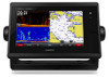
Garmin GPSMAP 7608xsv Owner s Manual
Garmin GPSMAP 7608xsv Manual
 |
View all Garmin GPSMAP 7608xsv manuals
Add to My Manuals
Save this manual to your list of manuals |
Garmin GPSMAP 7608xsv manual content summary:
- Garmin GPSMAP 7608xsv | Owner s Manual - Page 1
GPSMAP® 7400/7600 Series Owner's Manual February 2016 190-01841-00_0D - Garmin GPSMAP 7608xsv | Owner s Manual - Page 2
content of this manual without obligation to notify any person or organization of such changes or improvements. Go to www.garmin.com for current updates and supplemental information concerning the use of this product. Garmin®, the Garmin logo, BlueChart®, g2 Vision®, GPSMAP®, Ultrascroll®, and VIRB - Garmin GPSMAP 7608xsv | Owner s Manual - Page 3
1 Accessing Owner's Manuals on the Chartplotter 1 Downloading the Manuals 1 Getting More Information 1 Inserting Memory Cards 1 Software Update 2 Loading the New Software on a Memory Card 2 Updating the Device Software 2 GPS Satellite Signals 2 Selecting the GPS Source 2 Customizing the - Garmin GPSMAP 7608xsv | Owner s Manual - Page 4
the Race Timer 15 Setting the Distance between the Bow and the GPS Antenna 15 Laylines Settings 15 Setting the Keel Offset 16 Sailboat Autopilot the Heading with the Helm 28 Adjusting the Heading with the Chartplotter in Step Steering Mode 28 Steering Patterns 28 Following the U-Turn - Garmin GPSMAP 7608xsv | Owner s Manual - Page 5
Guide Chartplotter Automatically 39 System Settings 39 Station Settings 39 Viewing System Software Information 39 Viewing the Event Log 39 Preferences Settings 39 Units Settings 40 Navigation Settings 40 Communications Settings 41 NMEA 0183 Settings 41 NMEA 2000 Settings 41 Garmin Marine - Garmin GPSMAP 7608xsv | Owner s Manual - Page 6
Device with the Chartplotter from the GRID Device 44 Rotating the GRID Joystick 44 Cleaning the Screen 44 Viewing Images on a Memory card 45 Screenshots 45 Capturing Screenshots 45 Copying Screenshots to a Computer 45 Troubleshooting 45 My device will not acquire GPS signals 45 My device - Garmin GPSMAP 7608xsv | Owner s Manual - Page 7
to turn the chartplotter on. • Select Garmin Product Support. The website, www.garmin.com/support, offers many different troubleshooting tips to help resolve most issues and answer most questions. • Frequently-asked questions (FAQs) • Software updates • Owner's and installation manuals • Service - Garmin GPSMAP 7608xsv | Owner s Manual - Page 8
Update You may need to update the device software when you install the device or add an accessory to the device. Loading the New Software on a Memory Card 1 Insert a memory card into the card slot on the computer. 2 Go to www.garmin.com/support/software/marine.html. 3 Select Download next to GPSMAP - Garmin GPSMAP 7608xsv | Owner s Manual - Page 9
the Vessel Type You can select your boat type to configure the chartplotter settings and to use features customized for your boat type. 1 Select , enter a name, and select Done. • To edit the preset, select Edit, and update the preset. • To delete the preset, select Delete. • To reset all presets to - Garmin GPSMAP 7608xsv | Owner s Manual - Page 10
on the map data and accessories used. You can access the or the Fishing chart, when the chartplotter is connected to a radar. This Selecting a Map If your product has both BlueChart® g2 and Garmin LakeVü™ HD built-in maps, you can select which map Buoy Information Marine services Tide station - Garmin GPSMAP 7608xsv | Owner s Manual - Page 11
local services information , select Auto Guidance. 5 Review the course indicated by the use the GPS antenna heading for COG, select GPS Heading ( support all charts. Optional premium charts, such as BlueChart g2 Vision®, allow you to get the most out of your chartplotter. In addition to detailed marine - Garmin GPSMAP 7608xsv | Owner s Manual - Page 12
When you record data using Garmin Quickdraw Contours mapping, you should use a Speed Class 10 memory card to ensure that Garmin Quickdraw Contours Feature Before you can use the Garmin Quickdraw Contours feature, you must have a supported chartplotter with upgraded software, sonar depth, your GPS - Garmin GPSMAP 7608xsv | Owner s Manual - Page 13
each vessel includes the Maritime Mobile Service Identity (MMSI), location, GPS speed, GPS heading, time that has elapsed since the last position of the vessel was reported, nearest approach, and time to the nearest approach. Some chartplotter models also support Blue Force Tracking. Vessels being - Garmin GPSMAP 7608xsv | Owner s Manual - Page 14
10 minutes before it will likely occur, set Time To to 10, and the alarm will sound 10 alarm appears. Select Review > Go To Some options require premium maps or connected accessories, such as radar. These settings apply appears if the chartplotter is connected to a compatible marine wind sensor. When - Garmin GPSMAP 7608xsv | Owner s Manual - Page 15
Viewing a List of all Waypoints, page 10). Create Waypoint: Creates a new waypoint. views and chartplotter models. Some options require premium maps or connected accessories. From a Manual option calculates the laylines using manually charts, in some areas. NOTE: Mariner's Eye 3D and Fish Eye 3D - Garmin GPSMAP 7608xsv | Owner s Manual - Page 16
Waypoints. Editing a Saved Waypoint 1 Select Info > User Data > Waypoints. 2 Select a waypoint. 3 Select Review > Edit. 4 Select an option: • To add a name, select Name, and enter a name. • To change the symbol, select Symbol. • To change the depth, select Depth. 10 Navigation with a Chartplotter - Garmin GPSMAP 7608xsv | Owner s Manual - Page 17
. 1 Select a destination (Destinations, page 10). 2 Select Navigate To > Go To. turn on the chart. 5 Select Add Turn. The chartplotter marks the location of the turn with a waypoint. 6 1 Select Info > User Data > Routes & Auto Guidance Paths. 2 Select a route. 3 Select Review > Edit Route. 4 - Garmin GPSMAP 7608xsv | Owner s Manual - Page 18
your chartplotter to 10). 2 Select Navigate To > Auto Guidance. 3 Review instructions. • To delete the path, select Cancel Auto Guidance. • To save the path, select Done. Adjusting a Saved Auto Guidance Path 1 Select Info > User Data > Routes & Auto Guidance Paths. 2 Select a path, and select Review - Garmin GPSMAP 7608xsv | Owner s Manual - Page 19
> Stop Navigation, and proceed to step 10. • If the Auto Guidance line is Near or Far in step 6, review the placement of the Auto Guidance User Data > Tracks > Saved Tracks. Editing a Saved Track 1 Select Info > User Data > Tracks > Saved Tracks. 2 Select a track. Navigation with a Chartplotter - Garmin GPSMAP 7608xsv | Owner s Manual - Page 20
a specified distance of a set boundary. 1 Select Info > User Data > Boundaries. 2 Select a boundary. 3 Select Alarm > On. 4 Enter a distance. Deleting a Boundary 1 Select Info > User Data > Boundaries. 2 Select a boundary. 3 Select Review > Edit Boundary > Delete. 14 Navigation with a Chartplotter - Garmin GPSMAP 7608xsv | Owner s Manual - Page 21
Garmin Marine Network (Ethernet) automatically. NOTE: This feature is not available on all models. Select Settings > Preferences > User Data Sharing > On. If a change is made to a waypoint, track, or route on one chartplotter . The Manual option calculates the laylines using manually entered windward - Garmin GPSMAP 7608xsv | Owner s Manual - Page 22
configuration, see the installation instructions included with your autopilot. adjust the wind hold angle in increments of 10°, hold or . Tack and Gybe You does not prevent you from manually performing a gybe using the optional Garmin sounder module and a transducer, your compatible chartplotter can - Garmin GPSMAP 7608xsv | Owner s Manual - Page 23
models support SideVü sonar and scanning transducers. NOTE: To receive SideVü scanning sonar, you need a compatible chartplotter, a compatible sounder the live movement either in front of or below your boat. The screen updates very quickly, producing sonar views that look more like live video. The - Garmin GPSMAP 7608xsv | Owner s Manual - Page 24
. If you are connecting a transducer that was not included with the chartplotter, you may need to set the transducer type to make the sonar function Use AHRS. 3 Select Calibrate Compass. 4 Follow the on-screen instructions. Creating a Waypoint on the Sonar Screen 1 From a sonar view, select . - Garmin GPSMAP 7608xsv | Owner s Manual - Page 25
all chartplotter models. You can view the sonar data from all compatible sources on the Garmin Marine Network , you can view the sonar data using the GPSMAP 7407xsv mounted at the front of your boat. that has minimal or moderate terrain changes. Manually adjusting the range enables you to view a - Garmin GPSMAP 7608xsv | Owner s Manual - Page 26
To set the depth range of the magnified area manually, select Set Zoom, select View Up or View Down available depend on the chartplotter, sounder modules, and transducer being the Panoptix Sonar Views NOTE: Not all models support Panoptix transducers. Adjusting the Appearance of the LiveVü - Garmin GPSMAP 7608xsv | Owner s Manual - Page 27
the RealVü Sweep Speed You can update how quickly the transducer sweeps back and not included with the chartplotter, you may need to and settings apply to all models, sounder modules, and transducers. Sonar Settings set this setting to the Points and manually set the range shallower. Bottom Colors: - Garmin GPSMAP 7608xsv | Owner s Manual - Page 28
return. The 2/1 setting draws two columns of information on the screen per sounder return, and so on for the 4/1 and 8/1 settings. Sonar Alarm Settings NOTE: Some settings require external accessories. Select Settings > Alarms > Sonar. Shallow Water: Sets an alarm to sound when the depth is - Garmin GPSMAP 7608xsv | Owner s Manual - Page 29
energy. NOTE: Not all models support radar. When you connect your compatible chartplotter to an optional Garmin marine radar, such as a GMR™ 1226 1 With the chartplotter off, connect your radar as described in the radar installation instructions. 2 Turn on the chartplotter. The radar warms - Garmin GPSMAP 7608xsv | Owner s Manual - Page 30
radar object enters the zone. Sentry mode works with some Garmin GMR model radars. Enabling Timed Transmit Select Radar > GPS heading, nearest approach, and time to nearest approach. MARPA indicates the status of each tagged object (acquiring, lost, tracking, or dangerous), and the chartplotter - Garmin GPSMAP 7608xsv | Owner s Manual - Page 31
of the screen. Radar Overlay When you connect your chartplotter to an optional Garmin marine radar, you can use the Radar overlay to overlay a heading sensor is not available, the boat heading is based on GPS tracking data. GPS tracking data indicates the direction in which the boat is moving, not - Garmin GPSMAP 7608xsv | Owner s Manual - Page 32
setting that reflects the present sea conditions. When using a compatible radar model, the chartplotter adjusts the sea clutter based on the sea conditions automatically. Adjusting Sea Clutter on the Radar Screen Manually You can adjust the appearance of clutter caused by choppy sea conditions. The - Garmin GPSMAP 7608xsv | Owner s Manual - Page 33
radar overlay. NOTE: Not all options and settings are available on all radar and chartplotter models. Turning on Echo Trails From a radar screen or the radar overlay, leave the helm unattended. Always be prepared to promptly regain manual control of your boat. Learn to operate the autopilot on - Garmin GPSMAP 7608xsv | Owner s Manual - Page 34
until you let go of the key. • Hold to initiate a sequence of 10° turns. Steering Patterns WARNING You are responsible for the manually maintain a specific heading for a few seconds, the autopilot resumes a heading hold at the new heading. Adjusting the Heading with the Chartplotter - Garmin GPSMAP 7608xsv | Owner s Manual - Page 35
For information on placing distress calls from your radio, see the VHF radio owner's manual. For information about marking an MOB or SOS location, see Marking an SOS Location, page 10. Position Tracking When you connect the chartplotter to a VHF radio using NMEA 0183, you can track vessels that send - Garmin GPSMAP 7608xsv | Owner s Manual - Page 36
DSC List. 2 Select a vessel or a station to call. 3 Select Review > Call with Radio. 4 If necessary, select Channel, and select a new channel. 5 Select Send. The chartplotter sends information about the call to the radio. 6 On your Garmin VHF radio, select Call. Making an Individual Routine Call to - Garmin GPSMAP 7608xsv | Owner s Manual - Page 37
engine and fuel data. See the installation instructions for details. Select A/V, Gauges, Controls > engines are shown in the gauges, you must manually select the number of engines (Selecting the from a heading sensor, and GPS heading is calculated by your chartplotter GPS (course over ground). 1 - Garmin GPSMAP 7608xsv | Owner s Manual - Page 38
setting is 10 minutes. Increasing , select Change Date > Manual, and enter a date. Review. Tide Station Information You can view information about a tide station for a specific date and time, including the tide height, and when the next high and low tides will occur. By default, the chartplotter - Garmin GPSMAP 7608xsv | Owner s Manual - Page 39
you can select the media source you want to control from your chartplotter. NOTE: You can play media only from sources that are connected to the screen, select Scan. Adjusting the VHF Squelch NOTE: Your media player must support VHF radio to use this feature. 1 From the VHF source page, select - Garmin GPSMAP 7608xsv | Owner s Manual - Page 40
The activation process usually takes 10 to 15 minutes, but that appear in the channel guide. Select an option: • Garmin devices, including the Navigation chart on a compatible chartplotter. The weather data for each feature comes from reputable weather data centers such as the National Weather Service - Garmin GPSMAP 7608xsv | Owner s Manual - Page 41
of the latest update or as an animated loop of the latest updates. The time stamp indicates the elapsed time since the service provider generated the weather . The aqua lines on the chart indicate the boundaries of marine forecasts, coastal forecasts, and offshore forecasts. Weather bulletins may - Garmin GPSMAP 7608xsv | Owner s Manual - Page 42
20 knots 5 knots 50 knots 10 knots 65 knots 15 knots Wave chartplotter to adjust the temperature range automatically, select Auto Configure. The chartplotter automatically finds the lower and upper limits for the current screen, and updates service, select Current Cond.. 36 SiriusXM Weather - Garmin GPSMAP 7608xsv | Owner s Manual - Page 43
service was updated. From a weather chart, select Menu > Weather Subscription. Viewing Video Before you can view video, you must connect to a compatible source. Compatible devices include video devices connected to the ports on the chartplotter or to the Garmin Marine Network, as well as supported - Garmin GPSMAP 7608xsv | Owner s Manual - Page 44
options are available on all camera models and chartplotter models. You may need to update the camera software to use this feature. From the video screen supports gesture responses, you can control pan-tilt-zoom cameras using gestures directly on the chartplotter screen. Check your camera user manual - Garmin GPSMAP 7608xsv | Owner s Manual - Page 45
screens. This allows you to start and stop recording from other functions in the chartplotter. 1 Open the screen to which you want to add the VIRB X/XE software version for an optional Garmin radar (if applicable), and the unit ID number. You may need this information to update the system software - Garmin GPSMAP 7608xsv | Owner s Manual - Page 46
User Data Sharing: Allows you to share waypoints and routes over the Garmin Marine Network. All chartplotters Navigation Options > Stop Navigation, and proceed to step 10. • If the Auto Guidance line is too close you selected Near or Far in step 6, review the placement of the Auto Guidance line, and - Garmin GPSMAP 7608xsv | Owner s Manual - Page 47
: Changes the labels for available connected devices. Garmin Marine Network The Garmin Marine Network allows you to share data from Garmin peripheral devices with the chartplotters quickly and easily. You can connect a chartplotter to a Garmin Marine Network to receive data from and share data - Garmin GPSMAP 7608xsv | Owner s Manual - Page 48
data displayed by the chartplotter. 1 Select Settings > My Vessel > Calibrate Water Speed. 2 Follow the on-screen instructions. If the boat you continue to get the message, contact Garmin product support. Other Vessels Settings When your compatible chartplotter is connected to an AIS device or VHF - Garmin GPSMAP 7608xsv | Owner s Manual - Page 49
Changing the Wireless Channel You can change the wireless channel if you have trouble finding or connecting to a device, or if you experience interference. 1 -screen instructions. Using the Garmin Helm Application with the Chartplotter Before you can control the chartplotter with the Garmin Helm - Garmin GPSMAP 7608xsv | Owner s Manual - Page 50
a folder named Garmin\UserData. 3 Insert a memory card into the card slot. 4 Select Info > User Data > Data Transfer > Replace from Card. Saving System Information to a Memory Card You can save system information to a memory card as a troubleshooting tool. A product support representative may ask - Garmin GPSMAP 7608xsv | Owner s Manual - Page 51
from the chartplotter, and insert it into a card reader that is attached to a computer. 2 From Windows® Explorer, open the Garmin\scrn folder on the memory card. 3 Copy a .bmp file from the card and paste it to any location on the computer. Troubleshooting My device will not acquire GPS signals If - Garmin GPSMAP 7608xsv | Owner s Manual - Page 52
Position: Rapid update 129038 AIS class Marine Electronics Association (NMEA) format and sentences from: NMEA, Seven Riggs Avenue, Severna Park, MD 21146 USA (www.nmea.org) Software Software remain in Garmin and/or its thirdparty providers. You acknowledge that the Software is the property of Garmin - Garmin GPSMAP 7608xsv | Owner s Manual - Page 53
See product support home screen 2 customizing 2, 3 I images 45 J jibing. See tacking and gybing joystick 44 K keel offset 16, 42 keyboard 39 L lane width 9 language 39 locking, screen 1 M man overboard 10, 28, 29 manual viewer 1 maps. See charts marine services 10 mark location 10 MARPA 7 navigation - Garmin GPSMAP 7608xsv | Owner s Manual - Page 54
See Marine Network NMEA indicators 6 presets 3 product registration 44 product support 1 contact information 1 R radar 23-25 waypoint 18 whiteline 22 zoom 20 SOS 10, 29 stations 2 changing the station gauges 32 troubleshooting 45 U unit ID 39 units of measure 40 updates, software 2 user data deleting - Garmin GPSMAP 7608xsv | Owner s Manual - Page 55
wind hold 16 adjusting 16 wind speed graph 32 wireless devices 39, 43 connecting a wireless device 43 network configuration 43 Z zoom chart 4 radar 24 sonar 20 Index 49 - Garmin GPSMAP 7608xsv | Owner s Manual - Page 56
www.garmin.com/support 1800 235 822 +43 (0) 820 220230 + 32 2 672 52 54 1-866-429-9296 +420 221 985466 +420 39 02 36 699699 (+52) 001-855-792-7671 0800 427 652 +47 815 69 555 +35 1214 447 460 0861 GARMIN (427 646) +27 (0)11 251 9800 + 46 7744 52020 0808 238 0000 +44 870 850 1242 913-397-8200
-
 1
1 -
 2
2 -
 3
3 -
 4
4 -
 5
5 -
 6
6 -
 7
7 -
8
-
9
-
10
-
11
-
12
-
13
-
14
-
15
-
16
-
17
-
18
-
19
-
20
-
21
-
22
-
23
-
24
-
25
-
26
-
27
-
28
-
29
-
30
-
31
-
32
-
33
-
34
-
35
-
36
-
37
-
38
-
39
-
40
-
41
-
42
-
43
-
44
-
45
-
46
-
47
-
48
-
49
-
50
-
51
-
52
-
53
-
54
-
55
-
56
 |
 |
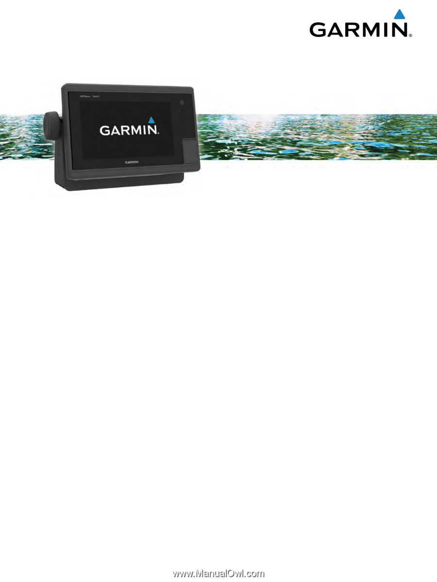
GPSMAP
®
7400/7600 Series
Owner’s Manual
February 2016
190-01841-00_0D