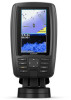
Garmin ECHOMAP Plus 43cv Owners Manual PDF
Garmin ECHOMAP Plus 43cv Manual
 |
View all Garmin ECHOMAP Plus 43cv manuals
Add to My Manuals
Save this manual to your list of manuals |
Garmin ECHOMAP Plus 43cv manual content summary:
- Garmin ECHOMAP Plus 43cv | Owners Manual PDF - Page 1
ECHOMAP™ PLUS SERIES Owner's Manual - Garmin ECHOMAP Plus 43cv | Owners Manual PDF - Page 2
the written consent of Garmin. Garmin reserves the right to change or improve its products and to make changes in the content of this manual without obligation to notify any person or organization of such changes or improvements. Go to www.garmin.com for current updates and supplemental information - Garmin ECHOMAP Plus 43cv | Owners Manual PDF - Page 3
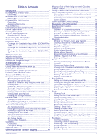
Shortcut Key 2 Tips and Shortcuts 2 Downloading the Manuals from the Web 2 Garmin Support Center 2 Inserting Memory Cards 2 Acquiring GPS Satellite Signals Destination Using the Navigation Chart 13 Searching for a Marine Services Destination 13 Setting and Following a Direct Course Using Go - Garmin ECHOMAP Plus 43cv | Owners Manual PDF - Page 4
Deleting All Saved Waypoints, Routes, and Tracks 18 Sailing Features 18 Setting the Vessel Type 18 Sail Racing 18 Starting Line Guidance 18 Using the Race Timer 18 Setting the Distance between the Bow and the GPS Antenna 18 Laylines Settings 18 Setting the Keel Offset 18 Sailboat Autopilot - Garmin ECHOMAP Plus 43cv | Owners Manual PDF - Page 5
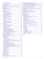
ID 35 Activating a SiriusXM Subscription 35 Customizing the Channel Guide 35 Saving a SiriusXM Channel to the Presets List 35 Screen 41 Screenshots 41 Capturing Screenshots 41 Copying Screenshots to a Computer 41 Troubleshooting 42 My device will not acquire GPS signals 42 My device will - Garmin ECHOMAP Plus 43cv | Owners Manual PDF - Page 6
- Garmin ECHOMAP Plus 43cv | Owners Manual PDF - Page 7
Introduction WARNING See the Important Safety and Product Information guide in the product box for product warnings and other important information. ECHOMAP Plus 40 Device View ECHOMAP Plus 60 Front View Power key Automatic backlight - Garmin ECHOMAP Plus 43cv | Owners Manual PDF - Page 8
mode, when available. Downloading the Manuals from the Web You can get the latest owner's manual and translations of manuals from the Garmin® website. 1 Go to garmin.com/manuals/echomapplus60-70-90. 2 Download the manual. Garmin Support Center Go to support.garmin.com for help and information - Garmin ECHOMAP Plus 43cv | Owners Manual PDF - Page 9
transfer Garmin Quickdraw contours you have downloaded or created Push smart notifications Begin navigating to a specific waypoint or navigating a specific route Manually synchronize waypoints and routes with the ECHOMAP Plus device Owner Guest Yes No Yes Yes Yes No Yes Yes Yes Yes Yes Yes - Garmin ECHOMAP Plus 43cv | Owners Manual PDF - Page 10
select Smart Notifications > Pair with Chartplotter. 5 Follow the on-screen instructions to pair the app to the ECHOMAP Plus device using Bluetooth technology. 6 data limits or charges from your internet service provider apply. Contact your internet service provider for more information about data - Garmin ECHOMAP Plus 43cv | Owners Manual PDF - Page 11
other obstacles. Viewing Location and Object Information on a Chart You can view information, such as tide, current, celestial, chart notes, or local services, about a location or an object on the Navigation chart or the Fishing chart. 1 From the Navigation chart or Fishing chart, select a location - Garmin ECHOMAP Plus 43cv | Owners Manual PDF - Page 12
the course to all visual sightings, and avoid any land, shallow water, or other obstacles that may be in your path. NOTE: Not all models support all charts. Optional premium charts, such as BlueChart® g3 Vision, allow you to get the most out of your chartplotter. In addition to detailed marine - Garmin ECHOMAP Plus 43cv | Owners Manual PDF - Page 13
information. The information reported for each vessel includes the Maritime Mobile Service Identity (MMSI), location, GPS speed, GPS heading, time that , and time to the nearest approach. Some chartplotter models also support Blue Force Tracking. Vessels being tracked with Blue Force Tracking are - Garmin ECHOMAP Plus 43cv | Owners Manual PDF - Page 14
provided, the projected course of the target is calculated based on the course over ground information. Activating a Target for an AIS Vessel 1 From a chart or a 3D chart view, select an AIS vessel. 2 Select AIS Vessel > Activate Target. Viewing Information about a Targeted AIS Vessel You can view - Garmin ECHOMAP Plus 43cv | Owners Manual PDF - Page 15
The menus may contain some settings that are not supported by your installed charts or your present location. or IALA navaid type. Service Points: Shows locations for marine services. Depth: Adjusts the items wind sensor. The Manual option calculates the laylines using manually entered windward and - Garmin ECHOMAP Plus 43cv | Owners Manual PDF - Page 16
Zone Collision Alarm, page 8). Water Layer Settings From a chart, select MENU > Layers > Water. NOTE: The menu may contain some settings that are not supported by your installed charts or your present location. If you make changes to those settings, the changes will not impact the chart view. Depth - Garmin ECHOMAP Plus 43cv | Owners Manual PDF - Page 17
You can view Garmin Quickdraw Contours in a combination screen or as a single view on the map. The amount of saved data depends on the size of your memory card, your sonar source, and the speed of your boat as you record data. You can record longer when you use a single-beam sonar. It is estimated - Garmin ECHOMAP Plus 43cv | Owners Manual PDF - Page 18
single-leg route and navigate it using Route To (Creating and Navigating a Route From Your Present Location, page 14). How do I make the device guide me to a location while avoiding charted obstacles? Build a multi-leg route and navigate it using Route To (Creating and Navigating a Route From Your - Garmin ECHOMAP Plus 43cv | Owners Manual PDF - Page 19
a path for me? If you have premium maps that support Auto Guidance and are in an area covered by Auto Guidance a Destination by Name You can search for saved waypoints, saved routes, saved tracks, and marine services destinations by name. 1 Select Nav Info > Search by Name. 2 Enter at least a - Garmin ECHOMAP Plus 43cv | Owners Manual PDF - Page 20
3 Select Review > Move. 4 Indicate a new location for the waypoint: • To move the waypoint while using the chart, select Use Chart, select a new location on the chart, and select Move. • To move the waypoint using coordinates, select Enter Coordinates, and enter the new coordinates. • To move the - Garmin ECHOMAP Plus 43cv | Owners Manual PDF - Page 21
To view a hazard and adjust the path near a hazard, select Hazard Review. • To adjust the path, select Adjust Path, and follow the onscreen instructions. • To delete the path, select Delete. • To save the path, select Done. Adjusting an Auto Guidance Path 1 Select Nav Info > Routes. 2 Select a path - Garmin ECHOMAP Plus 43cv | Owners Manual PDF - Page 22
an area at the beginning or the end of an Auto Guidance path is shallower than the Preferred Depth or lower than the Vertical Clearance settings, the Auto Guidance path may not be calculated in that area, depending on the map data. On the chart, the course through those areas appears as a gray line - Garmin ECHOMAP Plus 43cv | Owners Manual PDF - Page 23
data to the data fields on the chart. Creating a Boundary 1 Select Nav Info > Boundaries > New. 2 Select a boundary shape. 3 Follow the on-screen instructions. Converting a Route to a Boundary Before you can convert a route to a boundary, you must create and save at least one route (Creating and - Garmin ECHOMAP Plus 43cv | Owners Manual PDF - Page 24
the device calculates laylines. The Actual option calculates the laylines using the measured wind angle from the wind sensor. The Manual option calculates the laylines using manually entered windward and leeward angles. Windward Angle: Allows you to set a layline based on the windward sailing angle - Garmin ECHOMAP Plus 43cv | Owners Manual PDF - Page 25
to the autopilot. For advanced autopilot configuration, see the installation instructions included with your autopilot. 1 From the autopilot screen, select MENU Gybe Inhibitor NOTE: The gybe inhibitor does not prevent you from manually performing a gybe using the helm or step steering. The gybe - Garmin ECHOMAP Plus 43cv | Owners Manual PDF - Page 26
. Depth information Suspended targets or fish Bottom of the body of water SideVü Sonar View NOTE: Not all models provide built-in SideVü sonar support. If your model does not provide built-in SideVü sonar, you need a compatible sounder module and compatible SideVü transducer. If your model does - Garmin ECHOMAP Plus 43cv | Owners Manual PDF - Page 27
Panoptix™ Sonar Views NOTE: Not all models support Panoptix transducers. To receive Panoptix sonar, you need a compatible chartplotter and a compatible transducer. The Panoptix sonar views allow you to see all around the boat - Garmin ECHOMAP Plus 43cv | Owners Manual PDF - Page 28
Fish Bottom RealVü 3D Historical Sonar View This sonar view provides a three-dimensional view of what is behind your boat as you are moving and shows the entire water column in 3D, from the bottom to the top of the water. This view is used for finding fish. Flasher View The flasher shows sonar - Garmin ECHOMAP Plus 43cv | Owners Manual PDF - Page 29
on the AHRS sensor. 3 Select Calibrate Compass. 4 Follow the on-screen instructions. Selecting a Sonar Source This feature may not be available with all models. Select an option: • To increase or decrease the gain or brightness manually, select Up or Down. • To allow the chartplotter to adjust the - Garmin ECHOMAP Plus 43cv | Owners Manual PDF - Page 30
select Default. Sonar Recordings Recording the Sonar Display NOTE: Not all models support sonar recording. 1 Insert a memory card into the card slot. 2 for more options. • To set the depth range of the magnified area manually, select Manual > , select View Up or View Down to set the depth range of - Garmin ECHOMAP Plus 43cv | Owners Manual PDF - Page 31
within the lower or outer third of the sonar screen, and can be useful for tracking a bottom that has minimal or moderate terrain changes. Manually adjusting the range enables you to view a specified range, which can be useful for tracking a bottom that has large terrain changes, such as a drop - Garmin ECHOMAP Plus 43cv | Owners Manual PDF - Page 32
Range: Adjusts the range of the forward scale. Allowing the device to adjust the range automatically adjusts the forward scale in relation to the depth. Manually adjusting the range enables you to view a specified range. The bottom can appear on the screen as long as it appears within the range you - Garmin ECHOMAP Plus 43cv | Owners Manual PDF - Page 33
for the bottom. Bottom Style: Sets the style for the bottom. When you are in deep water, you can select the Points option and manually set the range to a shallower value. Color Key: Shows a legend of the depths the colors represent. Panoptix Transducer Installation Settings From a Panoptix sonar - Garmin ECHOMAP Plus 43cv | Owners Manual PDF - Page 34
you of the responsibility of safely operating your boat. Avoid navigational hazards and never leave the helm unattended. Always be prepared to promptly regain manual control of your boat. Learn to operate the autopilot on calm and hazard-free open water. Use caution when operating the autopilot near - Garmin ECHOMAP Plus 43cv | Owners Manual PDF - Page 35
using the remote, see the Reactor autopilot remote control instructions at garmin.com Pairing a Reactor Autopilot Remote Control With rotating propeller. Always disconnect the motor from the battery before cleaning or servicing the propeller to avoid injury. You are responsible for the safe and - Garmin ECHOMAP Plus 43cv | Owners Manual PDF - Page 36
> Compass Cal.. 3 Follow the on-screen instructions. Setting the Bow Offset Based on the installation angle the chartplotter must be connected to a VHF radio that supports DSC. Select Nav Info > Other Vessels > DSC Add Contact. 2 Enter the Maritime Mobile Service Identity (MMSI) of the vessel. 3 - Garmin ECHOMAP Plus 43cv | Owners Manual PDF - Page 37
designates a distress call in the DSC list and marks the position of the vessel on the Navigation chart at the time of the DSC distress call. Navigating to a Vessel in Distress designates a distress call in the DSC list and marks the position of a vessel on the Navigation chart at the time of the - Garmin ECHOMAP Plus 43cv | Owners Manual PDF - Page 38
2000 network capable of sensing engine and fuel data. See the installation instructions for details. Select Gauges > Engine. Setting the Fuel Capacity of can customize how the engines are shown in the gauges, you must manually select the number of engines (Selecting the Number of Engines Shown in - Garmin ECHOMAP Plus 43cv | Owners Manual PDF - Page 39
Celestial. 3 Select an option: • To view information for a different date, select Change Date > Manual, and enter a date. • To view information for today, select Change Date > Use Current menu appears only for devices that support multiple media sources. 2 Select a source. Digital Switching 33 - Garmin ECHOMAP Plus 43cv | Owners Manual PDF - Page 40
To listen to DAB stations, you must have the appropriate equipment (DAB Playback, page 34). For instructions on connecting a DAB adapter and antenna, see the installation instructions provided with your adapter and antenna. Setting the Tuner Region 1 From the media screen, select MENU > Installation - Garmin ECHOMAP Plus 43cv | Owners Manual PDF - Page 41
it must be turned on and receiving the SiriusXM signal. 5 If the service is not activated within the hour, go to http://care.siriusxm.com/refresh categories. You can select the categories of channels that appear in the channel guide. Select an option: • If the media device is a FUSION-Link capable - Garmin ECHOMAP Plus 43cv | Owners Manual PDF - Page 42
connected stereos and accessories. 1 Go to www.fusionentertainment.com/marine, and download the software update onto a USB flash drive. Software updates and instructions are available on your device product page. 2 Insert the USB flash drive into the USB port of the stereo. 3 On the chartplotter - Garmin ECHOMAP Plus 43cv | Owners Manual PDF - Page 43
Settings > My Vessel > Calibrate Water Speed. 2 Follow the on-screen instructions. If the boat is not moving fast enough or the speed sensor is connections. 6 If you continue to get the message, contact Garmin product support. Setting the Fuel Capacity of the Vessel 1 Select Settings > My Vessel - Garmin ECHOMAP Plus 43cv | Owners Manual PDF - Page 44
Wireless Network, page 38). NMEA 0183 The chartplotters support the NMEA 0183 standard, which is used to connect devices, see the chartplotter installation instructions. The approved NMEA 0183 sentences for can change the wireless channel if you have trouble finding or connecting to a device, or if - Garmin ECHOMAP Plus 43cv | Owners Manual PDF - Page 45
card. You must have a memory card installed in the device. This device supports up to a 32 GB memory card, formatted to FAT32. • You can Data Sharing Cable (010-12234-06), and connect the devices following the instructions included with the cable (User Data Sharing Cable Wiring Diagram, page 40). - Garmin ECHOMAP Plus 43cv | Owners Manual PDF - Page 46
Data Transfer > Replace from Card. Saving System Information to a Memory Card You can save system information to a memory card as a troubleshooting tool. A product support representative may ask you to use this information to retrieve data about the network. 1 Insert a memory card into the card slot - Garmin ECHOMAP Plus 43cv | Owners Manual PDF - Page 47
install the device or add an accessory to the device. This device supports up to a 32 GB memory card, formatted to FAT32. Before you instructions. 4 Wait several minutes while the software update process completes. 5 When prompted, leave the memory card in place and restart the chartplotter manually - Garmin ECHOMAP Plus 43cv | Owners Manual PDF - Page 48
items to attempt to troubleshoot the cause of the cable or the installation instructions for the exact not turn on, contact Garmin product support at support.garmin.com. Changing the Fuse in manually enter a waypoint location to transfer and share data from one device to the next. If you have manually - Garmin ECHOMAP Plus 43cv | Owners Manual PDF - Page 49
Specification Max. power draw Typical current draw (RMS) Max. current draw (RMS) Measurement 5 W 0.5 A 2 A 6-Inch Models Specification Dimensions on cradle and bail mount with swivel base (W x H x D) Display size (W x H) Display resolution Weight Compass-safe distance Clearance to nearest - Garmin ECHOMAP Plus 43cv | Owners Manual PDF - Page 50
Sentence MWV VDM Description Wind speed and angle AIS VHF data-link message You can purchase complete information about National Marine Electronics Association (NMEA) format and sentences from: NMEA, Seven Riggs Avenue, Severna Park, MD 21146 USA (www.nmea.org) NMEA 2000 PGN Information Transmit - Garmin ECHOMAP Plus 43cv | Owners Manual PDF - Page 51
G Garmin ClearVü 20 Garmin Marine Network 38 Garmin product support. See product support gauges engine 32 fuel 32, 37 limits 37 status alarms navaids 6 naviads 8 navigation alarms 38 navigation chart 5, 7, 13 ATONs 8 marine service points 13 MARPA 10 panning 5 setup 39 vessel trails 10, 31 NMEA 0183 - Garmin ECHOMAP Plus 43cv | Owners Manual PDF - Page 52
targets 25 views 20 waypoint 23 whiteline 25 zoom 24 support. See product support suspended targets 10 symbols 7 system information 36, 40 T 25, 27 trip gauges 31 trolling motor 29, 30 bow offset 30 compass 30 troubleshooting 42 U unit ID 36 units of measure 39 updates, software 41 updating charts - Garmin ECHOMAP Plus 43cv | Owners Manual PDF - Page 53
- Garmin ECHOMAP Plus 43cv | Owners Manual PDF - Page 54
support.garmin.com TA-2018/154 TA-2018/209 TA-2018/183 August 2019 190-02242-00_0F
-
 1
1 -
 2
2 -
 3
3 -
 4
4 -
 5
5 -
 6
6 -
 7
7 -
8
-
9
-
10
-
11
-
12
-
13
-
14
-
15
-
16
-
17
-
18
-
19
-
20
-
21
-
22
-
23
-
24
-
25
-
26
-
27
-
28
-
29
-
30
-
31
-
32
-
33
-
34
-
35
-
36
-
37
-
38
-
39
-
40
-
41
-
42
-
43
-
44
-
45
-
46
-
47
-
48
-
49
-
50
-
51
-
52
-
53
-
54
 |
 |
ECHOMAP
™
PLUS
SERIES
Owner’s Manual