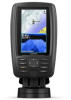
Garmin ECHOMAP Plus 45cv Owners Manual PDF
Garmin ECHOMAP Plus 45cv Manual
 |
View all Garmin ECHOMAP Plus 45cv manuals
Add to My Manuals
Save this manual to your list of manuals |
Garmin ECHOMAP Plus 45cv manual content summary:
- Garmin ECHOMAP Plus 45cv | Owners Manual PDF - Page 1
ECHOMAP™ PLUS SERIES Owner's Manual - Garmin ECHOMAP Plus 45cv | Owners Manual PDF - Page 2
change or improve its products and to make changes in the content of this manual without obligation to notify any person or organization of such changes or improvements. Go to www.garmin.com for current updates and supplemental information concerning the use of this product. Garmin®, the Garmin logo - Garmin ECHOMAP Plus 45cv | Owners Manual PDF - Page 3
ECHOMAP Plus 40 Device View 1 Device Keys 1 ECHOMAP Plus 60 Front View 1 Device Keys 1 ECHOMAP Plus 70/90 Front View 1 Device Keys 2 Assigning a Shortcut Key 2 Tips and Shortcuts 2 Downloading the Manuals from the Web 2 Garmin Support Searching for a Marine Services Destination 13 Setting - Garmin ECHOMAP Plus 45cv | Owners Manual PDF - Page 4
Speed 24 Adjusting the Range of the Depth or Width Scale 24 Sonar Appearance Settings 25 Sonar Alarms 25 Advanced Sonar Settings 25 Transducer Installation Settings 25 Sonar Frequencies 25 Turning On the A-Scope 26 Panoptix Sonar Setup 26 Adjusting the RealVü Viewing Angle and Zoom Level - Garmin ECHOMAP Plus 45cv | Owners Manual PDF - Page 5
40 Appendix 41 Registering Your Device 41 Software Update 41 Loading the New Software on a Memory Card 41 Updating the Device Software 41 Cleaning the Screen 41 Screenshots 41 Capturing Screenshots 41 Copying Screenshots to a Computer 41 Troubleshooting 42 My device will not acquire GPS - Garmin ECHOMAP Plus 45cv | Owners Manual PDF - Page 6
- Garmin ECHOMAP Plus 45cv | Owners Manual PDF - Page 7
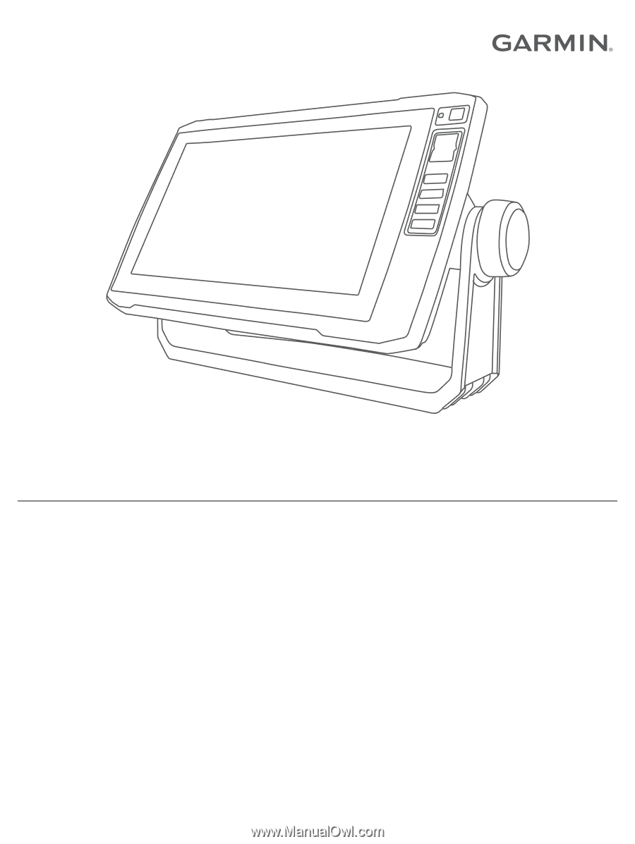
Product Information guide in the product box for product warnings and other important information. ECHOMAP Plus 40 Device View ECHOMAP Plus 60 Front View Power key Automatic backlight sensor Keys microSD memory card slot Device keys microSD® memory card slot Power and transducer connectors Beeper - Garmin ECHOMAP Plus 45cv | Owners Manual PDF - Page 8
manuals/echomapplus60-70-90. 2 Download the manual. Garmin Support Center Go to support.garmin.com for help and information, such as product manuals, frequently asked questions, videos, software updates, and customer support compatible transducer), transfer Page with the ECHOMAP Plus 70/90 You can - Garmin ECHOMAP Plus 45cv | Owners Manual PDF - Page 9
map cards to account Update software Automatically transfer Garmin Quickdraw contours you have downloaded or created Push smart notifications Begin navigating to a specific waypoint or navigating a specific route Manually synchronize waypoints and routes with the ECHOMAP Plus device Owner Guest Yes - Garmin ECHOMAP Plus 45cv | Owners Manual PDF - Page 10
. 5 Follow the on-screen instructions to pair the app to the ECHOMAP Plus device using Bluetooth technology. 6 When prompted, enter the key on your mobile device. 7 If necessary, adjust which notifications you receive in your mobile device settings. Updating Software with the ActiveCaptain App If - Garmin ECHOMAP Plus 45cv | Owners Manual PDF - Page 11
the sea floor according to the chart information. When a sonar transducer is connected, suspended targets (such as fish) are indicated by red view information, such as tide, current, celestial, chart notes, or local services, about a location or an object on the Navigation chart or the Fishing - Garmin ECHOMAP Plus 45cv | Owners Manual PDF - Page 12
the course to all visual sightings, and avoid any land, shallow water, or other obstacles that may be in your path. NOTE: Not all models support all charts. Optional premium charts, such as BlueChart® g3 Vision, allow you to get the most out of your chartplotter. In addition to detailed marine - Garmin ECHOMAP Plus 45cv | Owners Manual PDF - Page 13
information. The information reported for each vessel includes the Maritime Mobile Service Identity (MMSI), location, GPS speed, GPS heading, time that , and time to the nearest approach. Some chartplotter models also support Blue Force Tracking. Vessels being tracked with Blue Force Tracking are - Garmin ECHOMAP Plus 45cv | Owners Manual PDF - Page 14
provided, the projected course of the target is calculated based on the course over ground information. Activating a Target for an AIS Vessel 1 From a chart or a 3D chart view, select an AIS vessel. 2 Select AIS Vessel > Activate Target. Viewing Information about a Targeted AIS Vessel You can view - Garmin ECHOMAP Plus 45cv | Owners Manual PDF - Page 15
The menus may contain some settings that are not supported by your installed charts or your present location. or IALA navaid type. Service Points: Shows locations for marine services. Depth: Adjusts the items wind sensor. The Manual option calculates the laylines using manually entered windward and - Garmin ECHOMAP Plus 45cv | Owners Manual PDF - Page 16
, select MENU. View: Sets the perspective of the 3D chart view. Tracks: Shows tracks. Sonar Cone: Shows a cone that indicates the area covered by the transducer. Fish Symbols: Shows suspended targets. Supported Maps To help you have a safe and enjoyable time on the water, Garmin devices only - Garmin ECHOMAP Plus 45cv | Owners Manual PDF - Page 17
11). Connecting to the Garmin Quickdraw Community with ActiveCaptain 1 From your mobile device, open the ActiveCaptain app and connect to the ECHOMAP Plus device (Getting Started with the ActiveCaptain App, page 3). 2 From the app, select Quickdraw Community. You can download contours from others in - Garmin ECHOMAP Plus 45cv | Owners Manual PDF - Page 18
single-leg route and navigate it using Route To (Creating and Navigating a Route From Your Present Location, page 14). How do I make the device guide me to a location while avoiding charted obstacles? Build a multi-leg route and navigate it using Route To (Creating and Navigating a Route From Your - Garmin ECHOMAP Plus 45cv | Owners Manual PDF - Page 19
a path for me? If you have premium maps that support Auto Guidance and are in an area covered by Auto Guidance a Destination by Name You can search for saved waypoints, saved routes, saved tracks, and marine services destinations by name. 1 Select Nav Info > Search by Name. 2 Enter at least a - Garmin ECHOMAP Plus 45cv | Owners Manual PDF - Page 20
3 Select Review > Move. 4 Indicate a new location for the waypoint: • To move the waypoint while using the chart, select Use Chart, select a new location on the chart, and select Move. • To move the waypoint using coordinates, select Enter Coordinates, and enter the new coordinates. • To move the - Garmin ECHOMAP Plus 45cv | Owners Manual PDF - Page 21
To view a hazard and adjust the path near a hazard, select Hazard Review. • To adjust the path, select Adjust Path, and follow the onscreen instructions. • To delete the path, select Delete. • To save the path, select Done. Adjusting an Auto Guidance Path 1 Select Nav Info > Routes. 2 Select a path - Garmin ECHOMAP Plus 45cv | Owners Manual PDF - Page 22
an area at the beginning or the end of an Auto Guidance path is shallower than the Preferred Depth or lower than the Vertical Clearance settings, the Auto Guidance path may not be calculated in that area, depending on the map data. On the chart, the course through those areas appears as a gray line - Garmin ECHOMAP Plus 45cv | Owners Manual PDF - Page 23
data to the data fields on the chart. Creating a Boundary 1 Select Nav Info > Boundaries > New. 2 Select a boundary shape. 3 Follow the on-screen instructions. Converting a Route to a Boundary Before you can convert a route to a boundary, you must create and save at least one route (Creating and - Garmin ECHOMAP Plus 45cv | Owners Manual PDF - Page 24
wind angle from the wind sensor. The Manual option calculates the laylines using manually entered windward and leeward angles. Windward You can enter a keel offset to compensate the water depth reading for the transducer installation location. This allows you to view the depth of the water below the - Garmin ECHOMAP Plus 45cv | Owners Manual PDF - Page 25
configuration, see the installation instructions included with your autopilot. not prevent you from manually performing a gybe using the transducer, your ECHOMAP Plus device can be used as a fishfinder. For more information about which transducer is best for your needs, go to garmin.com/transducers - Garmin ECHOMAP Plus 45cv | Owners Manual PDF - Page 26
a custom combination screen (Creating a New Combination Page with the ECHOMAP Plus 70/90, page 2). Stopping the Transmission of Sonar Signals • To SideVü sonar support. If your model does not provide built-in SideVü sonar, you need a compatible sounder module and compatible SideVü transducer. If - Garmin ECHOMAP Plus 45cv | Owners Manual PDF - Page 27
all models support Panoptix transducers. To receive Panoptix sonar, you need a compatible chartplotter and a compatible transducer. The Panoptix updates with each sweep of the transducer. To see all five Panoptix sonar views, you need one transducer to show the down views and a second transducer - Garmin ECHOMAP Plus 45cv | Owners Manual PDF - Page 28
You may need to update the transducer software. A-scope, zoomed-in view of the right side view* A-scope with zoom area outlined** Depth scale Depth at your present location Angle and span of the transducer cone at the current frequency *The A-scopes are not available on ECHOMAP Plus 40 models. **On - Garmin ECHOMAP Plus 45cv | Owners Manual PDF - Page 29
3 Select Calibrate Compass. 4 Follow the on-screen instructions. Selecting a Sonar Source This feature may not be sonar data from another ECHOMAP Plus device and Garmin ClearVü transducer mounted at the front To increase or decrease the gain or brightness manually, select Up or Down. • To allow - Garmin ECHOMAP Plus 45cv | Owners Manual PDF - Page 30
Recording the Sonar Display NOTE: Not all models support sonar recording. 1 Insert a memory card into settings apply to all models, sounder modules, and transducers. From a sonar view, select MENU > set the depth range of the magnified area manually, select Manual > , select View Up or View Down - Garmin ECHOMAP Plus 45cv | Owners Manual PDF - Page 31
be useful for tracking a bottom that has minimal or moderate terrain changes. Manually adjusting the range enables you to view a specified range, which can information. Sonar Alarms NOTE: Not all options are available on all transducers. From an applicable sonar view, select MENU > Sonar Setup > - Garmin ECHOMAP Plus 45cv | Owners Manual PDF - Page 32
, turn the knob. Adjusting the RealVü Sweep Speed You can update how quickly the transducer sweeps back and forth. A faster sweep rate creates a less the range automatically adjusts the forward scale in relation to the depth. Manually adjusting the range enables you to view a specified range. The - Garmin ECHOMAP Plus 45cv | Owners Manual PDF - Page 33
. When you are in deep water, you can select the Points option and manually set the range to a shallower value. Color Key: Shows a legend of the depths the colors represent. Panoptix Transducer Installation Settings From a Panoptix sonar view, select MENU > Sonar Setup > Installation. Install Depth - Garmin ECHOMAP Plus 45cv | Owners Manual PDF - Page 34
you of the responsibility of safely operating your boat. Avoid navigational hazards and never leave the helm unattended. Always be prepared to promptly regain manual control of your boat. Learn to operate the autopilot on calm and hazard-free open water. Use caution when operating the autopilot near - Garmin ECHOMAP Plus 45cv | Owners Manual PDF - Page 35
using the remote, see the Reactor autopilot remote control instructions at garmin.com Pairing a Reactor Autopilot Remote Control With rotating propeller. Always disconnect the motor from the battery before cleaning or servicing the propeller to avoid injury. You are responsible for the safe and - Garmin ECHOMAP Plus 45cv | Owners Manual PDF - Page 36
> Compass Cal.. 3 Follow the on-screen instructions. Setting the Bow Offset Based on the installation angle the chartplotter must be connected to a VHF radio that supports DSC. Select Nav Info > Other Vessels > DSC Add Contact. 2 Enter the Maritime Mobile Service Identity (MMSI) of the vessel. 3 - Garmin ECHOMAP Plus 45cv | Owners Manual PDF - Page 37
the call. Gauges and Graphs The gauges and graphs provide various information about the engine and environment. To view the information, a compatible transducer or sensor must be connected to the network. Viewing the Compass You can view information about your bearing, heading, and route using the - Garmin ECHOMAP Plus 45cv | Owners Manual PDF - Page 38
2000 network capable of sensing engine and fuel data. See the installation instructions for details. Select Gauges > Engine. Setting the Fuel Capacity of can customize how the engines are shown in the gauges, you must manually select the number of engines (Selecting the Number of Engines Shown in - Garmin ECHOMAP Plus 45cv | Owners Manual PDF - Page 39
Celestial. 3 Select an option: • To view information for a different date, select Change Date > Manual, and enter a date. • To view information for today, select Change Date > Use Current menu appears only for devices that support multiple media sources. 2 Select a source. Digital Switching 33 - Garmin ECHOMAP Plus 45cv | Owners Manual PDF - Page 40
To listen to DAB stations, you must have the appropriate equipment (DAB Playback, page 34). For instructions on connecting a DAB adapter and antenna, see the installation instructions provided with your adapter and antenna. Setting the Tuner Region 1 From the media screen, select MENU > Installation - Garmin ECHOMAP Plus 45cv | Owners Manual PDF - Page 41
it must be turned on and receiving the SiriusXM signal. 5 If the service is not activated within the hour, go to http://care.siriusxm.com/refresh categories. You can select the categories of channels that appear in the channel guide. Select an option: • If the media device is a FUSION-Link capable - Garmin ECHOMAP Plus 45cv | Owners Manual PDF - Page 42
.com/marine, and download the software update onto a USB flash drive. Software updates and instructions are available on your device product page of from the transducer location (Setting the Keel Offset, page 18). Calibrate Water Speed: Calibrates the speed-sensing transducer or sensor ( - Garmin ECHOMAP Plus 45cv | Owners Manual PDF - Page 43
compensate the water depth reading for the transducer installation location. This allows you to view Calibrate Water Speed. 2 Follow the on-screen instructions. If the boat is not moving fast enough continue to get the message, contact Garmin product support. Setting the Fuel Capacity of the Vessel 1 - Garmin ECHOMAP Plus 45cv | Owners Manual PDF - Page 44
Wireless Network, page 38). NMEA 0183 The chartplotters support the NMEA 0183 standard, which is used to connect devices, see the chartplotter installation instructions. The approved NMEA 0183 sentences for can change the wireless channel if you have trouble finding or connecting to a device, or if - Garmin ECHOMAP Plus 45cv | Owners Manual PDF - Page 45
not affect maps or software updates. Sharing and Managing User card installed in the device. This device supports up to a 32 GB memory card, is not available on ECHOMAP Plus 70/90 devices. The blue and brown 06), and connect the devices following the instructions included with the cable (User Data - Garmin ECHOMAP Plus 45cv | Owners Manual PDF - Page 46
Data Transfer > Replace from Card. Saving System Information to a Memory Card You can save system information to a memory card as a troubleshooting tool. A product support representative may ask you to use this information to retrieve data about the network. 1 Insert a memory card into the card slot - Garmin ECHOMAP Plus 45cv | Owners Manual PDF - Page 47
be fully booted before the card is inserted. 3 Follow the on-screen instructions. 4 Wait several minutes while the software update process completes. 5 When prompted, leave the memory card in place and restart the chartplotter manually. 6 Remove the memory card. NOTE: If the memory card is removed - Garmin ECHOMAP Plus 45cv | Owners Manual PDF - Page 48
not, update the device software (Updating the to troubleshoot the installation instructions for on, contact Garmin product support at support.garmin.com. Changing transducer type (Selecting the Transducer Type, page 22). My device is not creating waypoints in the correct location You can manually - Garmin ECHOMAP Plus 45cv | Owners Manual PDF - Page 49
ground speed GPWPL WPL: Waypoint location GPXTE XTE: Cross track error PGRME E: Estimated error PGRMM M: Map datum PGRMZ Z: Altitude SDDBT DBT: Depth below transducer SDDPT DPT: Depth SDMTW MTW: Water temperature SDVHW VHW: Water speed and heading Receive Sentence DPT DBT MTW VHW WPL DSC DSE HDG - Garmin ECHOMAP Plus 45cv | Owners Manual PDF - Page 50
129025 129026 129029 129283 129284 129285 129540 Description Transmit and receive PGN list group function Magnetic Variance Position: Rapid update COG and SOG: Rapid update GNSS position data Cross track error Navigation data Navigation route and waypoint info GNSS satellites in view Receive PGN - Garmin ECHOMAP Plus 45cv | Owners Manual PDF - Page 51
quickdraw 10, 11 settings 9 symbols 5 updating 4 circuits 33 clock 38 alarm 38 collision Garmin Marine Network 38 Garmin product support. See product support gauges engine 32 fuel 32, 37 alarms 38 navigation chart 5, 7, 13 ATONs 8 marine service points 13 MARPA 10 panning 5 setup 39 vessel trails 10 - Garmin ECHOMAP Plus 45cv | Owners Manual PDF - Page 52
25 views 20 waypoint 23 whiteline 25 zoom 24 support. See product support suspended targets 10 symbols 7 system information 36, 40 transducer 19, 22, 25, 27 trip gauges 31 trolling motor 29, 30 bow offset 30 compass 30 troubleshooting 42 U unit ID 36 units of measure 39 updates, software 41 updating - Garmin ECHOMAP Plus 45cv | Owners Manual PDF - Page 53
- Garmin ECHOMAP Plus 45cv | Owners Manual PDF - Page 54
support.garmin.com TA-2018/154 TA-2018/209 TA-2018/183 August 2019 190-02242-00_0F
-
 1
1 -
 2
2 -
 3
3 -
 4
4 -
 5
5 -
 6
6 -
 7
7 -
8
-
9
-
10
-
11
-
12
-
13
-
14
-
15
-
16
-
17
-
18
-
19
-
20
-
21
-
22
-
23
-
24
-
25
-
26
-
27
-
28
-
29
-
30
-
31
-
32
-
33
-
34
-
35
-
36
-
37
-
38
-
39
-
40
-
41
-
42
-
43
-
44
-
45
-
46
-
47
-
48
-
49
-
50
-
51
-
52
-
53
-
54
 |
 |
ECHOMAP
™
PLUS
SERIES
Owner’s Manual