Garmin GPS III Plus 'Plus' Features Addendum - Page 4
Other New Map Features - maps
 |
UPC - 753759015817
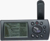
View all Garmin GPS III Plus manuals
Add to My Manuals
Save this manual to your list of manuals |
Page 4 highlights
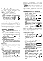
Other New Map Features Additional new map features include an accuracy circle, automatic controls of map detail to optimize decluttering and controls to enable/disable street labels. To enable accuracy circle or set the desired map detail level: 1. With the Map Page displayed, press MENU to display the Map Page Options. Then, use the ROCKER KEYPAD to highlight “Map Setup” and press ENTER 2. Use the ROCKER KEYPAD to highlight the “Map” file tab. 3. To enable/disable the accuracy circle: Use the ROCKER KEYPAD to select the field adjacent to “Acc. Circle” and press ENTER. A window will appear allowing you to turn the accuracy circle on or off. Select the desired setting and press ENTER. With the accuracy circle on, a gray circle will appear around your position (at lower scale settings) depicting the estimated accuracy of your position reading. 4. To set the desired map detail level: Use the ROCKER KEYPAD to select the field adjacent to “Detail” and press ENTER. A window will appear allowing you to select higher or lower detail levels for any map feature set to “Auto”. (Those features for which you specified a maximum scale, or turned “Off”, are unaffected by the detail setting.) Select the desired detail level and press ENTER. To enable/disable street labels: 1. Follow step #1 above, then highlight the “Line” file tab. 2. Select the field adjacent to “Street Labels” and press ENTER. A window will appear allowing you to disable street labels entirely or select the maximum scale at which you want the feature to appear. 3. Select the desired setting and press ENTER.
-
 1
1 -
 2
2 -
 3
3 -
 4
4
 |
 |
