Garmin Montana 750i Owners Manual
Garmin Montana 750i Manual
 |
View all Garmin Montana 750i manuals
Add to My Manuals
Save this manual to your list of manuals |
Garmin Montana 750i manual content summary:
- Garmin Montana 750i | Owners Manual - Page 1
MONTANA® 700 SERIES Owner's Manual - Garmin Montana 750i | Owners Manual - Page 2
the content of this manual without obligation to notify any person or organization of such changes or improvements. Go to www.garmin.com for current Garmin®, the Garmin logo, ANT+®, Auto Lap®, AutoLocate®, City Navigator®, inReach®, Montana®, TracBack®, VIRB®, and Xero® are trademarks of Garmin Ltd - Garmin Montana 750i | Owners Manual - Page 3
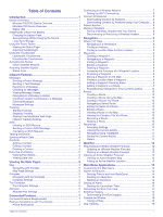
Table of Contents Introduction 1 Device Overviews 1 Montana 700i/750i Device Overview 1 Montana 700 Device Overview 1 Status LED 1 Installing Weather Location 13 Main Menu Applications 13 Customizing the Main Menu 14 Garmin Adventures 14 Sending Files to and from BaseCamp 14 Creating an - Garmin Montana 750i | Owners Manual - Page 4
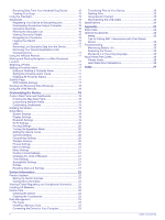
Alarm Tones 17 Disabling All Proximity Alarms 17 Satellite Page 17 GPS Satellite Settings 17 Sending and Receiving Data Wirelessly 18 Using the Data Fields 24 Optional Accessories 25 tempe 25 Tips for Pairing ANT+ Accessories with Your Garmin Device 25 Troubleshooting 25 Maximizing Battery - Garmin Montana 750i | Owners Manual - Page 5
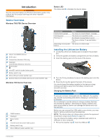
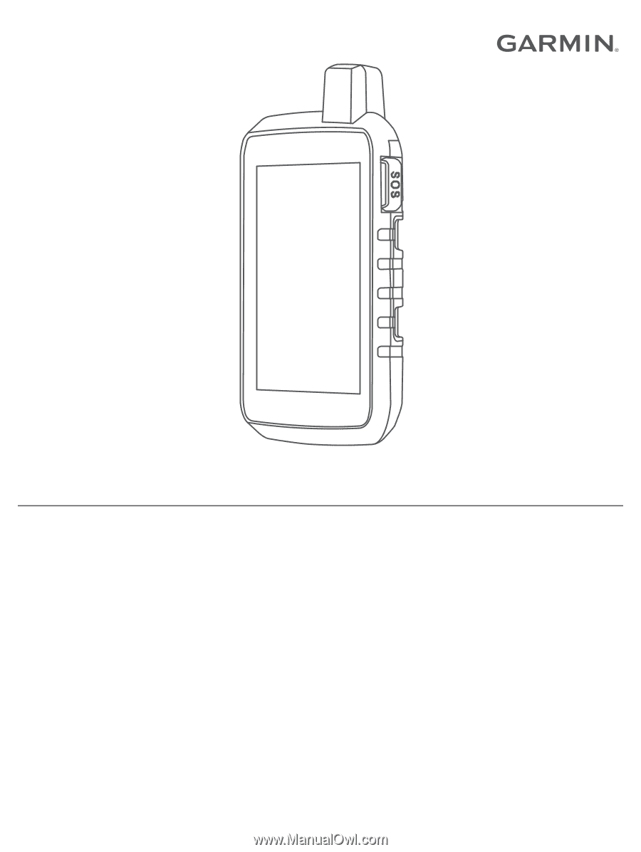
Introduction WARNING See the Important Safety and Product Information guide in the product box for product warnings and other important information. Device Overviews Montana 700i/750i Device Overview Status LED The status LED indicates the device status. Iridium® and GNSS antenna SOS button Camera - Garmin Montana 750i | Owners Manual - Page 6
Montana 700i/ 750i device, you must activate it (inReach Features, page 3). 1 Create an account, and select a satellite subscription at explore.garmin.com. 2 Turn on the device. 3 Select Next. 4 Follow the on-screen instructions +® sensor status GPS signal strength Charging battery 2 Introduction - Garmin Montana 750i | Owners Manual - Page 7
force a check for messages by manually checking for messages, sending a cell phone that does not support viewing maps or is outside Montana 700i/750i device to record track points and transmit them over the Iridium satellite network at the specified send interval. Track points appear on the Garmin - Garmin Montana 750i | Owners Manual - Page 8
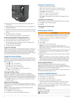
can cancel an SOS request after it is sent to the emergency response service. 1 Lift the protective cap, and hold the SOS button. 2 Select Garmin Explore app. Changes made to data such as collections, waypoints, routes, and tracks update automatically. You can now sync your data to your Montana 700i - Garmin Montana 750i | Owners Manual - Page 9
and History You can view plan details and data use on the Montana 700i/ 750i device. Viewing Plan Details 1 Select inReach > inReach optimal use on your map. When Off is selected, you must zoom in or out manually. Detail: Selects the amount of detail shown on the map. Showing more detail may cause - Garmin Montana 750i | Owners Manual - Page 10
. 2 Select Calibrate Compass > Start. 3 Follow the on-screen instructions. Heading Settings From the compass, select , and select Heading Setup. to the destination. Compass: Automatically switches from an electronic compass to a GPS compass when you are traveling at a higher rate of speed for a - Garmin Montana 750i | Owners Manual - Page 11
Allows you to manually calibrate the barometric instructions. Connected Features Connected features are available for your Montana GPS satellites and reduce the time it takes to get an initial GPS fix using the Garmin services to view live geocache data from www.geocaching.com using the Garmin - Garmin Montana 750i | Owners Manual - Page 12
to apps.garmin.com, and sign in. 3 Select a Connect IQ feature, and download it. 4 Follow the on-screen instructions. Garmin Explore The Garmin Explore Navigator® maps on the Montana 700i/750i device to search for addresses. You can purchase City Navigator maps for the Montana 700 device. See - Garmin Montana 750i | Owners Manual - Page 13
or marine services. For more information, go to buy.garmin.com or contact your Garmin dealer. Enabling data. When averaging, the device takes several GPS readings at the same location and uses the . 5 Select Start. 6 Follow the on-screen instructions. 7 When the confidence status bar reaches 100%, - Garmin Montana 750i | Owners Manual - Page 14
new name. Editing a Route 1 Select Route Planner. 2 Select a route. 3 Select Edit Route. 4 Select a point. 5 Select an option: • To view the point on the map, select Review. • To change the order of the points on the route, select Move Up or Move Down. • To insert an additional point on the route - Garmin Montana 750i | Owners Manual - Page 15
FIT option records your activity with fitness information that is tailored for the Garmin Connect application and can be used for navigation. The FIT and GPX and has acquired satellite signals. You can pause and start recording manually. 1 Select to open the status page. 2 Select Activity Recording - Garmin Montana 750i | Owners Manual - Page 16
This allows you to share your track wirelessly with other compatible Garmin devices. 1 Select Recorded Activities. 2 Select an activity. maps. inReach Weather: Your Montana 700i/750i can receive weather information for your current location, a waypoint, GPS coordinates, or a location you choose on - Garmin Montana 750i | Owners Manual - Page 17
weather location to view active weather for waypoints, GPS coordinates, or other locations. 1 While viewing list of adventures from the BaseCamp™ application (Garmin Adventures, page 14). Alarm Clock: Sets an inReach features are available only on the Montana 700i/750i device. inReach Remote: Allows - Garmin Montana 750i | Owners Manual - Page 18
GPS position. Trip Computer: Displays the trip computer (Trip Computer, page 6). Tracking: Allows you to record track points and transmit them over the Iridium satellite network (inReach Features, page 3). NOTE: inReach features are available only on the Montana 700i on-screen instructions to Garmin - Garmin Montana 750i | Owners Manual - Page 19
on your compatible handheld dog tracking device. See the owner's manual for your handheld dog tracking device for more information. 1 Place your handheld dog tracking device within 3 m (10 ft.) of your Montana device. TIP: Your Montana device receives data from one compatible device at a time. Stay - Garmin Montana 750i | Owners Manual - Page 20
Computer You can load geocaches manually onto your device using create an account. 4 Sign in. 5 Follow the instructions at geocaching.com to find and download geocaches to your Select Geocaching. 2 Select a geocache. 3 Select > Review Point. The geocache description and logs appear. Navigating to - Garmin Montana 750i | Owners Manual - Page 21
chirp is a small Garmin accessory that is programmed and only geocaches manually loaded on the Yes. 4 Wait while the Montana 700 device connects to your GPS accuracy, satellite locations, and signal strength. GPS Satellite Settings Select Satellite > . Use With GPS On: Allows you to turn the GPS - Garmin Montana 750i | Owners Manual - Page 22
GPS position using the Garmin AutoLocate® feature. Satellite Setup: Sets the satellite system options (Satellite Settings, page 19). Sending and Receiving Data Wirelessly Before you can share data wirelessly, you must be within 3 m (10 ft.) of a compatible Garmin instructions. Manual for Montana 700i - Garmin Montana 750i | Owners Manual - Page 23
navigation system data. Battery Type: Sets the battery type for the Montana 700 device. NOTE: This setting only appears when the optional AA battery pack is installed Overlay Service (WAAS/EGNOS). For more information about WAAS, go to garmin.com/aboutGPS. GPS and Other Satellite Systems Using GPS and - Garmin Montana 750i | Owners Manual - Page 24
collects fewer GPS track points. Instructions: Displays brief instructions accessory (Enabling chirp Searching, page 17). Program chirp: Programs the chirp accessory Montana 700i/750i device. NOTE: You can pair a compatible Garmin device and use it to remotely send messages from your Montana 700i - Garmin Montana 750i | Owners Manual - Page 25
for the device. Automatic sets the time zone automatically based on your GPS position. Daylight Saving Time: Sets the device to use daylight saving Sets the touchscreen sensitivity (Setting the Touchscreen Sensitivity, page 21). Review Text Size: Adjusts the size of the text. Scroll Controls: Adds - Garmin Montana 750i | Owners Manual - Page 26
instructions. Getting More Information You can find more information about this product on the Garmin website. • Go to support.garmin.com for additional manuals, articles, and software updates. • Go to buy.garmin.com, or contact your Garmin dealer for information about optional accessories and - Garmin Montana 750i | Owners Manual - Page 27
File Types The handheld device supports these file types: • Files from Garmin Explore. • GPX route and memory card appear as mounted volumes. NOTE: Some computers Garmin Connect 1 Connect the device to your computer using the USB cable. 2 Go to connect.garmin.com. 3 Follow the on-screen instructions - Garmin Montana 750i | Owners Manual - Page 28
Montana 700i/750i battery type Montana distance Wireless frequencies Up to 18 hr. in GPS mode Up to 2 wk. in expedition mode device must be connected to a cadence accessory for this data to appear. Calories: min. For more information, go to www.garmin.com/waterrating. 24 Course: The direction from - Garmin Montana 750i | Owners Manual - Page 29
device and only takes a few seconds when the accessories are activated and functioning correctly. • When paired, your Garmin device receives data from only your accessory, and you can go near other accessories. Troubleshooting Maximizing Battery Life You can do several things to extend the life - Garmin Montana 750i | Owners Manual - Page 30
Turn off wireless connectivity (Wi‑Fi Settings, page 20). • Turn off Bluetooth technology (Bluetooth Settings, page 19). • Turn off additional satellite systems (GPS and Other Satellite Systems, page 19). Restarting the Device If the device stops responding, you may need to restart it. This does not - Garmin Montana 750i | Owners Manual - Page 31
A accessories 20, Garmin Explore 23 Garmin Express 8, 22 updating software 22 geocaches 13, 15-17, 23 downloading 15, 16 navigating to 16 settings 20 GLONASS 19 GPS trip computer 6 trip information, viewing 6 trip planner. See routes troubleshooting 21, 22, 26 U units of measure 21 USB 19 connector - Garmin Montana 750i | Owners Manual - Page 32
W waypoints 2, 9 deleting 9 editing 9, 10 navigating 9 projecting 9 saving 9 weather 12, 13 inReach 12 map 12 radar 12 Weather 12 Where To? 8 Wi‑Fi 7 connecting 7, 8, 20 widgets 8 wireless headset 8 28 Index - Garmin Montana 750i | Owners Manual - Page 33
- Garmin Montana 750i | Owners Manual - Page 34
support.garmin.com August 2020 GUID-20A50E5B-3DFB-42C7-A3B4-8D55519B532C v1
-
 1
1 -
 2
2 -
 3
3 -
 4
4 -
 5
5 -
 6
6 -
 7
7 -
8
-
9
-
10
-
11
-
12
-
13
-
14
-
15
-
16
-
17
-
18
-
19
-
20
-
21
-
22
-
23
-
24
-
25
-
26
-
27
-
28
-
29
-
30
-
31
-
32
-
33
-
34
 |
 |
MONTANA
®
700
SERIES
Owner’s Manual