Garmin aera 500 Aviation Quick Reference Guide - Page 18
Map Range, Map Overlays
 |
View all Garmin aera 500 manuals
Add to My Manuals
Save this manual to your list of manuals |
Page 18 highlights
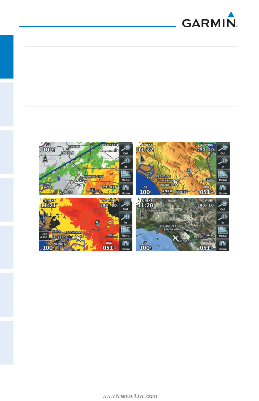
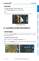
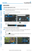
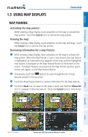
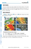
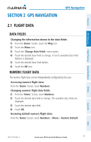
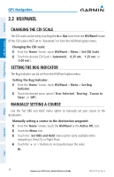
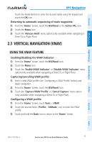
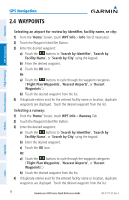
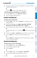
Overview GPS Navigation Hazard Avoidance Flight Planning Overview Map Range There are 23 different map ranges available, from 200 feet to 800 nm. The current map range is indicated in the lower right. The scale bar represents the map scale. To change the map range on any map, use the Out or In Icons to zoom 'out' (increasing), or zoom 'in' (decreasing). Map Overlays The ➊Weather, ➋Topography, ➌Terrain, and ➍Satellite Imagery map overlays can be displayed or removed. ➊ ➋ ➌ ➍ Displaying/removing map overlays: 1) From the 'Home' Screen, touch Map > Menu > Show/Hide. 2) Touch the 'Show/Hide' Data Option Button for the desired overlay. Satellite View only displays satellite imagery at and above the 20nm range. Below the 20nm range, 'no sat view' is displayed below the map range. Utilities Appendix Index 12 Garmin aera 500 Series Quick Reference Guide 190-01117-03 Rev. A
-
 1
1 -
2
-
3
-
4
-
5
-
6
-
7
-
8
-
9
-
10
-
11
-
12
-
 13
13 -
 14
14 -
 15
15 -
 16
16 -
 17
17 -
 18
18 -
 19
19 -
 20
20 -
 21
21 -
 22
22 -
 23
23 -
24
-
25
-
26
-
27
-
28
-
29
-
30
-
31
-
32
-
33
-
34
-
35
-
36
-
37
-
38
-
39
-
40
-
41
-
42
-
43
-
44
-
45
-
46
-
47
-
48
 |
 |