Garmin nuvi 1690 Owner's Manual - Page 24
Using the Pedestrian Map
 |
View all Garmin nuvi 1690 manuals
Add to My Manuals
Save this manual to your list of manuals |
Page 24 highlights
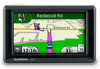
Using the Map Pages Using the Pedestrian Map Page ➊➋ ➊ ➌ ➍ In Pedestrian usage mode, your route is displayed on a two-dimensional map. The and icons indicate the navigation method for that section of the route. For example, when you see , board a bus at that point in the route. ➊ Touch to toggle between legs of the route. The nüvi zooms in and out on each leg of your route, but it does not automatically move to the next leg. ➋ Touch to view the route itinerary. ➌ Touch to zoom in and zoom out. ➍ Touch to recenter the map on your current location. 18 nüvi 1690 Owner's Manual
-
 1
1 -
2
-
3
-
4
-
5
-
6
-
7
-
8
-
9
-
10
-
11
-
12
-
13
-
14
-
15
-
16
-
17
-
18
-
 19
19 -
 20
20 -
 21
21 -
 22
22 -
 23
23 -
 24
24 -
 25
25 -
 26
26 -
 27
27 -
 28
28 -
 29
29 -
30
-
31
-
32
-
33
-
34
-
35
-
36
-
37
-
38
-
39
-
40
-
41
-
42
-
43
-
44
-
45
-
46
-
47
-
48
-
49
-
50
-
51
-
52
-
53
-
54
-
55
-
56
-
57
-
58
-
59
-
60
-
61
-
62
-
63
-
64
-
65
-
66
-
67
-
68
-
69
-
70
-
71
-
72
-
73
-
74
-
75
-
76
 |
 |

1µ
nüvi 1690 Owner’s Manual
Using the Map Pages
Using the Pedestrian
Map Page
➋
➊
➊
➌
➍
In Pedestrian usage mode, your route
is displayed on a two-dimensional
map. The
,
,
,
,
,
,
and
icons indicate the navigation
method for that section of the route.
For example, when you see
,
board a bus at that point in the route.
➊
Touch to toggle between
legs of the route. The nüvi
zooms in and out on each leg
of your route, but it does not
automatically move to the next
leg.
➋
Touch to view the route
itinerary.
➌
Touch to zoom in and zoom
out.
➍
Touch to recenter the map on
your current location.