LG LN835 Owners Manual - Page 28
too Iow'L - map update
 |
View all LG LN835 manuals
Add to My Manuals
Save this manual to your list of manuals |
Page 28 highlights
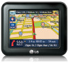
GPS tus The Navigator uses the GPS receiver to, pinpoint your location.. GPS signals are automatically aquired and your vehicle's location and position are constantly updated. The GPS receiver may' take a few minutes to find its initial location. For _st results, ensure that the GPS reviver has a clear ve_ical view of the sky. i . Touch Please check that: " The GPS .antenna has a clear view of the sky for uninterrupted GPS re_ptio, n. The navigator cannot calculate the route if there is no GPS re_ption (for example, in a tunnel). • The navigation ,device, is charged or connected to the cigarette lighter. Map up You can tap the "Mlap Setup" button to customize your map display, The following GPS information is displayed: _ _3_H_÷ The angular distance east o,r west on the ea_h's surface. IbaHtude: The location of a place north or south on the earth's surface. sp_: The rate of movement, as expressed by kilometers or miles per hour. _::_:_d_ The height above, sea level. Num You can check re_ption signals from the GPS satellite. _ Note If GPS signal can not _ dete_ed for a long time, please resta_ whole navigation system by pressing GPS not found When you first sta_ the navigator you will hear thie message "Signal too Iow'L This message means that your navigation device hasn't yet located a reliable GPS signal.. Ch_k that your device is connected to the cigarette lighter and has a clear view of the sky., The "GPS no€ found" message means that there is n,o GPS antenna ,or the antenna is not properly ins_lled. 2, Touch the desired item& When this option is sele_ed, the zoom is speed dependent. The map, zooms out at higher speeds, displaying a larger map area, and zooms in at slower speeds, displaying a smaller map area. If you manually change the zoom, the Automatic Zoom returns to a system defined zoom level after several seconds of inactivity. This opt:ion increases the size of street names to make the text easier to read. 3. Touch _.
-
 1
1 -
2
-
3
-
4
-
5
-
6
-
7
-
8
-
9
-
10
-
11
-
12
-
13
-
14
-
15
-
16
-
17
-
18
-
19
-
20
-
21
-
22
-
 23
23 -
 24
24 -
 25
25 -
 26
26 -
 27
27 -
 28
28 -
 29
29 -
 30
30 -
 31
31 -
 32
32 -
 33
33 -
34
-
35
-
36
-
37
-
38
-
39
-
40
-
41
-
42
-
43
-
44
-
45
-
46
-
47
-
48
-
49
-
50
 |
 |
