Lowrance HOOK Reveal 7 SplitShot HOOK Reveal X Series Operator Manual - Page 61
StructureMap, About StructureMap, The StructureMap image, StructureMap tips
 |
View all Lowrance HOOK Reveal 7 SplitShot manuals
Add to My Manuals
Save this manual to your list of manuals |
Page 61 highlights
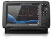
10 StructureMap About StructureMap The StructureMap feature overlays SideScan images from a SideScan source on the map. This makes it easier to visualize the underwater environment in relation to your position, and aids in interpreting SideScan images. Ú Note: SideScan is only available on TripleShot models with a SideScan capable transducer connected. The StructureMap image StructureMap can be displayed as an overlay on your GPS panel. When Structure overlay is selected in the GPS panel menu, the menu increases to show options for the Structure overlay. The example below shows a GPS panel with Structure overlay, combined with a traditional SideScan panel. You move around in the GPS panel as usual when you have a Structure overlay. Use the Zoom keys to zoom the GPS panel and the scanned image. StructureMap tips • To get a picture of taller structures (a wreck, etc.) - do not drive over it, instead, steer the boat so the structure is on the left or right side of your vessel. StructureMap | Hook Reveal X Series Operator Manual 61
-
 1
1 -
2
-
3
-
4
-
5
-
6
-
7
-
8
-
9
-
10
-
11
-
12
-
13
-
14
-
15
-
16
-
17
-
18
-
19
-
20
-
21
-
22
-
23
-
24
-
25
-
26
-
27
-
28
-
29
-
30
-
31
-
32
-
33
-
34
-
35
-
36
-
37
-
38
-
39
-
40
-
41
-
42
-
43
-
44
-
45
-
46
-
47
-
48
-
49
-
50
-
51
-
52
-
53
-
54
-
55
-
 56
56 -
 57
57 -
 58
58 -
 59
59 -
 60
60 -
 61
61 -
 62
62 -
 63
63 -
 64
64 -
 65
65 -
 66
66 -
67
-
68
-
69
-
70
-
71
-
72
-
73
-
74
-
75
-
76
-
77
-
78
 |
 |
