Uniden SDS200 English Owner Manual - Page 28
Understanding Location, Range, And Services
 |
View all Uniden SDS200 manuals
Add to My Manuals
Save this manual to your list of manuals |
Page 28 highlights
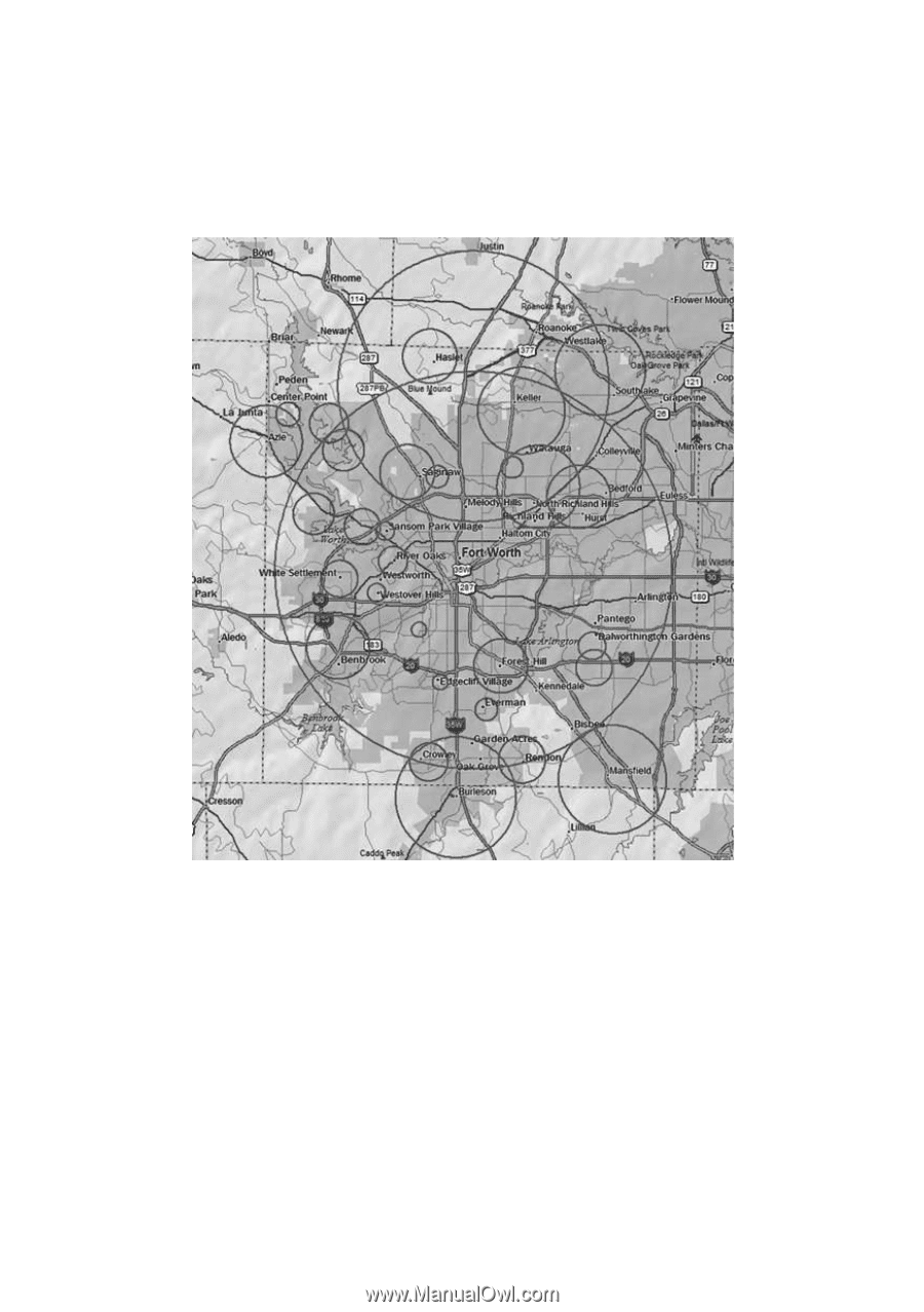
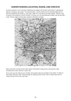
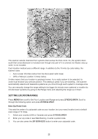
UNDERSTANDING LOCATION, RANGE, AND SERVICES All radio systems in your scanner's database are tagged with location information. A geotag has latitude, longitude, and range. This tag describes a circle centered at the latitude/longitude that fully encompasses the entity (i.e. city, town, state, etc.) served by the radio system. Taking a look at some of the systems in the Fort Worth, TX area, you can see that each system has its own little circle. These roughly outline each system's intended coverage. Each entry also includes all the radio system information (frequencies, descriptions, tags indicating how each channel is used, etc). If you use your zip code as your location, the scanner sets your location to be within 10 miles of the center of the zip code. Good enough for catching local comms. We've drawn that circle in using a thicker line on the next map. 22
-
 1
1 -
2
-
3
-
4
-
5
-
6
-
7
-
8
-
9
-
10
-
11
-
12
-
13
-
14
-
15
-
16
-
17
-
18
-
19
-
20
-
21
-
22
-
 23
23 -
 24
24 -
 25
25 -
 26
26 -
 27
27 -
 28
28 -
 29
29 -
 30
30 -
 31
31 -
 32
32 -
 33
33 -
34
-
35
-
36
-
37
-
38
-
39
-
40
-
41
-
42
-
43
-
44
-
45
-
46
-
47
-
48
-
49
-
50
-
51
-
52
-
53
-
54
-
55
-
56
-
57
-
58
-
59
-
60
-
61
-
62
-
63
-
64
-
65
-
66
-
67
-
68
 |
 |