Garmin 010-10680-50 Blue Chart User's Guide - Page 4
BlueChart User's Guide, Maritime Safety Queensland - part number
 |
UPC - 753759066451
View all Garmin 010-10680-50 manuals
Add to My Manuals
Save this manual to your list of manuals |
Page 4 highlights
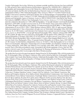
Thanet District Council (Ramsgate), Torbay Council Marine Services (Tor Bay; Torquay, Brixham, Paignton), Warrenpoint Harbour Authority, Weymouth & Portland Borough Council, and Whitstable Harbour. For Channel Islands: Jersey Harbours and States of Guernsey Harbour Authority. For Isle of Man: Isle of Man Harbours Division. For Republic of Ireland: Bantry Bay Harbour Commissioners, Drogheda Port Company, Dublin Port Company, Dun Laoghaire Harbour Company, and Port of Cork Company. © the British Crown, 2001-2008. All rights reserved. Some data and information contained in these Products are © Commonwealth of Australia, Australia Hydrographic Service, Maritime Safety Queensland and is © State of Queensland; © Crown in Right of the State of Western Australia; and is used under licence with the permission of the Crown in right of the State of Western Australia. Certain zoning information in this product is © Great Barrier Reef Marine Park Authority; and is used under license with the permission of the Great Barrier Reef Marine Park Authority. All rights reserved. Apart from the uses permitted to the licensee under the license, the information may not be modified or exploited by reverse engineering of formats and encryption or copied, reproduced, translated, or reduced to any electronic medium or machine readable form, in whole or part, without the prior written consent of the Great Barrier Reef Marine Park Authority, the Maritime Safety Queensland, and the Crown in right of the State of Western Australia.. Garmin International, Inc. is an authorized user and licensee of selected Australia Hydrographic Service data products under licensing agreement 0548FL. Apart from the uses permitted to the licensee under the licensing Agreements, the information may not be modified or exploited by reverse engineering of formats or encryption or copied, reproduced, translated or reduced to any electronic medium or machine readable form, in whole or part. Reeds Almanacs port services data contained in this product is © 2004-2008 Adlard Coles Nautical; Certain port services data contained in this product is © 2005-2008 Batmagasinet; ©Boatharbour Group, Finland; Certain port services data contained in this product is © 2006-2008 Boatlaunch Ltd.; © 2005-2008 BLOC MARINE Almanac & Cruising Guide; © 2004-2008 Bolina - Editrice Incontri Nautici; © 2005-2008 Gasthamnsguiden SXK AB; and © 2005-2008 Kort & Matrikelstyrelsen; The Explorer Charts logo is a registered trademark of Lewis Offshore Ltd., publishers of the Explorer Chartbook series; Some data and information contained in this Product are © 2008 Nautical Data International, Inc. Garmin International, Inc. is an authorized user and Licensee of selected Nautical Data International Inc. data products under Licensing Agreement number 0021704-087; Photos © 2008 CMT Group 1, Inc. and Garmin International, Inc. ** BlueChart g2 does not contain photos for all cards. Garmin is continuing to expand our growing database of navigationally significant photos. ** Navteq road data is included for many BlueChart g2 data cards. Not all data cards contain road data. ©2005-2008 Navteq. All rights reserved. ** Whereis® Map data is included in Australia BlueChart g2 data cards. Whereis © 2008 Telstra Corporation Limited and its licensors. WARNING: No national hydrographic office (HO), State Authority, and their licensors have verified the information in this product or quality assured it, and none accept liability for the accuracy of reproduction or any modifications made thereafter. No national hydrographic office and their licensors makes any warranties or representations, express or implied, with respect to this product. No national hydrographic office warrants that the product satisfies national or international regulations regarding the use of the appropriate products for navigation or that it contains the latest hydrographic information available. WARNING: All charts are digitized directly from existing government and other official charts and should not be used solely for navigation. Digital charts are intended to be used as an aid to traditional navigational charts, not as a replacement. Only official government charts and notices to mariners contain all information needed for the safety of navigation, and as always, the captain is responsible for their prudent use. A prudent navigator never relies on any single source of navigational information. Garmin strives to provide its customers with the most economical, accurate and up-to-date electronic maps available. However, features are continually changing, so the data may not reflect the latest modifications and/or additions in your area. Garmin makes no warranty as to the accuracy or completeness of the map data. iv BlueChart User's Guide
-
 1
1 -
 2
2 -
 3
3 -
 4
4 -
 5
5 -
 6
6 -
 7
7 -
 8
8 -
 9
9 -
 10
10 -
11
-
12
-
13
-
14
-
15
-
16
-
17
-
18
-
19
-
20
-
21
-
22
-
23
-
24
-
25
-
26
-
27
-
28
 |
 |
