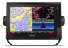
Garmin GPSMAP 1222 Touch Owners Manual - Page 35
Creating a Waypoint on the Sonar Screen
 |
View all Garmin GPSMAP 1222 Touch manuals
Add to My Manuals
Save this manual to your list of manuals |
Page 35 highlights
Structure Fish FrontVü Sonar View The Panoptix FrontVü sonar view increases your situational awareness by showing obstructions under the water, up to 91 meters (300 feet) in front of the boat. The ability to effectively avoid forward collisions with FrontVü sonar decreases as your speed rises above 8 knots. To see the FrontVü sonar view, you must install and connect a compatible transducer, such as a PS21 transducer. You may need to update the transducer software. • From a sonar view, select Menu > Sonar Setup > Installation > Transducers. • Select Settings > My Vessel > Transducers. 2 Select an option: • To enable the chartplotter to detect the transducer automatically, select the transducer to change, and select Auto Detect. • To select the transducer manually, select the transducer to change, select the transducer model from the list, and select Change Model. NOTE: If you select the transducer manually, disconnect that transducer, and then connect a different transducer, you should reset this option to Auto Detect. Panoptix LiveScope™ Sonar View This sonar view shows a live view of what is in front of or below the boat and can be used to see fish and structures. Depth information Suspended targets or fish Bottom of the body of water Perspective View This sonar view shows a live view of what is around and ahead of your boat and can be used to see shorelines, fish, and structures. This view is best used in shallow water of 50 feet (15 meters) or less. To see this sonar view, you must install a Panoptix LiveScope transducer on a Perspective Mode Mount (010-12970-00). Selecting a Sonar Source This feature may not be available with all models. When you are using more than one sonar data source for a particular sonar view, you can select the source to use for that sonar view. For example, if you have two sources for Garmin ClearVü, you can select the source to use from the Garmin ClearVü sonar view. 1 Open the sonar view for which you will change the source. 2 Select Menu > Sonar Setup > Source. 3 Select the source for this sonar view. Renaming a Sonar Source You can rename a sonar source to easily identify that source. For example, you use "Bow" as the name of the transducer on the bow of your boat. To rename a source, you must be in the applicable sonar view for the source. For example, to rename the Garmin ClearVü sonar source, you must open the Garmin ClearVü sonar view. 1 From the sonar view, select Menu > Sonar Setup > Source > Rename Sources. 2 Enter the name. Creating a Waypoint on the Sonar Screen 1 From a sonar view, drag the screen or select . 2 Select a location. 3 Select . 4 If necessary, edit the waypoint information. Pausing the Sonar Display From a sonar view, select . Viewing Sonar History You can scroll the sonar display to view historical sonar data. NOTE: Not all transducers save historical sonar data. 1 From a sonar view, drag the screen to the right. 2 Select Back to exit history. Selecting the Transducer Type This chartplotter is compatible with a range of accessory transducers, including the Garmin ClearVü™ transducers, which are available at garmin.com/transducers. If you are connecting a transducer that was not included with the chartplotter, you may need to set the transducer type to make the sonar function properly. NOTE: Not all chartplotters and sonar modules support this feature. 1 Complete an action: Sonar Sharing You can view the sonar data from all compatible sources on the Garmin Marine Network. You can view sonar data from a compatible external sonar module, such as a GCV™ sonar module. In addition, you can view the sonar data from other chartplotters that have a built-in sonar module. Each chartplotter on the network can display sonar data from every compatible sonar module and transducer on the network, no matter where the chartplotters and transducers are mounted on your boat. For example, from one GPSMAP 922 Plus device mounted at the back of the boat, you can view the sonar data from another GPSMAP device and Garmin ClearVü transducer mounted at the front of your boat. Sonar Fishfinder 27
-
 1
1 -
2
-
3
-
4
-
5
-
6
-
7
-
8
-
9
-
10
-
11
-
12
-
13
-
14
-
15
-
16
-
17
-
18
-
19
-
20
-
21
-
22
-
23
-
24
-
25
-
26
-
27
-
28
-
29
-
 30
30 -
 31
31 -
 32
32 -
 33
33 -
 34
34 -
 35
35 -
 36
36 -
 37
37 -
 38
38 -
 39
39 -
 40
40 -
41
-
42
-
43
-
44
-
45
-
46
-
47
-
48
-
49
-
50
-
51
-
52
-
53
-
54
-
55
-
56
-
57
-
58
-
59
-
60
-
61
-
62
-
63
-
64
-
65
-
66
-
67
-
68
-
69
-
70
-
71
-
72
-
73
-
74
-
75
-
76
-
77
-
78
-
79
-
80
 |
 |
