Garmin GPSMAP 1242xsv Touch Owners Manual - Page 41
Radar Interpretation
 |
View all Garmin GPSMAP 1242xsv Touch manuals
Add to My Manuals
Save this manual to your list of manuals |
Page 41 highlights
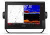
Panoptix transducer automatically. When this setting is turned off, you can enter the specific installation angle for the transducer using the Pitch Angle setting. Many forward view transducers are installed at a 45-degree angle and down view transducers are installed at a zero-degree angle. Flipped: Sets the orientation of the Panoptix sonar view when the down view transducer is installed with the cables pointing toward the port side of the boat. This applies to Panoptix transducers in the LiveVü Down, RealVü 3D Down, and RealVü 3D Historical sonar views. Calibrate Compass: Calibrates the internal compass in the Panoptix transducer (Calibrating the Compass, page 33). This applies to Panoptix transducers with an internal compass, such as the PS21-TR transducer. Orientation: Controls if the transducer is in down or forward installation mode. The Auto setting uses the AHRS sensor to determine the orientation. This applies to PS22 and LiveScope transducers. Focus: Adjusts the sonar view to compensate for the speed of sound in water. The Auto setting uses the temperature of the water to calculate the speed of sound. This applies to LiveScope transducers. Restore Sonar Defaults: Restores the sonar settings to the factory default values. Setting the Bow Offset For forward view Panoptix transducers, you can enter a bow offset to compensate the forward distance readings for the transducer installation location. This allows you to view the forward distance from the bow instead of the transducer installation location. This feature applies to Panoptix transducers in the FrontVü, LiveVü Forward, and RealVü 3D Forward sonar views. 1 Measure the horizontal distance from the transducer to the bow. NOTE: To use the compass, you must mount the transducer on the transom or the trolling motor shaft. The compass may not work when you mount the transducer on the motor. NOTE: For best results, you should use a heading sensor such as the SteadyCast™ heading sensor. The heading sensor shows the direction the transducer is pointing relative to the boat. NOTE: Compass calibration is available only for transducers with an internal compass, such as the PS21-TR transducer. You can begin turning your boat before calibrating, but you must fully rotate your boat 1.5 times during calibration. 1 From an applicable sonar view, select Menu > Sonar Setup > Installation. 2 If necessary, select Use AHRS to turn on the AHRS sensor. 3 Select Calibrate Compass. 4 Follow the on-screen instructions. Radar WARNING The marine radar transmits microwave energy that has the potential to be harmful to humans and animals. Before beginning radar transmission, verify that the area around the radar is clear. The radar transmits a beam approximately 12° above and below a line extending horizontally from the center of the radar. To avoid possible personal injury, do not look directly at the antenna at close range when the radar is transmitting. Eyes are the most sensitive part of the body to electromagnetic energy. When you connect your compatible chartplotter to an optional Garmin marine radar, such as a GMR™ Fantom™ 6 radar or a GMR 24 xHD, you can view more information about your surroundings. The radar transmits a narrow beam of microwave energy as it rotates to a 360° pattern. When the transmitted energy contacts a target, some of that energy is reflected back to the radar. 2 From an applicable sonar view, select Menu > Sonar Setup > Installation > Bow Offset. 3 Enter the distance measured, and select Done. On the applicable sonar view, the forward range shifts by the distance you entered. Calibrating the Compass Before you can calibrate the compass, the transducer must be installed on the shaft far enough away from the trolling motor to avoid magnetic interference, and deployed in the water. Calibration must be of sufficient quality to enable the internal compass. Radar Interpretation Reading and interpreting the radar display takes practice. The more you use the radar, the better you will become at relying on the radar display when you really need it. Radar can be useful in many situations, such as avoiding collisions when you have limited visibility, for example when it is dark or foggy, tracking weather, seeing what is ahead of you, and locating birds and fish. The radar overlay feature can help you interpret the radar display more easily, because it overlays the radar returns on top of the chart. This can help you identify the difference between a radar return of a land mass, bridge, or rain cloud. Showing the AIS vessels on the radar overlay can also help you identify features on the radar display. In the screenshot below, the radar overlay is turned on. This screen also shows a video feed. We can easily identify a few items on the radar screen. Radar 33
-
 1
1 -
2
-
3
-
4
-
5
-
6
-
7
-
8
-
9
-
10
-
11
-
12
-
13
-
14
-
15
-
16
-
17
-
18
-
19
-
20
-
21
-
22
-
23
-
24
-
25
-
26
-
27
-
28
-
29
-
30
-
31
-
32
-
33
-
34
-
35
-
 36
36 -
 37
37 -
 38
38 -
 39
39 -
 40
40 -
 41
41 -
 42
42 -
 43
43 -
 44
44 -
 45
45 -
 46
46 -
47
-
48
-
49
-
50
-
51
-
52
-
53
-
54
-
55
-
56
-
57
-
58
-
59
-
60
-
61
-
62
-
63
-
64
-
65
-
66
-
67
-
68
-
69
-
70
-
71
-
72
-
73
-
74
-
75
-
76
-
77
-
78
-
79
-
80
 |
 |
