Garmin GPSMAP 4010 Owner's Manual - Page 21
Enabling High-Resolution Satellite Imagery, Chart Setup, Photos, Land Only, Photo Map
 |
View all Garmin GPSMAP 4010 manuals
Add to My Manuals
Save this manual to your list of manuals |
Page 21 highlights
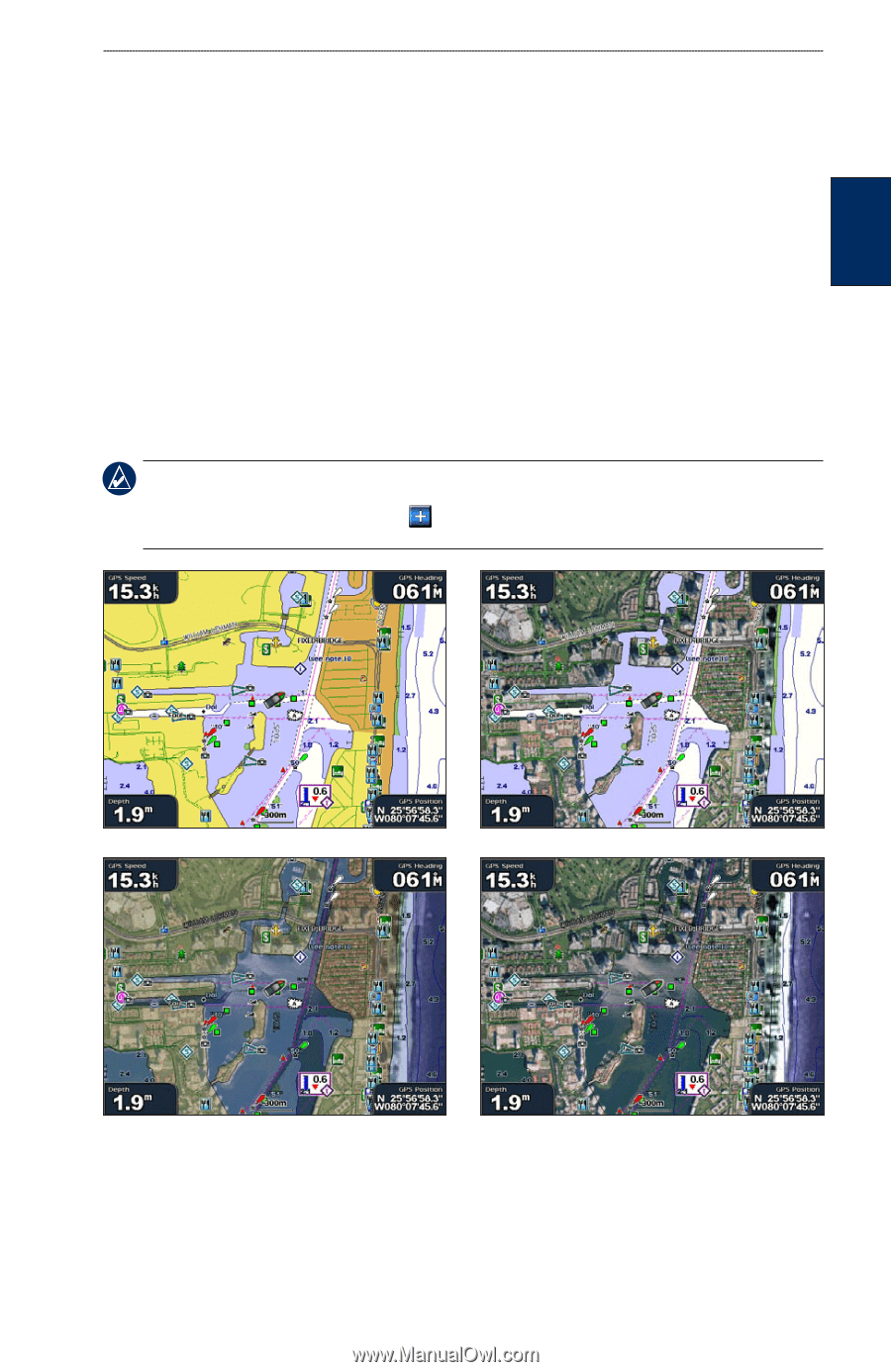
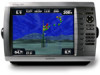
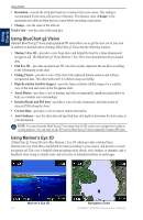
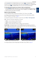
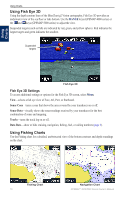
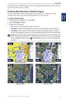
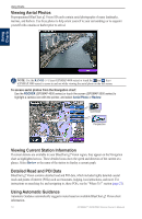
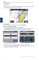
Using Charts Using Charts The Fishing chart uses detailed bathymetric data on a preprogrammed BlueChart g2 Vision SD card, and is best for offshore deep-sea fishing. Enabling High-Resolution Satellite Imagery You can overlay high-resolution satellite images on the land, the sea, or both portions of the Navigation chart when using a preprogrammed BlueChart g2 Vision SD card. To enable satellite imagery: 1. While viewing the Navigation chart, select Menu. 2. Select Chart Setup > Photos. 3. Select one of the following: • Off-standard chart information is shown on the map. • Land Only-standard chart information is shown on water with photos overlaying the land. • Photo Map-photos overlay both the water and the land at a specified opacity. The higher you set the percentage of opacity, the more the satellite photos will cover both land and water. NOTE: When enabled, the high-resolution satellite images are present only at lower zoom levels. If you cannot see the high-resolution images in your BlueChart g2 Vision region, zoom in using the RANGE (+) key (GPSMAP 4000 series) or touch (GPSMAP 5000 series). You can also try setting the detail level higher. Photo Overlay Off Land Only Photo Overlay Blend at 50% Blend at 100% GPSMAP® 4000/5000 Series Owner's Manual 17
-
 1
1 -
2
-
3
-
4
-
5
-
6
-
7
-
8
-
9
-
10
-
11
-
12
-
13
-
14
-
15
-
 16
16 -
 17
17 -
 18
18 -
 19
19 -
 20
20 -
 21
21 -
 22
22 -
 23
23 -
 24
24 -
 25
25 -
 26
26 -
27
-
28
-
29
-
30
-
31
-
32
-
33
-
34
-
35
-
36
-
37
-
38
-
39
-
40
-
41
-
42
-
43
-
44
-
45
-
46
-
47
-
48
-
49
-
50
-
51
-
52
-
53
-
54
-
55
-
56
-
57
-
58
-
59
-
60
-
61
-
62
-
63
-
64
-
65
-
66
-
67
-
68
 |
 |