Garmin GPSMAP 540 Owner's Manual - Page 72
Viewing Sea Conditions, Viewing Fish Forecasting, Understanding Surface Winds
 |
UPC - 753759065966
View all Garmin GPSMAP 540 manuals
Add to My Manuals
Save this manual to your list of manuals |
Page 72 highlights
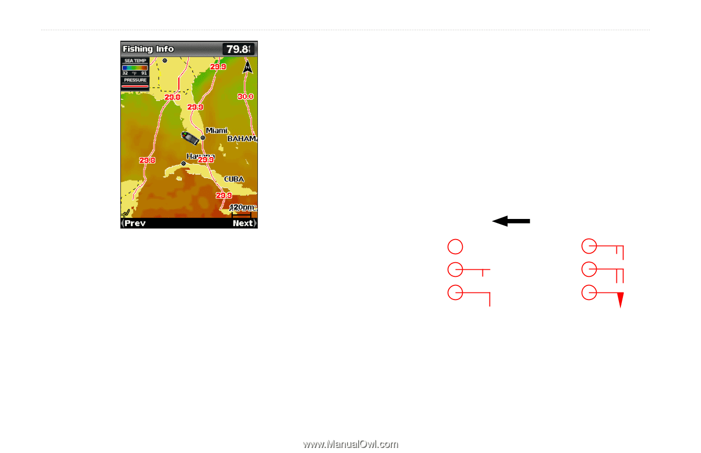
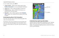
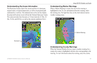
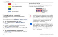
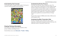
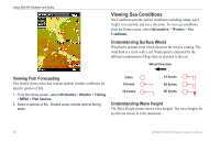
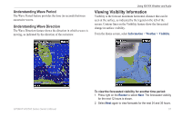
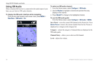
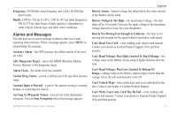
Using XM WX Weather and Audio Viewing Sea Conditions Sea Conditions provide surface conditions including winds, wave height, wave period, and wave direction. To view sea conditions, from the Home screen, select Information > Weather > Sea Conditions. Understanding Surface Winds Wind barbs indicate from which direction the wind is coming. The wind barb is a circle with a tail. Wind speed is indicated by the different combination of flags that are attached to the tail. Wind Direction Viewing Fish Forecasting This feature shows areas that contain optimal weather conditions for specific species of fish. 1. From the Home screen, select Information > Weather > Fishing > MENU > Fish Species. 2. Select a species of fish. Shaded areas indicate optimal fishing areas. Calm 5 knots 10 knots 15 knots 20 knots 50 knots Understanding Wave Height The Wave Height feature shows wave heights. The wave heights for an area are shown in color intensities. 66 GPSMAP 400/500 Series Owner's Manual
-
 1
1 -
2
-
3
-
4
-
5
-
6
-
7
-
8
-
9
-
10
-
11
-
12
-
13
-
14
-
15
-
16
-
17
-
18
-
19
-
20
-
21
-
22
-
23
-
24
-
25
-
26
-
27
-
28
-
29
-
30
-
31
-
32
-
33
-
34
-
35
-
36
-
37
-
38
-
39
-
40
-
41
-
42
-
43
-
44
-
45
-
46
-
47
-
48
-
49
-
50
-
51
-
52
-
53
-
54
-
55
-
56
-
57
-
58
-
59
-
60
-
61
-
62
-
63
-
64
-
65
-
66
-
 67
67 -
 68
68 -
 69
69 -
 70
70 -
 71
71 -
 72
72 -
 73
73 -
 74
74 -
 75
75 -
 76
76 -
 77
77 -
78
-
79
-
80
-
81
-
82
-
83
-
84
-
85
-
86
-
87
-
88
 |
 |