Garmin GPSMAP 546S Owner's Manual - Page 28
Using Automatic Guidance, Using the Chart/Sonar Screen, Automatic Identification System - with transducer
 |
UPC - 753759096168
View all Garmin GPSMAP 546S manuals
Add to My Manuals
Save this manual to your list of manuals |
Page 28 highlights
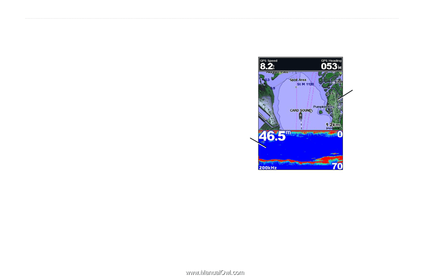
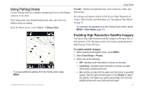
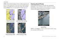
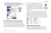
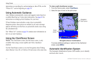
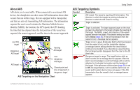
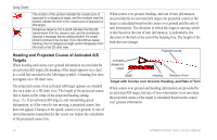
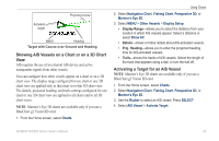
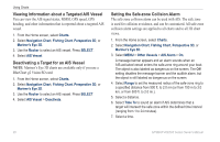
Using Charts instructions on searching for, and navigating to, these POIs, see the "Where To?" section beginning on page 28. Using Automatic Guidance Auto Guidance automatically creates and suggests routes based on available BlueChart g2 Vision chart information. See page 49 for instructions on setting up Auto Guidance for your boat. If Auto Guidance must calculate a route close to potentially dangerous points, those points are outlined in red, and a message appears informing you that there are potentially unsafe areas along the calculated route. The "Where To?" section on page 28 contains more information on how to use Auto Guidance. To view a split chart/sonar screen: 1. From the Home screen, select Chart/Sonar. 2. Select the type of chart on the split screen. Navigation chart screen Sonar screen Using the Chart/Sonar Screen Note: The Chart/Sonar screen, like the Sonar screen, is only available when using a sonar-capable unit with a transducer attached. Use the Chart/Sonar screen to view the Navigation chart, Fishing chart, Mariner's Eye 3D, or Fish Eye 3D and sonar at the same time. Navigation/Sonar Combination To access additional settings or options for the chart/sonar screen, press MENU. Automatic Identification System The Automatic Identification System (AIS) enables you to identify and track other vessels. 22 GPSMAP 400/500 Series Owner's Manual
-
 1
1 -
2
-
3
-
4
-
5
-
6
-
7
-
8
-
9
-
10
-
11
-
12
-
13
-
14
-
15
-
16
-
17
-
18
-
19
-
20
-
21
-
22
-
 23
23 -
 24
24 -
 25
25 -
 26
26 -
 27
27 -
 28
28 -
 29
29 -
 30
30 -
 31
31 -
 32
32 -
 33
33 -
34
-
35
-
36
-
37
-
38
-
39
-
40
-
41
-
42
-
43
-
44
-
45
-
46
-
47
-
48
-
49
-
50
-
51
-
52
-
53
-
54
-
55
-
56
-
57
-
58
-
59
-
60
-
61
-
62
-
63
-
64
-
65
-
66
-
67
-
68
-
69
-
70
-
71
-
72
-
73
-
74
-
75
-
76
-
77
-
78
-
79
-
80
-
81
-
82
-
83
-
84
-
85
-
86
-
87
-
88
-
89
-
90
-
91
-
92
-
93
-
94
-
95
-
96
 |
 |