Garmin GPSMAP 820 Owner's Manual - Page 12
Chart and 3D Chart View Settings
 |
View all Garmin GPSMAP 820 manuals
Add to My Manuals
Save this manual to your list of manuals |
Page 12 highlights
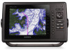
Turning Off AIS Reception AIS signal reception is turned on by default. Select Settings > Other Vessels > AIS > Off. All AIS functionality on all charts and 3D chart views is disabled. This includes AIS vessel targeting and tracking, collision alarms that result from AIS vessel targeting and tracking, and the display of information about AIS vessels. Chart and 3D Chart View Settings NOTE: Not all settings apply to all charts and 3D chart views. Some options require premium maps or connected accessories, such as radar. These settings apply to the charts and 3D chart views, except the radar overlay and Fish Eye 3D (Fish Eye 3D Settings). From a chart or a 3D chart view, select MENU. Waypoints & Tracks: See Waypoints and Tracks Settings on the Charts and Chart Views. Other Vessels: See Other Vessels Settings on the Charts and Chart Views. Surface Radar: Shows surface radar details on the Perspective 3D or Mariner's Eye 3D chart views. Weather Radar: Shows weather radar imaging on the Perspective 3D or Mariner's Eye 3D chart views. Navaids: Shows navigational aids on the Fishing chart. Laylines: Adjusts the laylines, when in sailing mode (Laylines Settings). Chart Setup: See Navigation and Fishing Chart Setup. Overlay Numbers: See Overlay Numbers Settings. This might appear in the Chart Setup menu. Chart Appearance: See Chart Appearance Settings. This might appear in the Chart Setup menu. Waypoints and Tracks Settings on the Charts and Chart Views From a chart or a 3D chart view, select MENU > Waypoints & Tracks. Tracks: Shows tracks on the chart or 3D chart view. Waypoints: Shows the Waypoints list (Viewing a List of all Waypoints). New Waypoint: Creates a new waypoint. Waypoint Display: Sets how to display waypoints on the chart. Active Tracks: Shows the active track options menu. Saved Tracks: Shows the list of saved tracks (Viewing a List of Saved Tracks). Tracks Display: Sets which tracks to display on the chart based on track color. Other Vessels Settings on the Charts and Chart Views NOTE: These options require connected accessories, such as an AIS receiver or VHF radio. From a chart or 3D chart view, select MENU > Other Vessels. AIS List: Shows the AIS list (Viewing a List of AIS Threats). DSC List: Shows the DSC list (DSC List). AIS Display Setup: See AIS Display Settings. DSC Trails: Shows the tracks of DSC vessels, and selects the length of the track that appears using a trail. AIS Alarm: Sets the safe-zone collision alarm (Setting the Safe- Zone Collision Alarm). AIS Display Settings NOTE: AIS requires the use of an external AIS device and active transponder signals from other vessels. From a chart or 3D chart view, select MENU > Other Vessels > AIS Display Setup. AIS Dis. Range: Indicates the distance from your location within which AIS vessels appear. Details: Shows details about AIS-activated vessels. Proj. Heading: Sets the projected heading time for AIS- activated vessels. Trails: Shows the tracks of AIS vessels, and select the length of the track that appears using a trail. Laylines Settings When in sailing mode (Setting the Vessel Type), you can display laylines on the navigation chart. Laylines can be especially helpful when racing. From the navigation chart, select MENU. Display: Adjusts how the laylines and vessel are shown on the chart, and adjusts the length of the laylines. Sailing Angle: Allows you to select how the device calculates laylines. The Actual setting calculates the laylines by using the measured wind angle from the wind sensor. The Manual setting calculates the laylines by using manually entered windward and leeward angles. Tide Correction: Corrects the laylines based on the tide. Navigation and Fishing Chart Setup NOTE: Not all settings apply to all charts and 3D chart views. Some settings require external accessories or applicable premium charts. From the Navigation chart or Fishing chart, select MENU > Chart Setup. Satellite Photos: Shows high-resolution satellite images on the land or on both land and sea portions of the Navigation chart, when certain premium maps are used (Showing Satellite Imagery on the Navigation Chart). Tides & Currents: Shows current station indicators and tide station indicators on the chart (Showing and Configuring Tides and Currents). Roses: Shows a compass rose around your boat, indicating compass direction oriented to the heading of the boat. A true wind direction or apparent wind direction indicator appears if the chartplotter is connected to a compatible marine wind sensor. When in sailing mode, true and apparent wind are shown on the wind rose. Weather: Sets which weather items are shown on the chart, when the chartplotter is connected to a compatible weather receiver with an active subscription. Lake Level: Allows you to enter the present level of the lake. Overlay Numbers: See Overlay Numbers Settings. Chart Appearance: See Chart Appearance Settings. Overlay Numbers Settings From a chart, 3D chart view, the Radar screen, or a Combinations screen, select MENU > Overlay Numbers. Edit Layout: Sets the layout of the data overlay, or data fields. You can select the data to be shown within each data field. Nav. Inset: Shows the navigation inset when the vessel is navigating to a destination. Navigation Inset Setup: Allows you to configure the navigation inset to show Route Leg Details, and to control when the inset appears before a turn or destination. Compass Tape: Shows the compass tape data bar when the vessel is navigating to a destination. Editing the Data Fields You can change the data shown in the overlay numbers displayed on the charts and other screens. 1 From a screen that supports overlay numbers, select MENU. 6 Charts and 3D Chart Views
-
 1
1 -
2
-
3
-
4
-
5
-
6
-
 7
7 -
 8
8 -
 9
9 -
 10
10 -
 11
11 -
 12
12 -
 13
13 -
 14
14 -
 15
15 -
 16
16 -
 17
17 -
18
-
19
-
20
-
21
-
22
-
23
-
24
-
25
-
26
-
27
-
28
-
29
-
30
-
31
-
32
-
33
-
34
-
35
-
36
-
37
-
38
-
39
-
40
 |
 |
