Garmin eTrex 30 Owner's Manual - Page 34
Heading Settings, Altimeter Settings, Go To Line Pointer
 |
View all Garmin eTrex 30 manuals
Add to My Manuals
Save this manual to your list of manuals |
Page 34 highlights
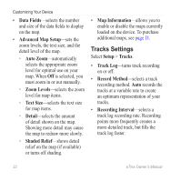
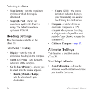
Customizing Your Device • Map Datum-sets the coordinate system on which the map is structured. • Map Spheroid-shows the coordinate system the device is using. The default coordinate system is WGS 84. Heading Settings This function is available on the eTrex 30. Select Setup > Heading. • Display-sets the type of directional heading on the compass. • North Reference-sets the north reference of the compass. • Go To Line (Pointer)-allows you to select how the course appears. ◦◦ Bearing (Small or Large)- sets the direction to your destination. ◦◦ Course (CDI)-the course deviation indicator displays your relationship to a course line leading to a destination. • Compass-switches from an electronic compass to a GPS compass when you are traveling at a higher rate of speed for a set period of time (Auto), or turns the compass off. • Calibrate Compass-page 17. Altimeter Settings This function is available on the eTrex 30. Select Setup > Altimeter. • Auto Calibration-allows the altimeter to self-calibrate each time you turn the device on. 34 eTrex Owner's Manual
-
 1
1 -
2
-
3
-
4
-
5
-
6
-
7
-
8
-
9
-
10
-
11
-
12
-
13
-
14
-
15
-
16
-
17
-
18
-
19
-
20
-
21
-
22
-
23
-
24
-
25
-
26
-
27
-
28
-
 29
29 -
 30
30 -
 31
31 -
 32
32 -
 33
33 -
 34
34 -
 35
35 -
 36
36 -
 37
37 -
 38
38 -
 39
39 -
40
-
41
-
42
-
43
-
44
-
45
-
46
-
47
-
48
-
49
-
50
-
51
-
52
-
53
-
54
-
55
-
56
-
57
-
58
-
59
-
60
 |
 |