Lowrance Elite-7 Ti Operators Manual EN - Page 29
Chart data, Selecting chart type, Vessel symbol, Chart scale - gps
 |
View all Lowrance Elite-7 Ti manuals
Add to My Manuals
Save this manual to your list of manuals |
Page 29 highlights
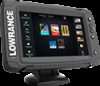
* Optional chart items. You turn the optional chart items on/off individually from the Chart settings dialog. Chart data The system is delivered with different embedded cartography depending on region. All units support Insight charts from Navico including Insight Genesis. The system also supports charts from Navionics and Jeppesen as well as content created by a variety of third party mapping providers in the AT5 format. For a full selection of available charts, visit gofreeshop.com, c-map.jeppesen.com, or navionics.com. Ú Note: In this manual, all possible chart menu options are described. These options vary depending on the chart you are using. Ú Note: The system does not automatically switch to embedded cartography if the chart card is removed. A lowresolution chart will be displayed until you re-insert the card or manually switch back to the embedded cartography. Selecting chart type You specify the chart type in the Chart panel by selecting one of the available chart types in the chart source menu option. Vessel symbol When the system has a valid GPS position lock, the vessel symbol indicates vessel position. If no GPS position is available, the vessel symbol includes a question mark. Ú Note: Without a heading sensor on the network, the vessel icon orientates itself using COG (Course over Ground). Chart scale You zoom in and out on the chart by using the zoom (+ or -) buttons or the + and - keys. Charts | ELITE Ti Operator Manual 29
-
 1
1 -
2
-
3
-
4
-
5
-
6
-
7
-
8
-
9
-
10
-
11
-
12
-
13
-
14
-
15
-
16
-
17
-
18
-
19
-
20
-
21
-
22
-
23
-
 24
24 -
 25
25 -
 26
26 -
 27
27 -
 28
28 -
 29
29 -
 30
30 -
 31
31 -
 32
32 -
 33
33 -
 34
34 -
35
-
36
-
37
-
38
-
39
-
40
-
41
-
42
-
43
-
44
-
45
-
46
-
47
-
48
-
49
-
50
-
51
-
52
-
53
-
54
-
55
-
56
-
57
-
58
-
59
-
60
-
61
-
62
-
63
-
64
-
65
-
66
-
67
-
68
-
69
-
70
-
71
-
72
-
73
-
74
-
75
-
76
-
77
-
78
-
79
-
80
-
81
-
82
-
83
-
84
-
85
-
86
-
87
-
88
-
89
-
90
-
91
-
92
-
93
-
94
-
95
-
96
-
97
-
98
-
99
-
100
-
101
-
102
-
103
-
104
-
105
-
106
-
107
-
108
-
109
-
110
-
111
-
112
-
113
-
114
-
115
-
116
-
117
-
118
-
119
-
120
-
121
-
122
-
123
-
124
-
125
-
126
-
127
-
128
-
129
-
130
 |
 |
