Macrom M-NV iGo 8 - Page 50
D object types, 1.2.3 Elements of the active route
 |
View all Macrom M-NV manuals
Add to My Manuals
Save this manual to your list of manuals |
Page 50 highlights
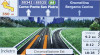
4.1.2.2 3D object types To enable or disable 3D visualisation on the map, tap the following buttons: , , , . M-NV supports the following 3D object types: Type Description 3D landmarks Landmarks are 3D artistic or block representations of prominent or wellknown objects. 3D landmarks are only available in selected cities and countries. Elevation model Hills and mountains are shown in the background of the 3D map view, and illustrated by colour on the 2D map. Elevated roads Complex intersections and vertically isolated roads (such as overpasses or underground tunnels) are displayed in 3D. 3D buildings 3D terrain Full 3D city building data that represents actual building size and position on the map. Building data is limited to the city centres of major cities in the US and Europe. 3D terrain map data shows changes in terrain, elevations or depressions in the land when you view the map, and use it to plot the route map in 3D when you navigate. 4.1.2.3 Elements of the active route M-NV shows the route in the following way: Symbol Name Current GPS position Description Your current position displayed on the map. This is not the exact GPS position. The arrow is put on the nearest road. Cursor (selected map location) The location selected in the Find menu, or a map point selected by tapping the map. Start point The first point of the route. Normally if GPS position is available, it is the start point of the route. If there is no valid GPS position, M-NV uses the last known GPS position as the start point. When you are using a saved route, M-NV asks you if you want to use your GPS position or the first point in the saved route as the start point. You can also modify the start point in the Cursor menu. If you do so, automatic off-route 49
-
 1
1 -
2
-
3
-
4
-
5
-
6
-
7
-
8
-
9
-
10
-
11
-
12
-
13
-
14
-
15
-
16
-
17
-
18
-
19
-
20
-
21
-
22
-
23
-
24
-
25
-
26
-
27
-
28
-
29
-
30
-
31
-
32
-
33
-
34
-
35
-
36
-
37
-
38
-
39
-
40
-
41
-
42
-
43
-
44
-
 45
45 -
 46
46 -
 47
47 -
 48
48 -
 49
49 -
 50
50 -
 51
51 -
 52
52 -
 53
53 -
 54
54 -
 55
55 -
56
-
57
-
58
-
59
-
60
-
61
-
62
-
63
-
64
-
65
-
66
-
67
-
68
-
69
-
70
-
71
-
72
-
73
-
74
-
75
-
76
-
77
-
78
 |
 |
