Magellan MapSend BlueNav Local Chart Quick Reference Guide - Page 2
Contents - mapsend bluenav charts
 |
UPC - 763357104905
View all Magellan MapSend BlueNav Local Chart manuals
Add to My Manuals
Save this manual to your list of manuals |
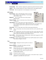
Page 2 highlights
1 Introduction Overview Magellan MapSend Lite version 2.0 is a freely licensed PC application that offers a user a means to view and work with Chapter Contents: maps that are usable on supported Magellan handheld GPS receivers. The Magellan MapSend Lite can: • Open maps that work with supported Magellan handheld GPS receivers. Maps must be in eXporist Introduction 1 Installation 2 First Time Use 3 format with an .imi extension. Maps loaded on the PC using MapSend products are exempt from this restriction. ° PC software maps (Magellan MapSend Topo, MapSend DirectRoute, etc.) [Note: MapSend software needs to be fully installed for maps to be available to MapSend Lite.] ° Magellan MapSend products preloaded on SD cards (MapSend Topo Mexico, Topo France, etc.) ° MapSend BlueNav Charts ° MapSend Lakes USA products ° Detailed MapSend maps that have been loaded in the Magellan eXplorist. ° Background maps preloaded in a Magellan eXplorist ° "Magellan Certified" products created and distributed by third-parties. • Create, edit and visualize user data, such as waypoints, tracks, routes and geocaches. • Give access to utilities to convert user data between popular Magellan formats. • Offer a way to transfer user data between a PC and Magellan eXplorist. (User data can also be transfered between a PC and Magellan Meridian and SporTrak GPS receivers.) • Provide advanced search options to the user. • Give access to geocaching tools that include view, manage and add/edit geocaches as well as a proximity search and GPX/LOC support. • Display topographic and 3-D information (when available from the uploaded map) in an easy-to-view format. • Provide street routing capabilities (when a street routing data map has been uploaded). • Load and save waypoints, routes and tracks in GPX format. Note: Magellan MapSend Lite does not support the cutting and exporting of map regions. Supported GPS Receivers • eXplorist 210 • eXplorist 400 / 500 / 600 • eXplorist XL Introduction
-
 1
1 -
 2
2 -
 3
3 -
 4
4 -
 5
5 -
 6
6 -
 7
7 -
 8
8 -
9
-
10
-
11
-
12
-
13
-
14
 |
 |