Magellan MapSend Streets USA Quick Reference Guide - Page 7
Map Manager - maps
 |
UPC - 763357102857
View all Magellan MapSend Streets USA manuals
Add to My Manuals
Save this manual to your list of manuals |
Page 7 highlights
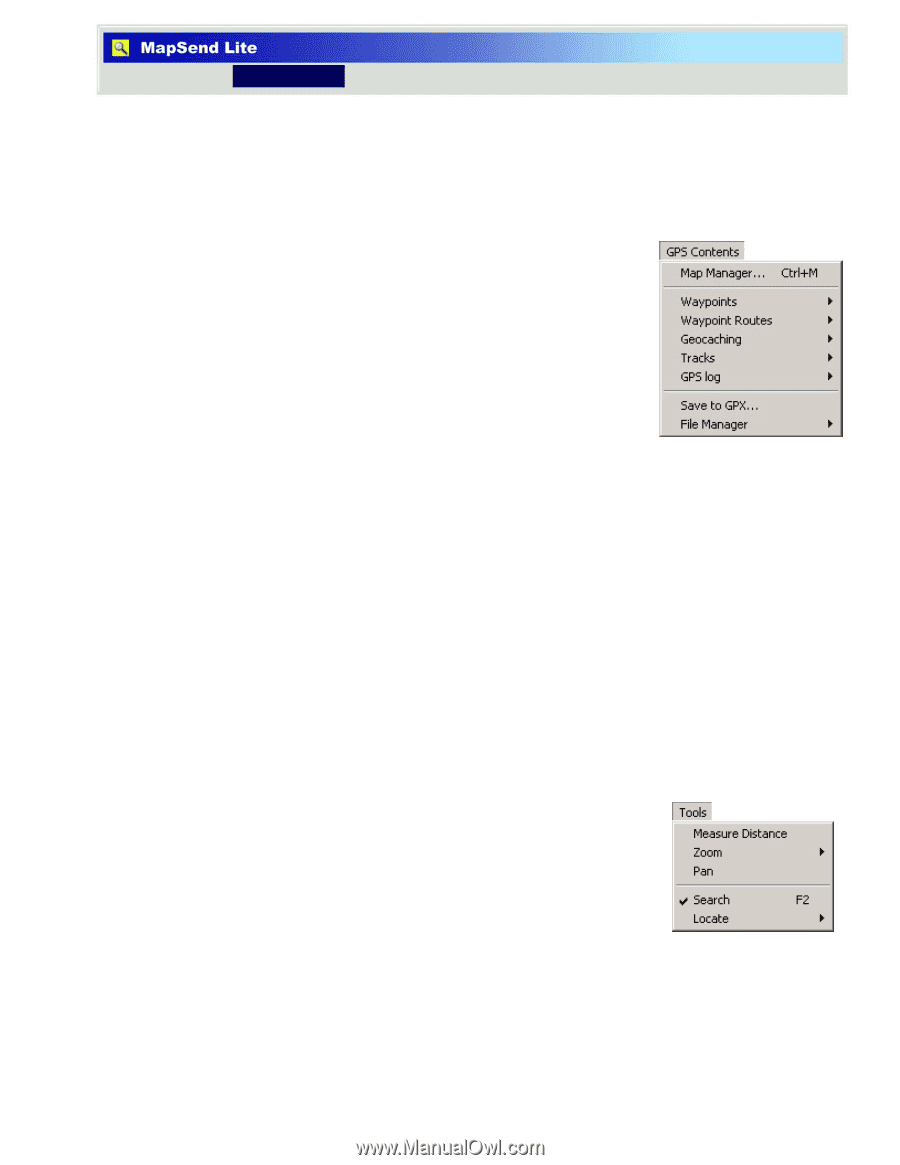
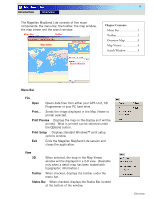
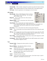
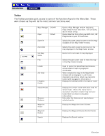
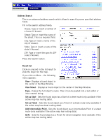
5 Introduction Overview Overview Map When checked, displays the overview map above the search window. Legend When checked replaces the Search Window with a map legend window. Full Screen Sets the application to be displayed on the full screen. GPS Contents Map Manager Opens a Map Manager window accessing maps saved on your hard drive. You can open, add or delete a map. Waypoints This is a drop down menu that accesses waypoint tools. Waypoint Routes This is a drop down menu that accesses routing tools. Street Routes This is a drop down menu that accesses tools to be used with street routes. (Note: this menu item is accessible only when a detail map has been loaded that has street routing data information.) Geocaching This is a drop down menu that accesses geocaching tools. Tracks This is a drop down menu that accesses tools that can be used with saved tracks. GPS Log This is a drop down menu that accesses tools that can be used with a GPS log. (A GPS log is taken by connecting a laptop to a GPS receiver. Access Start to begin recording the log and Stop to end it.) Save to GPX... This provides a way of saving routes, tracks and/or waypoints to GPX (GPS eXchange) file format. File Manager Used to transfer data between PC and a GPS receiver and to convert data between Magellan formats. Tools Elevation Profile Displays the vertical profile of a track or route. Measure Distance Calculates the distance and area between selected points. Zoom Selects the zoom cursor to change the map scale for the map displayed in the Map Viewer window. Pan Selects the pan cursor used to move the map in the Map Viewer window. Search Displays the Search window. Locate Used to quick find predefined land masses, active detail maps or specific geographic coordinates the user has set. Overview
-
 1
1 -
 2
2 -
 3
3 -
 4
4 -
 5
5 -
 6
6 -
 7
7 -
 8
8 -
 9
9 -
 10
10 -
 11
11 -
 12
12 -
13
-
14
 |
 |