Pioneer AVIC-8000NEX Owner's Manual - Page 52
Offer Congestion Detour on Highways - bypass
 |
View all Pioneer AVIC-8000NEX manuals
Add to My Manuals
Save this manual to your list of manuals |
Page 52 highlights
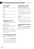
Chapter 10 Customizing preferences of the navigation Data Fields Touch and hold down this key and then select the values that you wish to have displayed to customize the data fields in the corner of the Map screen. You can choose to have different values displayed for when navigating a route to a select destination and for when just cruising around without any particular destination in mind. You can select such options to display as general trip data including the current speed or altitude, route data related to the final destination, and route data related to the next waypoint along the selected route. Route Progress Bar You can turn on the route progress bar to display the current route as a straight line located on the right side of the map. The arrow represents your current position and moves up the line as you travel along the route. Waypoints and traffic event markers also display on the line. Offer Freeway Services You may need a gas station or a restaurant during your journey. This feature displays a new key on the map when you are driving on freeways. Touch this key to open a panel with the details of the next few exits or service stations. Touch any of them to display it on the map and add it as a waypoint to your route if needed. Automatic Overview When selected, the map zooms out to show an overview of the surrounding area if the next route event (maneuver) is far. When you get close to the event, the map returns to the normal map view. Facility Types You can select the service types displayed for the freeway exits. Choose from the POI categories. Signposts Whenever adequate information is available, lane information similar to the real ones on road signs above the road is displayed at the top of the map. You can turn this feature on or off. Junction View If you are approaching a freeway exit or a complex intersection and the necessary information exists, the map is replaced with a 3D view of the junction. Tunnel View When entering tunnels, the surface roads and buildings can be distracting. This feature shows a generic picture of a tunnel instead of the map. A top-down overview of the tunnel and remaining distance are also displayed. Offer Congestion Detour on Highways When you slow down while driving on a freeway, there is a chance it is due to traffic congestion, so this navigation system offers you a detour using the next exit. The message shows you distance of the exit and the difference in distance and estimated time compared to the original route. You can choose from one of the following options: ! Touch [Dismiss] or just ignore the message if you want to keep the original route. ! Touch [Preview] to see the overview of the original route and the detour to make the decision. You can accept the detour as offered or increase the bypassed freeway segment before accepting. ! Turn to the suggested new direction and the route will be automatically recalculated. Offer Real-time Route Alternatives Alternative routes can be suggested when driving on normal roads. This navigation system will select a different turn in the upcoming intersection and offer you a different route for the next section of the route. But you cannot modify the offered detour. 52 En
-
 1
1 -
2
-
3
-
4
-
5
-
6
-
7
-
8
-
9
-
10
-
11
-
12
-
13
-
14
-
15
-
16
-
17
-
18
-
19
-
20
-
21
-
22
-
23
-
24
-
25
-
26
-
27
-
28
-
29
-
30
-
31
-
32
-
33
-
34
-
35
-
36
-
37
-
38
-
39
-
40
-
41
-
42
-
43
-
44
-
45
-
46
-
 47
47 -
 48
48 -
 49
49 -
 50
50 -
 51
51 -
 52
52 -
 53
53 -
 54
54 -
 55
55 -
 56
56 -
 57
57 -
58
-
59
-
60
-
61
-
62
-
63
-
64
-
65
-
66
-
67
-
68
-
69
-
70
-
71
-
72
-
73
-
74
-
75
-
76
-
77
-
78
-
79
-
80
-
81
-
82
-
83
-
84
-
85
-
86
-
87
-
88
-
89
-
90
-
91
-
92
-
93
-
94
-
95
-
96
-
97
-
98
-
99
-
100
-
101
-
102
-
103
-
104
-
105
-
106
-
107
-
108
-
109
-
110
-
111
-
112
-
113
-
114
-
115
-
116
-
117
-
118
-
119
-
120
-
121
-
122
-
123
-
124
-
125
-
126
-
127
-
128
-
129
-
130
-
131
-
132
-
133
-
134
-
135
-
136
-
137
-
138
-
139
-
140
-
141
-
142
-
143
-
144
-
145
-
146
-
147
-
148
-
149
-
150
-
151
-
152
-
153
-
154
-
155
-
156
-
157
-
158
-
159
-
160
-
161
-
162
-
163
-
164
-
165
-
166
-
167
-
168
-
169
-
170
-
171
-
172
-
173
-
174
-
175
-
176
-
177
-
178
-
179
-
180
-
181
-
182
-
183
-
184
-
185
-
186
-
187
-
188
-
189
-
190
-
191
-
192
-
193
-
194
-
195
-
196
-
197
-
198
-
199
-
200
-
201
-
202
-
203
-
204
-
205
-
206
-
207
-
208
-
209
-
210
-
211
-
212
-
213
-
214
-
215
-
216
-
217
-
218
-
219
-
220
-
221
-
222
-
223
-
224
-
225
-
226
-
227
-
228
 |
 |
