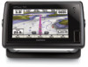
Garmin GPSMAP 721 Owner's Manual
Garmin GPSMAP 721 Manual
 |
View all Garmin GPSMAP 721 manuals
Add to My Manuals
Save this manual to your list of manuals |
Garmin GPSMAP 721 manual content summary:
- Garmin GPSMAP 721 | Owner's Manual - Page 1
GPSMAP® 500/700 Series and echoMAP™ 50/70 Series Owner's Manual February 2013 190-01556-00_0A Printed in Taiwan - Garmin GPSMAP 721 | Owner's Manual - Page 2
the content of this manual without obligation to notify any person or organization of such changes or improvements. Go to www.garmin.com for current updates and supplemental information concerning the use of this product. Garmin®, the Garmin logo, BlueChart®, g2 Vision®, GPSMAP®, and MapSource® are - Garmin GPSMAP 721 | Owner's Manual - Page 3
GPSMAP 700 Series 1 Using the Touchscreen 1 echoMAP 50 Series and GPSMAP 500 Series 1 Device Keys 1 Tips and Shortcuts 1 GPS 3D Settings 7 Navigation with a Chartplotter 7 Basic Navigation Questions 7 Destinations Info 7 Searching for a Marine Services Destination 7 Courses 8 Setting and - Garmin GPSMAP 721 | Owner's Manual - Page 4
....... 16 Manually Adjusting Gain Guide 22 Saving a SiriusXM Channel to the Presets List 22 Adjusting SiriusXM Satellite Radio Volume 22 Device Configuration 22 Turning On the Chartplotter Automatically 22 System Settings 23 GPS Settings 23 Viewing the Event Log 23 Viewing System Software - Garmin GPSMAP 721 | Owner's Manual - Page 5
Up Data to a Computer 27 Restoring Backup Data to a Chartplotter 27 Saving System Information to a Memory Card 27 Appendix 27 Registering Your Device 27 Calibrating the Touchscreen 27 Updating the Device Software 27 Screenshots 27 Capturing Screenshots 27 Copying Screenshots to a Computer - Garmin GPSMAP 721 | Owner's Manual - Page 6
- Garmin GPSMAP 721 | Owner's Manual - Page 7
Information guide in the product box for product warnings and other important information. Device Views echoMAP 70 Series and GPSMAP 700 the chartplotter loses satellite signals, disappears and a flashing question mark appears over on the chart. For more information about GPS, go to www.garmin.com - Garmin GPSMAP 721 | Owner's Manual - Page 8
radar information on the Navigation chart or the Fishing chart, when the chartplotter is connected to a radar. This feature is not available with the detailed charts. Icon Description Buoy Information Marine services Tide station Current station Overhead photo available Perspective photo - Garmin GPSMAP 721 | Owner's Manual - Page 9
Route To. • To use Auto Guidance, select Guide To. 5 Review the course indicated by the magenta line. NOTE: celestial, chart notes, or local services information near the cursor, select Information you to get the most out of your chartplotter. In addition to detailed marine charting, premium - Garmin GPSMAP 721 | Owner's Manual - Page 10
the direction of the cone. 2 Select Review > Aerial Photo. Automatic Identification System The Automatic When connected to an external AIS device, the chartplotter can show some AIS information about other vessels the Maritime Mobile Service Identity (MMSI), location, GPS speed, GPS heading, time - Garmin GPSMAP 721 | Owner's Manual - Page 11
You can view the AIS signal status, MMSI, GPS speed, GPS heading, and other information that is reported about a safe-zone collision alarm, you must have a compatible chartplotter connected to an AIS device. The safe-zone collision distress signal alarm appears. Select Review > Go To to begin - Garmin GPSMAP 721 | Owner's Manual - Page 12
services may be obtained. Roses: Shows a compass rose around your boat, indicating compass direction oriented to the heading of the boat. A true wind direction or apparent wind direction indicator appears if the chartplotter . 1 From a screen that supports overlay numbers, select Menu > Overlay - Garmin GPSMAP 721 | Owner's Manual - Page 13
? How do I make the device guide me to a location while avoiding charted If you have premium maps that support Auto Guidance and are in an area services. 1 Select Nav Info. 2 Select Offshore Services or Inland Services. 3 If necessary, select the marine service category. The chartplotter - Garmin GPSMAP 721 | Owner's Manual - Page 14
(page 7). 2 Select Navigate To > Guide To. 3 Review the course indicated by the magenta Auto Guidance Guide To), if you are connected through a NMEA 2000® network to a compatible Garmin MOB symbol marks the active MOB point and the chartplotter sets a direct course back to the marked location - Garmin GPSMAP 721 | Owner's Manual - Page 15
including turns, select Route To. • To use Auto Guidance, select Guide To. 5 Review the course indicated by the magenta line. NOTE: When using Auto location of the next turn on the chart. 5 Select Add Turn. The chartplotter marks the location of the turn with a waypoint. 6 If necessary, repeat - Garmin GPSMAP 721 | Owner's Manual - Page 16
• To navigate the track from the destination point used when the track was created, select Backward. 5 Review the course indicated by the colored line. 6 Follow the line along each leg in the route, steering , select Time > Change, and enter the time interval. 10 Navigation with a Chartplotter - Garmin GPSMAP 721 | Owner's Manual - Page 17
they are not available on all chartplotter models. The chartplotters also provide almanac information about tides and fuel data. See the installation instructions for details. Select Gauges > Engine. engines are shown in the gauges, you must manually select the number of engines (page 11). 1 - Garmin GPSMAP 721 | Owner's Manual - Page 18
wind gauge. Magnetic heading is the heading data received from a heading sensor, and GPS heading is calculated by your chartplotter GPS (course over ground). 1 Select Gauges > Wind > Menu > Heading Source. 2 Select GPS Hdg or Magnetic. Selecting the Range of the Close-Hauled Wind Gauge You can - Garmin GPSMAP 721 | Owner's Manual - Page 19
option: • To increase or decrease the gain manually, select Up or Down. • To allow the chartplotter to adjust the gain automatically, select an automatic Sonar When properly connected to an optional Garmin sounder module and a transducer, your compatible chartplotter can be used as a fishfinder. - Garmin GPSMAP 721 | Owner's Manual - Page 20
directly at the radar, because the eyes are the most susceptible parts of the body. NOTE: Not all models support radar. When you connect your compatible chartplotter to an optional Garmin marine radar, such as a GMR™ 1206 xHD or a GMR 24 HD, you can view more information about your surroundings - Garmin GPSMAP 721 | Owner's Manual - Page 21
1 With the chartplotter off, connect your radar as described in the radar installation instructions. 2 Turn on the chartplotter. The radar warms alarm when a radar object enters the zone. Sentry mode works with all Garmin GMR model radars. Enabling Timed Transmit Select Radar > Sentry > Menu > - Garmin GPSMAP 721 | Owner's Manual - Page 22
Overlay When you connect your chartplotter to an optional Garmin marine radar, you can use available, the boat heading is based on GPS tracking data. GPS tracking data indicates the direction in which setting (page 16). 3 Adjust the gain setting manually (page 17). Range of Radar Signals The range - Garmin GPSMAP 721 | Owner's Manual - Page 23
based on average conditions, the range of the radar signal, and the selected radar mode. The chartplotter does not readjust the gain automatically in response to changing conditions. Manually Adjusting Gain on the Radar Screen For optimal radar performance that accounts for actual conditions, you - Garmin GPSMAP 721 | Owner's Manual - Page 24
call. For information on placing distress calls from your radio, see the VHF radio owner's manual. For information about marking an MOB, see page 8. Position Tracking When you connect your Garmin chartplotter to a VHF radio using NMEA 0183, you can track vessels that send position reports. This - Garmin GPSMAP 721 | Owner's Manual - Page 25
you connect your Garmin chartplotter to a Garmin VHF radio over the NMEA 2000 or the NMEA 0183 network, you can use the chartplotter interface to set weather information provided through this product is subject to service interruptions and may contain errors, inaccuracies, or outdated information - Garmin GPSMAP 721 | Owner's Manual - Page 26
garmin.com for more information. You must also have a valid subscription to receive satellite weather and radio. For more information, refer to the instructions latest update or as an animated loop of the latest updates. The time stamp indicates the elapsed time since the service provider - Garmin GPSMAP 721 | Owner's Manual - Page 27
• To view the weather forecast for the previous 12 hours, select Previous Forecast or , and to view previous forecasts, up to 48 hours ago, in 12-hour increments, select Previous Forecast or again. Viewing a Marine Forecast or an Offshore Forecast 1 Select Weather > Forecast. 2 Pan the chart to - Garmin GPSMAP 721 | Owner's Manual - Page 28
and barometric pressure. 1 From a weather chart, select . 2 Select Review > Buoy. Review does not appear if the cursor is not near an object. If the service was updated. Select Weather > Weather Subscription. SiriusXM Radio When you have a Garmin SiriusXM receiver connected to the chartplotter - Garmin GPSMAP 721 | Owner's Manual - Page 29
used in combination with GPS to provide more software version for an optional Garmin radar (if applicable), and the unit ID number. You may need this information to update the system software chartplotter. 1 Select Settings > My Vessel > Calibrate Water Speed. 2 Follow the on-screen instructions - Garmin GPSMAP 721 | Owner's Manual - Page 30
output sentences for system information. Garmin: Enables NMEA 0183 output sentences for Garmin proprietary sentences. Sounder: Enables a GPSMAP chartplotter to an existing NMEA 2000 network and to see a list of supported NMEA 2000 PGN numbers, see the chartplotter installation instructions. - Garmin GPSMAP 721 | Owner's Manual - Page 31
allows you to enter the magnetic variation value manually. Position Format: Sets the position format in time zone, or allows automatic selection based on GPS location. Navigation Settings NOTE: Some settings and Safe Height settings influence how the chartplotter calculates an Auto Guidance line. - Garmin GPSMAP 721 | Owner's Manual - Page 32
To > Guide To. 5 Review the Garmin radar (if applicable), and the unit ID number. You may need this information to update the system software or to purchase additional map data information. Select Settings > System > System Information > Software Information. Restoring the Original Chartplotter - Garmin GPSMAP 721 | Owner's Manual - Page 33
memory card is not included, go to www.garmin.com to make sure your device software is up-todate. 1 If necessary, load the software update onto the memory card from your computer by following the instructions on www.garmin.com. 2 Turn on the chartplotter. 3 Insert the memory card into the card - Garmin GPSMAP 721 | Owner's Manual - Page 34
Water referenced 128267 Water depth 130306 Wind data 130312 Temperature Transmit 127258 Magnetic Variance 129025 Position: Rapid update 129026 COG and SOG: Rapid update 129029 GNSS position data Type PGN Description 129283 Cross track error 129284 Navigation data 129285 Navigation route - Garmin GPSMAP 721 | Owner's Manual - Page 35
23 GLONASS 23 signals 1 WAAS 23 GPS accuracy 25 H hazard colors 6 home screen, customizing 1 K keel offset 23 keys 1 power 1 L lane width 6 language 23 locking, screen 1 M man overboard 8 marine services 7 mark location 8 memory card 26, 27 detailed maps 27 installing 1 slot 1 MOB, device 5 music - Garmin GPSMAP 721 | Owner's Manual - Page 36
23, 26 shoreline distance 26 SiriusXM 20 SiriusXM Satellite Radio 22 software, updating 27 sonar 13 a-scope 14 alarms 14 appearance 14 bottom 10 transducer 13 trip gauges 11 U unit ID 23, 26 units of measure 25 updates, software 27 user data, deleting 11 V vessel trails 7, 19 VHF radio 18 calling an - Garmin GPSMAP 721 | Owner's Manual - Page 37
- Garmin GPSMAP 721 | Owner's Manual - Page 38
www.garmin.com/support 913-397-8200 1-800-800-1020 +32 2 672 52 54 +49 (0)1805-427646-880 00800 4412 454 +44 2380 662 915 0808 238 0000 +44
-
 1
1 -
 2
2 -
 3
3 -
 4
4 -
 5
5 -
 6
6 -
 7
7 -
8
-
9
-
10
-
11
-
12
-
13
-
14
-
15
-
16
-
17
-
18
-
19
-
20
-
21
-
22
-
23
-
24
-
25
-
26
-
27
-
28
-
29
-
30
-
31
-
32
-
33
-
34
-
35
-
36
-
37
-
38
 |
 |

GPSMAP
®
500/700 Series and echoMAP
™
50/70
Series
Owner’s Manual
February 2013
190-01556-00_0A
Printed in Taiwan