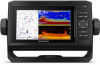
Garmin ECHOMAP UHD 62cv Owners Manual - Page 17
Garmin Quickdraw Contours Settings
 |
View all Garmin ECHOMAP UHD 62cv manuals
Add to My Manuals
Save this manual to your list of manuals |
Page 17 highlights
Sharing Your Garmin Quickdraw Contours Maps with the Garmin Quickdraw Community Using ActiveCaptain You can share Garmin Quickdraw Contours maps that you have created with others in the Garmin Quickdraw Community. When you share a contour map, only the contour map is shared. Your waypoints are not shared. When you set up your ActiveCaptain app, you may have selected to share your contours with the community automatically. If not, follow these steps to enable sharing. From the ActiveCaptain app on your mobile device, select Sync with Plotter > Contribute to Community. The next time you connect the ActiveCaptain app to the ECHOMAP UHD device, your contour maps are transferred to the community automatically. Connecting to the Garmin Quickdraw Community with Garmin Connect 1 Go to connect.garmin.com. 2 Select Getting Started > Quickdraw Community > Getting Started. 3 If you do not have a Garmin Connect account, create one. 4 Sign in to your Garmin Connect account. 5 Select Marine in the upper-right to open the Garmin Quickdraw widget. TIP: Make sure you have a memory card in your computer to share Garmin Quickdraw Contours maps. Sharing Your Garmin Quickdraw Contours Maps with the Garmin Quickdraw Community Using Garmin Connect You can share Garmin Quickdraw Contours maps that you have created with others in the Garmin Quickdraw Community. When you share a contour map, only the contour map is shared. Your waypoints are not shared. 1 Insert a memory card into the card slot (Inserting Memory Cards, page 1). 2 Insert the memory card into your computer. 3 Access the Garmin Quickdraw Community (Connecting to the Garmin Quickdraw Community with Garmin Connect, page 11). 4 Select Share Your Contours. 5 Browse to your memory card, and select the Garmin folder. 6 Open the Quickdraw folder, and select the file named ContoursLog.svy. After the file is uploaded, delete the ContoursLog.svy file from your memory card to avoid issues with future uploads. Your data will not be lost. Downloading Garmin Quickdraw Community Maps Using Garmin Connect You can download Garmin Quickdraw Contours maps that other users have created and shared with the Garmin Quickdraw Community. If your device does not have Wi‑Fi technology, you can access the Garmin Quickdraw Community using the Garmin Connect website. If your device has Wi‑Fi technology, you should access the Garmin Quickdraw Community using the ActiveCaptain app (Connecting to the Garmin Quickdraw Community with ActiveCaptain, page 10). 1 Insert the memory card into your computer. 2 Access the Garmin Quickdraw Community (Connecting to the Garmin Quickdraw Community with Garmin Connect, page 11). 3 Select Search for Contours. 4 Use the map and search features to locate an area to download. The red dots represent Garmin Quickdraw Contours maps that have been shared for that region. 5 Select Select an Area to Download. 6 Drag the edges of the box to select the area to download. 7 Select Start Download. 8 Save the file to your memory card. TIP: If you cannot find the file, look in the "Downloads" folder. The browser may have saved the file there. 9 Remove the memory card from your computer. 10Insert the memory card into the card slot (Inserting Memory Cards, page 1). The chartplotter automatically recognizes the contours maps. The chartplotter may take a few minutes to load the maps. Garmin Quickdraw Contours Settings From a chart, select MENU > Quickdraw Contours > Settings. Recording Offset: Sets the distance between the sonar depth and the contour recording depth. If the water level has changed since your last recording, adjust this setting so the recording depth is the same for both recordings. For example, if the last time you recorded had a sonar depth of 3.1 m (10.5 ft.), and today's sonar depth is 3.6 m (12 ft.), enter -0.5 m (-1.5 ft.) for the a Recording Offset value. User Display Offset: Sets differences in contour depths and depth labels on your own contours maps to compensate for changes in the water level of a body of water, or for depth errors in recorded maps. Comm. Display Offset: Sets differences in contour depths and depth labels on the community contours maps to compensate for changes in the water level of a body of water, or for depth errors in recorded maps. Survey Coloring: Sets the color of the Garmin Quickdraw Contours display. When this setting is turned on, the colors indicate the quality of the recording. When this setting is turned off, the contour areas use standard map colors. Green indicates good depth and GPS position, and a speed under 16 km/h (10 mph). Yellow indicates good depth and GPS position, and a speed between 16 and 32 km/h (10 and 20 mph). Red indicates poor depth or GPS position, and a speed above 32 km/h (20 mph). Navigation with a Chartplotter WARNING All route and navigation lines displayed on the chartplotter are only intended to provide general route guidance or to identify proper channels, and are not intended to be precisely followed. Always defer to the navaids and conditions on the water when navigating to avoid groundings or hazards that could result in vessel damage, personal injury, or death. The Auto Guidance feature is based on electronic chart information. That data does not ensure obstacle and bottom clearance. Carefully compare the course to all visual sightings, and avoid any land, shallow water, or other obstacles that may be in your path. When using Go To, a direct course and a corrected course may pass over land or shallow water. Use visual sightings, and steer to avoid land, shallow water, and other dangerous objects. CAUTION If your vessel has an autopilot system, a dedicated autopilot control display must be installed at each steering helm in order to disable the autopilot system. Navigation with a Chartplotter 11
-
 1
1 -
2
-
3
-
4
-
5
-
6
-
7
-
8
-
9
-
10
-
11
-
 12
12 -
 13
13 -
 14
14 -
 15
15 -
 16
16 -
 17
17 -
 18
18 -
 19
19 -
 20
20 -
 21
21 -
 22
22 -
23
-
24
-
25
-
26
-
27
-
28
-
29
-
30
-
31
-
32
-
33
-
34
-
35
-
36
-
37
-
38
-
39
-
40
-
41
-
42
-
43
-
44
-
45
-
46
-
47
-
48
-
49
-
50
-
51
-
52
 |
 |